Confluence is a borough in Somerset County, Pennsylvania, United States. It is part of the Johnstown, Pennsylvania, Metropolitan Statistical Area. The population was 724 at the 2020 census.
| Name: | Confluence borough |
|---|---|
| LSAD Code: | 21 |
| LSAD Description: | borough (suffix) |
| State: | Pennsylvania |
| County: | Somerset County |
| Incorporated: | 1873 |
| Total Area: | 1.68 sq mi (4.35 km²) |
| Land Area: | 1.60 sq mi (4.14 km²) |
| Water Area: | 0.08 sq mi (0.21 km²) |
| Total Population: | 722 |
| Population Density: | 451.25/sq mi (174.19/km²) |
| Area code: | 814 |
| FIPS code: | 4215680 |
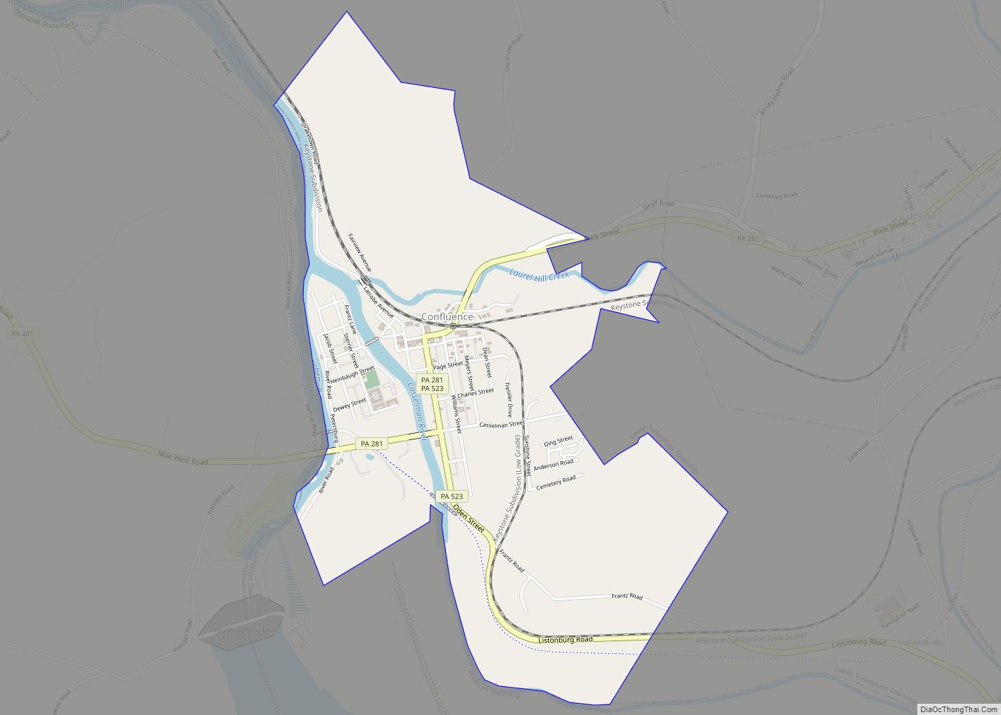
Online Interactive Map
Click on ![]() to view map in "full screen" mode.
to view map in "full screen" mode.
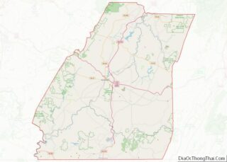
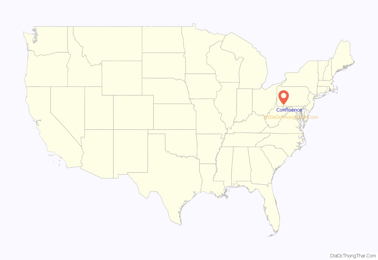
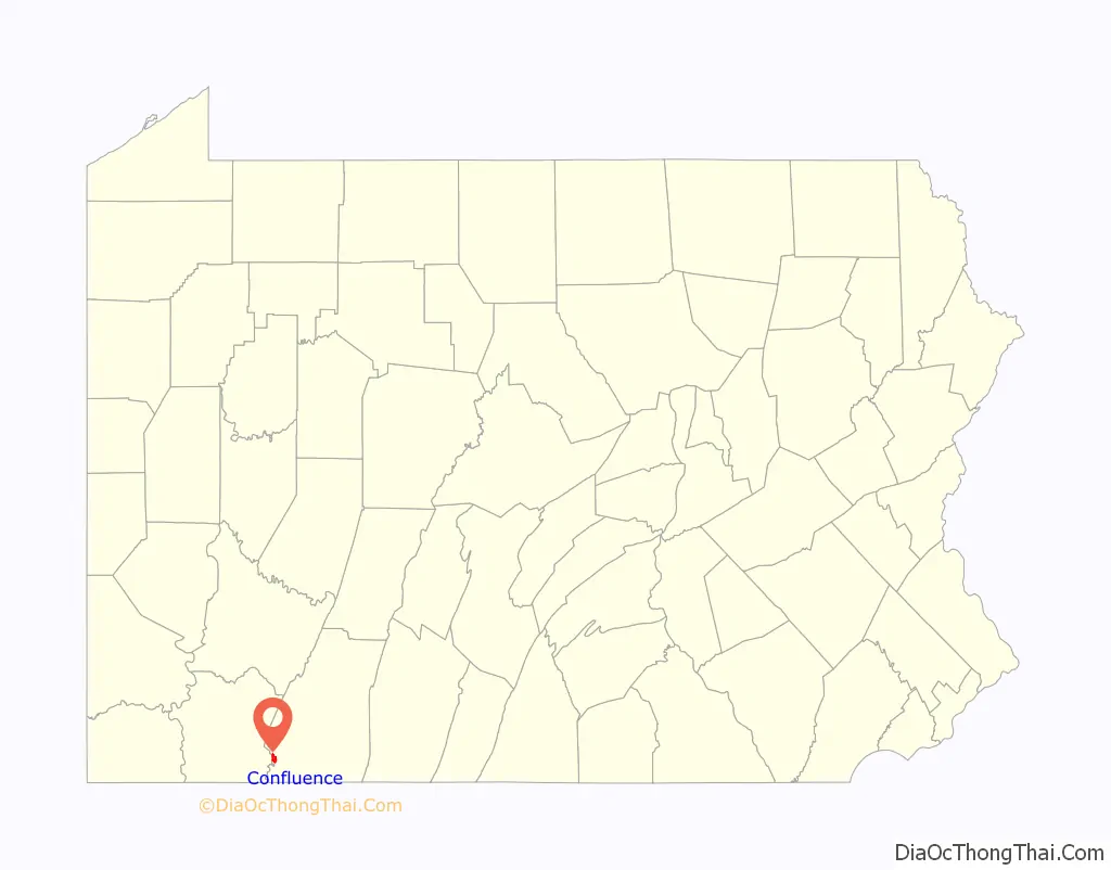
Confluence location map. Where is Confluence borough?
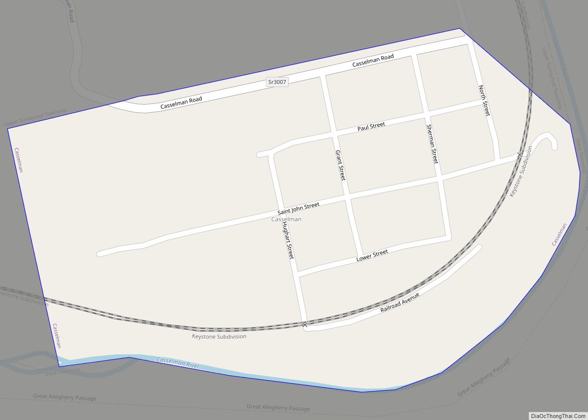
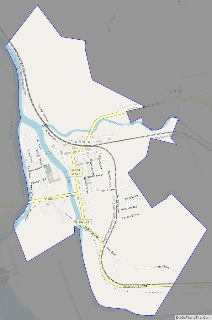
Confluence Road Map
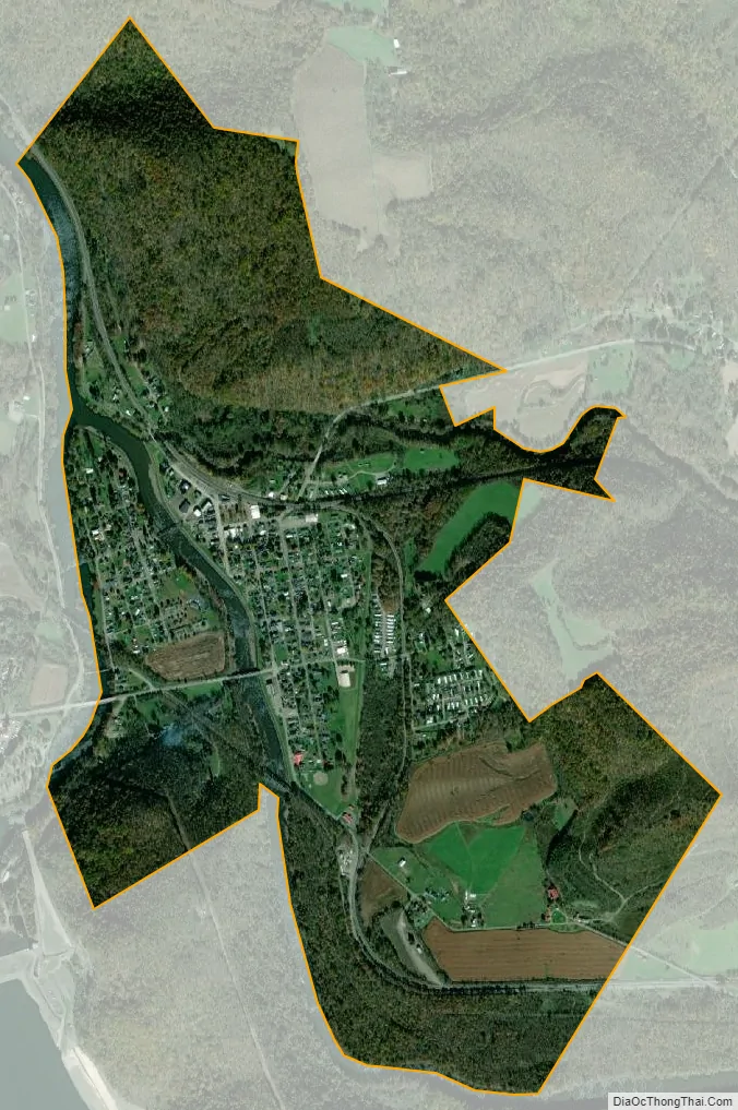
Confluence city Satellite Map
Geography
Confluence is at 39°48′36″N 79°21′24″W / 39.81000°N 79.35667°W / 39.81000; -79.35667 (39.809997, -79.356692). The borough is located at the southern end of Lower Turkeyfoot Township, and the borough of Ursina sits to its east.
Confluence is named for the juncture of the Casselman River and Laurel Hill Creek with the Youghiogheny River. It therefore provides many opportunities for boating and fishing (and hiking, as Pennsylvania’s highest point, Mount Davis, is located nearby).
According to the United States Census Bureau, the borough has a total area of 1.6 square miles (4.1 km), of which 1.6 square miles (4.1 km) is land and 0.1 square miles (0.26 km) (3.03%) is water. The borough is bordered to the south by the 2,840-acre (11.5 km) Youghiogheny River Lake and to the north by the 19,052-acre (77.10 km) Ohiopyle State Park.
Climate
The climate in this area has mild differences between highs and lows, and there is adequate rainfall year-round. According to the Köppen Climate Classification system, Confluence has a marine west coast climate, abbreviated “Cfb” on climate maps.
See also
Map of Pennsylvania State and its subdivision:- Adams
- Allegheny
- Armstrong
- Beaver
- Bedford
- Berks
- Blair
- Bradford
- Bucks
- Butler
- Cambria
- Cameron
- Carbon
- Centre
- Chester
- Clarion
- Clearfield
- Clinton
- Columbia
- Crawford
- Cumberland
- Dauphin
- Delaware
- Elk
- Erie
- Fayette
- Forest
- Franklin
- Fulton
- Greene
- Huntingdon
- Indiana
- Jefferson
- Juniata
- Lackawanna
- Lancaster
- Lawrence
- Lebanon
- Lehigh
- Luzerne
- Lycoming
- Mc Kean
- Mercer
- Mifflin
- Monroe
- Montgomery
- Montour
- Northampton
- Northumberland
- Perry
- Philadelphia
- Pike
- Potter
- Schuylkill
- Snyder
- Somerset
- Sullivan
- Susquehanna
- Tioga
- Union
- Venango
- Warren
- Washington
- Wayne
- Westmoreland
- Wyoming
- York
- Alabama
- Alaska
- Arizona
- Arkansas
- California
- Colorado
- Connecticut
- Delaware
- District of Columbia
- Florida
- Georgia
- Hawaii
- Idaho
- Illinois
- Indiana
- Iowa
- Kansas
- Kentucky
- Louisiana
- Maine
- Maryland
- Massachusetts
- Michigan
- Minnesota
- Mississippi
- Missouri
- Montana
- Nebraska
- Nevada
- New Hampshire
- New Jersey
- New Mexico
- New York
- North Carolina
- North Dakota
- Ohio
- Oklahoma
- Oregon
- Pennsylvania
- Rhode Island
- South Carolina
- South Dakota
- Tennessee
- Texas
- Utah
- Vermont
- Virginia
- Washington
- West Virginia
- Wisconsin
- Wyoming