Conneaut Lakeshore is a census-designated place (CDP) in Crawford County, Pennsylvania, United States. The population was 2,395 at the 2010 census.
| Name: | Conneaut Lakeshore CDP |
|---|---|
| LSAD Code: | 57 |
| LSAD Description: | CDP (suffix) |
| State: | Pennsylvania |
| County: | Crawford County |
| Elevation: | 1,080 ft (330 m) |
| Total Area: | 6.67 sq mi (17.28 km²) |
| Land Area: | 5.19 sq mi (13.43 km²) |
| Water Area: | 1.49 sq mi (3.85 km²) |
| Total Population: | 2,307 |
| Population Density: | 444.85/sq mi (171.76/km²) |
| ZIP code: | 16316 (Conneaut Lake) |
| Area code: | 814 |
| FIPS code: | 4215755 |
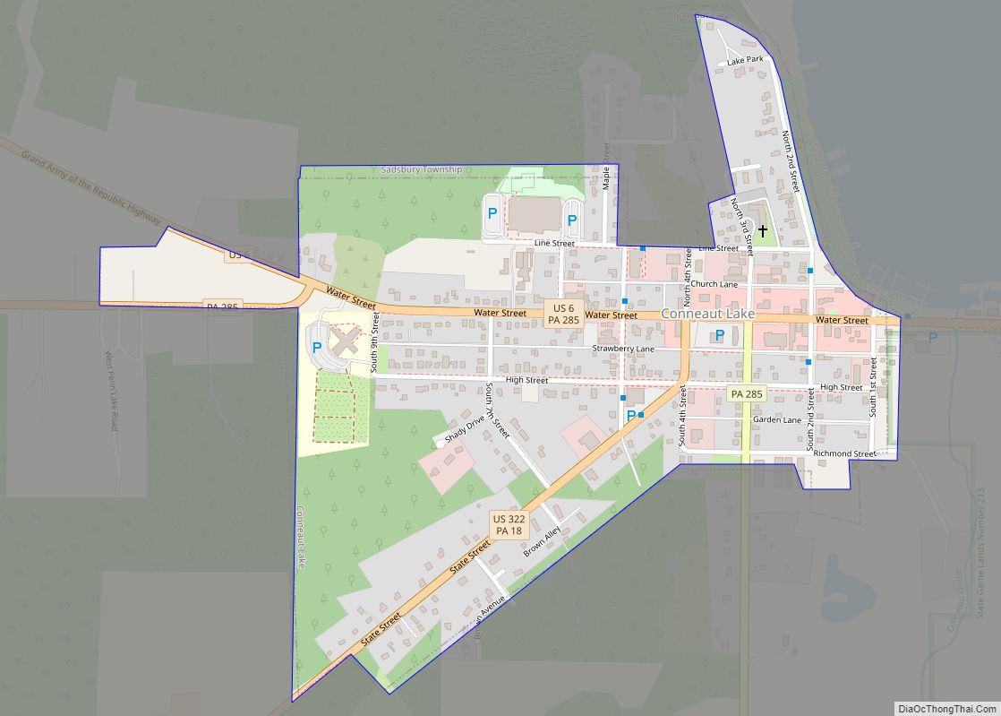
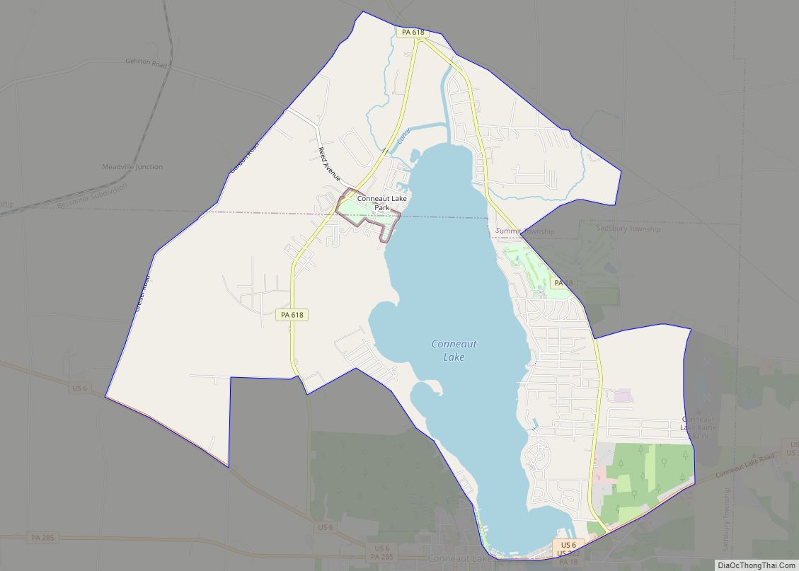
Online Interactive Map
Click on ![]() to view map in "full screen" mode.
to view map in "full screen" mode.
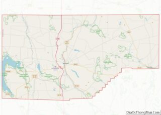
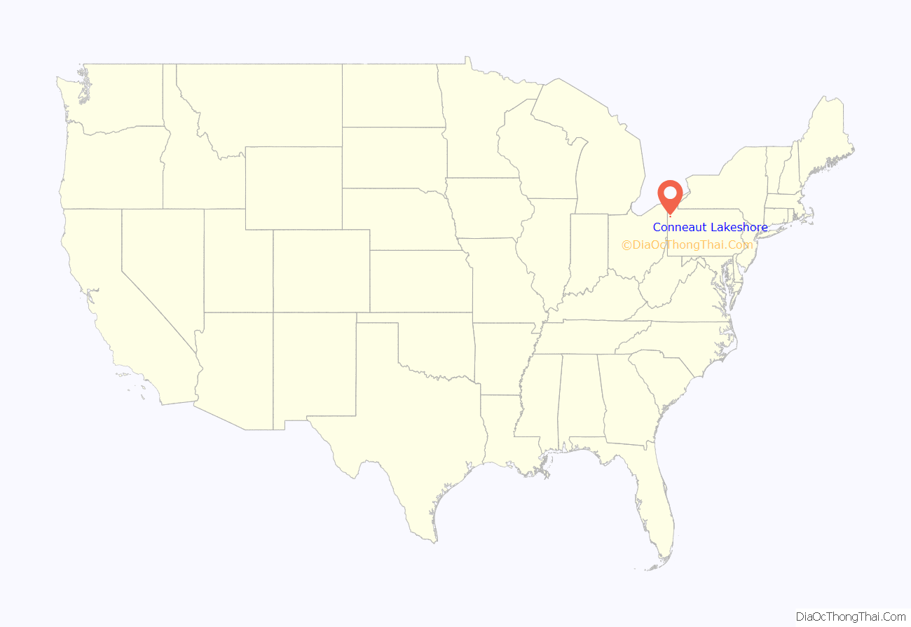
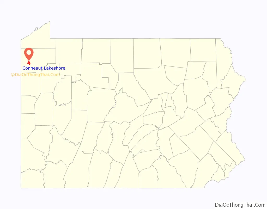
Conneaut Lakeshore location map. Where is Conneaut Lakeshore CDP?
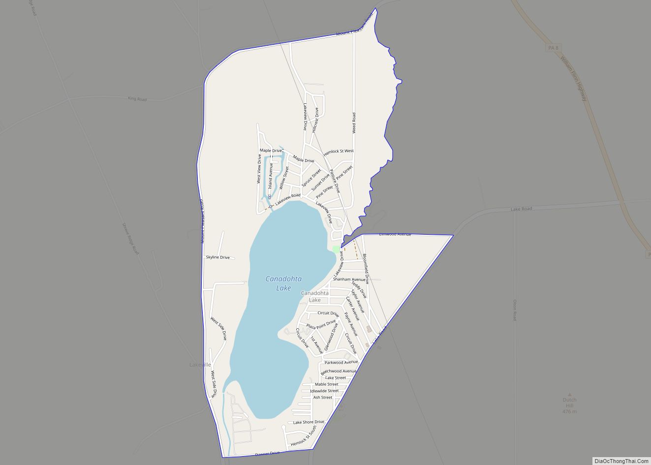
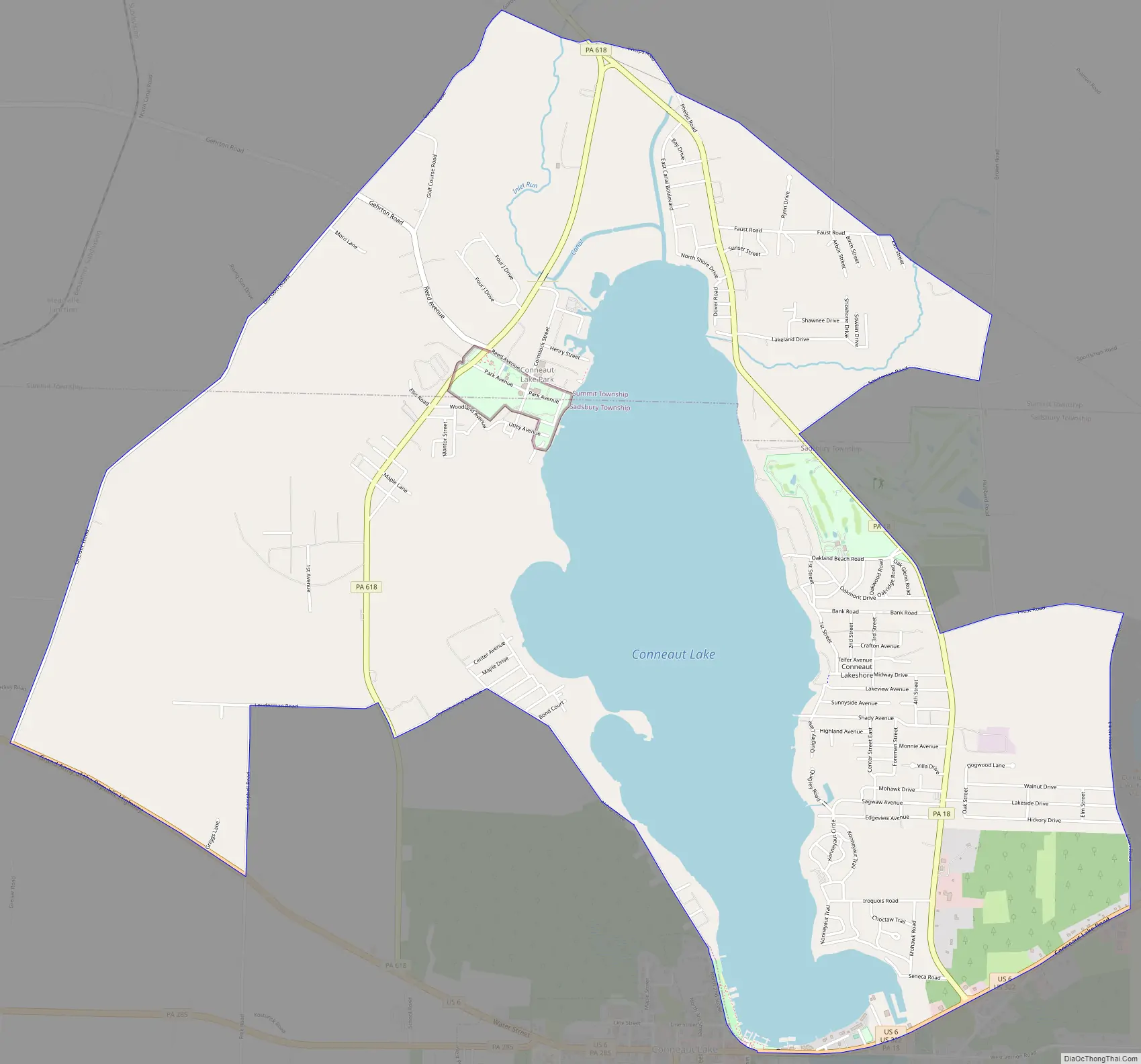
Conneaut Lakeshore Road Map
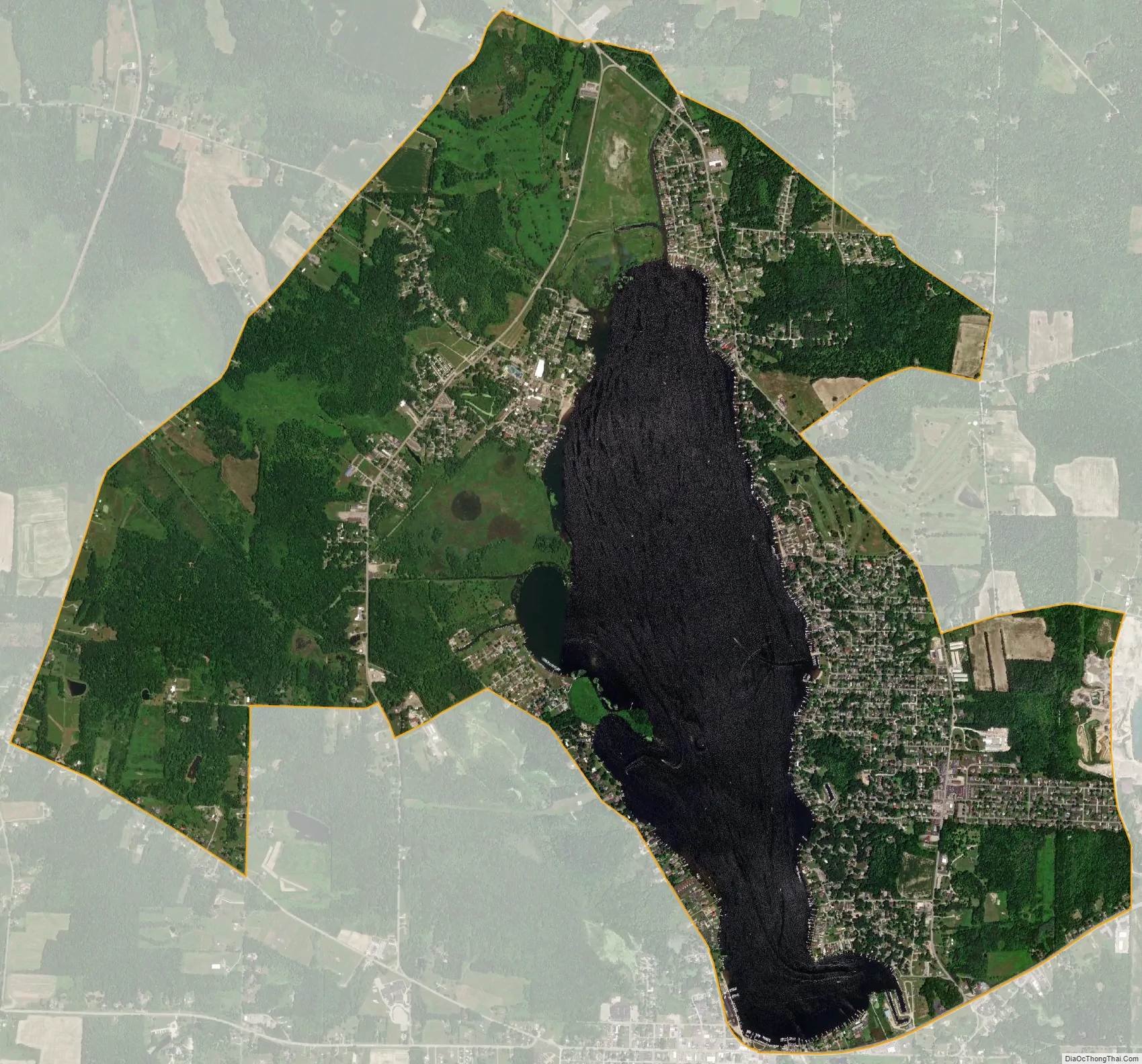
Conneaut Lakeshore city Satellite Map
Geography
The Conneaut Lakeshore CDP surrounds Conneaut Lake, the largest natural lake wholly in Pennsylvania. It is located in northwestern Pennsylvania at 41°37′31″N 80°17′52″W / 41.62528°N 80.29778°W / 41.62528; -80.29778 (41.625296, -80.297706), in western Crawford County. The CDP consists of all development around the lake except for the borough of Conneaut Lake at the southern end. Most of the CDP is in Sadsbury Township, with the northern end of the lake and CDP extending into Summit Township. Conneaut Lake Park, a resort area, is near the center of the CDP, on the western side of the lake. Harmonsburg is directly to the north.
U.S. Route 6 runs along parts of the southern edge of the CDP, leading northwest 12 miles (19 km) to the Ohio border and east with U.S. Route 322 9 miles (14 km) to Meadville, the Crawford County seat. Pennsylvania Route 18 runs through the CDP along the eastern side of the lake, leading north through Harmonsburg 11 miles (18 km) to Conneautville. Pennsylvania Route 618 runs west of the lake, passing through Conneaut Lake Park and connecting PA 18 and US 6.
According to the United States Census Bureau, the Conneaut Lakeshore CDP has a total area of 6.7 square miles (17.3 km), of which 5.2 square miles (13.4 km) is land and 1.5 square miles (3.9 km), or 22.29%, is water.
See also
Map of Pennsylvania State and its subdivision:- Adams
- Allegheny
- Armstrong
- Beaver
- Bedford
- Berks
- Blair
- Bradford
- Bucks
- Butler
- Cambria
- Cameron
- Carbon
- Centre
- Chester
- Clarion
- Clearfield
- Clinton
- Columbia
- Crawford
- Cumberland
- Dauphin
- Delaware
- Elk
- Erie
- Fayette
- Forest
- Franklin
- Fulton
- Greene
- Huntingdon
- Indiana
- Jefferson
- Juniata
- Lackawanna
- Lancaster
- Lawrence
- Lebanon
- Lehigh
- Luzerne
- Lycoming
- Mc Kean
- Mercer
- Mifflin
- Monroe
- Montgomery
- Montour
- Northampton
- Northumberland
- Perry
- Philadelphia
- Pike
- Potter
- Schuylkill
- Snyder
- Somerset
- Sullivan
- Susquehanna
- Tioga
- Union
- Venango
- Warren
- Washington
- Wayne
- Westmoreland
- Wyoming
- York
- Alabama
- Alaska
- Arizona
- Arkansas
- California
- Colorado
- Connecticut
- Delaware
- District of Columbia
- Florida
- Georgia
- Hawaii
- Idaho
- Illinois
- Indiana
- Iowa
- Kansas
- Kentucky
- Louisiana
- Maine
- Maryland
- Massachusetts
- Michigan
- Minnesota
- Mississippi
- Missouri
- Montana
- Nebraska
- Nevada
- New Hampshire
- New Jersey
- New Mexico
- New York
- North Carolina
- North Dakota
- Ohio
- Oklahoma
- Oregon
- Pennsylvania
- Rhode Island
- South Carolina
- South Dakota
- Tennessee
- Texas
- Utah
- Vermont
- Virginia
- Washington
- West Virginia
- Wisconsin
- Wyoming