Dawson is a borough in Fayette County, Pennsylvania, United States. The population was 352 at the 2020 census, a decline from the figure of 367 tabulated in 2010.
| Name: | Dawson borough |
|---|---|
| LSAD Code: | 21 |
| LSAD Description: | borough (suffix) |
| State: | Pennsylvania |
| County: | Fayette County |
| Total Area: | 0.21 sq mi (0.55 km²) |
| Land Area: | 0.17 sq mi (0.45 km²) |
| Water Area: | 0.04 sq mi (0.11 km²) |
| Total Population: | 352 |
| Population Density: | 2,034.68/sq mi (785.71/km²) |
| Area code: | 724 |
| FIPS code: | 4218360 |
Online Interactive Map
Click on ![]() to view map in "full screen" mode.
to view map in "full screen" mode.
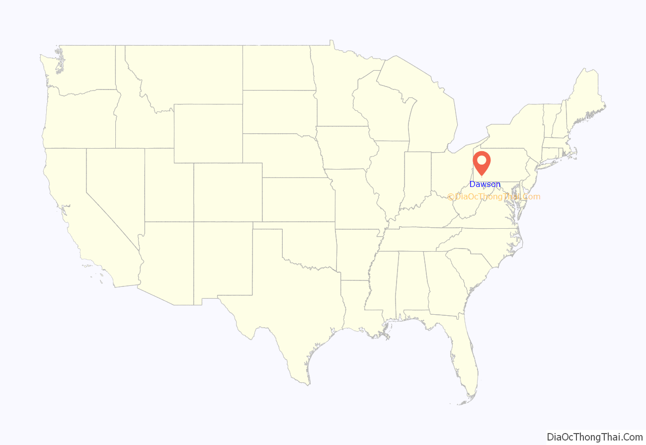
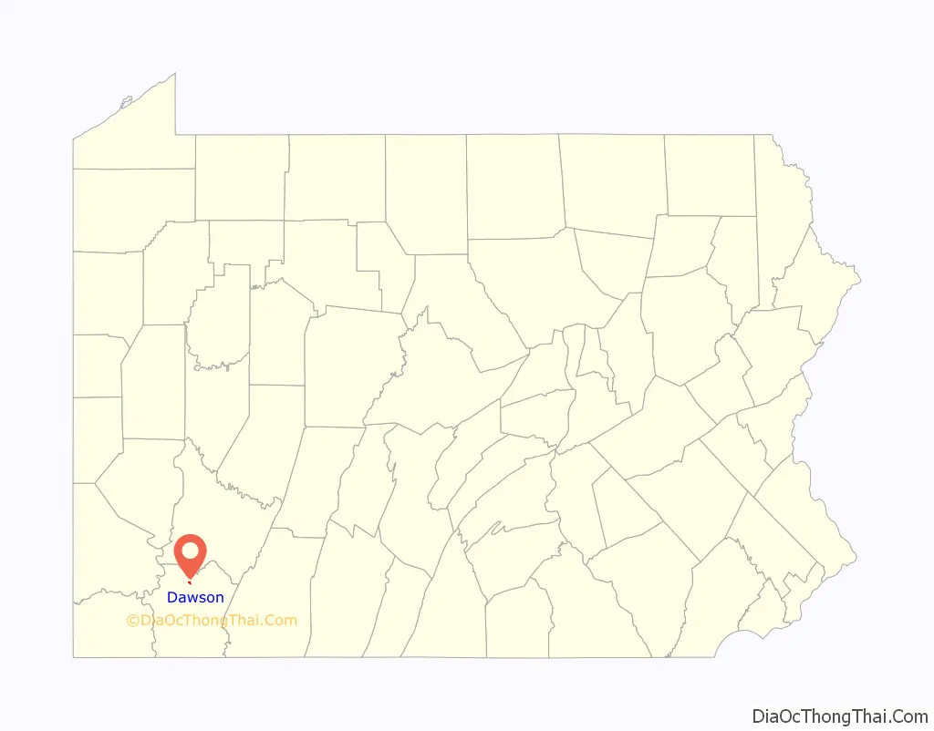
Dawson location map. Where is Dawson borough?
History
The land where Dawson was developed had belonged to John Smilie, who held multiple public offices in the government of Pennsylvania and was a member of Congress when he died in December 1812. The property remained in a trust as a part of Smilie’s estate, until his last child died in 1851, when the property was sold.
The “bottom land” where Dawson is situated was acquired by John Smilie’s granddaughter, Sarah Huston Dawson, and her second husband, George Dawson.
The Smilie farm, except the river bottom, was sold to Stewart Strickler. The bottom land was sold to George Dawson, who used it for purposes of cultivation. The Pittsburgh and Connellsville Railroad was located through the tract, and upon the opening of the line Dawson’s Station was established at this point. A post office was established at the same time.
The property passed, in the division of the Dawson estate, to Mrs. Alfred [Elizabeth Dawson] Howell, and in 1866 a town plat was laid out and surveyed by Martin Dickson for Mr. Howell.
Alfred Howell arranged for the tract to be duly surveyed and laid out into building lots, and so conducted his enterprise as in the course of a few years to erect a prosperous and desirable village, with churches, public schools, etc., upon what was before, and but for his business foresight and energy would have remained, merely an uninhabitable portion of an old farm.
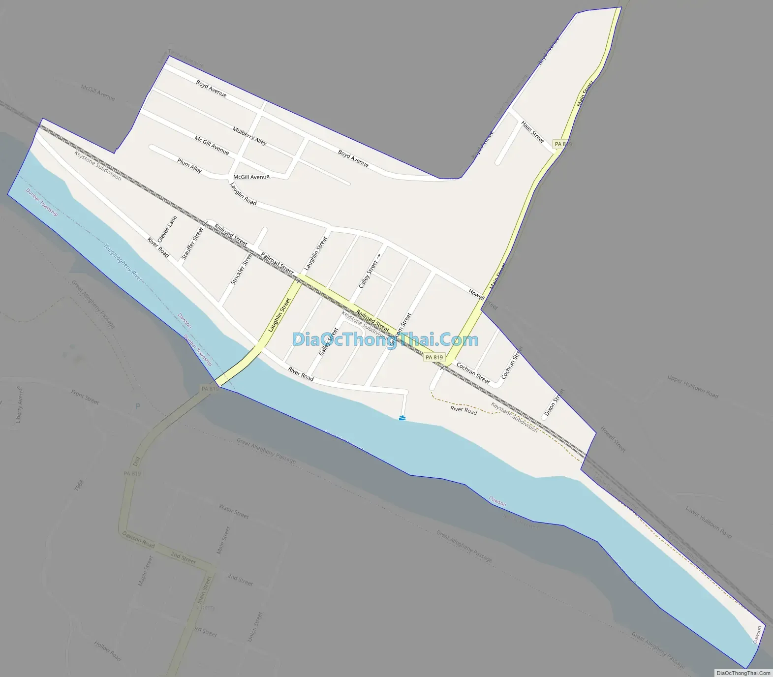
Dawson Road Map
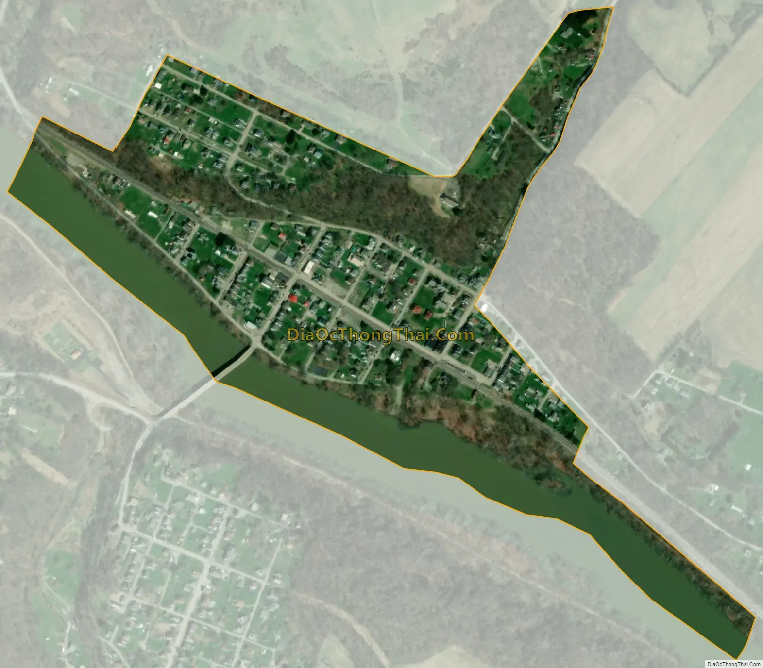
Dawson city Satellite Map
Geography
Dawson is located in northern Fayette County at 40°2′52″N 79°39′31″W / 40.04778°N 79.65861°W / 40.04778; -79.65861 (40.047892, -79.658659), on the north bank of the Youghiogheny River. Pennsylvania Route 819 passes through the center of town, crossing the Youghiogheny into the unincorporated community of Liberty on the other side. PA 819 leads northeast 6 miles (10 km) to Scottdale and south 1 mile (1.6 km) to Vanderbilt. The city of Connellsville is 5.5 miles (8.9 km) to the southeast via PA 819 and PA 201.
According to the United States Census Bureau, Dawson has a total area of 0.21 square miles (0.54 km), of which 0.16 square miles (0.41 km) is land and 0.05 square miles (0.13 km), or 23.55%, is water.
Smiley Run joins the Youghiogheny River on the west side of the borough.
See also
Map of Pennsylvania State and its subdivision:- Adams
- Allegheny
- Armstrong
- Beaver
- Bedford
- Berks
- Blair
- Bradford
- Bucks
- Butler
- Cambria
- Cameron
- Carbon
- Centre
- Chester
- Clarion
- Clearfield
- Clinton
- Columbia
- Crawford
- Cumberland
- Dauphin
- Delaware
- Elk
- Erie
- Fayette
- Forest
- Franklin
- Fulton
- Greene
- Huntingdon
- Indiana
- Jefferson
- Juniata
- Lackawanna
- Lancaster
- Lawrence
- Lebanon
- Lehigh
- Luzerne
- Lycoming
- Mc Kean
- Mercer
- Mifflin
- Monroe
- Montgomery
- Montour
- Northampton
- Northumberland
- Perry
- Philadelphia
- Pike
- Potter
- Schuylkill
- Snyder
- Somerset
- Sullivan
- Susquehanna
- Tioga
- Union
- Venango
- Warren
- Washington
- Wayne
- Westmoreland
- Wyoming
- York
- Alabama
- Alaska
- Arizona
- Arkansas
- California
- Colorado
- Connecticut
- Delaware
- District of Columbia
- Florida
- Georgia
- Hawaii
- Idaho
- Illinois
- Indiana
- Iowa
- Kansas
- Kentucky
- Louisiana
- Maine
- Maryland
- Massachusetts
- Michigan
- Minnesota
- Mississippi
- Missouri
- Montana
- Nebraska
- Nevada
- New Hampshire
- New Jersey
- New Mexico
- New York
- North Carolina
- North Dakota
- Ohio
- Oklahoma
- Oregon
- Pennsylvania
- Rhode Island
- South Carolina
- South Dakota
- Tennessee
- Texas
- Utah
- Vermont
- Virginia
- Washington
- West Virginia
- Wisconsin
- Wyoming