Dormont is a borough in Allegheny County, Pennsylvania, United States and is part of the Pittsburgh Metro Area. The population was 8,244 at the 2020 census. Dormont includes young professionals, working families, and retirees. Dormont is mixed use and urban and features a pedestrian friendly business district, with bars, coffee shops, restaurants, and retail stores. It is famous for one of the largest municipal pools in Pennsylvania, the historic Dormont Pool. Loosely translated, Dormont means “Mountain of Gold” in French.
| Name: | Dormont borough |
|---|---|
| LSAD Code: | 21 |
| LSAD Description: | borough (suffix) |
| State: | Pennsylvania |
| County: | Allegheny County |
| Total Area: | 0.76 sq mi (1.97 km²) |
| Land Area: | 0.76 sq mi (1.97 km²) |
| Water Area: | 0.00 sq mi (0.00 km²) |
| Total Population: | 8,244 |
| Population Density: | 10,847.37/sq mi (4,186.02/km²) |
| ZIP code: | 15216 |
| Area code: | 412 |
| FIPS code: | 4219576 |
| Website: | www.boro.dormont.pa.us |
Online Interactive Map
Click on ![]() to view map in "full screen" mode.
to view map in "full screen" mode.
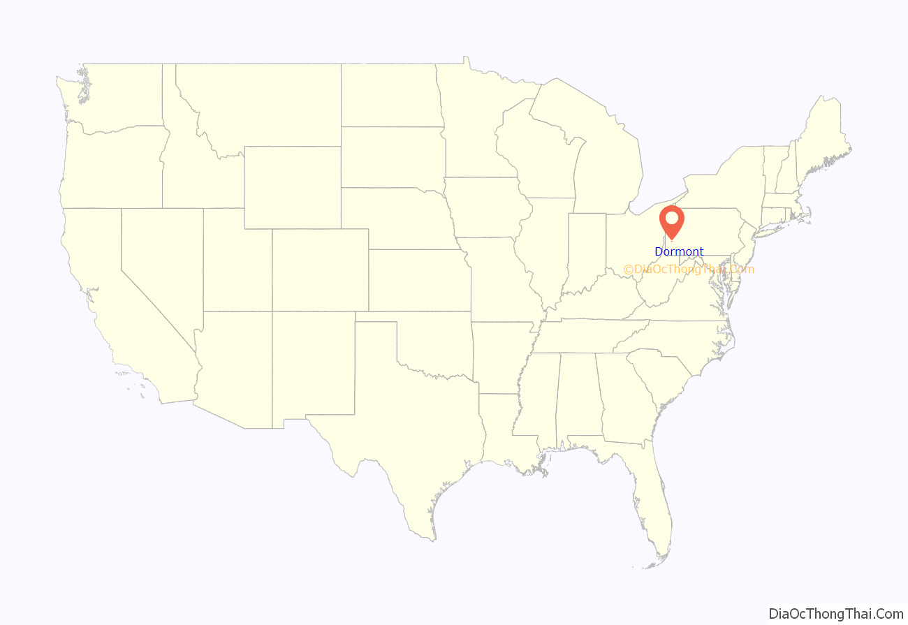
Dormont location map. Where is Dormont borough?
History
The territory in which Dormont Borough is situated was held by the Delaware and Shawnee tribes until 1768, when the territory was part of the transaction in which Fort Stanwix was purchased from the Six Nations. In following years, Dormont’s area was part of Cumberland County, Pitt Township in Bedford County, Penn Township in Washington County, and finally, St. Clair Township in Allegheny County in 1788.
Dormont was originally fashioned from parts of Scott and Union Townships. An order of incorporation was signed on March 31, 1909, making Dormont the first independent municipality in the South Hills of Allegheny County. Municipal officials initially wanted to name the new community “Mt. Lebanon”; however, objections were raised by their as yet unincorporated neighbors to the south, who eventually adopted the name. Instead, the name Dormont was chosen from the Americanized version of the French term “mont d’or”, loosely translated as “Mountain of Gold.”
The first election of borough officials was held on April 27, 1909. Dormont later annexed part of Scott Township in 1909, two additional parts of Union Township in 1913 and 1916, and a portion of Mt. Lebanon Township in January 1921, giving it a total area of just less than one square mile. With the construction of the streetcar tunnel and the Liberty Tunnels came rapid growth.
A town without “streets”
Once the borough of Dormont was incorporated in 1909, at least 30 different streets were given new names. Today, all but two of Dormont’s “side streets” are designated as avenues, the exceptions being Memorial Drive and Park Blvd. Two of Dormont’s mainline streets, Scott Road and McFarland Road, are two-lane “borough line” streets in which one lane is located in Dormont and the other in Mt. Lebanon. The northern stretch of another “borough line” street, McNeilly Avenue, runs through Dormont on one side and the Pittsburgh neighborhood of Brookline on the other. Before the incorporation and street name changes, Dormont actually had four designated “streets”: Beech St. (Dwight Ave.), Sycamore St. (Philadelphia Ave.), Sylvester St. (Texas Ave.) and “C” St. (Miles Ave.).
Leisure
Through the years, the convenience of the borough, plus the amenities offered its residents, has kept it densely populated. Its citizens enjoy one of the largest swimming pools in Pennsylvania (>60,000 square feet), two parks, basketball and tennis courts, two Little League fields, a fine library, an impressive volunteer-built children’s playground, as well as seasonal activities for both children and adults. “Dormont Day,” the annual Fourth of July park-wide event, is the highlight of the summer season and features all day family entertainment beginning with the 8:00 a.m. Twenty-One Gun Salute and culminating with one of the most spectacular fireworks displays for a community of this size. During the day, park goers are treated to live music, picnics, food booths, games, pony rides, and youth foot races. In the fall, Dormont hosts the Dormont Street and Music Festival, featuring two stages of bands playing a variety of music from 2:00 – 10:00 PM.
Dormont Road Map
Dormont city Satellite Map
Geography
Dormont is located in Southwestern Pennsylvania, in Allegheny County, approximately 4 miles (6.4 km) south of the county seat of Pittsburgh.
Dormont’s map coordinates are: 40°23′37″N 80°2′15″W / 40.39361°N 80.03750°W / 40.39361; -80.03750 (40.393646, -80.037466).
According to the United States Census Bureau, the borough has a total area of 0.7 square miles (1.8 km), all land.
See also
Map of Pennsylvania State and its subdivision:- Adams
- Allegheny
- Armstrong
- Beaver
- Bedford
- Berks
- Blair
- Bradford
- Bucks
- Butler
- Cambria
- Cameron
- Carbon
- Centre
- Chester
- Clarion
- Clearfield
- Clinton
- Columbia
- Crawford
- Cumberland
- Dauphin
- Delaware
- Elk
- Erie
- Fayette
- Forest
- Franklin
- Fulton
- Greene
- Huntingdon
- Indiana
- Jefferson
- Juniata
- Lackawanna
- Lancaster
- Lawrence
- Lebanon
- Lehigh
- Luzerne
- Lycoming
- Mc Kean
- Mercer
- Mifflin
- Monroe
- Montgomery
- Montour
- Northampton
- Northumberland
- Perry
- Philadelphia
- Pike
- Potter
- Schuylkill
- Snyder
- Somerset
- Sullivan
- Susquehanna
- Tioga
- Union
- Venango
- Warren
- Washington
- Wayne
- Westmoreland
- Wyoming
- York
- Alabama
- Alaska
- Arizona
- Arkansas
- California
- Colorado
- Connecticut
- Delaware
- District of Columbia
- Florida
- Georgia
- Hawaii
- Idaho
- Illinois
- Indiana
- Iowa
- Kansas
- Kentucky
- Louisiana
- Maine
- Maryland
- Massachusetts
- Michigan
- Minnesota
- Mississippi
- Missouri
- Montana
- Nebraska
- Nevada
- New Hampshire
- New Jersey
- New Mexico
- New York
- North Carolina
- North Dakota
- Ohio
- Oklahoma
- Oregon
- Pennsylvania
- Rhode Island
- South Carolina
- South Dakota
- Tennessee
- Texas
- Utah
- Vermont
- Virginia
- Washington
- West Virginia
- Wisconsin
- Wyoming
