Harmonsburg is a census-designated place (CDP) in Crawford County, Pennsylvania, United States. The population was 401 at the 2010 census, up from 356 in 2000.
| Name: | Harmonsburg CDP |
|---|---|
| LSAD Code: | 57 |
| LSAD Description: | CDP (suffix) |
| State: | Pennsylvania |
| County: | Crawford County |
| Elevation: | 1,120 ft (340 m) |
| Total Area: | 1.38 sq mi (3.57 km²) |
| Land Area: | 1.38 sq mi (3.57 km²) |
| Water Area: | 0.00 sq mi (0.00 km²) |
| Total Population: | 309 |
| Population Density: | 224.40/sq mi (86.67/km²) |
| ZIP code: | 16422 |
| Area code: | 814 |
| FIPS code: | 4232656 |
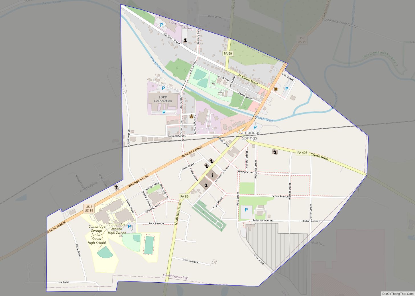
Online Interactive Map
Click on ![]() to view map in "full screen" mode.
to view map in "full screen" mode.
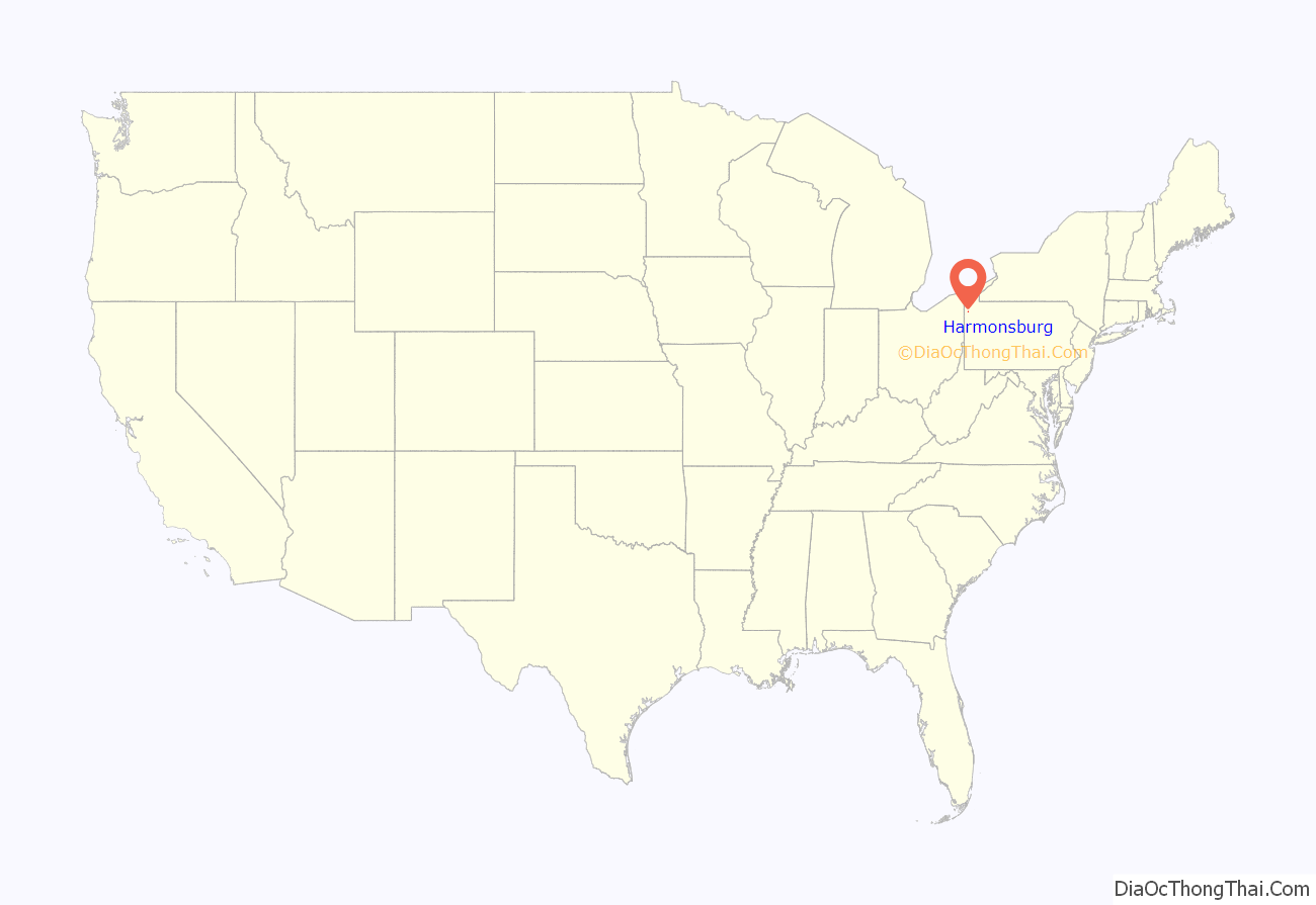
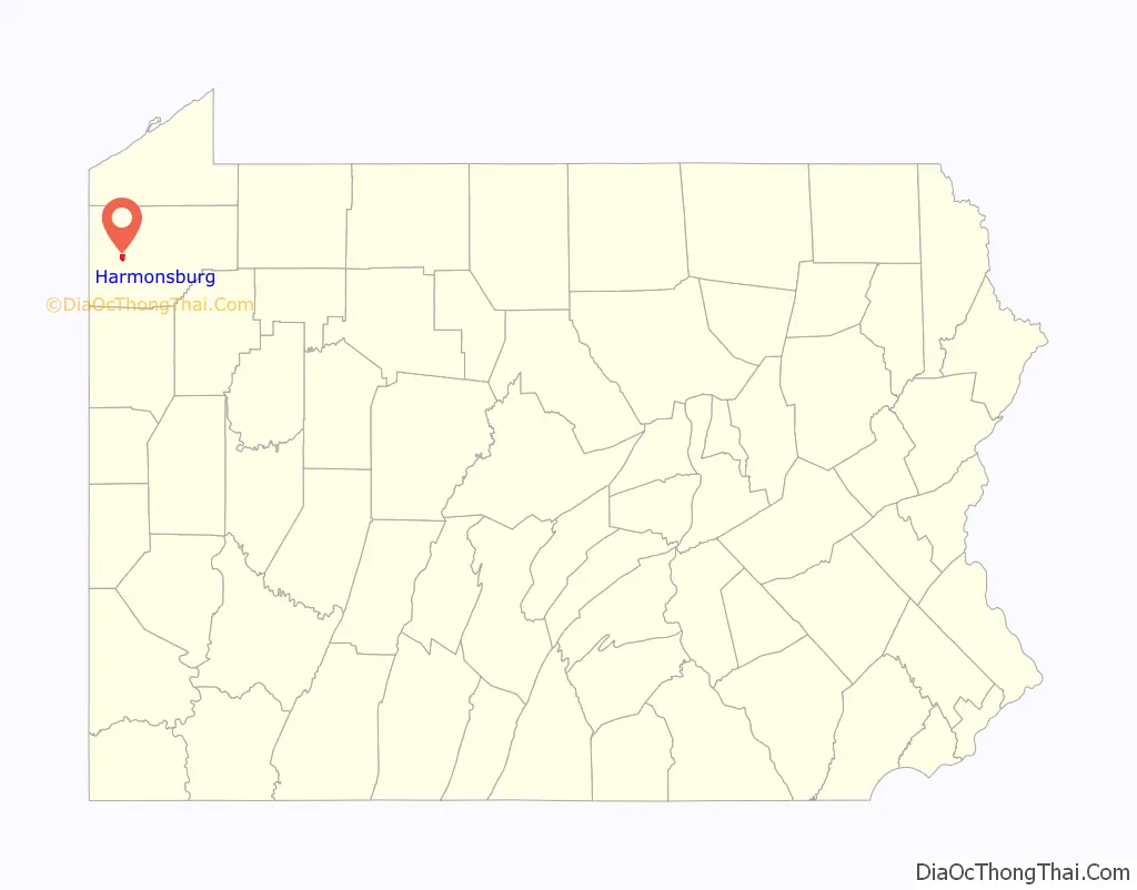
Harmonsburg location map. Where is Harmonsburg CDP?
History
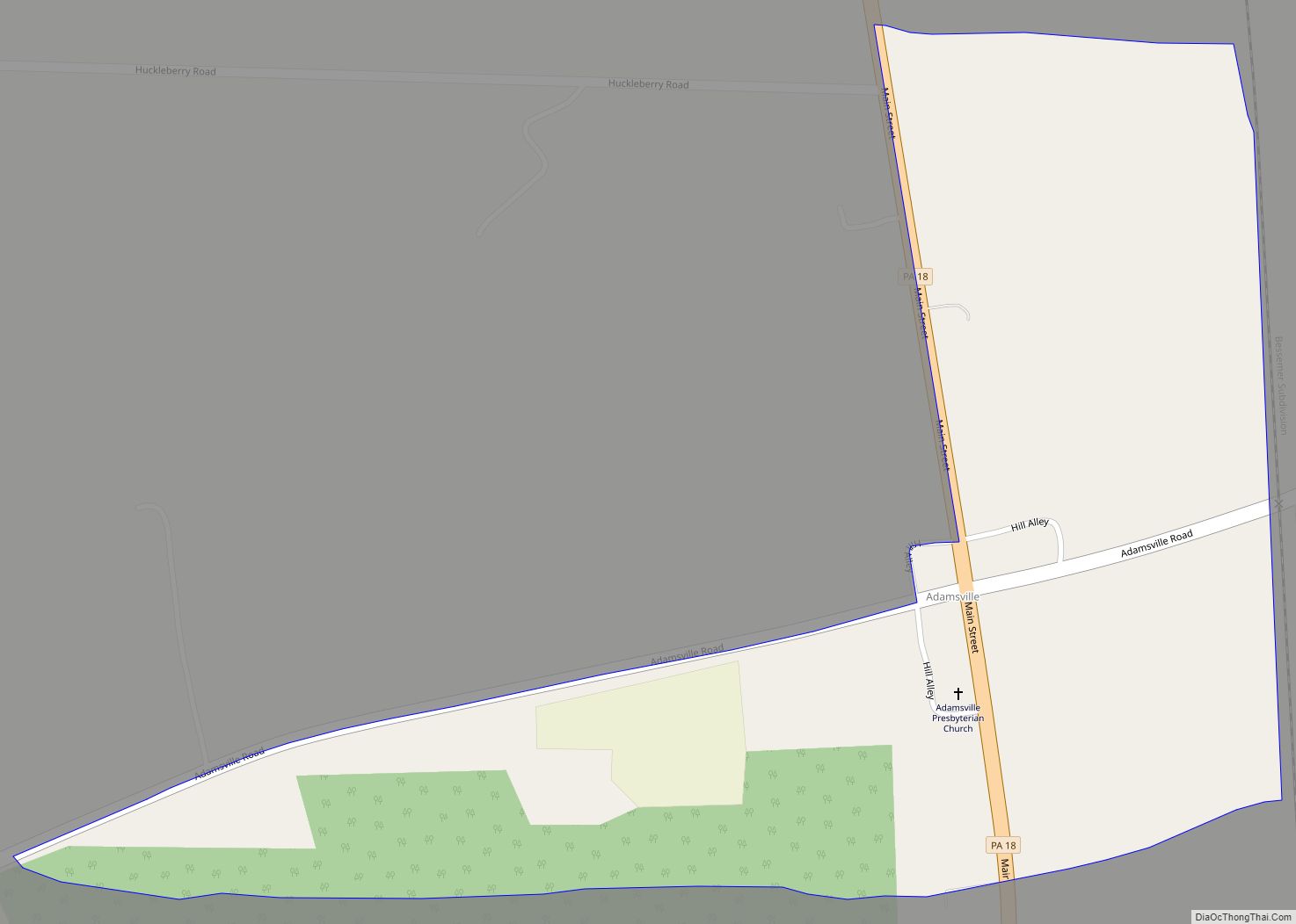
Harmonsburg was laid out in 1816 by Henry Bright, a German Dunkard who laid out the village on land he had purchased in 1802. For many years, the village was known as “Brightstown”. Bright was a blacksmith and farmer, and he lived in the village until his death in 1838. The first house was built by Joseph McMurtry and served as a tavern.
The village never grew to be very large, at most 160 or so inhabitants in the village proper. An early log grist and sawmill were located about a half a mile south of the village. A short distance east was a cheese factory.
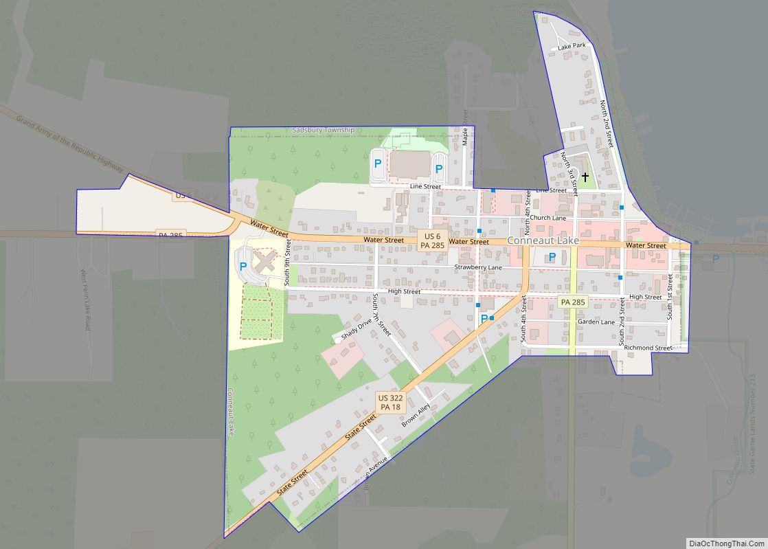
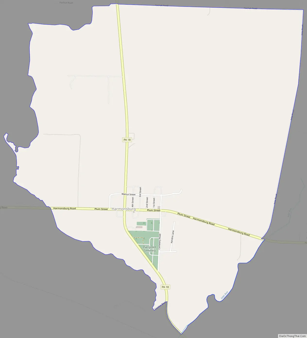
Harmonsburg Road Map
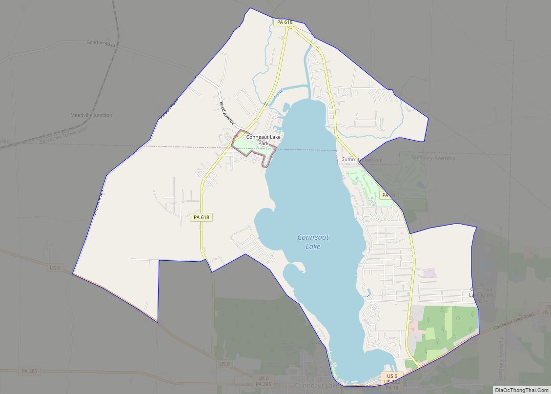
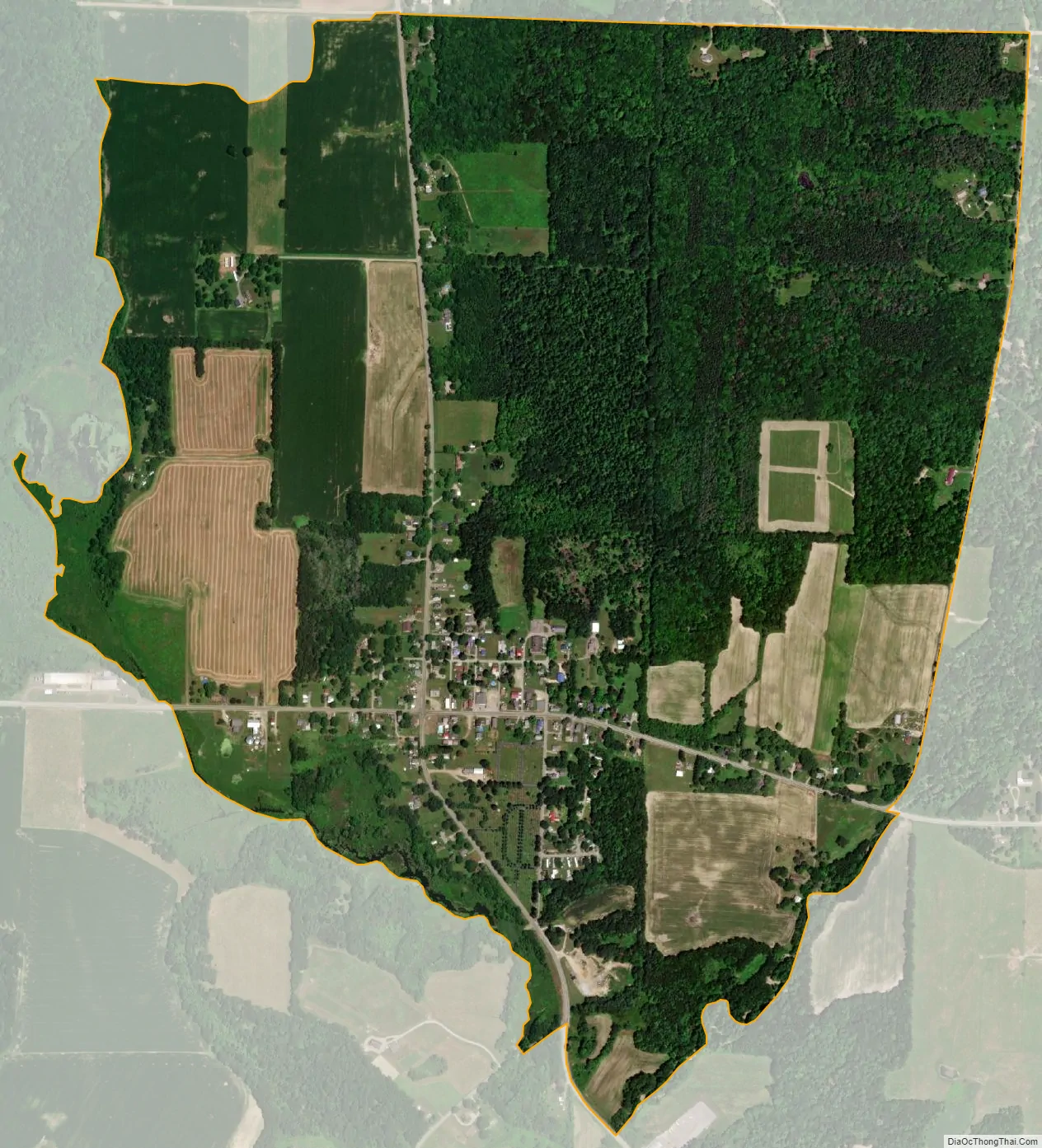
Harmonsburg city Satellite Map
Geography
Harmonsburg is located in western Crawford County at 41°39′40″N 80°18′58″W / 41.66111°N 80.31611°W / 41.66111; -80.31611 (41.661068, -80.316181), slightly east of the center of Summit Township. It is less than 2 miles (3 km) north of Conneaut Lake. Pennsylvania Route 18 passes through the community, leading north 7 miles (11 km) to Conneautville and south 5 miles (8 km) to the borough of Conneaut Lake at the southern end of the lake.
Harmonsburg is surrounded by farms and farmland. The area is ideal for farming, being nearly level with access to water from Conneaut Inlet and Conneaut Creek. A great variety of timber—hemlock, sugar maple, pine, oak, sycamore, beech—are native here.
According to the United States Census Bureau, the CDP has a total area of 1.4 square miles (3.6 km), all land.
See also
Map of Pennsylvania State and its subdivision:- Adams
- Allegheny
- Armstrong
- Beaver
- Bedford
- Berks
- Blair
- Bradford
- Bucks
- Butler
- Cambria
- Cameron
- Carbon
- Centre
- Chester
- Clarion
- Clearfield
- Clinton
- Columbia
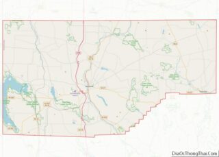
- Crawford
- Cumberland
- Dauphin
- Delaware
- Elk
- Erie
- Fayette
- Forest
- Franklin
- Fulton
- Greene
- Huntingdon
- Indiana
- Jefferson
- Juniata
- Lackawanna
- Lancaster
- Lawrence
- Lebanon
- Lehigh
- Luzerne
- Lycoming
- Mc Kean
- Mercer
- Mifflin
- Monroe
- Montgomery
- Montour
- Northampton
- Northumberland
- Perry
- Philadelphia
- Pike
- Potter
- Schuylkill
- Snyder
- Somerset
- Sullivan
- Susquehanna
- Tioga
- Union
- Venango
- Warren
- Washington
- Wayne
- Westmoreland
- Wyoming
- York
- Alabama
- Alaska
- Arizona
- Arkansas
- California
- Colorado
- Connecticut
- Delaware
- District of Columbia
- Florida
- Georgia
- Hawaii
- Idaho
- Illinois
- Indiana
- Iowa
- Kansas
- Kentucky
- Louisiana
- Maine
- Maryland
- Massachusetts
- Michigan
- Minnesota
- Mississippi
- Missouri
- Montana
- Nebraska
- Nevada
- New Hampshire
- New Jersey
- New Mexico
- New York
- North Carolina
- North Dakota
- Ohio
- Oklahoma
- Oregon
- Pennsylvania
- Rhode Island
- South Carolina
- South Dakota
- Tennessee
- Texas
- Utah
- Vermont
- Virginia
- Washington
- West Virginia
- Wisconsin
- Wyoming