Homestead is a borough in Allegheny County, Pennsylvania. The borough is located in the Monongahela River valley 7 miles (11 km) southeast of downtown Pittsburgh and directly across the river from the city limits. The borough is known for the Homestead Strike of 1892, an important event in the history of labor relations in the United States. The population of Homestead was 2,884 at the 2020 census.
| Name: | Homestead borough |
|---|---|
| LSAD Code: | 21 |
| LSAD Description: | borough (suffix) |
| State: | Pennsylvania |
| County: | Allegheny County |
| Total Area: | 0.64 sq mi (1.66 km²) |
| Land Area: | 0.58 sq mi (1.49 km²) |
| Water Area: | 0.07 sq mi (0.17 km²) |
| Total Population: | 2,884 |
| Population Density: | 5,006.94/sq mi (1,932.88/km²) |
| ZIP code: | 15120 |
| Area code: | 412 |
| FIPS code: | 4235424 |
| Website: | www.homesteadborough.com |
Online Interactive Map
Click on ![]() to view map in "full screen" mode.
to view map in "full screen" mode.
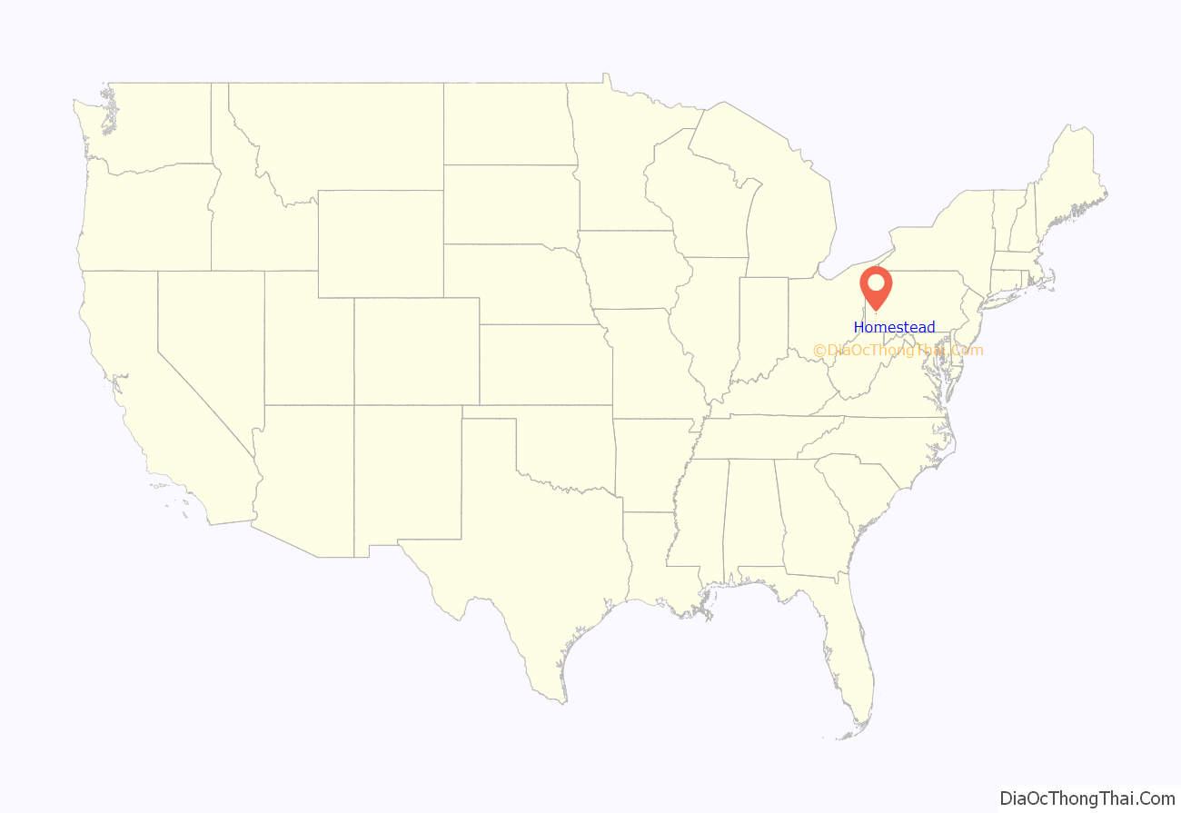
Homestead location map. Where is Homestead borough?
History
The area on the south bank of the Monongahela River now comprising the boroughs of Homestead, Munhall and West Homestead saw the first white settlers arrive in the 1770s. One hundred years later, much of the existing farmland on the flats and hillsides by the river was purchased, laid out in lots and sold by local banks and land owners to create the town of Homestead. The town was chartered in 1880. The building of a railroad, glass factory, and in 1881 the first iron mill began a period of rapid growth and prosperity. In 1883, Andrew Carnegie bought out Homestead Steel Works, adding it to his empire of steel and coke enterprises. Carnegie had recently acquired a controlling interest in Henry Clay Frick’s coke works on the Monongahela, setting the stage for the dramatic labor clash in Homestead.
Homestead gained international notoriety in July 1892 as the site of a violent clash between locked-out steelworkers and hired Pinkerton guards, known as the Homestead Strike. When Henry Clay Frick, manager for Andrew Carnegie, owner of the local Homestead Steel Works, announced in the spring of 1892 that skilled workers would receive a reduction in wages, the advisory committee of the Amalgamated Association of Iron and Steel Workers refused to sign a new contract. Carnegie’s management locked the workforce out, declaring that the union would no longer be recognized at the steel works.
To break the strike and secure the mill from the disgruntled workers, industrialist Henry Clay Frick hired hundreds of armed toughs from the Pinkerton National Detective Agency. When barges carrying the Pinkertons arrived at the mill on the morning of July 6, workers and townspeople met them at the riverbanks. Though eyewitness accounts differed on which side first fired a shot, a day-long armed battle ensued which resulted in eleven deaths and dozens of injuries. The governor of Pennsylvania eventually called out the National Guard to restore order to the town and take control of the mill. Frick successfully destroyed the union in Homestead and, by extension, in most of his other steel mills through the nation. The “Battle of Homestead,” as the event came to be known, represented a stunning setback for unionization in the highly mechanized steel industry. It also set the stage for the future steel strike of 1919, in which Homestead played an important role.
At the turn of the 20th century, in 1900, the population of Homestead was 12,554 people, of whom some 7,000 were employed in the plants. Due mostly to immigration from Eastern and Southern Europe, by 1910 the population jumped to 18,713, then to 20,452 in 1920. In the first decade of the 20th century, Homestead was studied as part of the sociological Pittsburgh Survey, the results of which were eventually published as Homestead: The Households of a Mill Town.
In 1940, 19,041 people lived in Homestead. During the early 1940s half the population was displaced as the United States government added to the steel mills to have the capacity for armor plating for ships and tanks (preparing for World War II). After the end of the war, a decline in the steel-making industry of the United States took place.
By 1980, it had become difficult to obtain employment at the Homestead Works, which was not producing much steel at that time. In 1986, the mill closed. The Homestead Works was demolished in the early 1990s, replaced in 1999 by The Waterfront shopping mall. As a direct result of the loss of mill employment, the number of people living in Homestead dwindled. By the time of the 2010 census, the borough population was 3,165. The borough began financially recovering in 2002, with the enlarging retail tax base.
Homestead Road Map
Homestead city Satellite Map
Geography
Homestead is located at 40°24′18″N 79°54′28″W / 40.40500°N 79.90778°W / 40.40500; -79.90778 (40.405069, −79.907785). According to the U.S. Census Bureau, the borough has a total area of 0.6 square miles (1.6 km), of which 0.6 square miles (1.6 km) is land and 0.1 square miles (0.26 km), or 11.11%, is water.
See also
Map of Pennsylvania State and its subdivision:- Adams
- Allegheny
- Armstrong
- Beaver
- Bedford
- Berks
- Blair
- Bradford
- Bucks
- Butler
- Cambria
- Cameron
- Carbon
- Centre
- Chester
- Clarion
- Clearfield
- Clinton
- Columbia
- Crawford
- Cumberland
- Dauphin
- Delaware
- Elk
- Erie
- Fayette
- Forest
- Franklin
- Fulton
- Greene
- Huntingdon
- Indiana
- Jefferson
- Juniata
- Lackawanna
- Lancaster
- Lawrence
- Lebanon
- Lehigh
- Luzerne
- Lycoming
- Mc Kean
- Mercer
- Mifflin
- Monroe
- Montgomery
- Montour
- Northampton
- Northumberland
- Perry
- Philadelphia
- Pike
- Potter
- Schuylkill
- Snyder
- Somerset
- Sullivan
- Susquehanna
- Tioga
- Union
- Venango
- Warren
- Washington
- Wayne
- Westmoreland
- Wyoming
- York
- Alabama
- Alaska
- Arizona
- Arkansas
- California
- Colorado
- Connecticut
- Delaware
- District of Columbia
- Florida
- Georgia
- Hawaii
- Idaho
- Illinois
- Indiana
- Iowa
- Kansas
- Kentucky
- Louisiana
- Maine
- Maryland
- Massachusetts
- Michigan
- Minnesota
- Mississippi
- Missouri
- Montana
- Nebraska
- Nevada
- New Hampshire
- New Jersey
- New Mexico
- New York
- North Carolina
- North Dakota
- Ohio
- Oklahoma
- Oregon
- Pennsylvania
- Rhode Island
- South Carolina
- South Dakota
- Tennessee
- Texas
- Utah
- Vermont
- Virginia
- Washington
- West Virginia
- Wisconsin
- Wyoming
