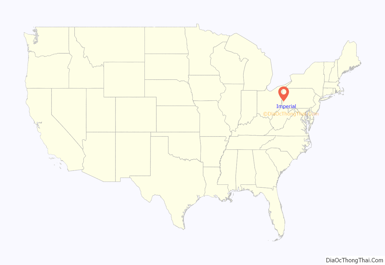
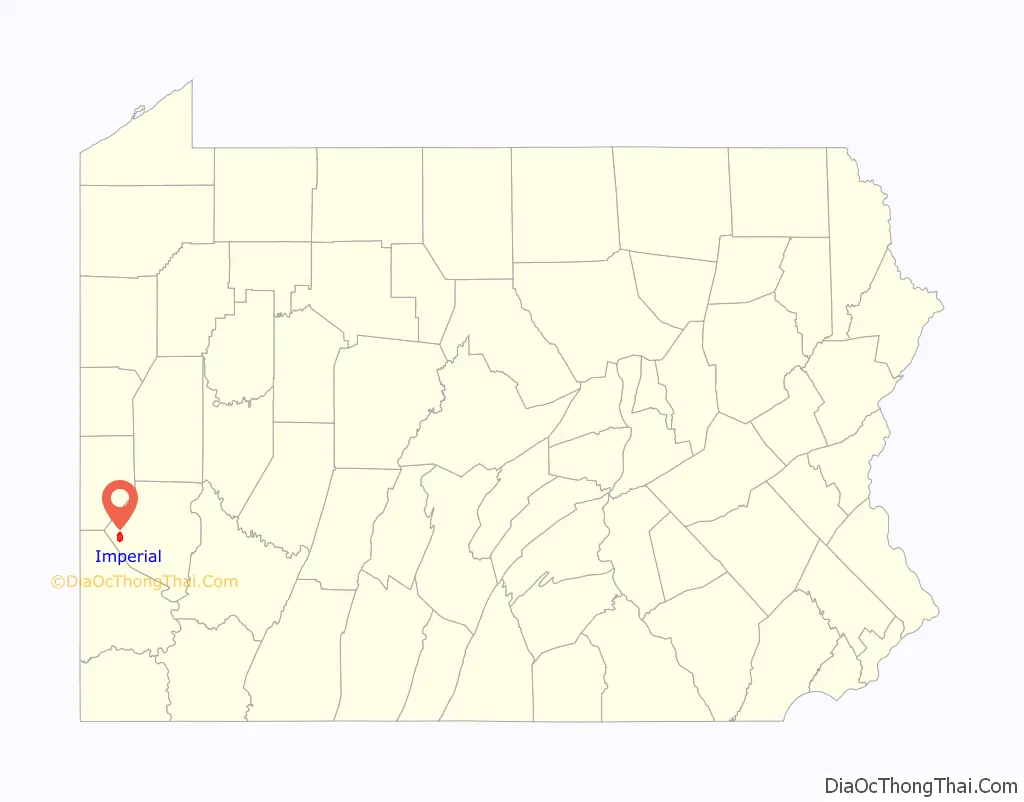
Imperial is a census-designated place (CDP) in Allegheny County, Pennsylvania, United States and part of the Pittsburgh metropolitan area. The population was 2,722 at the 2020 census. The CDP is located in North Fayette and Findlay Townships, and geographically close to Pittsburgh International Airport.
| Name: | Imperial CDP |
|---|---|
| LSAD Code: | 57 |
| LSAD Description: | CDP (suffix) |
| State: | Pennsylvania |
| County: | Allegheny County |
| Total Area: | 3.17 sq mi (8.22 km²) |
| Land Area: | 3.17 sq mi (8.22 km²) |
| Water Area: | 0.00 sq mi (0.00 km²) |
| Total Population: | 2,722 |
| Population Density: | 857.86/sq mi (331.27/km²) |
| FIPS code: | 4236768 |
Online Interactive Map
Click on ![]() to view map in "full screen" mode.
to view map in "full screen" mode.
Imperial location map. Where is Imperial CDP?
History
Imperial was established as a mining town circa 1879 by the Imperial Coal Company. It sits along Montour Run on land that had been the farm of Robert Wilson. Known at first as Montour City, the town soon took the name of the coal company, with a post office under the name Imperial opening in 1880. The town and nearby mines were served by the Montour Railroad. The community was formerly part of the Imperial-Enlow CDP before splitting into two separate CDPs. In 2020, Amazon opened a large fulfillment center complex in Imperial off of Pennsylvania Route 576.
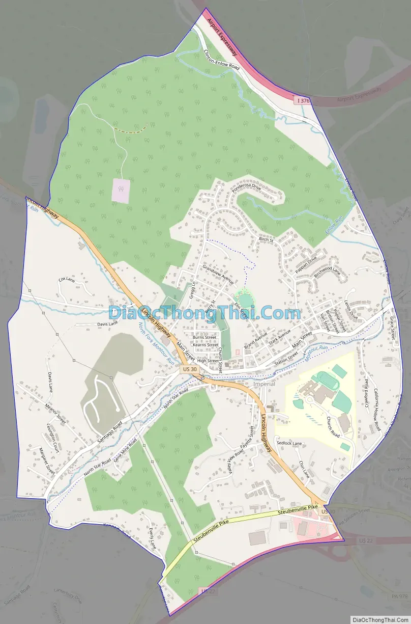
Imperial Road Map
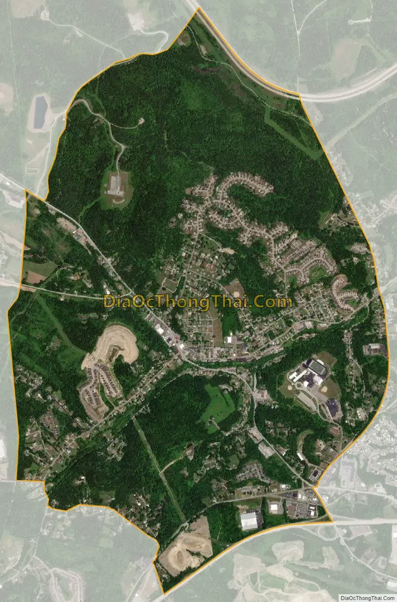
Imperial city Satellite Map
Geography
Imperial is located at 40°27′13″N 80°14′59″W / 40.45361°N 80.24972°W / 40.45361; -80.24972 (40.4536 N, 80.2498 W). According to the U.S. Census Bureau, the CDP has a total area of 3.1 square miles (8.0 km), all land.
In terms of road access to Imperial, U.S. Route 30 passes through the middle of the township, with U.S. Route 22 and Interstate 376 providing expressway access to roads in Imperial. Additionally, the partially-completed Pennsylvania Route 576 has an exit serving Imperial.
See also
Map of Pennsylvania State and its subdivision:- Adams
- Allegheny
- Armstrong
- Beaver
- Bedford
- Berks
- Blair
- Bradford
- Bucks
- Butler
- Cambria
- Cameron
- Carbon
- Centre
- Chester
- Clarion
- Clearfield
- Clinton
- Columbia
- Crawford
- Cumberland
- Dauphin
- Delaware
- Elk
- Erie
- Fayette
- Forest
- Franklin
- Fulton
- Greene
- Huntingdon
- Indiana
- Jefferson
- Juniata
- Lackawanna
- Lancaster
- Lawrence
- Lebanon
- Lehigh
- Luzerne
- Lycoming
- Mc Kean
- Mercer
- Mifflin
- Monroe
- Montgomery
- Montour
- Northampton
- Northumberland
- Perry
- Philadelphia
- Pike
- Potter
- Schuylkill
- Snyder
- Somerset
- Sullivan
- Susquehanna
- Tioga
- Union
- Venango
- Warren
- Washington
- Wayne
- Westmoreland
- Wyoming
- York
- Alabama
- Alaska
- Arizona
- Arkansas
- California
- Colorado
- Connecticut
- Delaware
- District of Columbia
- Florida
- Georgia
- Hawaii
- Idaho
- Illinois
- Indiana
- Iowa
- Kansas
- Kentucky
- Louisiana
- Maine
- Maryland
- Massachusetts
- Michigan
- Minnesota
- Mississippi
- Missouri
- Montana
- Nebraska
- Nevada
- New Hampshire
- New Jersey
- New Mexico
- New York
- North Carolina
- North Dakota
- Ohio
- Oklahoma
- Oregon
- Pennsylvania
- Rhode Island
- South Carolina
- South Dakota
- Tennessee
- Texas
- Utah
- Vermont
- Virginia
- Washington
- West Virginia
- Wisconsin
- Wyoming


