Laurel Mountain is a borough that is located in Westmoreland County, Pennsylvania, United States. The population was 185 at the time of the 2000 census.
Situated at the foot of Laurel Mountain (elev. 2,800 ft.), the borough lies near numerous limestone caves and is surrounded by venues for skiing, hiking, and other outdoor activities.
| Name: | Laurel Mountain borough |
|---|---|
| LSAD Code: | 21 |
| LSAD Description: | borough (suffix) |
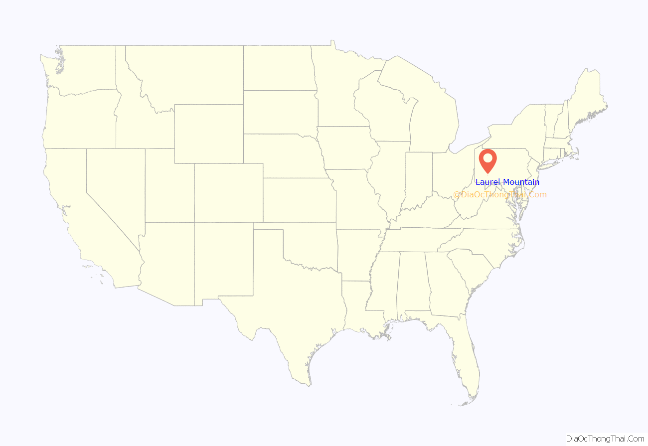
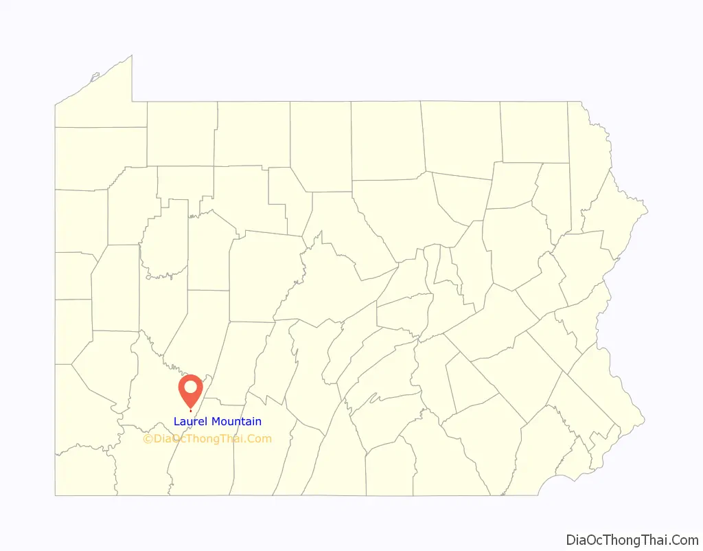
| State: | Pennsylvania |
| County: | Westmoreland County |
| Incorporated: | 1982 |
| Elevation: | 1,421 ft (433 m) |
| Total Area: | 0.13 sq mi (0.33 km²) |
| Land Area: | 0.13 sq mi (0.33 km²) |
| Water Area: | 0.00 sq mi (0.00 km²) |
| Total Population: | 146 |
| Population Density: | 1,131.78/sq mi (436.81/km²) |
| FIPS code: | 4241834 |
Online Interactive Map
Click on ![]() to view map in "full screen" mode.
to view map in "full screen" mode.
Laurel Mountain location map. Where is Laurel Mountain borough?
History
On July 28, 1769, Richard and Thomas Penn obtained the land where the community of Laurel Mountain would ultimately be located. Purchased from members of the Iroquois Confederacy as part of a larger acquisition encompassing a major portion of what is, today, southwestern Pennsylvania, the price was ten thousand dollars.
During the early nineteenth century, Alexander Johnson obtained a patent from the Commonwealth of Pennsylvania, which transferred ownership to him in 1815 of a 724-acre portion of this same area, including the section that would later become Laurel Mountain. Roughly three decades later, on May 27, 1843, Joseph Naugle purchased 283 acres of the 724-acre segment, and built a home there, paving the way for the creation of a new community.
By the early 1900s, that community had become a place of retreat for business and civic leaders seeking summer vacation homes outside of the city of Pittsburgh. On September 1, 1944, Laurel Mountain Park, Inc. was chartered and empowered to oversee operation of the growing community’s recreational facilities.
On December 21, 1979, the Westmoreland Court of Common Pleas approved the incorporation of Laurel Mountain as a borough. The first borough council was subsequently established in January 1982.
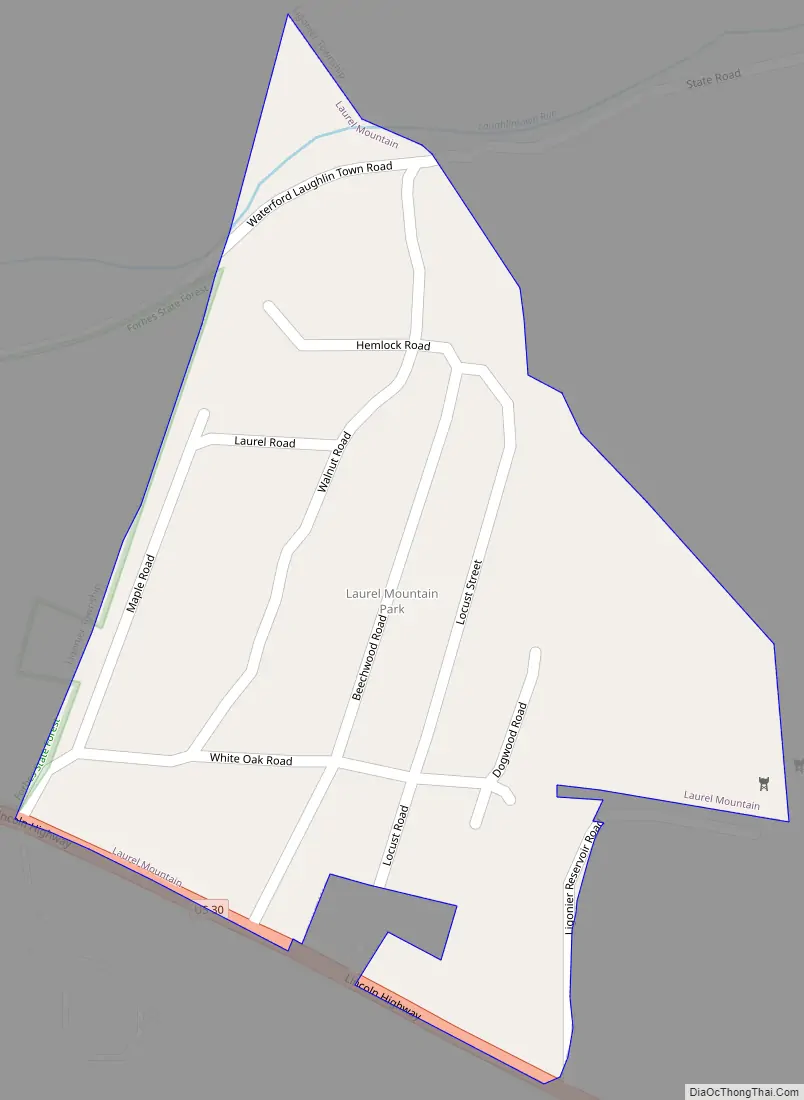
Laurel Mountain Road Map
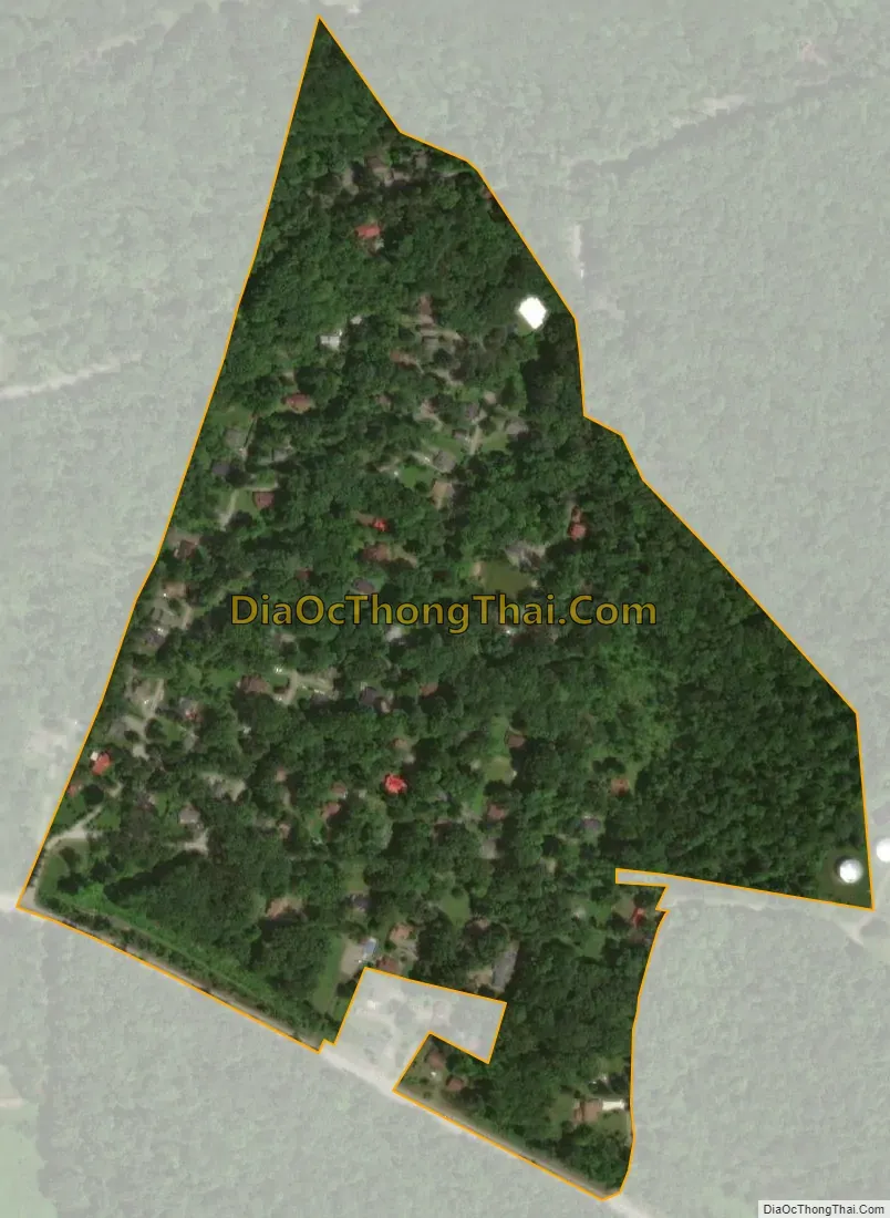
Laurel Mountain city Satellite Map
Geography
Laurel Mountain is located at 40°12′41″N 79°11′4″W / 40.21139°N 79.18444°W / 40.21139; -79.18444 (40.211418, -79.184568). According to the United States Census Bureau, the borough has a total area of 0.1 square miles (0.26 km), all land.
It is situated in the southern part of Ligonier Township.
See also
Map of Pennsylvania State and its subdivision:- Adams
- Allegheny
- Armstrong
- Beaver
- Bedford
- Berks
- Blair
- Bradford
- Bucks
- Butler
- Cambria
- Cameron
- Carbon
- Centre
- Chester
- Clarion
- Clearfield
- Clinton
- Columbia
- Crawford
- Cumberland
- Dauphin
- Delaware
- Elk
- Erie
- Fayette
- Forest
- Franklin
- Fulton
- Greene
- Huntingdon
- Indiana
- Jefferson
- Juniata
- Lackawanna
- Lancaster
- Lawrence
- Lebanon
- Lehigh
- Luzerne
- Lycoming
- Mc Kean
- Mercer
- Mifflin
- Monroe
- Montgomery
- Montour
- Northampton
- Northumberland
- Perry
- Philadelphia
- Pike
- Potter
- Schuylkill
- Snyder
- Somerset
- Sullivan
- Susquehanna
- Tioga
- Union
- Venango
- Warren
- Washington
- Wayne
- Westmoreland
- Wyoming
- York
- Alabama
- Alaska
- Arizona
- Arkansas
- California
- Colorado
- Connecticut
- Delaware
- District of Columbia
- Florida
- Georgia
- Hawaii
- Idaho
- Illinois
- Indiana
- Iowa
- Kansas
- Kentucky
- Louisiana
- Maine
- Maryland
- Massachusetts
- Michigan
- Minnesota
- Mississippi
- Missouri
- Montana
- Nebraska
- Nevada
- New Hampshire
- New Jersey
- New Mexico
- New York
- North Carolina
- North Dakota
- Ohio
- Oklahoma
- Oregon
- Pennsylvania
- Rhode Island
- South Carolina
- South Dakota
- Tennessee
- Texas
- Utah
- Vermont
- Virginia
- Washington
- West Virginia
- Wisconsin
- Wyoming


