Oakdale is a borough in Allegheny County, Pennsylvania, United States and is a Pittsburgh suburb. The population was 1,475 at the 2020 census. Its zip code is 15071.
| Name: | Oakdale borough |
|---|---|
| LSAD Code: | 21 |
| LSAD Description: | borough (suffix) |
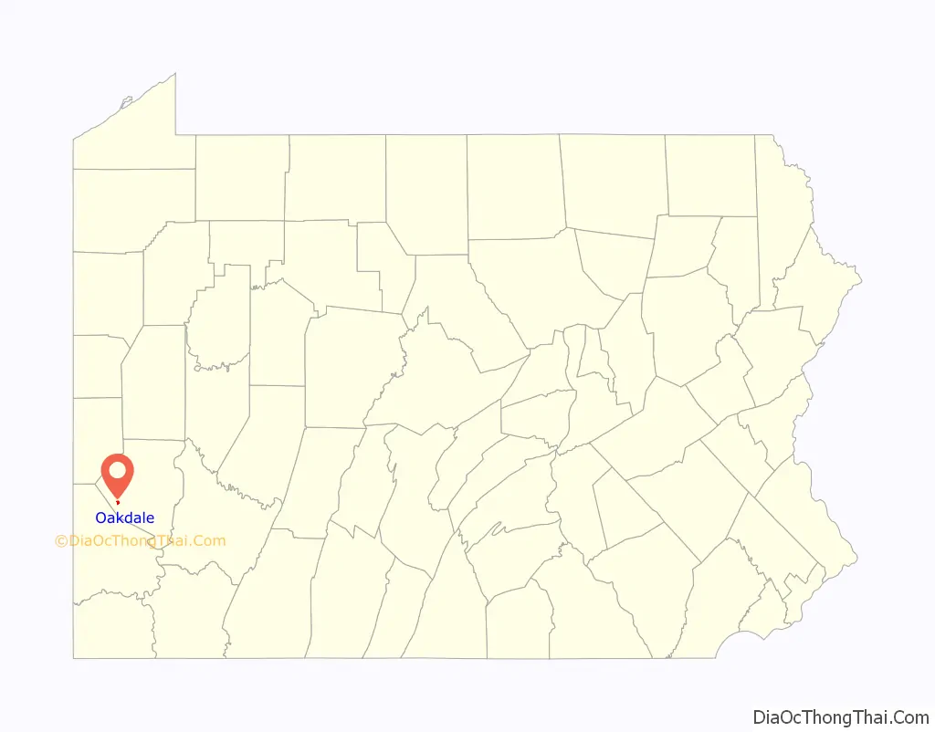
| State: | Pennsylvania |
| County: | Allegheny County |
| Total Area: | 0.47 sq mi (1.22 km²) |
| Land Area: | 0.47 sq mi (1.22 km²) |
| Water Area: | 0.00 sq mi (0.00 km²) |
| Total Population: | 1,475 |
| Population Density: | 3,144.99/sq mi (1,213.11/km²) |
| FIPS code: | 4255840 |
| Website: | www.oakdaleborough.com |
Online Interactive Map
Click on ![]() to view map in "full screen" mode.
to view map in "full screen" mode.
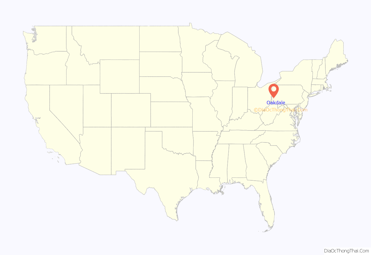
Oakdale location map. Where is Oakdale borough?
History
Oakdale Borough was incorporated in 1892. On May 18, 1918 a TNT explosion in a local chemical factory killed 200 people. On September 17, 2004, Oakdale was devastated by a flood resulting from the rain brought by the remnants of category 5 Hurricane Ivan. The downpour from Ivan followed a steady rain that had covered the Allegheny County area from category 4 Hurricane Frances, which struck the area just 10 days before Ivan hit. The flooding caused a large-scale evacuation of the community, and brought Red Cross volunteers and National Guard members to the area in an effort to control the confusion. The flooding destroyed businesses, many of which never reopened, and displaced many residents whose homes were condemned.
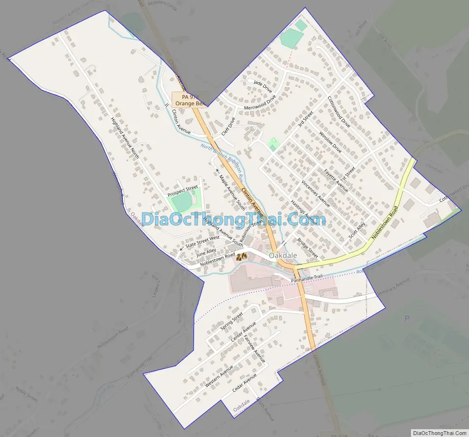
Oakdale Road Map
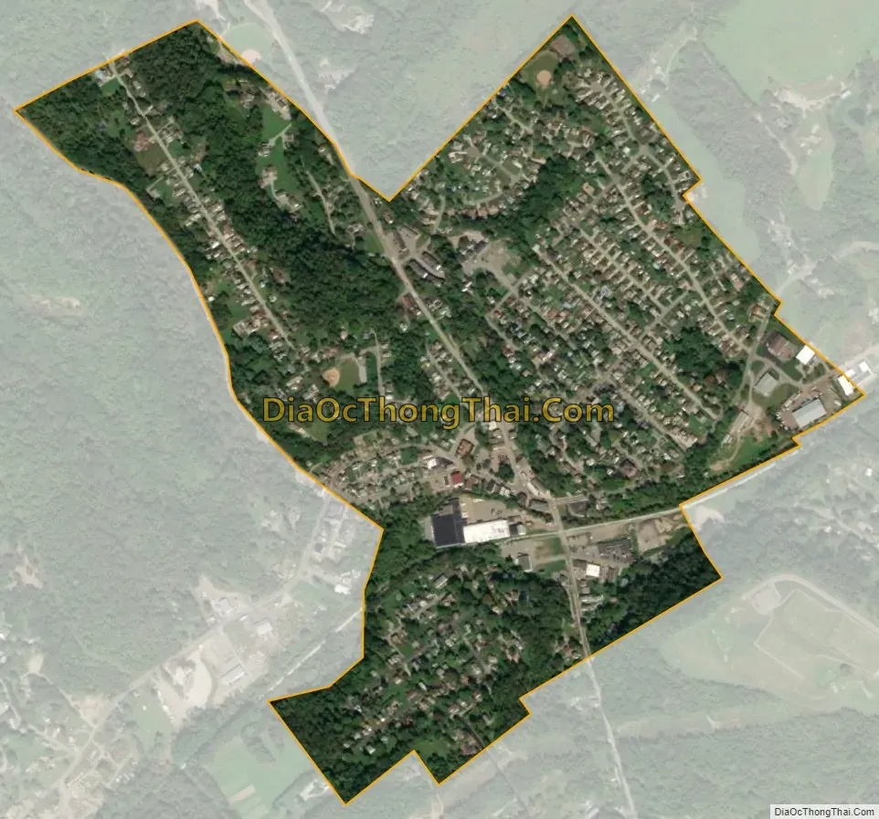
Oakdale city Satellite Map
Geography
According to the United States Census Bureau, the borough has a total area of 0.5 square miles (1.3 km), all land.
Robinson Run, a tributary to Chartiers Creek, flows through the southeastern part of the borough. Oakdale is bordered by North Fayette Township to the north and South Fayette Township to the south.
See also
Map of Pennsylvania State and its subdivision:- Adams
- Allegheny
- Armstrong
- Beaver
- Bedford
- Berks
- Blair
- Bradford
- Bucks
- Butler
- Cambria
- Cameron
- Carbon
- Centre
- Chester
- Clarion
- Clearfield
- Clinton
- Columbia
- Crawford
- Cumberland
- Dauphin
- Delaware
- Elk
- Erie
- Fayette
- Forest
- Franklin
- Fulton
- Greene
- Huntingdon
- Indiana
- Jefferson
- Juniata
- Lackawanna
- Lancaster
- Lawrence
- Lebanon
- Lehigh
- Luzerne
- Lycoming
- Mc Kean
- Mercer
- Mifflin
- Monroe
- Montgomery
- Montour
- Northampton
- Northumberland
- Perry
- Philadelphia
- Pike
- Potter
- Schuylkill
- Snyder
- Somerset
- Sullivan
- Susquehanna
- Tioga
- Union
- Venango
- Warren
- Washington
- Wayne
- Westmoreland
- Wyoming
- York
- Alabama
- Alaska
- Arizona
- Arkansas
- California
- Colorado
- Connecticut
- Delaware
- District of Columbia
- Florida
- Georgia
- Hawaii
- Idaho
- Illinois
- Indiana
- Iowa
- Kansas
- Kentucky
- Louisiana
- Maine
- Maryland
- Massachusetts
- Michigan
- Minnesota
- Mississippi
- Missouri
- Montana
- Nebraska
- Nevada
- New Hampshire
- New Jersey
- New Mexico
- New York
- North Carolina
- North Dakota
- Ohio
- Oklahoma
- Oregon
- Pennsylvania
- Rhode Island
- South Carolina
- South Dakota
- Tennessee
- Texas
- Utah
- Vermont
- Virginia
- Washington
- West Virginia
- Wisconsin
- Wyoming


