Plum is a borough in Allegheny County, Pennsylvania, United States. The population was 27,144 at the 2020 census. A suburb of the Pittsburgh metropolitan area, it is located northeast of the city in what is commonly referred to as the East Hills suburbs.
Plum is often referred to as “Plum Boro” or more correctly “Plum Borough” by locals to distinguish it from its previous status as a township. It was founded as Plum Township in 1788 and was reorganized as a borough in 1956. The borough took its name from nearby Plum Creek.
| Name: | Plum borough |
|---|---|
| LSAD Code: | 21 |
| LSAD Description: | borough (suffix) |
| State: | Pennsylvania |
| County: | Allegheny County |
| Total Area: | 28.94 sq mi (74.95 km²) |
| Land Area: | 28.57 sq mi (74.00 km²) |
| Water Area: | 0.37 sq mi (0.96 km²) 1.34% |
| Total Population: | 27,144 |
| Population Density: | 950.09/sq mi (366.83/km²) |
| FIPS code: | 4261536 |
| Website: | www.plumboro.com |
Online Interactive Map
Click on ![]() to view map in "full screen" mode.
to view map in "full screen" mode.
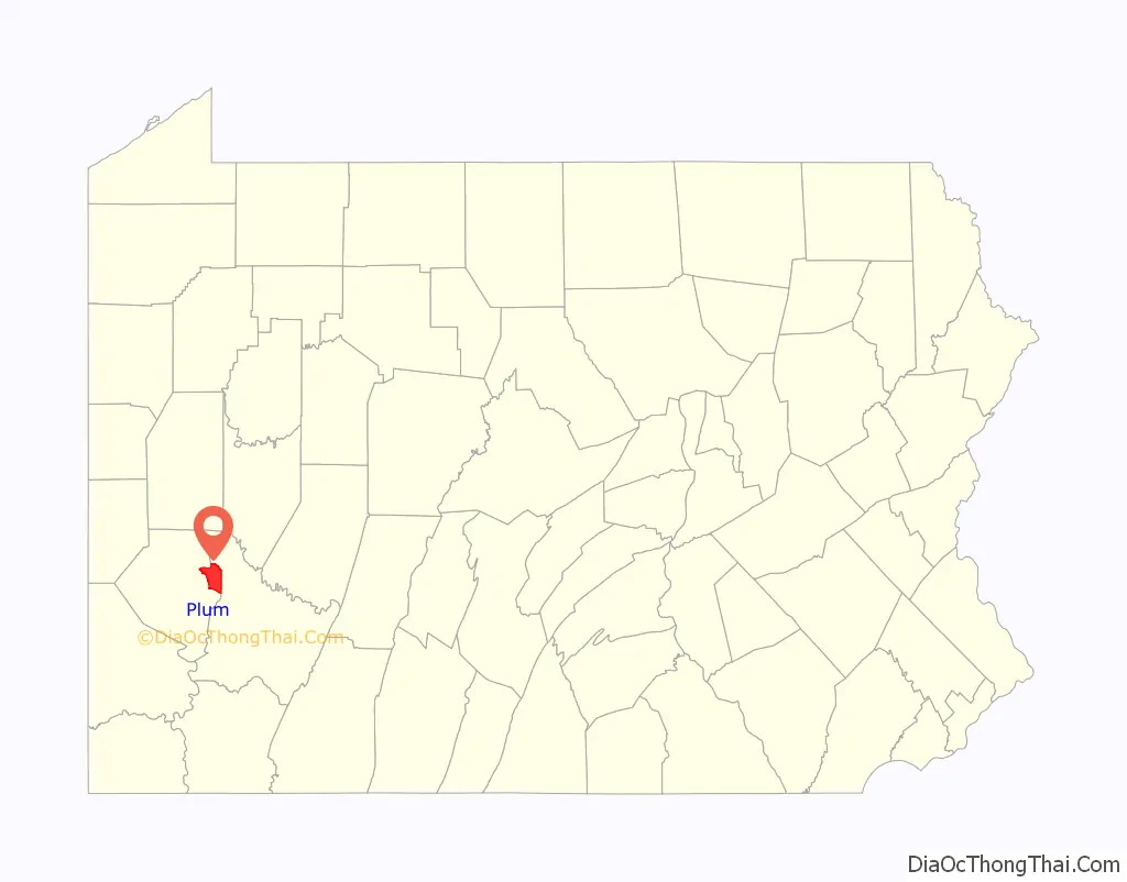
Plum location map. Where is Plum borough?

History
Plum Township was founded on December 18, 1788, as one of the original seven townships of Allegheny County. It originally extended as far south as Versailles (modern-day North Versailles Township), east to the county line, west to Pitt Township, and north to the Allegheny River. Plum has shrunk greatly over the years in area, but still remains among the larger municipalities in Allegheny County.
The 1889 history of Allegheny county, Pennsylvania, describes the township as having “no villages of importance”, but listed the first postoffice, Antrim, 1840–1857; New Texas, a hamlet, in the geographic center of the township with “the usual mechanics, local stores, etc.”, post office from 1856; and Logan’s Ferry, on the Allegheny River and Allegheny Valley railroad, in the northeastern part of the township, deriving its name from early settler Alexander Logan and family, post office from 1844.
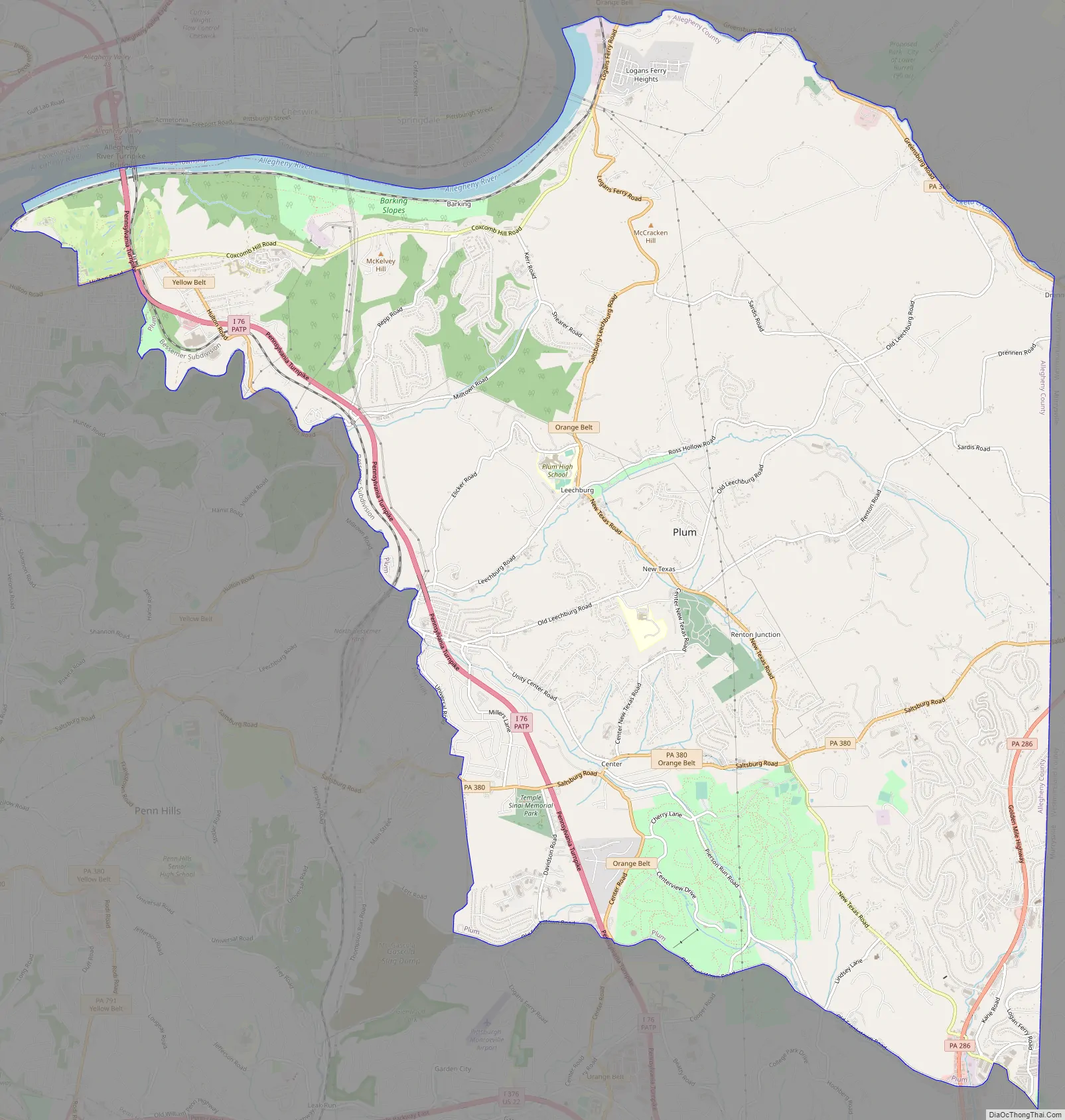
Plum Road Map
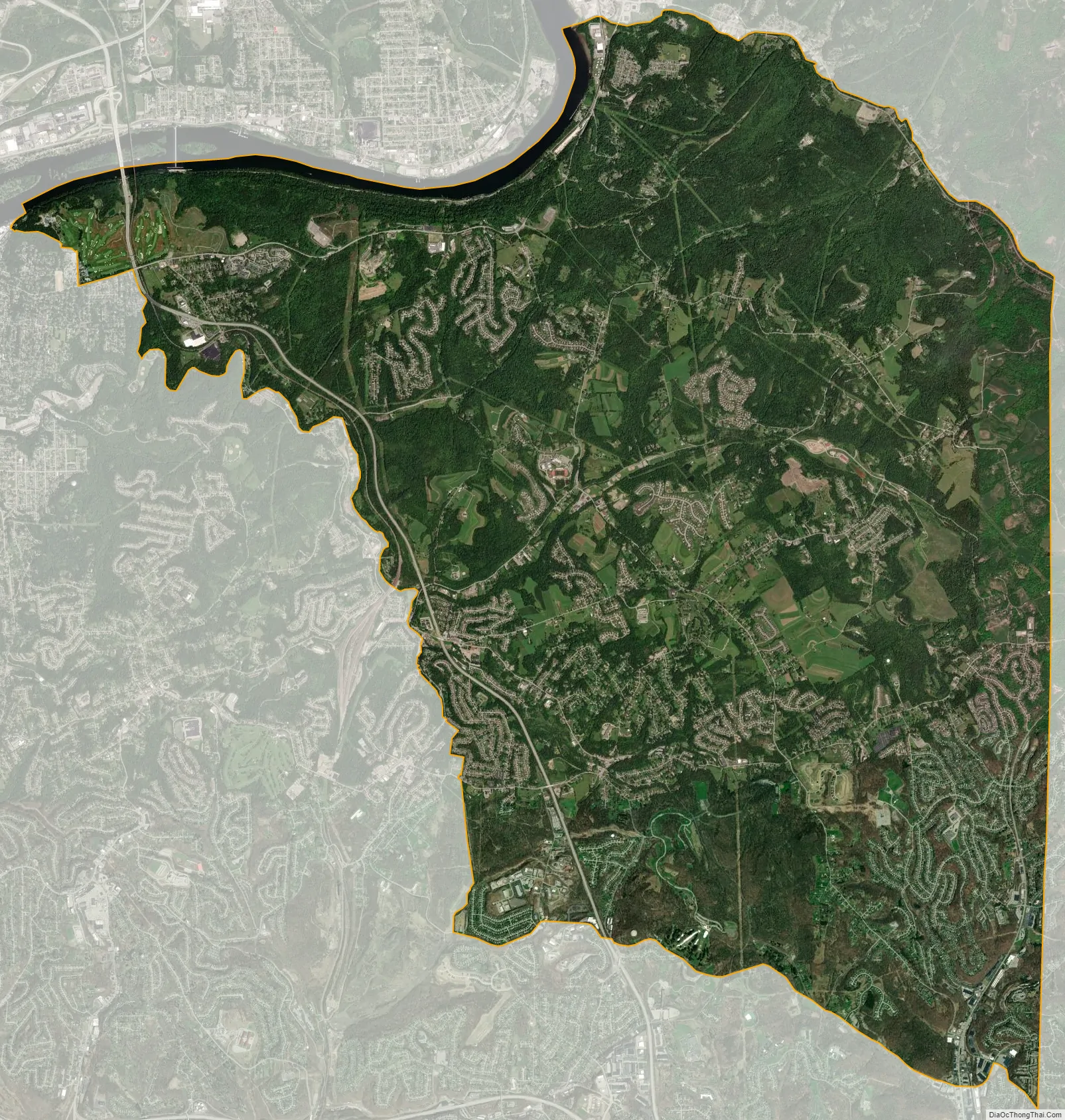
Plum city Satellite Map
Geography
According to the United States Census Bureau, the borough has a total area of 29.0 square miles (75 km), of which 28.6 square miles (74 km) is land and 0.4 square miles (1.0 km), or 1.34%, is water. Plum Borough is the second largest borough (area-wise) in the state of Pennsylvania.
Streams
- Pucketa Creek joins the Allegheny River where the creek forms the boundary between the borough of Plum and the city of Lower Burrell.
- Abers Creek
- Plum Creek rises in the borough.
- Little Plum Creek
Surrounding communities
- Monroeville (south)
- Penn Hills (west)
- Oakmont (west)
- Harmar Township (north across Allegheny River)
- Cheswick (north across Allegheny River)
- Springdale (north across Allegheny River)
- Lower Burrell (north, in Westmoreland County)
- New Kensington (north, in Westmoreland County)
- Upper Burrell Township (northeast, in Westmoreland County)
- Murrysville (east, in Westmoreland County)
See also
Map of Pennsylvania State and its subdivision:- Adams
- Allegheny
- Armstrong
- Beaver
- Bedford
- Berks
- Blair
- Bradford
- Bucks
- Butler
- Cambria
- Cameron
- Carbon
- Centre
- Chester
- Clarion
- Clearfield
- Clinton
- Columbia
- Crawford
- Cumberland
- Dauphin
- Delaware
- Elk
- Erie
- Fayette
- Forest
- Franklin
- Fulton
- Greene
- Huntingdon
- Indiana
- Jefferson
- Juniata
- Lackawanna
- Lancaster
- Lawrence
- Lebanon
- Lehigh
- Luzerne
- Lycoming
- Mc Kean
- Mercer
- Mifflin
- Monroe
- Montgomery
- Montour
- Northampton
- Northumberland
- Perry
- Philadelphia
- Pike
- Potter
- Schuylkill
- Snyder
- Somerset
- Sullivan
- Susquehanna
- Tioga
- Union
- Venango
- Warren
- Washington
- Wayne
- Westmoreland
- Wyoming
- York
- Alabama
- Alaska
- Arizona
- Arkansas
- California
- Colorado
- Connecticut
- Delaware
- District of Columbia
- Florida
- Georgia
- Hawaii
- Idaho
- Illinois
- Indiana
- Iowa
- Kansas
- Kentucky
- Louisiana
- Maine
- Maryland
- Massachusetts
- Michigan
- Minnesota
- Mississippi
- Missouri
- Montana
- Nebraska
- Nevada
- New Hampshire
- New Jersey
- New Mexico
- New York
- North Carolina
- North Dakota
- Ohio
- Oklahoma
- Oregon
- Pennsylvania
- Rhode Island
- South Carolina
- South Dakota
- Tennessee
- Texas
- Utah
- Vermont
- Virginia
- Washington
- West Virginia
- Wisconsin
- Wyoming


