Rennerdale is an unincorporated community and census-designated place in Collier Township, Allegheny County, Pennsylvania, United States, about 9 miles (14 km) southwest of Pittsburgh. As of the 2020 census it had a population of 1,103.
| Name: | Rennerdale CDP |
|---|---|
| LSAD Code: | 57 |
| LSAD Description: | CDP (suffix) |
| State: | Pennsylvania |
| County: | Allegheny County |
| Total Area: | 0.8 sq mi (2.0 km²) |
| Land Area: | 0.8 sq mi (2.0 km²) |
| Water Area: | 0 sq mi (0 km²) |
| Total Population: | 1,103 |
| Population Density: | 1,400/sq mi (550/km²) |
| FIPS code: | 4264184 |
Online Interactive Map
Click on ![]() to view map in "full screen" mode.
to view map in "full screen" mode.
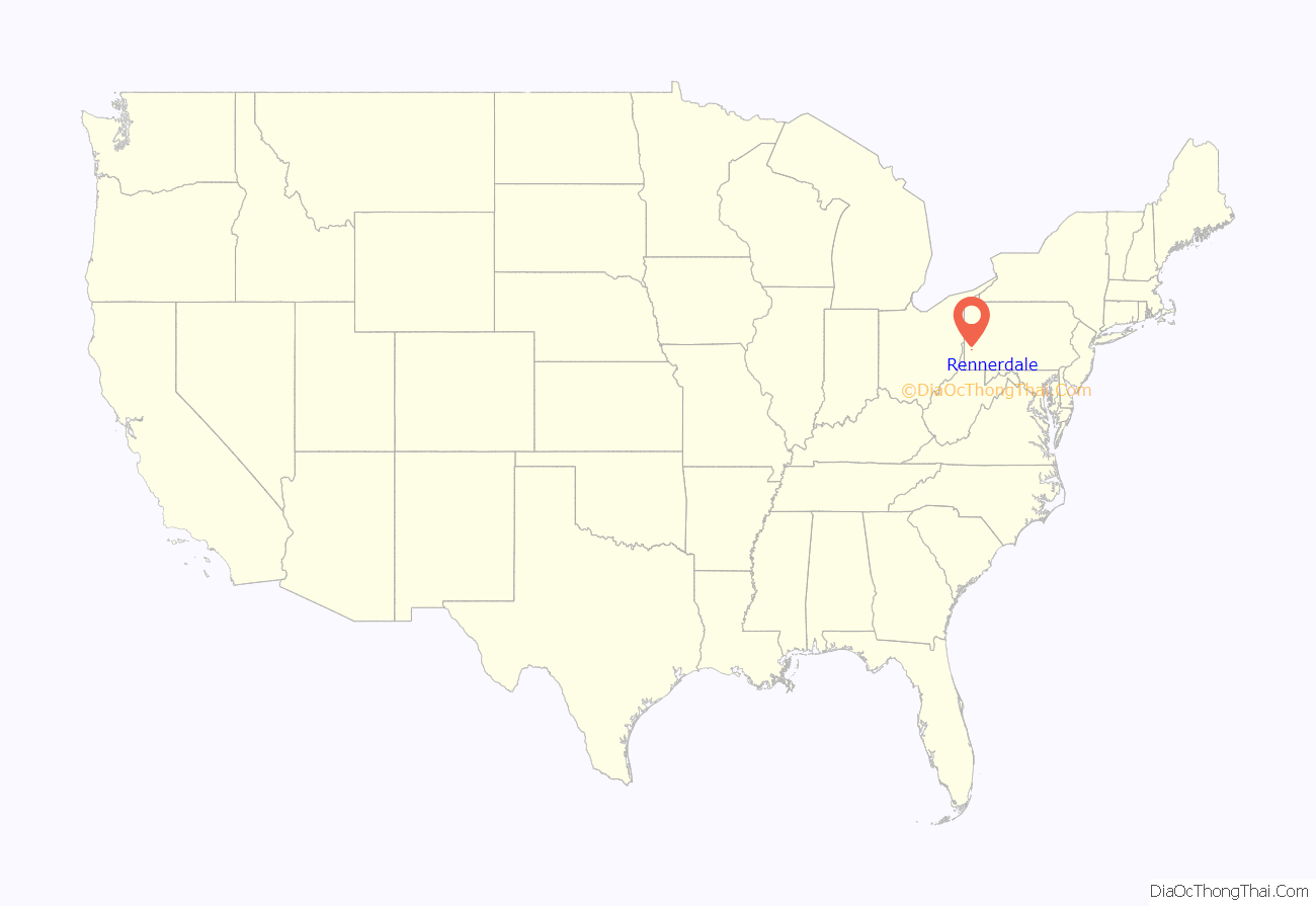
Rennerdale location map. Where is Rennerdale CDP?
History
An early settler of this region was James Ewing, who arrived in 1770 and built a grist mill on Robinson’s Run. Gabriel Walker and Isaac Walker, Scots-Irish brothers from Lancaster County, Pennsylvania, arrived in 1772. Gabriel Walker’s household was raided by Indians in 1782. Walker’s Mills, the village east of Rennerdale, is named for Isaac Walker. Between 1760 and 1790, Gabriel Walker built a log cabin about 2 miles (3 km) northwest of present-day Rennerdale; today known as the Walker-Ewing Log House, the structure still stands. In 1976, it was placed on the National Register of Historic Places. Many Walkers have continued to live in the area up to the present day.
An 1876 atlas of Pittsburgh shows only these families residing on the land where Rennerdale is now located: Mrs. J. Maloney, James Hayes, J.E. Walker, E. Walker and G. Walker.
Rennerdale’s origins as a town are connected to the railroad. A railway that followed Robinson’s Run was known as the Panhandle Route, because it crossed the Northern Panhandle of West Virginia. Connecting Pittsburgh with Cincinnati, Ohio, the railway was operated by the Pittsburgh, Cincinnati, Chicago and St. Louis Railroad (PCC&StL) and the Pittsburgh, Cincinnati and St. Louis Railroad. John W. Renner (b. January 1, 1845 in Petersburg, Pennsylvania – d. after 1915) was a comptroller for the latter company and for the Pennsylvania Railroad. In 1895, 60 acres on the PCC&StL line near Pittsburgh were purchased, and employees of the railroad’s Lines West Accounting Department founded the town, which was named Rennerdale in honor of the comptroller.
The 1910 census does not list Rennerdale as part of Collier Township, but 72 persons are counted on Sunnyside Avenue. Of the 21 heads of households, 11 were clerks in the railroad.
The 1920 census enumerated 319 persons specifically in Rennerdale. Many heads of households were clerks in the railroad office; the others were either railway workers, miners or laborers. The following streets were extant: Sunnyside Avenue, Home Avenue, Linden Avenue, Maple Avenue and State Street (probably Noblestown Road). One of these clerks, William Kerr, was instrumental in establishing national Flag Day.
Rennerdale Road Map
Rennerdale city Satellite Map
Geography
Set in the Allegheny Plateau, Rennerdale is built on a southward-facing hill that slopes from 1,032 feet (315 m) down to 882 feet (269 m), where it approaches Robinson’s Run, a creek that flows eastward toward Chartiers Creek and the Ohio River. The surrounding area was mined for coal from as early as 1870, but the only currently active extraction enterprise is a quarry east of the town.
See also
Map of Pennsylvania State and its subdivision:- Adams
- Allegheny
- Armstrong
- Beaver
- Bedford
- Berks
- Blair
- Bradford
- Bucks
- Butler
- Cambria
- Cameron
- Carbon
- Centre
- Chester
- Clarion
- Clearfield
- Clinton
- Columbia
- Crawford
- Cumberland
- Dauphin
- Delaware
- Elk
- Erie
- Fayette
- Forest
- Franklin
- Fulton
- Greene
- Huntingdon
- Indiana
- Jefferson
- Juniata
- Lackawanna
- Lancaster
- Lawrence
- Lebanon
- Lehigh
- Luzerne
- Lycoming
- Mc Kean
- Mercer
- Mifflin
- Monroe
- Montgomery
- Montour
- Northampton
- Northumberland
- Perry
- Philadelphia
- Pike
- Potter
- Schuylkill
- Snyder
- Somerset
- Sullivan
- Susquehanna
- Tioga
- Union
- Venango
- Warren
- Washington
- Wayne
- Westmoreland
- Wyoming
- York
- Alabama
- Alaska
- Arizona
- Arkansas
- California
- Colorado
- Connecticut
- Delaware
- District of Columbia
- Florida
- Georgia
- Hawaii
- Idaho
- Illinois
- Indiana
- Iowa
- Kansas
- Kentucky
- Louisiana
- Maine
- Maryland
- Massachusetts
- Michigan
- Minnesota
- Mississippi
- Missouri
- Montana
- Nebraska
- Nevada
- New Hampshire
- New Jersey
- New Mexico
- New York
- North Carolina
- North Dakota
- Ohio
- Oklahoma
- Oregon
- Pennsylvania
- Rhode Island
- South Carolina
- South Dakota
- Tennessee
- Texas
- Utah
- Vermont
- Virginia
- Washington
- West Virginia
- Wisconsin
- Wyoming
