Rices Landing is a borough in Greene County, Pennsylvania, United States. The population was 426 at the 2020 census.
| Name: | Rices Landing borough |
|---|---|
| LSAD Code: | 21 |
| LSAD Description: | borough (suffix) |
| State: | Pennsylvania |
| County: | Greene County |
| Elevation: | 971 ft (296 m) |
| Total Area: | 0.91 sq mi (2.36 km²) |
| Land Area: | 0.79 sq mi (2.06 km²) |
| Water Area: | 0.12 sq mi (0.30 km²) |
| Total Population: | 426 |
| Population Density: | 534.01/sq mi (206.11/km²) |
| ZIP code: | 15357 |
| Area code: | 724 |
| FIPS code: | 4264432 |
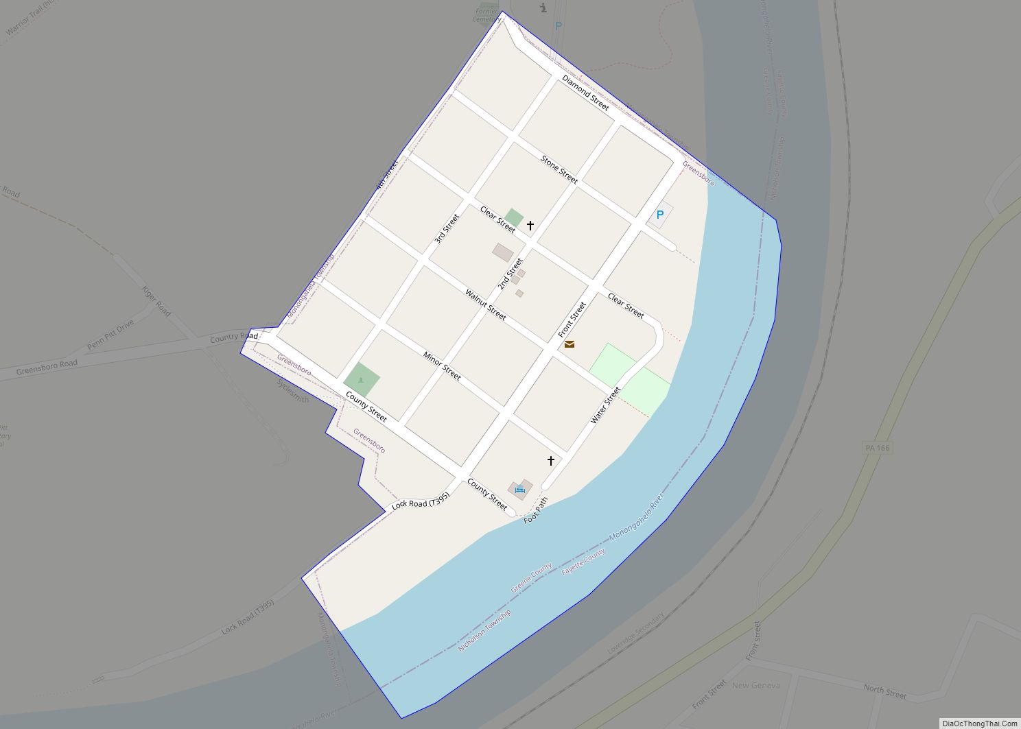
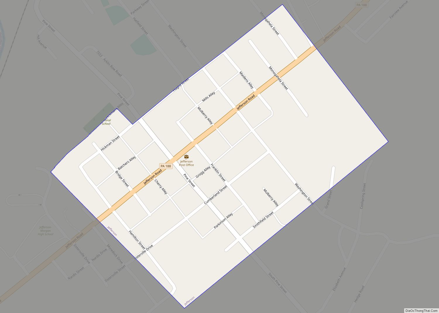
Online Interactive Map
Click on ![]() to view map in "full screen" mode.
to view map in "full screen" mode.
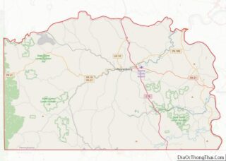
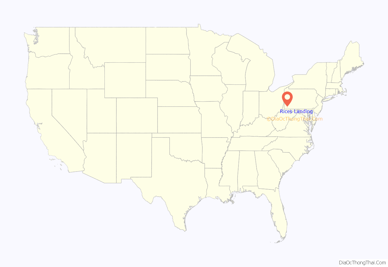
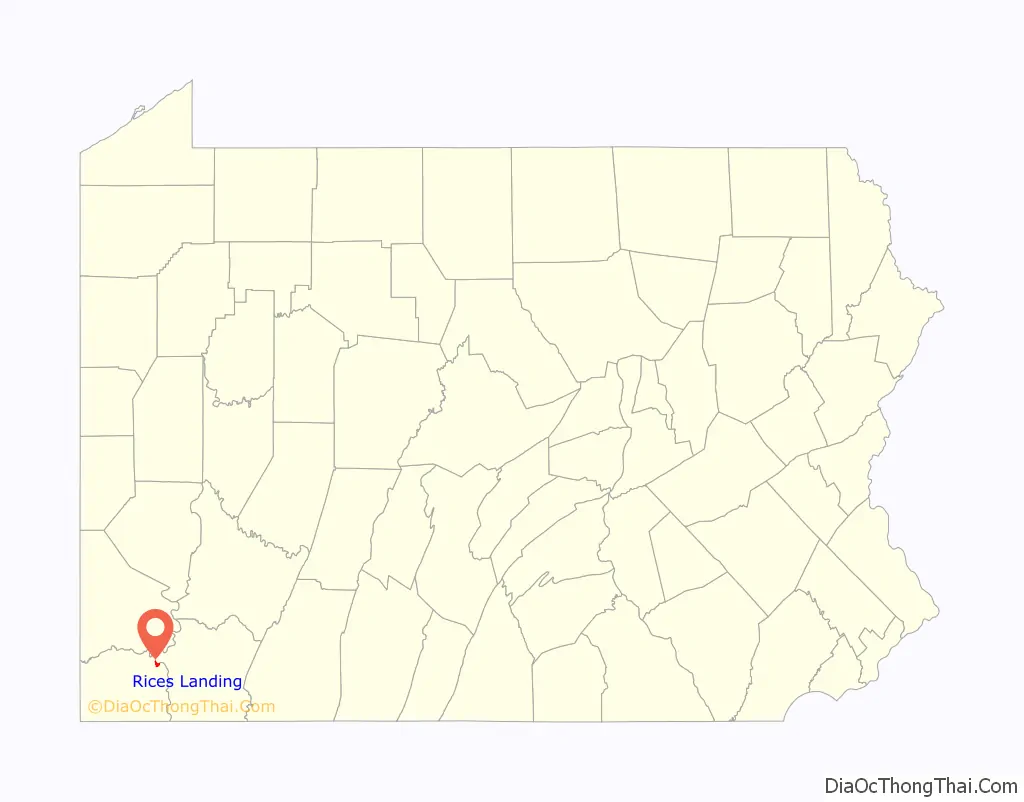
Rices Landing location map. Where is Rices Landing borough?
History
Rices Landing is a small rural town located along the western bank of the Monongahela River, approximately 50 miles (80 km) south of Pittsburgh. One of the first visitors to the area was George Washington. Tale has it that in 1755, while he was traveling to Fort Duquesne, he and his men camped in this area, just across from Pumpkin Run on the other side of the river after he crossed.
In 1786, John Rice purchased land on the east side of Enoch’s Run, and at about the same time, Abijah McClain purchased land on the west side. John Rice named the community he built “Rices Landing”, while Abijah McClain called his settlement “Newport”. In 1801, Benjamin Franklin mapped out the area and combined the two communities under the name “Rices Landing”. Enoch’s Run was renamed “Swan Run” before it eventually took the name it holds today, Pumpkin Run.
Rices Landing officially incorporated in April 1903. The availability of valuable resources such as trees, clay, sand, coal and transportation allowed the community to thrive. Shops, trading posts, taverns, and other businesses once lined its busy streets. It was so prosperous that it was regarded as the “Gateway to Western Pennsylvania” by frontier settlers.
Although things have quieted today, the residents still see their community as a charming and respectable community that was once the talk of the frontier world.
Rices Landing is the former home of US Olympic wrestler and four-time state champion Cary Kolat. Kolat attended Jefferson-Morgan High School. He is known as being one of the best wrestlers in history, going 137–0 in high school and 111–7 in college. Kolat won many international medals and competed in the 2000 Sydney Olympics.
Established in 1903, Rices Landing is a town rich in tradition. The center of industry in Rices Landing during the First and Second World Wars was the W. A. Young and Sons Foundry and Machine Shop, which is still in existence. The foundry was used to make many different items for the war effort and will undergo construction in the coming year. The town was in the heart of the steel industry, with many coal mines located in and around the town. Many of these mines and industry are no longer around. Rices Landing is home to Pumpkin Run Park, which is owned and maintained by the borough. The park opens on Memorial Day and closes on Labor Day. Located in the downtown area is the Greene River Bike and Walking Trail, which is a continuing project that reaches from Fredericktown to Crucible.
The Rice’s Landing Historic District was added to the National Register of Historic Places in 1992.
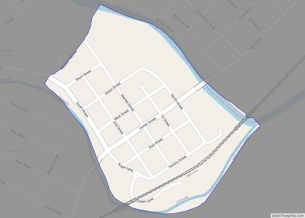
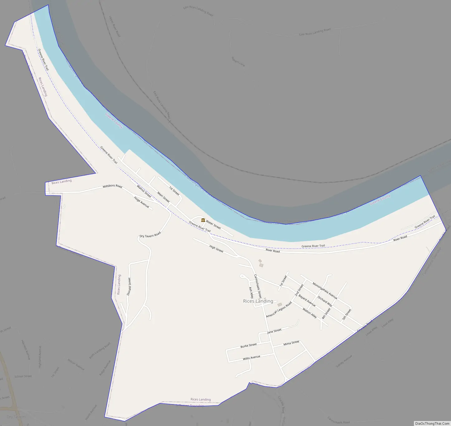
Rices Landing Road Map
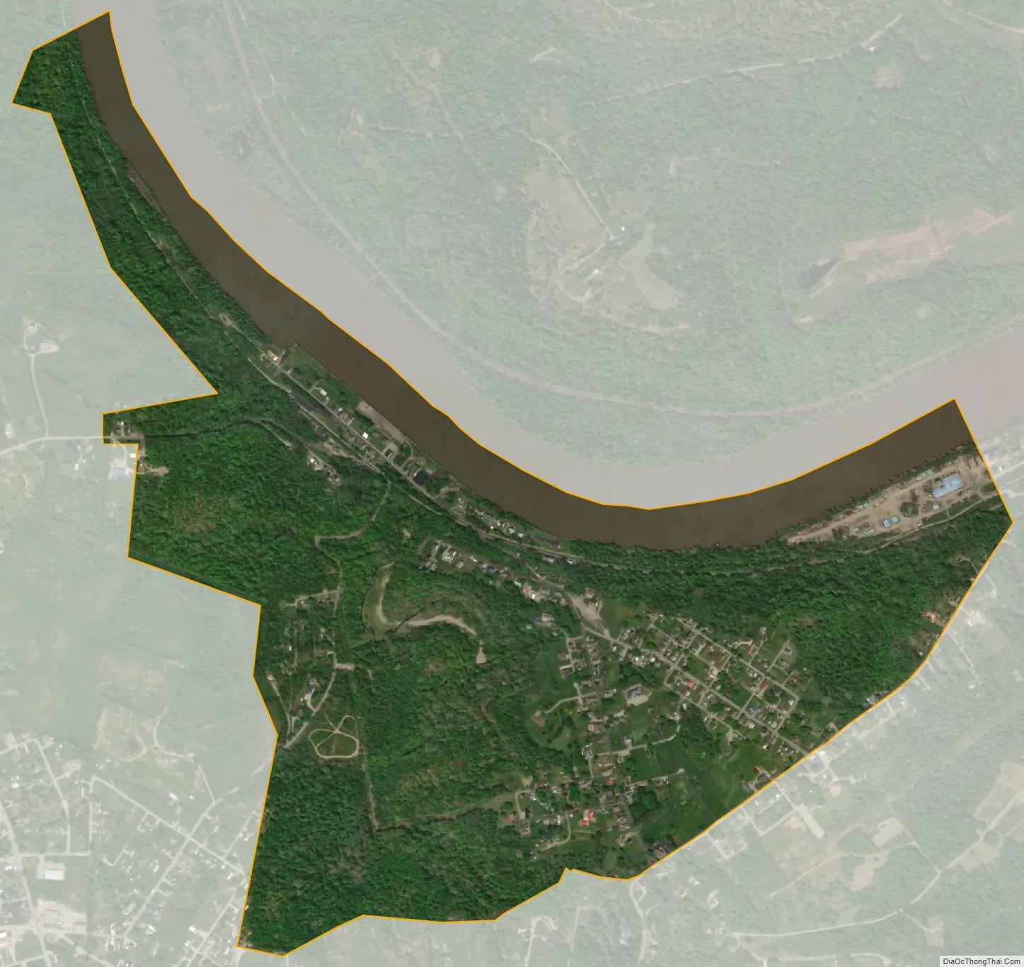
Rices Landing city Satellite Map
Geography
Rices Landing is located in northeastern Greene County at 39°56′47″N 79°59′36″W / 39.94639°N 79.99333°W / 39.94639; -79.99333 (39.946282, -79.993295), on the south (west) bank of the Monongahela River at the mouth of Pumpkin Run. It is bordered to the southeast by Cumberland Township, to the southwest and west by Jefferson Township, and to the north, across the Monongahela, by Luzerne Township in Fayette County. The closest road crossings of the Monongahela are the Mon–Fayette Expressway Bridge (Pennsylvania Route 43) 11 miles (18 km) by road to the north, and the Masontown Bridge (Pennsylvania Route 21) 9 miles (14 km) to the south.
According to the United States Census Bureau, the borough of Rices Landing has a total area of 0.93 square miles (2.4 km), of which 0.81 square miles (2.1 km) is land and 0.1 square miles (0.3 km), or 12.86%, is water.
See also
Map of Pennsylvania State and its subdivision:- Adams
- Allegheny
- Armstrong
- Beaver
- Bedford
- Berks
- Blair
- Bradford
- Bucks
- Butler
- Cambria
- Cameron
- Carbon
- Centre
- Chester
- Clarion
- Clearfield
- Clinton
- Columbia
- Crawford
- Cumberland
- Dauphin
- Delaware
- Elk
- Erie
- Fayette
- Forest
- Franklin
- Fulton
- Greene
- Huntingdon
- Indiana
- Jefferson
- Juniata
- Lackawanna
- Lancaster
- Lawrence
- Lebanon
- Lehigh
- Luzerne
- Lycoming
- Mc Kean
- Mercer
- Mifflin
- Monroe
- Montgomery
- Montour
- Northampton
- Northumberland
- Perry
- Philadelphia
- Pike
- Potter
- Schuylkill
- Snyder
- Somerset
- Sullivan
- Susquehanna
- Tioga
- Union
- Venango
- Warren
- Washington
- Wayne
- Westmoreland
- Wyoming
- York
- Alabama
- Alaska
- Arizona
- Arkansas
- California
- Colorado
- Connecticut
- Delaware
- District of Columbia
- Florida
- Georgia
- Hawaii
- Idaho
- Illinois
- Indiana
- Iowa
- Kansas
- Kentucky
- Louisiana
- Maine
- Maryland
- Massachusetts
- Michigan
- Minnesota
- Mississippi
- Missouri
- Montana
- Nebraska
- Nevada
- New Hampshire
- New Jersey
- New Mexico
- New York
- North Carolina
- North Dakota
- Ohio
- Oklahoma
- Oregon
- Pennsylvania
- Rhode Island
- South Carolina
- South Dakota
- Tennessee
- Texas
- Utah
- Vermont
- Virginia
- Washington
- West Virginia
- Wisconsin
- Wyoming