Sharpsburg is a borough in Allegheny County, Pennsylvania, United States, 5 miles (8 km) northeast of downtown Pittsburgh, along the Allegheny River. In 1900, nearly 7,000 people lived here; in 1920, the population peaked at just over 8,900 people. The population was 3,187 at the 2020 census.
In the past, it had a rolling mill, foundries, machine shops, and manufacturers of varnish, brick, glass, lumber products, wire, hair, felt, and lubricating oil. In January 1869, the H. J. Heinz Company was founded in Sharpsburg as Heinz Noble & Company to manufacture and sell bricks.
| Name: | Sharpsburg borough |
|---|---|
| LSAD Code: | 21 |
| LSAD Description: | borough (suffix) |
| State: | Pennsylvania |
| County: | Allegheny County |
| Total Area: | 0.63 sq mi (1.63 km²) |
| Land Area: | 0.48 sq mi (1.24 km²) |
| Water Area: | 0.15 sq mi (0.39 km²) |
| Total Population: | 3,187 |
| Population Density: | 6,926.93/sq mi (2,676.96/km²) |
| ZIP code: | 15215 |
| Area code: | 412, 878 |
| FIPS code: | 4269776 |
| Website: | www.sharpsburgborough.com |
Online Interactive Map
Click on ![]() to view map in "full screen" mode.
to view map in "full screen" mode.
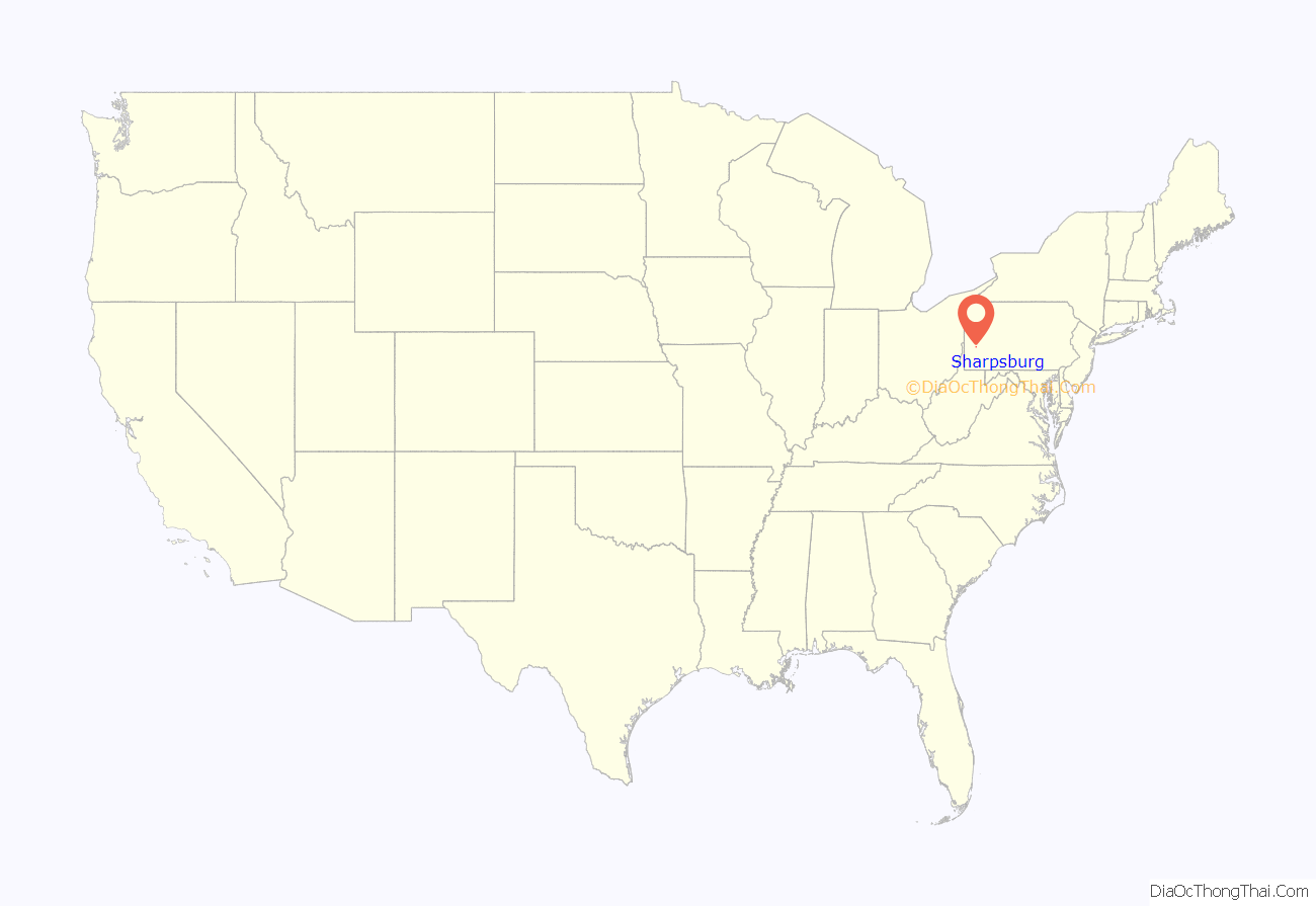
Sharpsburg location map. Where is Sharpsburg borough?
History
Guyasuta and the Seneca People
The Borough of Sharpsburg is located along the Allegheny River just over 5 miles (8 km) outside of downtown Pittsburgh. Sharpsburg has a rich history dating back to the 18th century when the Seneca people settled into the area. One Seneca in particular, Guyasuta, has a special connection to the community.
Guyasuta was a strong warrior and skilled hunter. He was chosen by George Washington to be a hunter guide with his party in 1753. When the two met again in Ohio 17 years later, General Washington greeted him with warmth and affection. In 1758, Guyasuta was involved in a bitter battle at Grant’s Hill, where the Allegheny County Courthouse stands today. In the early 1760s, Guyasuta sought peace with the British Army. Guyasuta’s peace efforts culminated in a peace treaty, in which the government received a tract of land in what is now western Pennsylvania. James O’Hara, who had purchased a portion of the river land, donated a small portion of it, where Sharpsburg is today, to Guyasuta.
James Sharp and the initial settlement
In 1826, a man named James Sharp rode into this area and purchased over 257 acres (1.04 km) of land for $1,337.37 in what was then Indiana Township, building a log cabin for his wife, Isabella L. Sharp. The original deed, recorded on October 10, 1826, can be found in the Allegheny County Department of Real Estate at deed book volume 35(K2), page 156. Opening the land to settlers, Sharp built a school and church while continuing to donate his land for the growing needs of the community. On December 14, 1841, the borough applied for incorporation, and received its charter March 14, 1842. The charter was recorded on March 26, 1842.
James Sharp was born near Chambersburg, Franklin County, Pennsylvania on February 10, 1784, of Scottish descent. His colonial ancestor and grandfather was Captain James Sharp (Third Battalion, Pennsylvania Regiment), a veteran of the Forbes Campaign. Captain Sharp was present in 1758 at the capture of Fort Duquesne and served under Gen. Hugh Mercer and Col. William Clapham. His father, Matthew Sharp, was a veteran of the Revolutionary War, having served as a private in the Eighth Battalion, Cumberland County, Pennsylvania Militia. In 1780 he married Elizabeth (Lindsay) Culbertson and together they had three children: Rosana, James, and Mary.
With his family, young Sharp moved to Pittsburgh in 1797 and remained in Pittsburgh until 1826 when he purchased land at Sheriff’s Sale, formerly owned by Gen. John Wilkins, “being number Thirteen in Cunninghams district containing two hundred and fifty seven acres and eighty seven perches on which are a square log dwelling, a good orchard and about fifty acres of cleared land, with fine meadows, a coal bank, and one of the best springs in the County.” Sharp moved permanently to the land, part of which would later become the Borough of Sharpsburg. Sharp’s first marriage to Sarah Thompson ended with the death of Thompson a few years after their nuptials. He later married Isabella Stockman, with whom he had six children. During his lifetime, Sharp was described as a gentleman: courteous in manners, affable in disposition, and generous in hospitality. Sharp was an abolitionist, a zealous advocate for universal education, a member of the temperance movement, and a member of the Presbyterian Church. Sharp died on March 12, 1861.
Industry
Since its incorporation, Sharpsburg became an industrial town, manufacturing iron, brick and glass while goods were transported through the canal that bisected the borough, along with the Allegheny River. When railroads became the preferred mode of transportation for that time, Sharpsburg continued to thrive as thousands came for the plethora of job opportunities available.
H. J. Heinz Company
One of the most well-known industries that had its beginnings in Sharpsburg was the H. J. Heinz Company. The Heinz glass works in Sharpsburg once manufactured all of the glassware for Heinz products. In 1869, Heinz began creating and bottling his first horseradish in the kitchen of his Sharpsburg residence. This house is the place where it all began. Shortly thereafter, the house became Heinz’s first factory. Although he moved his company down the Allegheny along the North Shore of Pittsburgh, he was very gracious to the people of Sharpsburg until his death, donating gifts to the community that was his family home for many years. One of these included the life-sized statue of Guyasuta that was installed at the intersection of Main and North Canal streets. The statue has twice been hit by automobiles—the first occurrence in 1930 and the second occurrence in 1988. Each incident resulted in the destruction and subsequent replacement of the statue.
A town divided
Less than a century ago, Sharpsburg was divided into two sections because of a railroad track that went through the location where Kennedy Park currently sits. There were two fire departments, one on each side of the tracks. There were two schools on each side of the track as well, one “up street” and one “down street”. Once the railroad tracks weren’t used anymore, the railcars sat vacant on the tracks. The Junior Chamber of Commerce in Sharpsburg went to the railroad company as well as the Heinz family to try to change something about this. The Heinz family said they would help build a park if it was used for recreation purposes only. The park was built around the time when President John F. Kennedy was assassinated, and that is why the area was named Kennedy Park.
Today, Sharpsburg continues to boast pride of its industrial past while looking forward to the opportunities of economic growth within the business district, and its residents enjoy being a part of this unique riverfront community.
Sharpsburg Road Map
Sharpsburg city Satellite Map
Geography
Sharpsburg is located at 40°29′43″N 79°55′44″W / 40.49528°N 79.92889°W / 40.49528; -79.92889 (40.495368, -79.928991).
According to the United States Census Bureau, the borough has a total area of 0.6 square miles (1.6 km), of which 0.5 square miles (1.3 km) is land and 0.2 square miles (0.52 km), or 26.15%, is water.
Surrounding and adjacent neighborhoods
Sharpsburg has five land borders, including Etna to the west, Shaler Township to the northwest, two of the five non-contiguous areas of O’Hara Township to the north and southeast, and Aspinwall to the east. To the south, across the Allegheny River via 62nd Street Bridge, are the Pittsburgh neighborhoods of Upper Lawrenceville and Morningside.
See also
Map of Pennsylvania State and its subdivision:- Adams
- Allegheny
- Armstrong
- Beaver
- Bedford
- Berks
- Blair
- Bradford
- Bucks
- Butler
- Cambria
- Cameron
- Carbon
- Centre
- Chester
- Clarion
- Clearfield
- Clinton
- Columbia
- Crawford
- Cumberland
- Dauphin
- Delaware
- Elk
- Erie
- Fayette
- Forest
- Franklin
- Fulton
- Greene
- Huntingdon
- Indiana
- Jefferson
- Juniata
- Lackawanna
- Lancaster
- Lawrence
- Lebanon
- Lehigh
- Luzerne
- Lycoming
- Mc Kean
- Mercer
- Mifflin
- Monroe
- Montgomery
- Montour
- Northampton
- Northumberland
- Perry
- Philadelphia
- Pike
- Potter
- Schuylkill
- Snyder
- Somerset
- Sullivan
- Susquehanna
- Tioga
- Union
- Venango
- Warren
- Washington
- Wayne
- Westmoreland
- Wyoming
- York
- Alabama
- Alaska
- Arizona
- Arkansas
- California
- Colorado
- Connecticut
- Delaware
- District of Columbia
- Florida
- Georgia
- Hawaii
- Idaho
- Illinois
- Indiana
- Iowa
- Kansas
- Kentucky
- Louisiana
- Maine
- Maryland
- Massachusetts
- Michigan
- Minnesota
- Mississippi
- Missouri
- Montana
- Nebraska
- Nevada
- New Hampshire
- New Jersey
- New Mexico
- New York
- North Carolina
- North Dakota
- Ohio
- Oklahoma
- Oregon
- Pennsylvania
- Rhode Island
- South Carolina
- South Dakota
- Tennessee
- Texas
- Utah
- Vermont
- Virginia
- Washington
- West Virginia
- Wisconsin
- Wyoming
