Tarentum is a borough in Allegheny County in the U.S. state of Pennsylvania. It is 22 miles (35 km) northeast of Downtown Pittsburgh, along the Allegheny River. Tarentum was an industrial center where plate glass and bottles were manufactured; bricks, lumber, steel and iron novelties, steel billets and sheets, sack and wrapping paper were also produced.
The Pennsylvania Railroad operated a station in Tarentum; its rail line ran through the town. The population was 4,352 at the 2020 census. Two statues of Hebe, the Greek goddess of youth, are displayed by the borough in Tarentum.
| Name: | Tarentum borough |
|---|---|
| LSAD Code: | 21 |
| LSAD Description: | borough (suffix) |
| State: | Pennsylvania |
| County: | Allegheny County |
| Incorporated: | March 7, 1842 |
| Elevation: | 840 ft (260 m) |
| Total Area: | 1.38 sq mi (3.58 km²) |
| Land Area: | 1.23 sq mi (3.19 km²) |
| Water Area: | 0.15 sq mi (0.39 km²) |
| Total Population: | 4,352 |
| Population Density: | 3,538.21/sq mi (1,366.09/km²) |
| ZIP code: | 15084 |
| Area code: | 724, 878 |
| FIPS code: | 4276104 |
| Website: | www.tarentumboro.com |
Online Interactive Map
Click on ![]() to view map in "full screen" mode.
to view map in "full screen" mode.
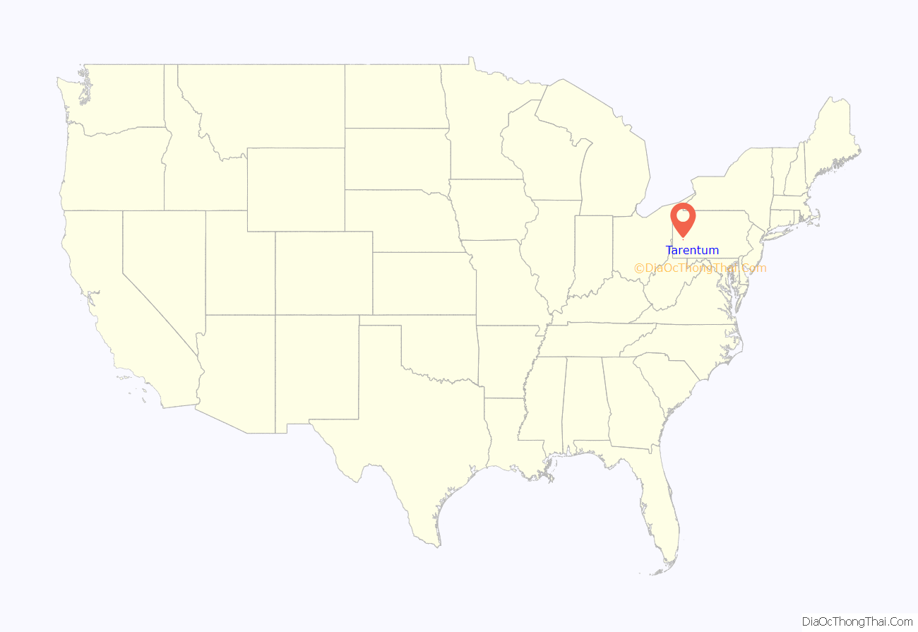
Tarentum location map. Where is Tarentum borough?
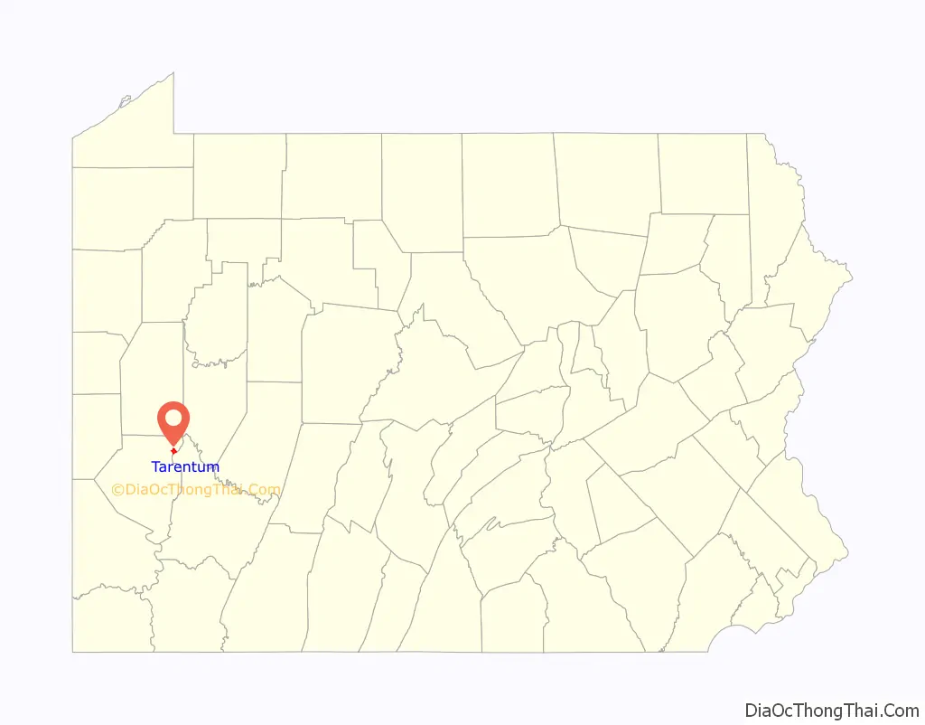
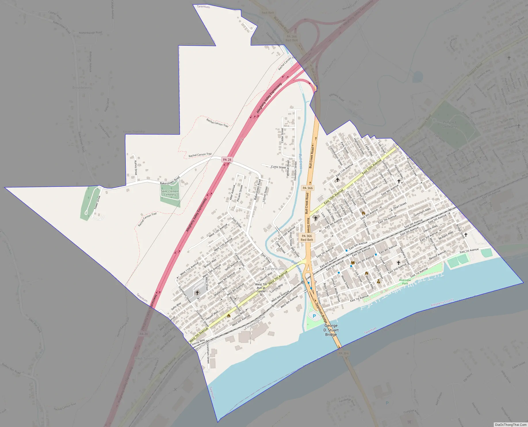
Tarentum Road Map
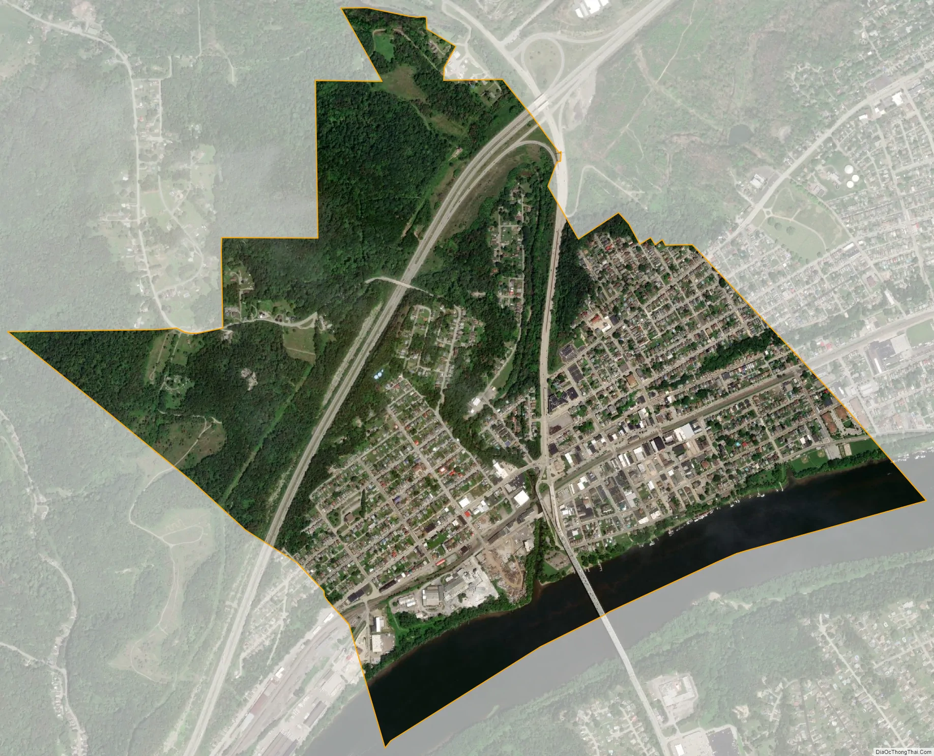
Tarentum city Satellite Map
Geography
Tarentum is located at 40°36′11″N 79°45′20″W / 40.60306°N 79.75556°W / 40.60306; -79.75556 (40.603042, -79.755447).
According to the United States Census Bureau, the borough has a total area of 1.4 square miles (3.6 km), of which 1.2 square miles (3.1 km) is land and 0.2 square miles (0.52 km), or 12.06%, is water.
Streams
- The Allegheny River forms the borough’s eastern border with Westmoreland County.
- Bull Creek joins the Allegheny River at Tarentum.
- Little Bull Creek joins Bull Creek via a culvert underneath Bull Creek Road (Pennsylvania Route 366) at Tarentum.
See also
Map of Pennsylvania State and its subdivision:- Adams
- Allegheny
- Armstrong
- Beaver
- Bedford
- Berks
- Blair
- Bradford
- Bucks
- Butler
- Cambria
- Cameron
- Carbon
- Centre
- Chester
- Clarion
- Clearfield
- Clinton
- Columbia
- Crawford
- Cumberland
- Dauphin
- Delaware
- Elk
- Erie
- Fayette
- Forest
- Franklin
- Fulton
- Greene
- Huntingdon
- Indiana
- Jefferson
- Juniata
- Lackawanna
- Lancaster
- Lawrence
- Lebanon
- Lehigh
- Luzerne
- Lycoming
- Mc Kean
- Mercer
- Mifflin
- Monroe
- Montgomery
- Montour
- Northampton
- Northumberland
- Perry
- Philadelphia
- Pike
- Potter
- Schuylkill
- Snyder
- Somerset
- Sullivan
- Susquehanna
- Tioga
- Union
- Venango
- Warren
- Washington
- Wayne
- Westmoreland
- Wyoming
- York
- Alabama
- Alaska
- Arizona
- Arkansas
- California
- Colorado
- Connecticut
- Delaware
- District of Columbia
- Florida
- Georgia
- Hawaii
- Idaho
- Illinois
- Indiana
- Iowa
- Kansas
- Kentucky
- Louisiana
- Maine
- Maryland
- Massachusetts
- Michigan
- Minnesota
- Mississippi
- Missouri
- Montana
- Nebraska
- Nevada
- New Hampshire
- New Jersey
- New Mexico
- New York
- North Carolina
- North Dakota
- Ohio
- Oklahoma
- Oregon
- Pennsylvania
- Rhode Island
- South Carolina
- South Dakota
- Tennessee
- Texas
- Utah
- Vermont
- Virginia
- Washington
- West Virginia
- Wisconsin
- Wyoming


