Wall is a borough in Allegheny County, Pennsylvania, United States. The population was 519 at the 2020 census.
| Name: | Wall borough |
|---|---|
| LSAD Code: | 21 |
| LSAD Description: | borough (suffix) |
| State: | Pennsylvania |
| County: | Allegheny County |
| Total Area: | 0.44 sq mi (1.13 km²) |
| Land Area: | 0.44 sq mi (1.13 km²) |
| Water Area: | 0.00 sq mi (0.00 km²) |
| Total Population: | 519 |
| Population Density: | 1,271.69/sq mi (491.40/km²) |
| FIPS code: | 4280600 |
| Website: | www.wallborough.com |
Online Interactive Map
Click on ![]() to view map in "full screen" mode.
to view map in "full screen" mode.
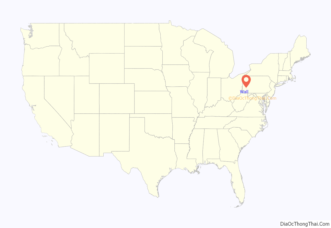
Wall location map. Where is Wall borough?
History
Wall is located at the site of a farm purchased by James Walls in 1829. The property, on the south bank of Turtle Creek, was passed to James’ sons Henry and John Walls, who lived in a log cabin near the heart of present-day Wall. A station on the Pennsylvania Railroad opened in the early 1840s, which was named “Walls’ Station” in honor of the Walls family. Eventually, the name of the station and the town that grew up around it was shortened to “Wall Station”. Henry and John Walls sold their property to their cousin Frank Wall, an engineer on riverboats who developed the property around the station. Wall got its name after this Frank Wall, whose said property development led to him being the owner of the first two houses erected in the region.
The town around Wall Station was incorporated in 1904 as Wall Borough. The borough grew rapidly during the first half of the twentieth century because a freight depot of the Pennsylvania Railroad was located at Wall. The population and economic vitality of the borough declined during the second half of the twentieth century as the railroad industry was eclipsed by the airline and trucking industries.
Channel 40, WPCB-TV, broadcasts from Wall.
Wall, along with East Mckeesport, is served by United Volunteer Fire/Rescue, formerly Wall VFD and East Mckeesport VFC #2.
Wall Road Map
Wall city Satellite Map
Geography
Wall is located at 40°23′36″N 79°47′16″W / 40.39333°N 79.78778°W / 40.39333; -79.78778 (40.393468, −79.787692).
According to the United States Census Bureau, the borough has a total area of 0.4 square miles (1.0 km), all land.
See also
Map of Pennsylvania State and its subdivision:- Adams
- Allegheny
- Armstrong
- Beaver
- Bedford
- Berks
- Blair
- Bradford
- Bucks
- Butler
- Cambria
- Cameron
- Carbon
- Centre
- Chester
- Clarion
- Clearfield
- Clinton
- Columbia
- Crawford
- Cumberland
- Dauphin
- Delaware
- Elk
- Erie
- Fayette
- Forest
- Franklin
- Fulton
- Greene
- Huntingdon
- Indiana
- Jefferson
- Juniata
- Lackawanna
- Lancaster
- Lawrence
- Lebanon
- Lehigh
- Luzerne
- Lycoming
- Mc Kean
- Mercer
- Mifflin
- Monroe
- Montgomery
- Montour
- Northampton
- Northumberland
- Perry
- Philadelphia
- Pike
- Potter
- Schuylkill
- Snyder
- Somerset
- Sullivan
- Susquehanna
- Tioga
- Union
- Venango
- Warren
- Washington
- Wayne
- Westmoreland
- Wyoming
- York
- Alabama
- Alaska
- Arizona
- Arkansas
- California
- Colorado
- Connecticut
- Delaware
- District of Columbia
- Florida
- Georgia
- Hawaii
- Idaho
- Illinois
- Indiana
- Iowa
- Kansas
- Kentucky
- Louisiana
- Maine
- Maryland
- Massachusetts
- Michigan
- Minnesota
- Mississippi
- Missouri
- Montana
- Nebraska
- Nevada
- New Hampshire
- New Jersey
- New Mexico
- New York
- North Carolina
- North Dakota
- Ohio
- Oklahoma
- Oregon
- Pennsylvania
- Rhode Island
- South Carolina
- South Dakota
- Tennessee
- Texas
- Utah
- Vermont
- Virginia
- Washington
- West Virginia
- Wisconsin
- Wyoming
