Whitehall is a borough in Allegheny County, Pennsylvania, United States. It is part of the Pittsburgh metropolitan area. The population was 15,064 at the 2020 census, an increase of 1,120 since the 2010 census.
| Name: | Whitehall borough |
|---|---|
| LSAD Code: | 21 |
| LSAD Description: | borough (suffix) |
| State: | Pennsylvania |
| County: | Allegheny County |
| Incorporated: | 1948 |
| Total Area: | 3.33 sq mi (8.61 km²) |
| Land Area: | 3.33 sq mi (8.61 km²) |
| Water Area: | 0.00 sq mi (0.00 km²) |
| Total Population: | 15,064 |
| Population Density: | 4,530.53/sq mi (1,748.99/km²) |
| Area code: | 412 |
| FIPS code: | 4284512 |
| GNISfeature ID: | 1214840 |
| Website: | www.whitehallboro.org |
Online Interactive Map
Click on ![]() to view map in "full screen" mode.
to view map in "full screen" mode.
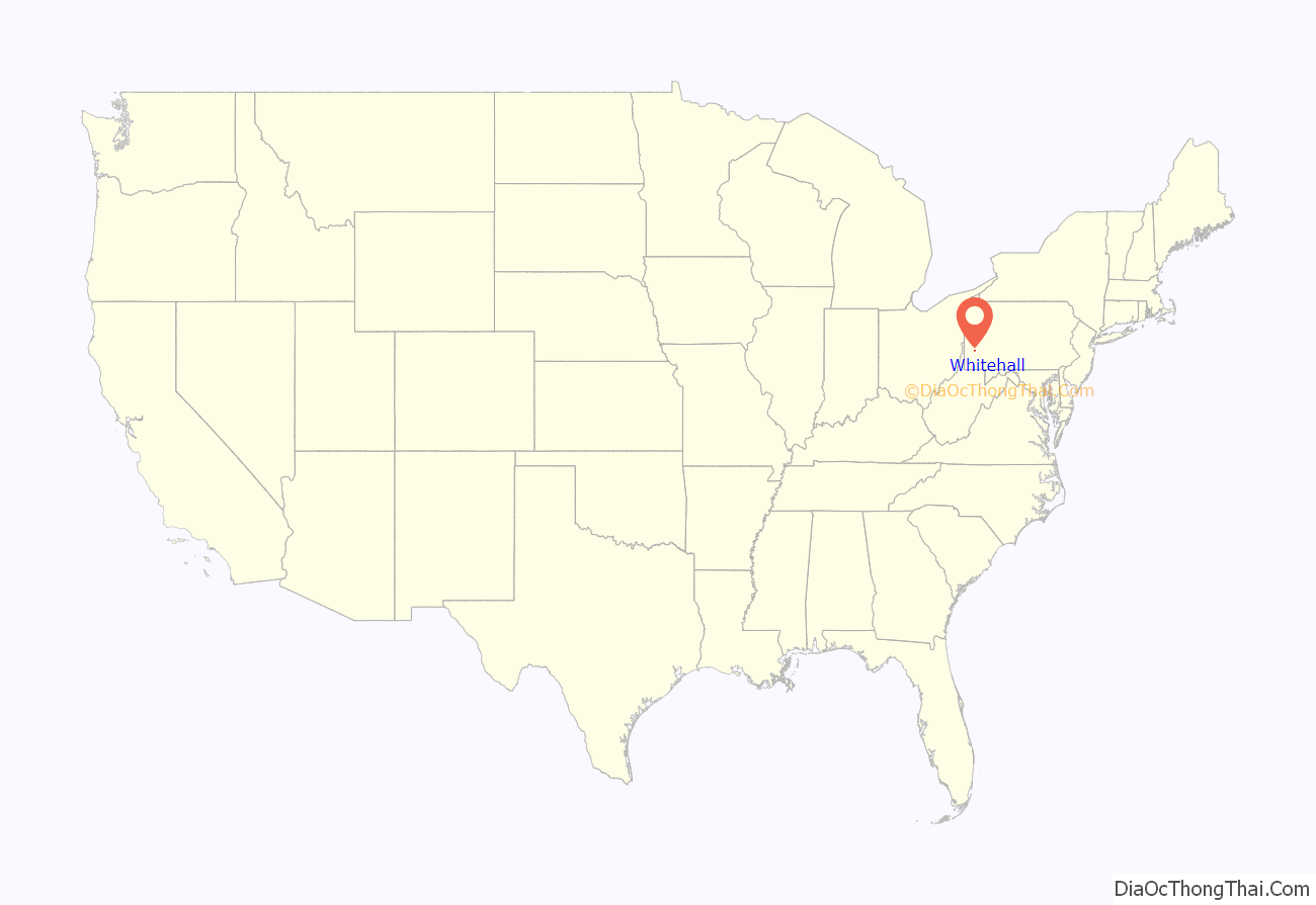
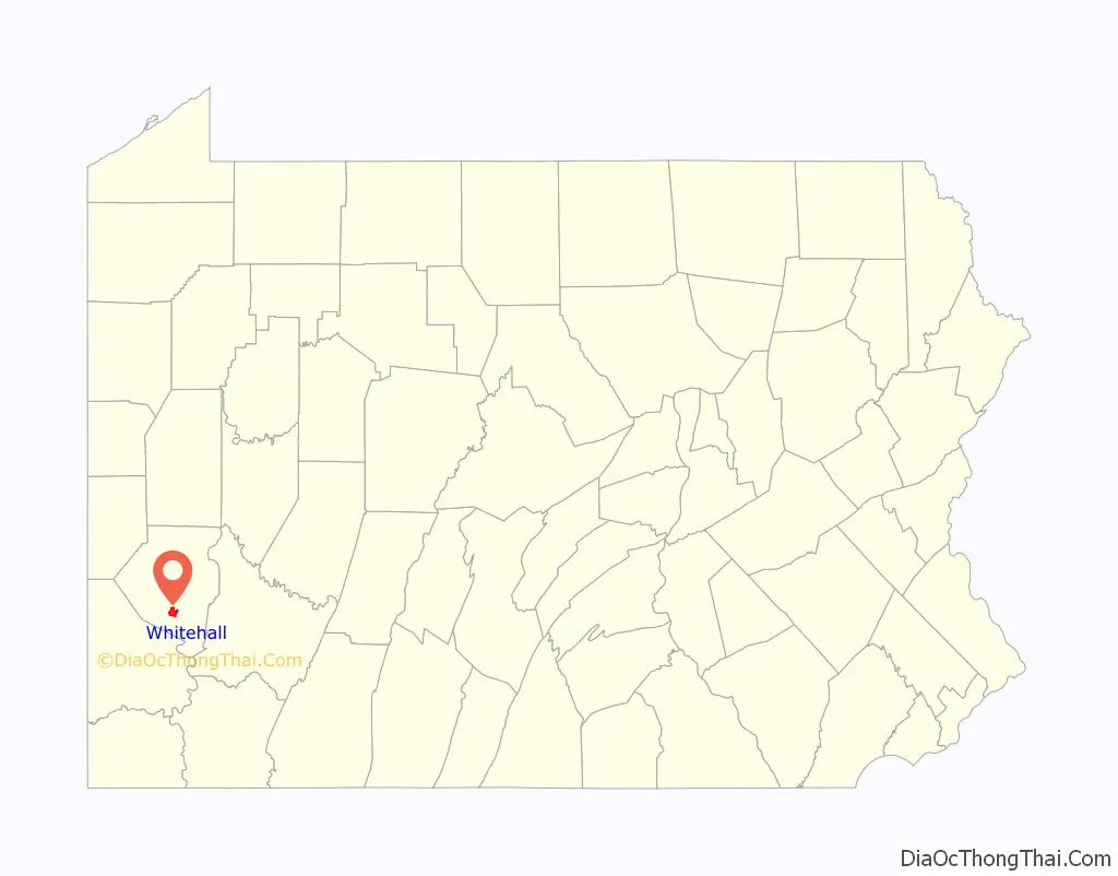
Whitehall location map. Where is Whitehall borough?
History
Whitehall is probably named after Silas D. Prior’s tavern on Brownsville Road, which was renamed White Hall in the 1850s. The building is still in existence, but is in Brentwood. Another possible source of the borough’s name is that the area, which used to be located within the township of Baldwin, was known as Whitehall Driving Park.
In 1946, residents of Baldwin Township’s fourth, fifth, sixth, and seventh wards began the process of secession. A petition was filed on October 14, 1946, in the Quarterly Sessions of Allegheny County, with 1320 signatures out of the 1627 freeholders in the proposed borough. In response to this, Baldwin Township officials called an emergency meeting to file a petition to have Baldwin Township incorporated into a borough, as it is much more difficult to secede from a borough than from a township. On January 5, 1948, Whitehall separated from Baldwin Township to become an independent municipality. According to former mayor Edwin F. Brennan, residents of Whitehall wanted better services and zoning than they received under the jurisdiction of the township.
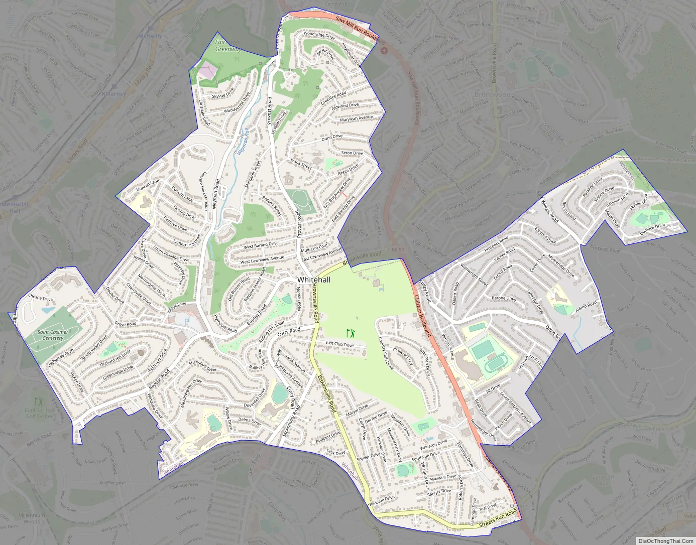
Whitehall Road Map
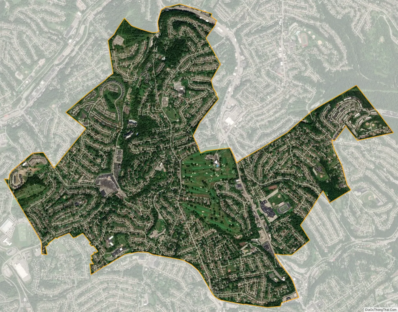
Whitehall city Satellite Map
Geography
Whitehall is located at 40°21′37″N 79°59′11″W / 40.36028°N 79.98639°W / 40.36028; -79.98639 (40.360292, -79.986271).
According to the United States Census Bureau, the borough has a total area of 3.3 square miles (8.5 km), all land.
See also
Map of Pennsylvania State and its subdivision:- Adams
- Allegheny
- Armstrong
- Beaver
- Bedford
- Berks
- Blair
- Bradford
- Bucks
- Butler
- Cambria
- Cameron
- Carbon
- Centre
- Chester
- Clarion
- Clearfield
- Clinton
- Columbia
- Crawford
- Cumberland
- Dauphin
- Delaware
- Elk
- Erie
- Fayette
- Forest
- Franklin
- Fulton
- Greene
- Huntingdon
- Indiana
- Jefferson
- Juniata
- Lackawanna
- Lancaster
- Lawrence
- Lebanon
- Lehigh
- Luzerne
- Lycoming
- Mc Kean
- Mercer
- Mifflin
- Monroe
- Montgomery
- Montour
- Northampton
- Northumberland
- Perry
- Philadelphia
- Pike
- Potter
- Schuylkill
- Snyder
- Somerset
- Sullivan
- Susquehanna
- Tioga
- Union
- Venango
- Warren
- Washington
- Wayne
- Westmoreland
- Wyoming
- York
- Alabama
- Alaska
- Arizona
- Arkansas
- California
- Colorado
- Connecticut
- Delaware
- District of Columbia
- Florida
- Georgia
- Hawaii
- Idaho
- Illinois
- Indiana
- Iowa
- Kansas
- Kentucky
- Louisiana
- Maine
- Maryland
- Massachusetts
- Michigan
- Minnesota
- Mississippi
- Missouri
- Montana
- Nebraska
- Nevada
- New Hampshire
- New Jersey
- New Mexico
- New York
- North Carolina
- North Dakota
- Ohio
- Oklahoma
- Oregon
- Pennsylvania
- Rhode Island
- South Carolina
- South Dakota
- Tennessee
- Texas
- Utah
- Vermont
- Virginia
- Washington
- West Virginia
- Wisconsin
- Wyoming


