Glendale is a city in Milwaukee County, Wisconsin, United States. It is a suburb of the neighboring Milwaukee. The population was 13,357 at the 2020 census.
| Name: | Glendale city |
|---|---|
| LSAD Code: | 25 |
| LSAD Description: | city (suffix) |
| State: | Wisconsin |
| County: | Milwaukee County |
| Incorporated: | December 28, 1950; 72 years ago (December 28, 1950) |
| Elevation: | 653 ft (199 m) |
| Total Area: | 5.96 sq mi (15.45 km²) |
| Land Area: | 5.76 sq mi (14.93 km²) |
| Water Area: | 0.20 sq mi (0.52 km²) |
| Total Population: | 13,357 |
| Population Density: | 2,241.1/sq mi (862.5/km²) |
| Area code: | 414 |
| FIPS code: | 5529400 |
| GNISfeature ID: | 1565570 |
| Website: | glendalewi.gov |
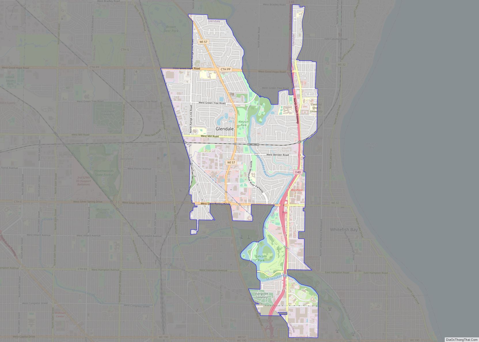
Online Interactive Map
Click on ![]() to view map in "full screen" mode.
to view map in "full screen" mode.
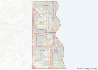
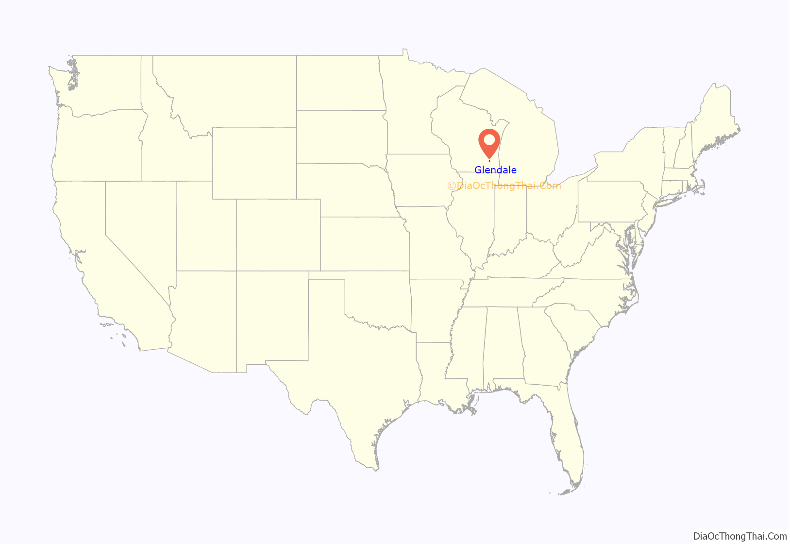
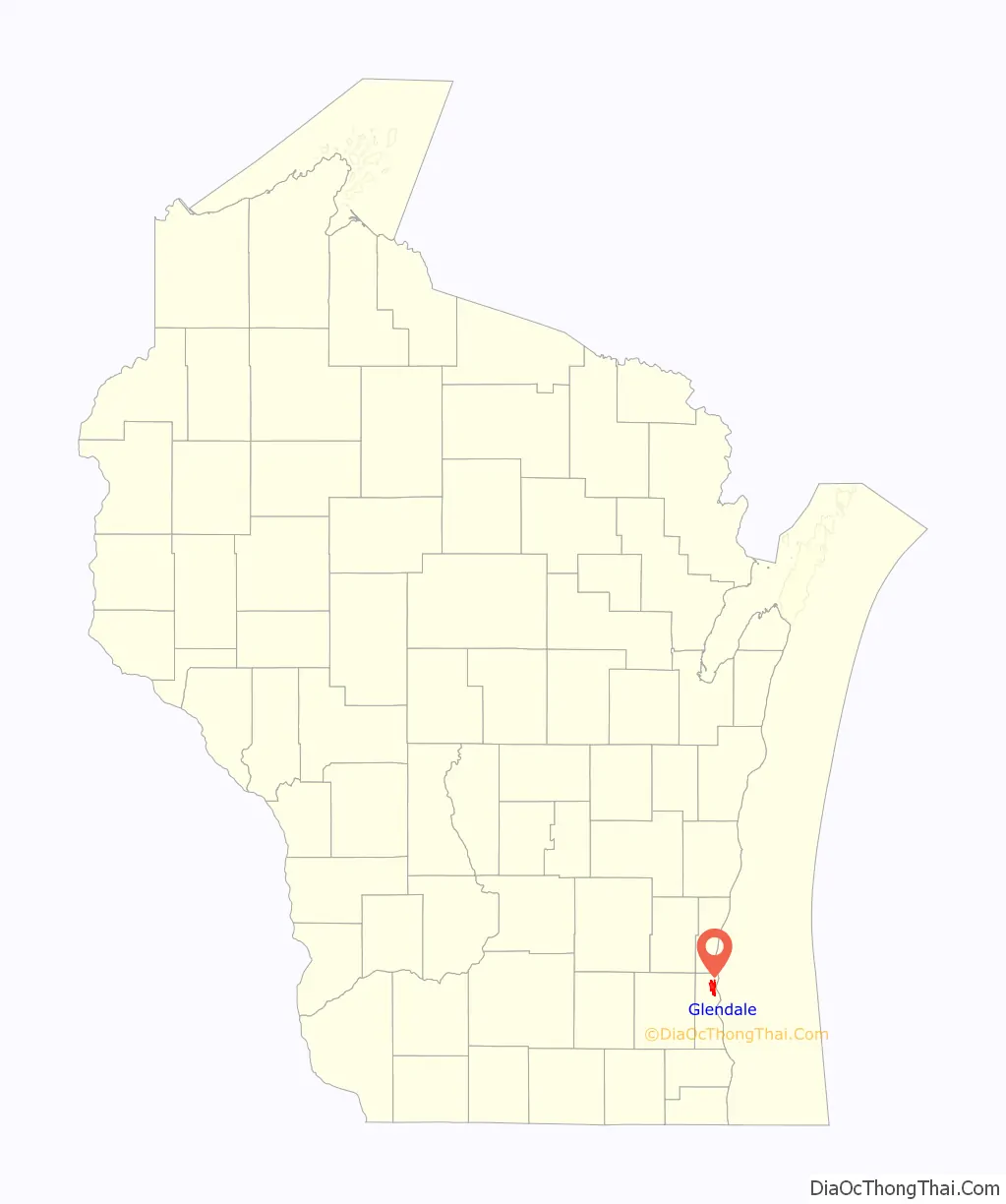
Glendale location map. Where is Glendale city?
History
The Glendale area has been inhabited for thousands of years. The earliest known inhabitants were Woodland period Mound Builders, who constructed earthen effigy and burial mounds in the area. Many of the mounds were destroyed by white farmers between 1850 and 1920, though some still exist in Kletzsch Park. In the early 19th century, the land was controlled by Native Americans, including the Menominee, Potawatomi, and Sauk people. The Menominee surrendered the land east of the Milwaukee River to the United States Federal Government through the Treaty of Washington in 1832. In 1833, the Potawatomi surrendered the land west of the river by signing the 1833 Treaty of Chicago, which (after being ratified in 1835) required them to leave Wisconsin by 1838.
The land was organized as part of the Town of Milwaukee in 1838, and the first white settlers were farmers, many of whom were German immigrants. One center of settlement was the Good Hope community, which formed as a stagecoach stop on Green Bay Road in the late 1840s and was a prosperous rural community with a tavern, a school, and a railroad station into the 1890s.
Glendale incorporated as a city on December 28, 1950, from portions of the Town of Milwaukee, including a prosperous industrial corridor along Capitol Drive. It began to develop rapidly in the 1950s, reflecting post-World War II metropolitan growth and migration patterns throughout the United States. Bayshore Town Center (formerly called Bayshore Mall) was established on the eastern border of the city in 1954, and Cardinal Stritch University built a campus straddling the city and the neighboring Village of Fox Point in 1959. In the 1950s, the construction of Interstate 43 further contributed to the city’s rapid growth, and the population roughly tripled between 1950 and 1960.
Unlike other northshore suburbs of Milwaukee, Glendale has a mix of industry and commercial sites in addition to residential areas. The southern areas of the city have mainly industrial and higher density residential sites, while the north features medium to lower density residential plots. Interstate 43 divides the city into east and west sections. Nicolet High School is also located in Glendale and serves the city, along with the suburbs of Fox Point, Bayside, and River Hills. Glendale has begun an ambitious campaign to attract business and population growth. Major roads have undergone massive streetscaping projects, Bayshore Town Center has undergone a multimillion-dollar renovation, and the Glendale Business Park continues to welcome high tech clients. In June 2017, the Richard E. Maslowski Glendale Community Park was opened which includes an amphitheater, playground, veterans memorial, beer garden and community room.
Glendale Road Map
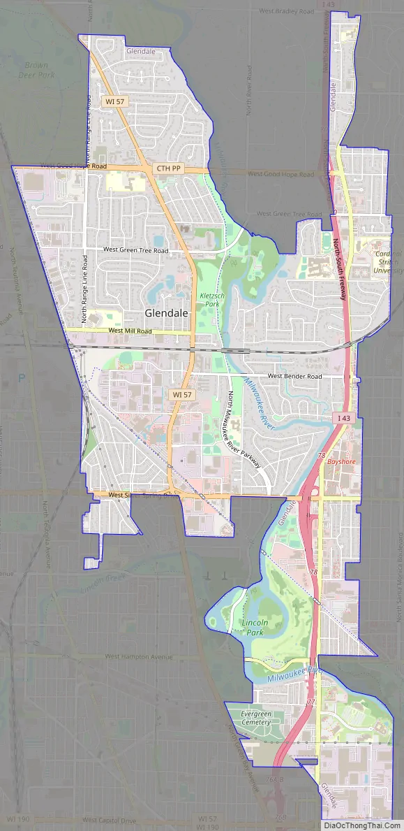
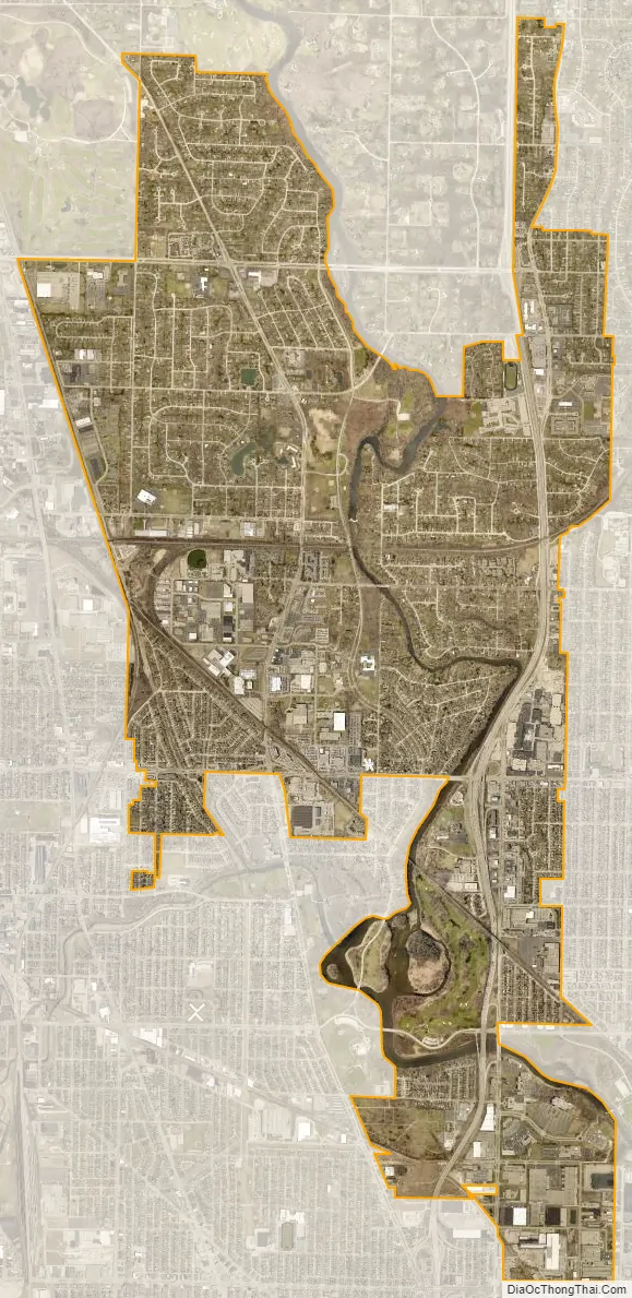
Glendale city Satellite Map
Geography
Glendale is located at 43°7′48″N 87°55′40″W / 43.13000°N 87.92778°W / 43.13000; -87.92778 (43.130060, −87.927719).
According to the United States Census Bureau, the city has a total area of 5.97 square miles (15.46 km), of which, 5.76 square miles (14.92 km) is land and 0.21 square miles (0.54 km) is water.
See also
Map of Wisconsin State and its subdivision:- Adams
- Ashland
- Barron
- Bayfield
- Brown
- Buffalo
- Burnett
- Calumet
- Chippewa
- Clark
- Columbia
- Crawford
- Dane
- Dodge
- Door
- Douglas
- Dunn
- Eau Claire
- Florence
- Fond du Lac
- Forest
- Grant
- Green
- Green Lake
- Iowa
- Iron
- Jackson
- Jefferson
- Juneau
- Kenosha
- Kewaunee
- La Crosse
- Lafayette
- Lake Michigan
- Lake Superior
- Langlade
- Lincoln
- Manitowoc
- Marathon
- Marinette
- Marquette
- Menominee
- Milwaukee
- Monroe
- Oconto
- Oneida
- Outagamie
- Ozaukee
- Pepin
- Pierce
- Polk
- Portage
- Price
- Racine
- Richland
- Rock
- Rusk
- Saint Croix
- Sauk
- Sawyer
- Shawano
- Sheboygan
- Taylor
- Trempealeau
- Vernon
- Vilas
- Walworth
- Washburn
- Washington
- Waukesha
- Waupaca
- Waushara
- Winnebago
- Wood
- Alabama
- Alaska
- Arizona
- Arkansas
- California
- Colorado
- Connecticut
- Delaware
- District of Columbia
- Florida
- Georgia
- Hawaii
- Idaho
- Illinois
- Indiana
- Iowa
- Kansas
- Kentucky
- Louisiana
- Maine
- Maryland
- Massachusetts
- Michigan
- Minnesota
- Mississippi
- Missouri
- Montana
- Nebraska
- Nevada
- New Hampshire
- New Jersey
- New Mexico
- New York
- North Carolina
- North Dakota
- Ohio
- Oklahoma
- Oregon
- Pennsylvania
- Rhode Island
- South Carolina
- South Dakota
- Tennessee
- Texas
- Utah
- Vermont
- Virginia
- Washington
- West Virginia
- Wisconsin
- Wyoming