New Madrid County (/ˈmædrɪd/ MAD-rid; Spanish: Condado de Nueva Madrid; French: Comté de New Madrid) is a county located in the Bootheel of the U.S. state of Missouri. As of the 2020 census, the population was 16,434. The largest city and county seat is New Madrid, located on the northern side of the Kentucky Bend in the Mississippi River, where it has formed an oxbow around an exclave of Fulton County, Kentucky. This feature has also been known as New Madrid Bend or Madrid Bend, for the city.
The county was officially organized on October 1, 1812, and is named after Nuevo Madrid, a district located in the region. This area was under Spanish rule following France’s cession of Louisiana after being defeated in the Seven Years’ War. The Spanish named the district after Madrid, the capital of Spain.
The county includes a large part of the New Madrid Fault that produced the 1811–12 New Madrid earthquakes. This zone remains geologically active, and had continued to produce smaller earthquakes with some frequency.
| Name: | New Madrid County |
|---|---|
| FIPS code: | 29-143 |
| State: | Missouri |
| Founded: | October 1, 1812 |
| Named for: | Madrid, Spain |
| Seat: | New Madrid |
| Largest city: | New Madrid |
| Total Area: | 697 sq mi (1,810 km²) |
| Land Area: | 675 sq mi (1,750 km²) |
| Total Population: | 16,434 |
| Population Density: | 24/sq mi (9.1/km²) |
| Time zone: | UTC−6 (Central) |
| Summer Time Zone (DST): | UTC−5 (CDT) |
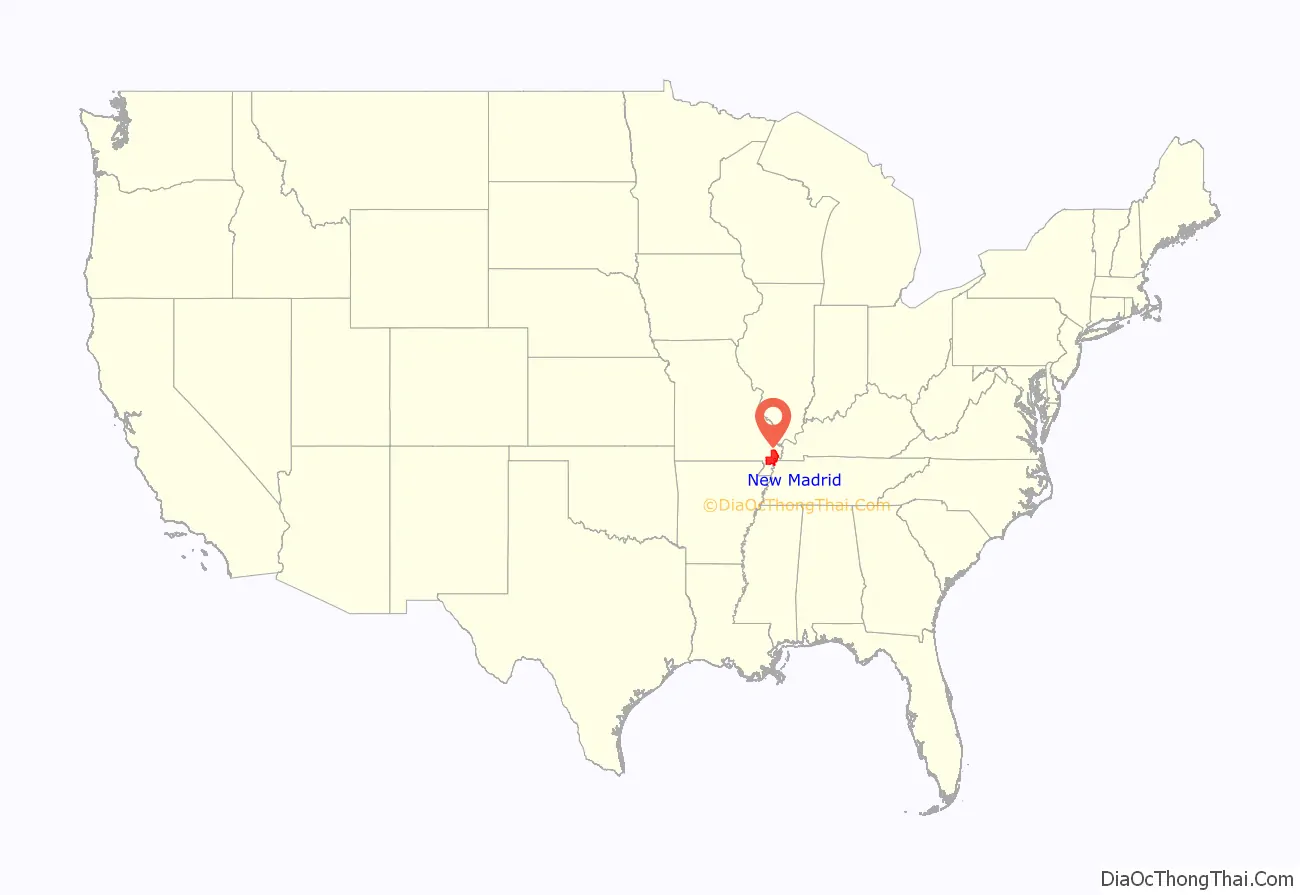
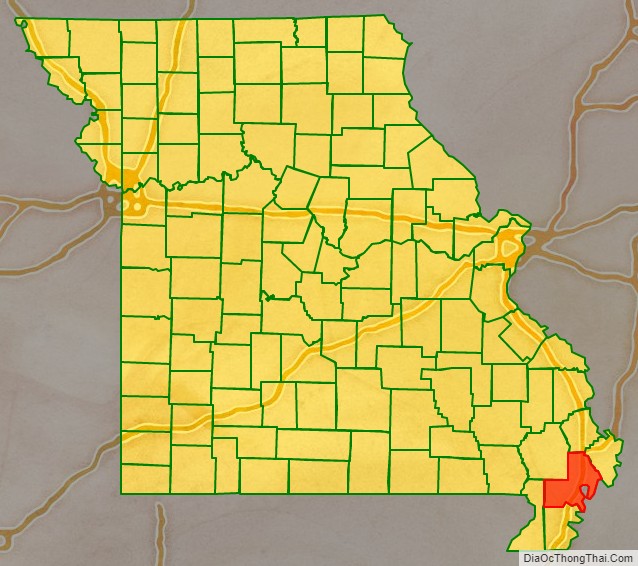
New Madrid County location map. Where is New Madrid County?
History
French Canadians from New France landed in this area in 1781 and established the first European settlement in the present county at New Madrid along the Mississippi River. France had ceded this area to Spain following its loss in the Seven Years’ War. The Spanish governor, Bernardo de Gálvez, appointed American colonel William Morgan, a Revolutionary War veteran from New Jersey, as empresario to recruit new settlers for the area. Morgan attracted about 2,000 settlers before Spain returned this territory to France in the late 18th century. They settled mostly in the area of what is now the city of New Madrid, Missouri. After failing to regain control of its colony of Saint-Domingue, where a slave rebellion had been raging, France gave up on North America, selling its large territory west of the Mississippi River in 1803 to the United States under the Louisiana Purchase.
New Madrid County was organized on October 1, 1812, as an act of the First General Assembly of the Missouri Territory. In the floodplain of the Mississippi, this area was long cultivated by planters using enslaved African Americans for cotton production.
A series of more than 1,000 earthquakes struck the area in 1811 and 1812. The New Madrid earthquakes were the strongest non-subduction zone earthquake in the United States. A request dated January 13, 1814, by the Territorial Governor William Clark, asked for federal relief for the “inhabitants of New Madrid County.”
The county had its peak of population in 1940, according to US census records, as shown in the table. Many residents left the rural county from 1950 to 1970, seeking better work opportunities in the North and Midwest. County population has continued to decline. In 2017 the county was featured in an episode of Madrid de sol a sol, a show from Spanish public channel Telemadrid exploring locations named “Madrid”.
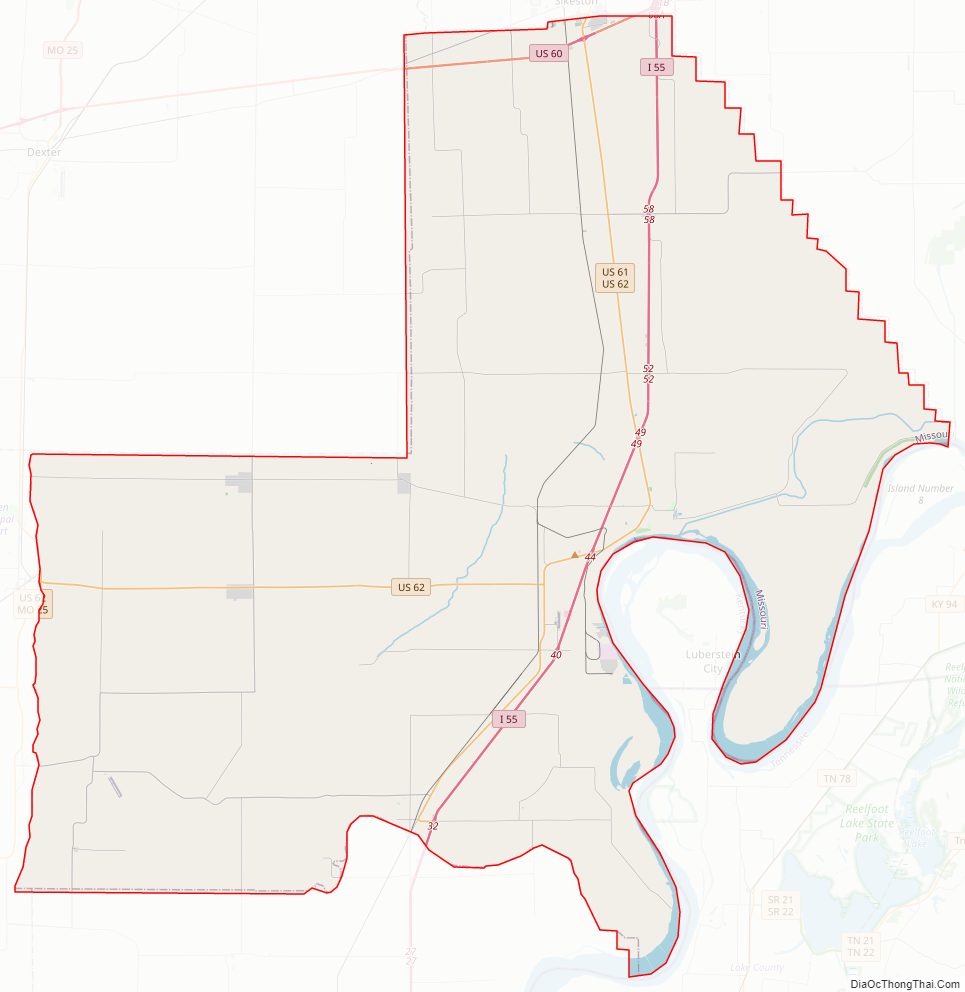
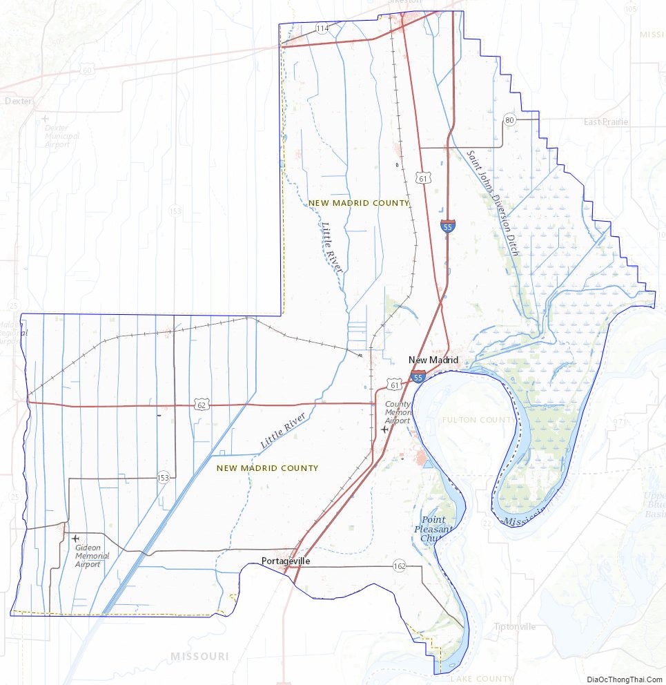
New Madrid County Road Map
Geography
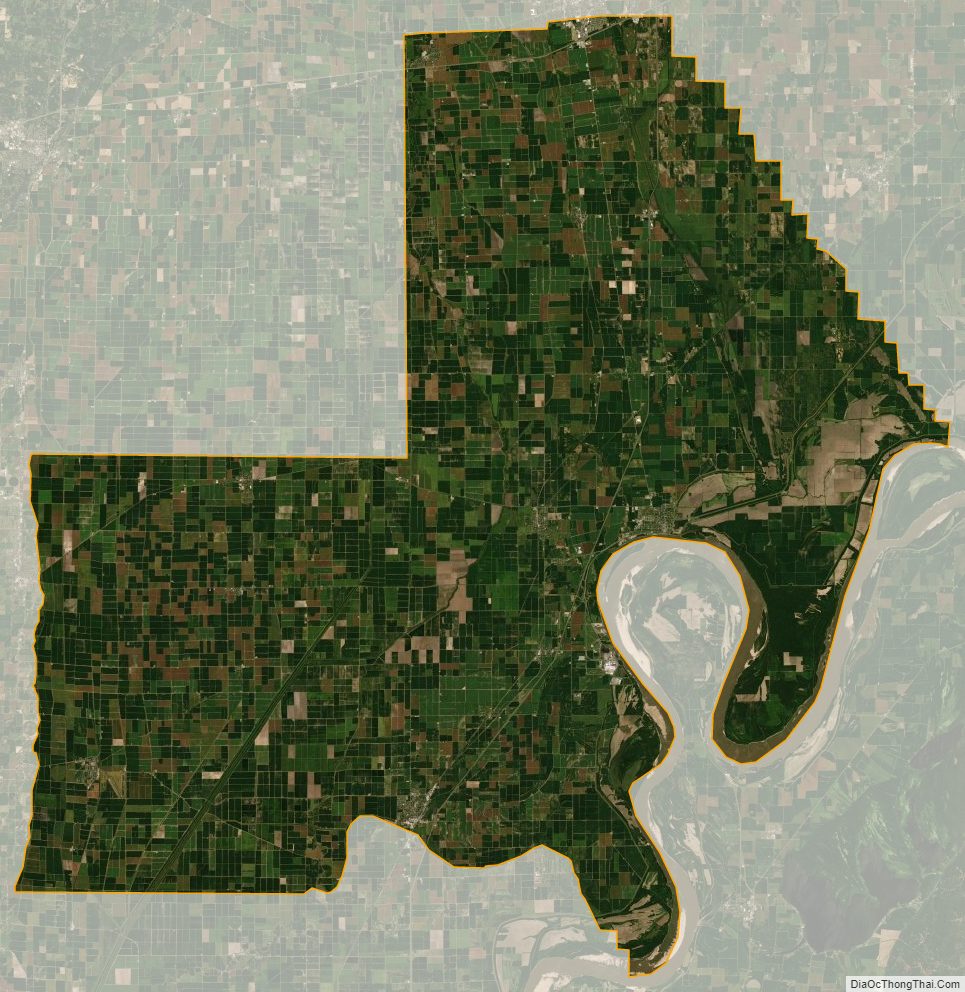
According to the U.S. Census Bureau, the county has a total area of 697 square miles (1,810 km), of which 675 square miles (1,750 km) is land and 22 square miles (57 km) (3.1%) is water.
The county is located on the Kentucky Bend of the Mississippi River, which forms a border of the county. This feature is also known as New Madrid Bend or Madrid Bend. This oxbow flows around an exclave of Fulton County, Kentucky. Scientists expect that eventually the river will cut a new channel across the narrow neck of the peninsula, which will gradually be attached by infill land to Missouri.
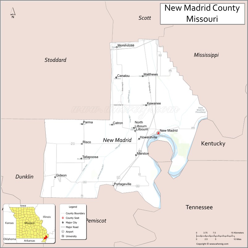
Adjacent counties
- Scott County (north)
- Mississippi County (northeast)
- Fulton County, Kentucky (south and east across the Mississippi river)
- Lake County, Tennessee (south across the river)
- Pemiscot County (south)
- Dunklin County (southwest)
- Stoddard County (northwest)
Major highways
- Interstate 55
- U.S. Route 60
- U.S. Route 61
- U.S. Route 62
- Route 153
- Route 162
New Madrid County Topographic Map
New Madrid County Satellite Map
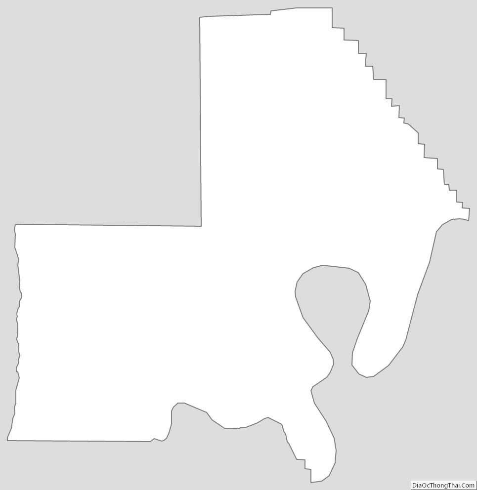
New Madrid County Outline Map
See also
Map of Missouri State and its subdivision:- Adair
- Andrew
- Atchison
- Audrain
- Barry
- Barton
- Bates
- Benton
- Bollinger
- Boone
- Buchanan
- Butler
- Caldwell
- Callaway
- Camden
- Cape Girardeau
- Carroll
- Carter
- Cass
- Cedar
- Chariton
- Christian
- Clark
- Clay
- Clinton
- Cole
- Cooper
- Crawford
- Dade
- Dallas
- Daviess
- De Kalb
- Dent
- Douglas
- Dunklin
- Franklin
- Gasconade
- Gentry
- Greene
- Grundy
- Harrison
- Henry
- Hickory
- Holt
- Howard
- Howell
- Iron
- Jackson
- Jasper
- Jefferson
- Johnson
- Knox
- Laclede
- Lafayette
- Lawrence
- Lewis
- Lincoln
- Linn
- Livingston
- Macon
- Madison
- Maries
- Marion
- McDonald
- Mercer
- Miller
- Mississippi
- Moniteau
- Monroe
- Montgomery
- Morgan
- New Madrid
- Newton
- Nodaway
- Oregon
- Osage
- Ozark
- Pemiscot
- Perry
- Pettis
- Phelps
- Pike
- Platte
- Polk
- Pulaski
- Putnam
- Ralls
- Randolph
- Ray
- Reynolds
- Ripley
- Saint Charles
- Saint Clair
- Saint Francois
- Saint Louis
- Sainte Genevieve
- Saline
- Schuyler
- Scotland
- Scott
- Shannon
- Shelby
- Stoddard
- Stone
- Sullivan
- Taney
- Texas
- Vernon
- Warren
- Washington
- Wayne
- Webster
- Worth
- Wright
- Alabama
- Alaska
- Arizona
- Arkansas
- California
- Colorado
- Connecticut
- Delaware
- District of Columbia
- Florida
- Georgia
- Hawaii
- Idaho
- Illinois
- Indiana
- Iowa
- Kansas
- Kentucky
- Louisiana
- Maine
- Maryland
- Massachusetts
- Michigan
- Minnesota
- Mississippi
- Missouri
- Montana
- Nebraska
- Nevada
- New Hampshire
- New Jersey
- New Mexico
- New York
- North Carolina
- North Dakota
- Ohio
- Oklahoma
- Oregon
- Pennsylvania
- Rhode Island
- South Carolina
- South Dakota
- Tennessee
- Texas
- Utah
- Vermont
- Virginia
- Washington
- West Virginia
- Wisconsin
- Wyoming