Ralls County is a county located in the northeastern portion of the U.S. state of Missouri. As of the 2020 census, the population was 10,355. Its county seat is New London. The county was organized November 16, 1820 and named for Daniel Ralls, Missouri state legislator.
Ralls County is part of the Hannibal, MO Micropolitan Statistical Area, which is also included in the Quincy-Hannibal, IL-MO Combined Statistical Area.
| Name: | Ralls County |
|---|---|
| FIPS code: | 29-173 |
| State: | Missouri |
| Founded: | November 16, 1820 |
| Named for: | Daniel Ralls |
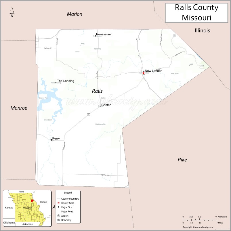
| Seat: | New London |
| Largest city: | Hannibal |
| Total Area: | 484 sq mi (1,250 km²) |
| Land Area: | 470 sq mi (1,200 km²) |
| Total Population: | 10,355 |
| Population Density: | 21/sq mi (8.3/km²) |
| Time zone: | UTC−6 (Central) |
| Summer Time Zone (DST): | UTC−5 (CDT) |
| Website: | www.rallscounty.org |
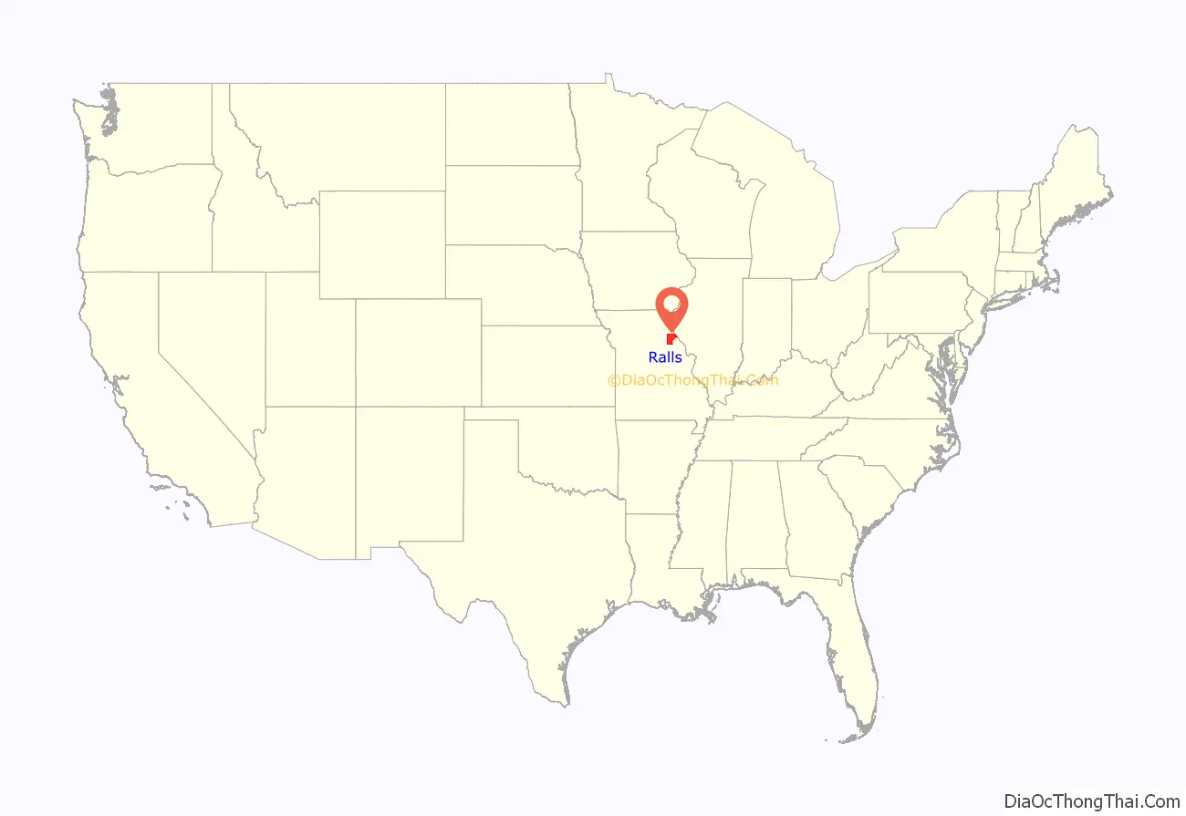
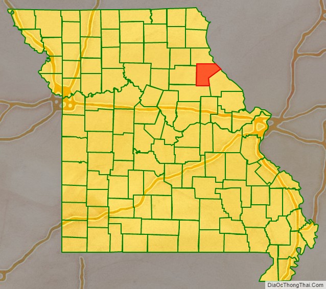
Ralls County location map. Where is Ralls County?
History
Ralls County was one of several along the Mississippi River settled in the early years primarily by European-American migrants from the Upper South, especially Kentucky and Tennessee. They brought slaves and slaveholding traditions with them, and quickly started cultivating crops similar to those in Middle Tennessee and Kentucky: hemp and tobacco. They also brought characteristic antebellum architecture and culture. Ralls is considered one of the counties in the outer ring of what is called the Little Dixie region. Most of the Little Dixie counties are located further west along the Missouri River, from Callaway County west.
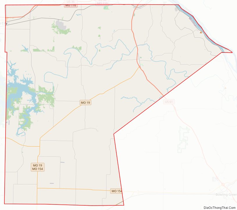
Ralls County Road Map
Geography
According to the U.S. Census Bureau, the county has a total area of 484 square miles (1,250 km), of which 470 square miles (1,200 km) is land and 14 square miles (36 km) (2.9%) is water.
Adjacent counties
- Marion County (north)
- Pike County, Illinois (northeast)
- Pike County (southeast)
- Audrain County (south)
- Monroe County (west)
Major highways
- Interstate 72 (proposed)
- U.S. Route 24
- U.S. Route 36
- U.S. Route 54
- U.S. Route 61
U.S. Route 61 Business- Route 19
- Route 79
- Route 154
- Great River Road
Ralls County Topographic Map

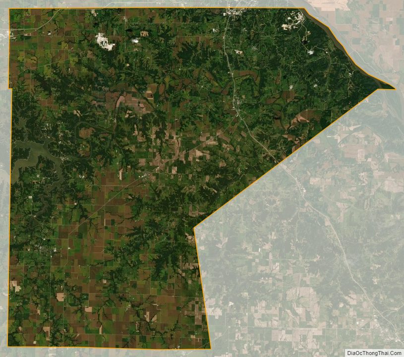
Ralls County Satellite Map
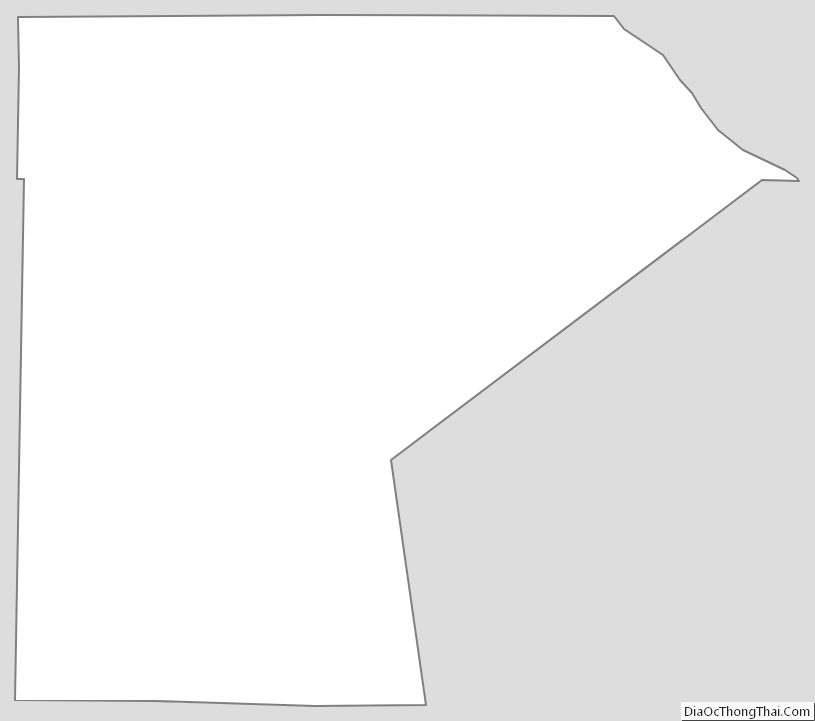
Ralls County Outline Map
See also
Map of Missouri State and its subdivision:- Adair
- Andrew
- Atchison
- Audrain
- Barry
- Barton
- Bates
- Benton
- Bollinger
- Boone
- Buchanan
- Butler
- Caldwell
- Callaway
- Camden
- Cape Girardeau
- Carroll
- Carter
- Cass
- Cedar
- Chariton
- Christian
- Clark
- Clay
- Clinton
- Cole
- Cooper
- Crawford
- Dade
- Dallas
- Daviess
- De Kalb
- Dent
- Douglas
- Dunklin
- Franklin
- Gasconade
- Gentry
- Greene
- Grundy
- Harrison
- Henry
- Hickory
- Holt
- Howard
- Howell
- Iron
- Jackson
- Jasper
- Jefferson
- Johnson
- Knox
- Laclede
- Lafayette
- Lawrence
- Lewis
- Lincoln
- Linn
- Livingston
- Macon
- Madison
- Maries
- Marion
- McDonald
- Mercer
- Miller
- Mississippi
- Moniteau
- Monroe
- Montgomery
- Morgan
- New Madrid
- Newton
- Nodaway
- Oregon
- Osage
- Ozark
- Pemiscot
- Perry
- Pettis
- Phelps
- Pike
- Platte
- Polk
- Pulaski
- Putnam
- Ralls
- Randolph
- Ray
- Reynolds
- Ripley
- Saint Charles
- Saint Clair
- Saint Francois
- Saint Louis
- Sainte Genevieve
- Saline
- Schuyler
- Scotland
- Scott
- Shannon
- Shelby
- Stoddard
- Stone
- Sullivan
- Taney
- Texas
- Vernon
- Warren
- Washington
- Wayne
- Webster
- Worth
- Wright
- Alabama
- Alaska
- Arizona
- Arkansas
- California
- Colorado
- Connecticut
- Delaware
- District of Columbia
- Florida
- Georgia
- Hawaii
- Idaho
- Illinois
- Indiana
- Iowa
- Kansas
- Kentucky
- Louisiana
- Maine
- Maryland
- Massachusetts
- Michigan
- Minnesota
- Mississippi
- Missouri
- Montana
- Nebraska
- Nevada
- New Hampshire
- New Jersey
- New Mexico
- New York
- North Carolina
- North Dakota
- Ohio
- Oklahoma
- Oregon
- Pennsylvania
- Rhode Island
- South Carolina
- South Dakota
- Tennessee
- Texas
- Utah
- Vermont
- Virginia
- Washington
- West Virginia
- Wisconsin
- Wyoming