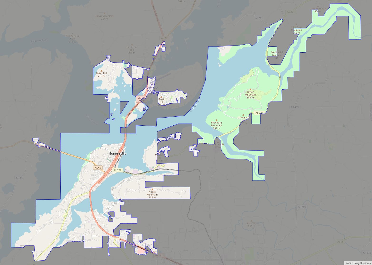
Guntersville (previously known as Gunter’s Ferry and later Gunter’s Landing) is a city and the county seat of Marshall County, Alabama, United States. At the 2020 census, the population of the city was 8,553. Guntersville is located in a HUBZone as identified by the U.S. Small Business Administration (SBA).
| Name: | Guntersville city |
|---|---|
| LSAD Code: | 25 |
| LSAD Description: | city (suffix) |
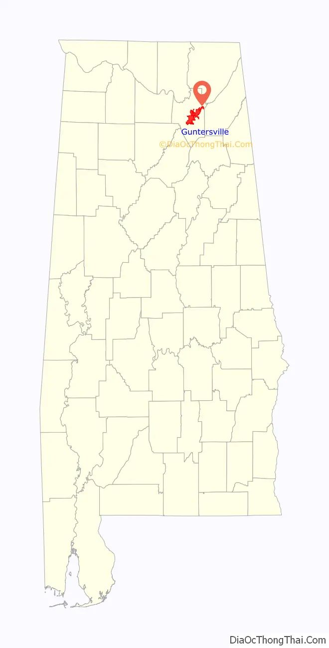
| State: | Alabama |
| County: | Marshall County |
| Elevation: | 607 ft (185 m) |
| Total Area: | 42.70 sq mi (110.59 km²) |
| Land Area: | 25.64 sq mi (66.39 km²) |
| Water Area: | 17.06 sq mi (44.19 km²) |
| Total Population: | 8,553 |
| Population Density: | 333.65/sq mi (128.82/km²) |
| ZIP code: | 35976 |
| Area code: | 256 |
| FIPS code: | 0132416 |
| GNISfeature ID: | 2403774 |
| Website: | guntersvilleal.org |
Online Interactive Map
Click on ![]() to view map in "full screen" mode.
to view map in "full screen" mode.
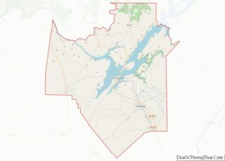
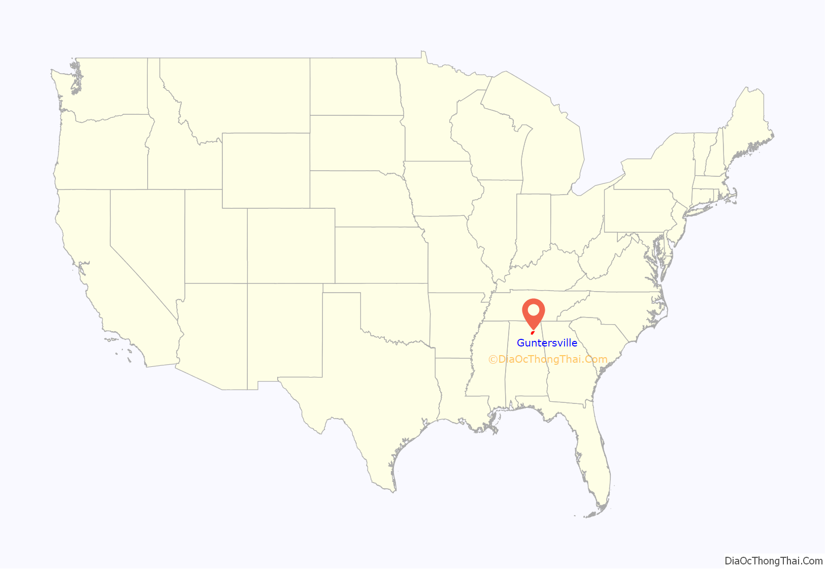
Guntersville location map. Where is Guntersville city?
History
Guntersville was founded by John Gunter (1765–1835), the great-grandfather of American humorist Will Rogers. Gunter’s own great-great-grandfather, of Welsh-English descent, had emigrated to the New World in 1644. Gunter was the wealthy owner of a salt mine in the early 19th century. In order to obtain more land to mine, Gunter struck a deal with the Cherokee tribe that inhabited the area to use in his household as servants. As part of the deal, Gunter married the daughter (Ghe-No-He-Li, aka Katy and Cathrine) of the tribe’s chief (Chief Bushyhead of the Paint Clan) and agreed to give salt to the tribe. A town sprung up next to the mine and was named after Gunter. The town of Guntersville puts on a festival every July to celebrate Will Rogers, which involves many activities which were of interest to Rogers.
Initially incorporated as “Gunter’s Landing” in 1848, it won the contest to become county seat from Warrenton (which had been the seat since 1841). It formally changed its name to Guntersville in 1854.
The United States Navy began operating a fleet of gunboats on the Tennessee River in late 1864. Confederate troops mounted a spirited defense of the river from Guntersville. In January 1865, the USS General Grant attempted to destroy the town in retaliation.
For much of the 20th century, the economy of Guntersville revolved around cotton processing, especially with the Saratoga Victory Mill.
Guntersville Road Map
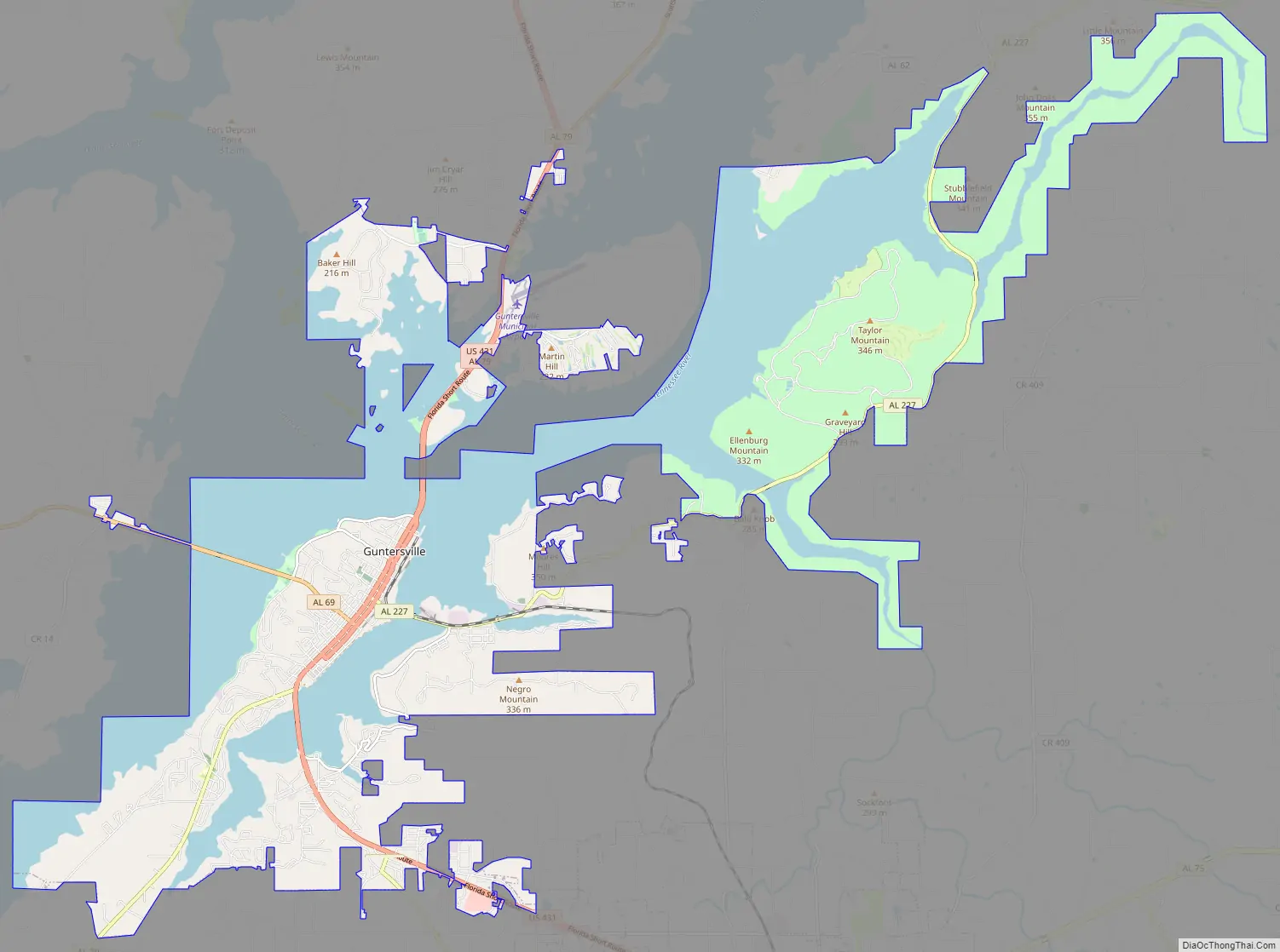
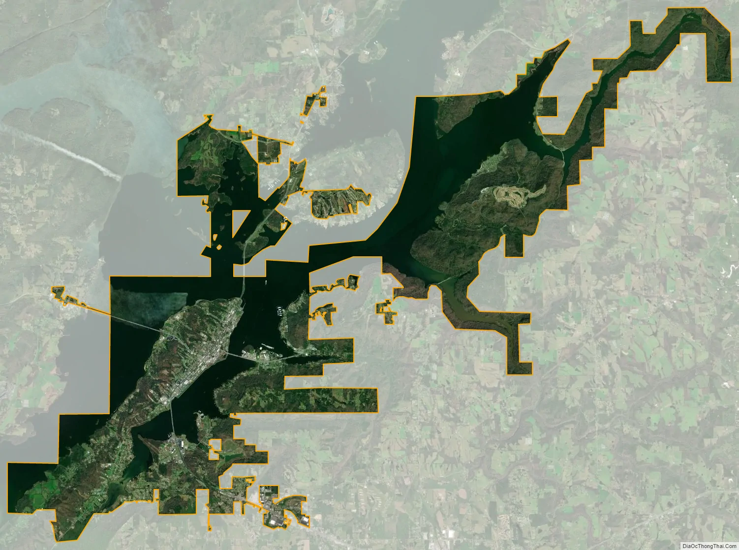
Guntersville city Satellite Map
Geography
Guntersville is located in central Marshall County at 34°20′54″N 86°17′40″W / 34.34833°N 86.29444°W / 34.34833; -86.29444 (34.348197, −86.294523). U.S. Route 431 (Gunter Avenue and Blount Avenue) is the main road through the city, leading northwest 37 miles (60 km) to Huntsville, and southeast 10 miles (16 km) to Albertville. Gadsden is 36 miles (58 km) to the southeast via US 431.
According to the U.S. Census Bureau, the city of Guntersville has a total area of 42.7 square miles (110.6 km), of which 25.6 square miles (66.4 km) are land and 17.1 square miles (44.2 km), or 40.0%, are water. Guntersville is located at the southernmost point of the Tennessee River on Lake Guntersville, formed by the Guntersville Dam (built by the Tennessee Valley Authority). Geologically, the lake occupies a southern extension of the Sequatchie Valley, which continues south as Browns Valley.
Climate
See also
Map of Alabama State and its subdivision:- Autauga
- Baldwin
- Barbour
- Bibb
- Blount
- Bullock
- Butler
- Calhoun
- Chambers
- Cherokee
- Chilton
- Choctaw
- Clarke
- Clay
- Cleburne
- Coffee
- Colbert
- Conecuh
- Coosa
- Covington
- Crenshaw
- Cullman
- Dale
- Dallas
- De Kalb
- Elmore
- Escambia
- Etowah
- Fayette
- Franklin
- Geneva
- Greene
- Hale
- Henry
- Houston
- Jackson
- Jefferson
- Lamar
- Lauderdale
- Lawrence
- Lee
- Limestone
- Lowndes
- Macon
- Madison
- Marengo
- Marion
- Marshall
- Mobile
- Monroe
- Montgomery
- Morgan
- Perry
- Pickens
- Pike
- Randolph
- Russell
- Saint Clair
- Shelby
- Sumter
- Talladega
- Tallapoosa
- Tuscaloosa
- Walker
- Washington
- Wilcox
- Winston
- Alabama
- Alaska
- Arizona
- Arkansas
- California
- Colorado
- Connecticut
- Delaware
- District of Columbia
- Florida
- Georgia
- Hawaii
- Idaho
- Illinois
- Indiana
- Iowa
- Kansas
- Kentucky
- Louisiana
- Maine
- Maryland
- Massachusetts
- Michigan
- Minnesota
- Mississippi
- Missouri
- Montana
- Nebraska
- Nevada
- New Hampshire
- New Jersey
- New Mexico
- New York
- North Carolina
- North Dakota
- Ohio
- Oklahoma
- Oregon
- Pennsylvania
- Rhode Island
- South Carolina
- South Dakota
- Tennessee
- Texas
- Utah
- Vermont
- Virginia
- Washington
- West Virginia
- Wisconsin
- Wyoming