Lipscomb is a city in western Jefferson County, Alabama. It is part of the Birmingham, Alabama, metropolitan area. At the 2020 census, the population was 2,086.
It does not have its own U.S. Post Office or ZIP code, instead sharing the Bessemer ZIP code (35020).
| Name: | Lipscomb city |
|---|---|
| LSAD Code: | 25 |
| LSAD Description: | city (suffix) |
| State: | Alabama |
| County: | Jefferson County |
| Elevation: | 541 ft (165 m) |
| Total Area: | 1.18 sq mi (3.05 km²) |
| Land Area: | 1.18 sq mi (3.05 km²) |
| Water Area: | 0.00 sq mi (0.00 km²) |
| Total Population: | 2,086 |
| Population Density: | 1,773.81/sq mi (684.84/km²) |
| Area code: | 205 & 659 |
| FIPS code: | 0143336 |
| GNISfeature ID: | 2404936 |
Online Interactive Map
Click on ![]() to view map in "full screen" mode.
to view map in "full screen" mode.
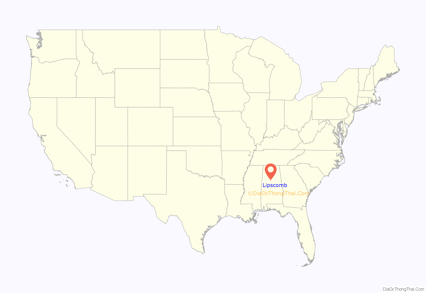
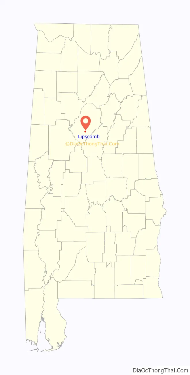
Lipscomb location map. Where is Lipscomb city?
History
The city of Lipscomb was first incorporated on June 30, 1910, and was named for L. Y. Lipscomb, one of three brothers who first settled in the area in 1885. As early as the 1880s, the community was called Wheeling and the town had 200-300 residents by 1906. The community was originally named after Wheeling, West Virginia because the owners of Woodward Iron Company, who employed many of the residents, also had business interests in that state. Y. L. Lipscomb ran a general store on the old South Bessemer car line which opened in 1890, though the first settlers actually came to the area in the 1830s, when Vincent Loveless established his farm in the area. The first church was established in the area in June, 1834 when a log structure was built named Union Baptist Church which sat on the site of the present church.
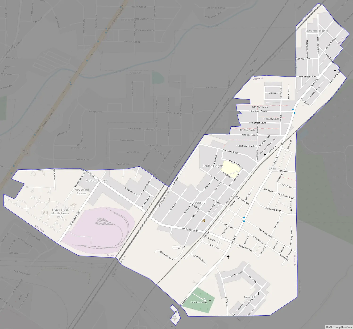
Lipscomb Road Map
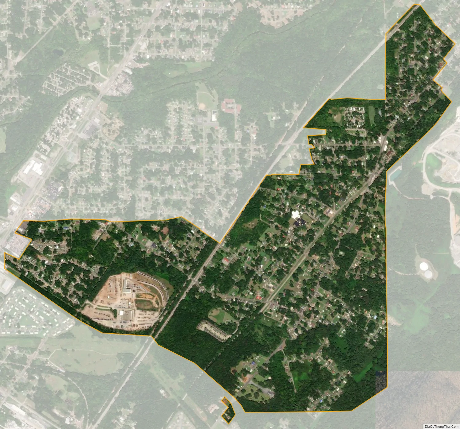
Lipscomb city Satellite Map
Geography
According to the U.S. Census Bureau, the town has a total area of 1.1 square miles (2.8 km), all land.
See also
Map of Alabama State and its subdivision:- Autauga
- Baldwin
- Barbour
- Bibb
- Blount
- Bullock
- Butler
- Calhoun
- Chambers
- Cherokee
- Chilton
- Choctaw
- Clarke
- Clay
- Cleburne
- Coffee
- Colbert
- Conecuh
- Coosa
- Covington
- Crenshaw
- Cullman
- Dale
- Dallas
- De Kalb
- Elmore
- Escambia
- Etowah
- Fayette
- Franklin
- Geneva
- Greene
- Hale
- Henry
- Houston
- Jackson
- Jefferson
- Lamar
- Lauderdale
- Lawrence
- Lee
- Limestone
- Lowndes
- Macon
- Madison
- Marengo
- Marion
- Marshall
- Mobile
- Monroe
- Montgomery
- Morgan
- Perry
- Pickens
- Pike
- Randolph
- Russell
- Saint Clair
- Shelby
- Sumter
- Talladega
- Tallapoosa
- Tuscaloosa
- Walker
- Washington
- Wilcox
- Winston
- Alabama
- Alaska
- Arizona
- Arkansas
- California
- Colorado
- Connecticut
- Delaware
- District of Columbia
- Florida
- Georgia
- Hawaii
- Idaho
- Illinois
- Indiana
- Iowa
- Kansas
- Kentucky
- Louisiana
- Maine
- Maryland
- Massachusetts
- Michigan
- Minnesota
- Mississippi
- Missouri
- Montana
- Nebraska
- Nevada
- New Hampshire
- New Jersey
- New Mexico
- New York
- North Carolina
- North Dakota
- Ohio
- Oklahoma
- Oregon
- Pennsylvania
- Rhode Island
- South Carolina
- South Dakota
- Tennessee
- Texas
- Utah
- Vermont
- Virginia
- Washington
- West Virginia
- Wisconsin
- Wyoming


