Leeds is a tri-county municipality located in Jefferson, St. Clair, and Shelby counties in the State of Alabama and is an eastern suburb of Birmingham. As of the 2020 census, the population of the city was 12,324.
Leeds was founded in 1877, during the final years of the post-Civil War Reconstruction Era. It housed the workers and their families of Lehigh, a Portland cement manufacturing plant.
| Name: | Leeds city |
|---|---|
| LSAD Code: | 25 |
| LSAD Description: | city (suffix) |
| State: | Alabama |
| County: | Jefferson County, Shelby County, St. Clair County |
| Elevation: | 673 ft (205 m) |
| Total Area: | 22.99 sq mi (59.55 km²) |
| Land Area: | 22.76 sq mi (58.95 km²) |
| Water Area: | 0.23 sq mi (0.60 km²) |
| Total Population: | 12,324 |
| Population Density: | 541.48/sq mi (209.07/km²) |
| ZIP code: | 35094 |
| Area code: | 205 & 659 |
| FIPS code: | 0141968 |
| GNISfeature ID: | 2404905 |
| Website: | leedsalabama.org |
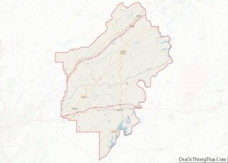
Online Interactive Map
Click on ![]() to view map in "full screen" mode.
to view map in "full screen" mode.
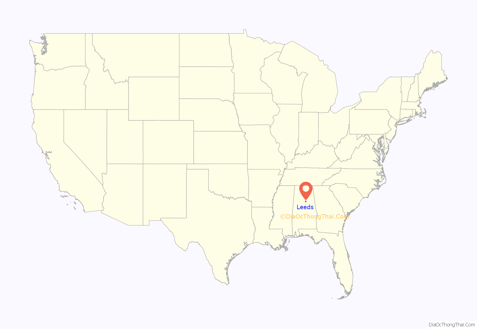
Leeds location map. Where is Leeds city?

History
History
The War of 1812, geography, geology, and three cultures shaped the history of Leeds. Lying at the crossroads of ancient Native American paths in the center of Alabama, Leeds drew European settlers and their African-American slaves to a land of fertile growing seasons and rich sources of coal and mineral ore. The early settlers built churches and schools with many remaining in Cedar Grove, Oak Ridge, Ohanafeefee and Mt. Pleasant. The principal survey of Leeds was entered into Jefferson County Map Book 10, page 21, in 1908. The settlement, dating to 1818 and incorporating on April 27, 1887 as “Leeds”, has existed along the banks of the Little Cahaba River; beside an historic stagecoach route; and along two large railroads for the greater part of American History.
James Hamilton, a Scottish-Irish American veteran of the War of 1812 and first sheriff of Shelby County, settled in Cedar Grove in 1816. John Richard Ingram Pashal Stewart, a Cherokee English teacher and American veteran of the War of 1812, settled at Ohanafeefee Village c.1840. At Oak Ridge in 1820 or 1821, European settlers formed Shiloh Cumberland Presbyterian Church, the first CPC congregation in middle Alabama. By 1887, the original railroad pioneers included free African-American settlers who came to work at the Leeds cement plant and the Central of Georgia as the Georgia Pacific railroads. Some gravitated to historic Mt. Pleasant Church where a handful of freed slaves had founded Scott City, Hillard Holley, Ciscero Davis, Jeff Harris, and Bill Johnson started Leeds Negro/Primary School in 1921.
Folklore
The tale of John Henry was believed to have originated in Leeds. In this folk story, John Henry, the “steel-drivin’ man”, races and wins against a steam engine in the laying of railroad that penetrates the Oak Mountain Tunnel in Leeds. Retired chemistry professor and folklorist John Garst, of the University of Georgia, has argued that the contest happened at the Coosa Mountain Tunnel or the Oak Mountain Tunnel of the Columbus and Western Railway (now part of Norfolk Southern Railway) in Leeds on September 20, 1887.
Based on documentation that corresponds with the account of C.C. Spencer, who claimed in the 1920s to have witnessed the contest, Garst speculates that John Henry may have been a man named Henry who was born a slave to P.A.L. Dabney, the father of the chief engineer of that railroad, in 1850. Since 2007, the city of Leeds has honored John Henry’s legend during an annual festival held on the third weekend in September, the Leeds Downtown Folk Festival & John Henry Celebration.
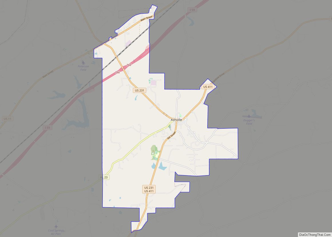
Leeds Road Map
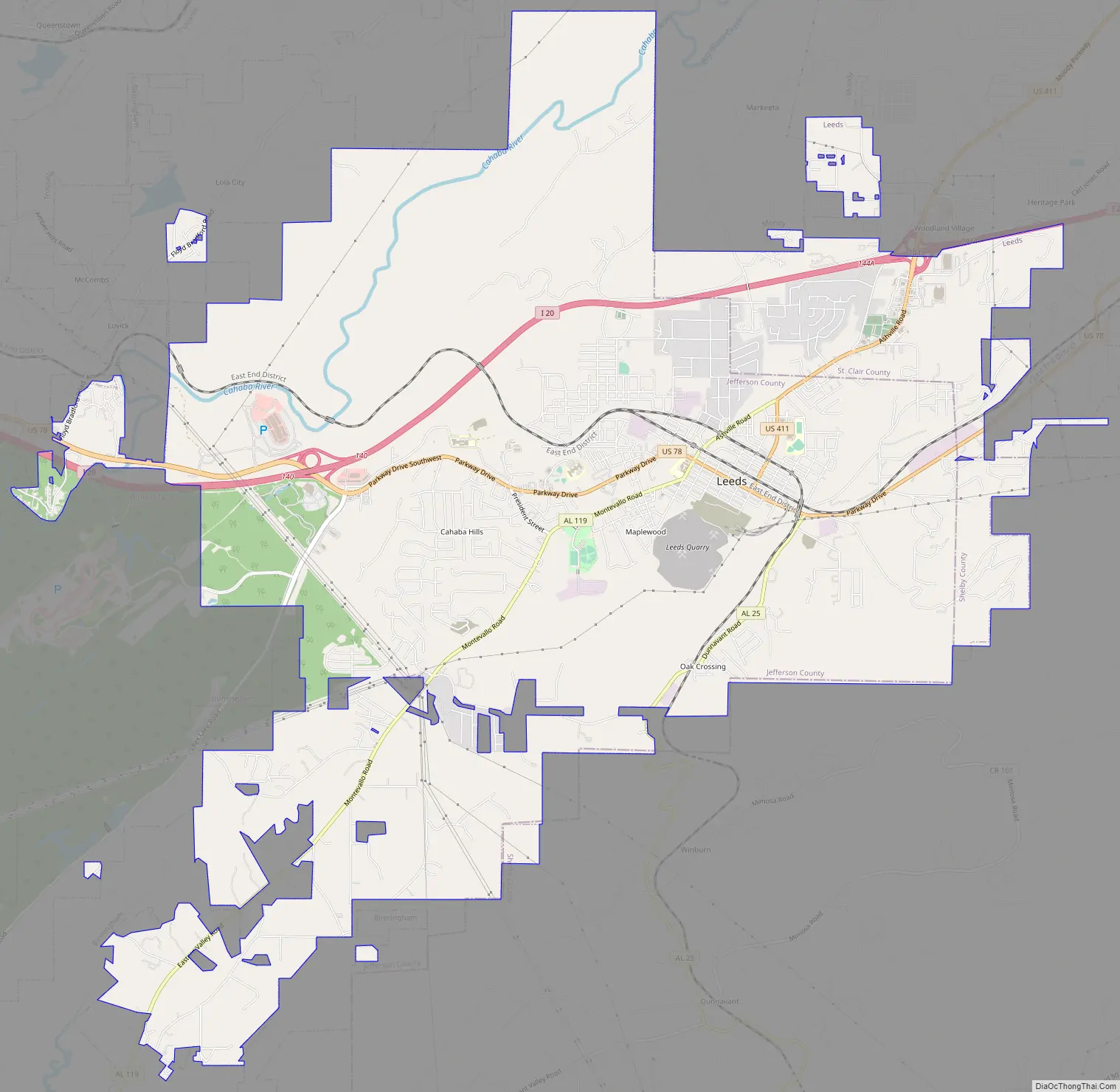
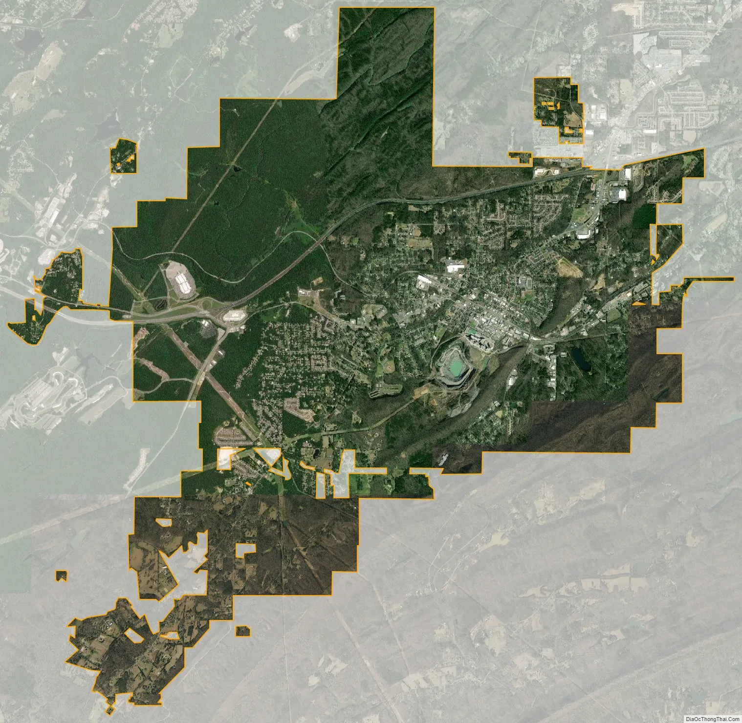
Leeds city Satellite Map
Geography
Leeds is located at 33°32′44″N 86°33′27″W / 33.54556°N 86.55750°W / 33.54556; -86.55750 (33.545592, -86.557388), primarily within Jefferson County.
According to the U.S. Census Bureau, the city has a total area of 22.5 square miles (58 km), of which 22.4 square miles (58 km) is land and 0.2 square miles (0.52 km) (0.67%) is water.
The city is located east of Birmingham along Interstate 20, which runs north of the city. Access to the city is found from exits 140 and 144. Via I-20, downtown Birmingham is 18 mi (29 km) west, and Atlanta is east 129 mi (208 km). U.S. Route 411 begins in the city from its junction with U.S. Route 78. US 411 leads northeast 5 mi (8.0 km) to Moody.
In November 2019, the Alabama Political Reporter announced that the Superfund site at Interstate Lead Co. (ILCO) in Leeds was at risk due to flood hazards associated with climate change.
See also
Map of Alabama State and its subdivision:- Autauga
- Baldwin
- Barbour
- Bibb
- Blount
- Bullock
- Butler
- Calhoun
- Chambers
- Cherokee
- Chilton
- Choctaw
- Clarke
- Clay
- Cleburne
- Coffee
- Colbert
- Conecuh
- Coosa
- Covington
- Crenshaw
- Cullman
- Dale
- Dallas
- De Kalb
- Elmore
- Escambia
- Etowah
- Fayette
- Franklin
- Geneva
- Greene
- Hale
- Henry
- Houston
- Jackson
- Jefferson
- Lamar
- Lauderdale
- Lawrence
- Lee
- Limestone
- Lowndes
- Macon
- Madison
- Marengo
- Marion
- Marshall
- Mobile
- Monroe
- Montgomery
- Morgan
- Perry
- Pickens
- Pike
- Randolph
- Russell
- Saint Clair
- Shelby
- Sumter
- Talladega
- Tallapoosa
- Tuscaloosa
- Walker
- Washington
- Wilcox
- Winston
- Alabama
- Alaska
- Arizona
- Arkansas
- California
- Colorado
- Connecticut
- Delaware
- District of Columbia
- Florida
- Georgia
- Hawaii
- Idaho
- Illinois
- Indiana
- Iowa
- Kansas
- Kentucky
- Louisiana
- Maine
- Maryland
- Massachusetts
- Michigan
- Minnesota
- Mississippi
- Missouri
- Montana
- Nebraska
- Nevada
- New Hampshire
- New Jersey
- New Mexico
- New York
- North Carolina
- North Dakota
- Ohio
- Oklahoma
- Oregon
- Pennsylvania
- Rhode Island
- South Carolina
- South Dakota
- Tennessee
- Texas
- Utah
- Vermont
- Virginia
- Washington
- West Virginia
- Wisconsin
- Wyoming