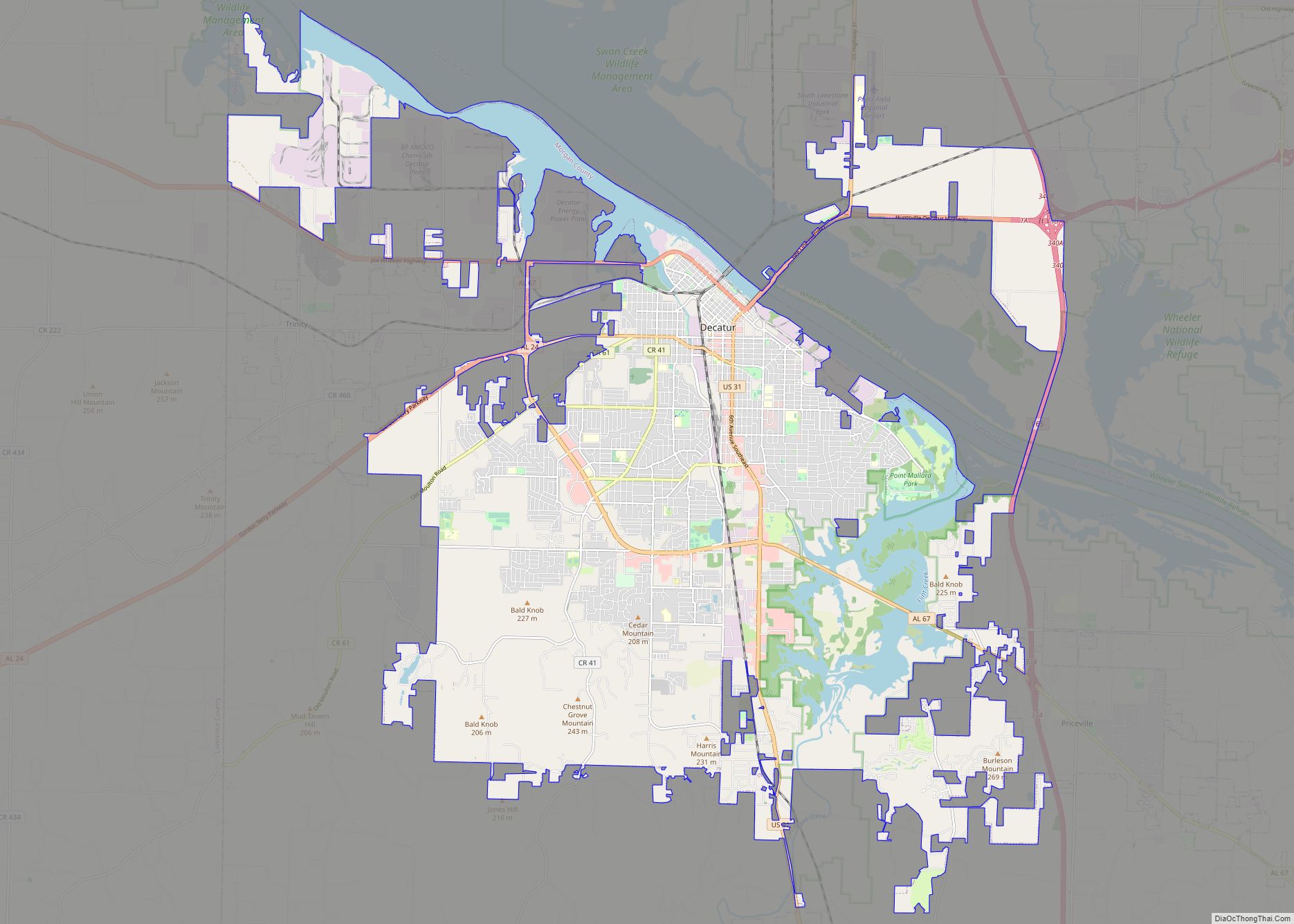
Decatur (dɪˈkeɪtə(r)) is the largest city and county seat of Morgan County (with a portion also in Limestone County) in the U.S. state of Alabama. Nicknamed “The River City”, it is located in northern Alabama on the banks of Wheeler Lake, along the Tennessee River. The population in 2020 was 57,938.
Decatur is the core city of the two-county large Decatur metropolitan area, which had an estimated population of 156,494 in 2020. Combined with the Huntsville Metropolitan Area, the two create the Huntsville-Decatur Combined Statistical Area, of which Decatur is the second-largest city.
Like many southern cities in the early 19th century, Decatur’s early success was based upon its location along a river. Railroad routes and boating traffic pushed the city to the front of North Alabama’s economic atmosphere. The city rapidly grew into a large economic center within the Tennessee Valley and was a hub for travelers and cargo between Nashville and Mobile, as well as Chattanooga and New Orleans. Throughout the 20th century, the city experienced steady growth, but was eclipsed as the regional economic center by the fast-growing Huntsville during the space race. Decatur now finds its economy heavily based on manufacturing, mining, cargo transit, chemical, and high-tech companies such as Vulcan Materials, Daikin, Toray, and United Launch Alliance.
| Name: | Decatur city |
|---|---|
| LSAD Code: | 25 |
| LSAD Description: | city (suffix) |
| State: | Alabama |
| County: | Limestone County, Morgan County |
| Founded: | 1820 |
| Elevation: | 594 ft (181 m) |
| Land Area: | 54.36 sq mi (140.79 km²) |
| Water Area: | 6.50 sq mi (16.84 km²) |
| Population Density: | 1,065.86/sq mi (411.53/km²) |
| ZIP code: | 35600-35699 |
| Area code: | 256 |
| FIPS code: | 0120104 |
| GNISfeature ID: | 2404206 |
| Website: | www.decaturalabamausa.com |
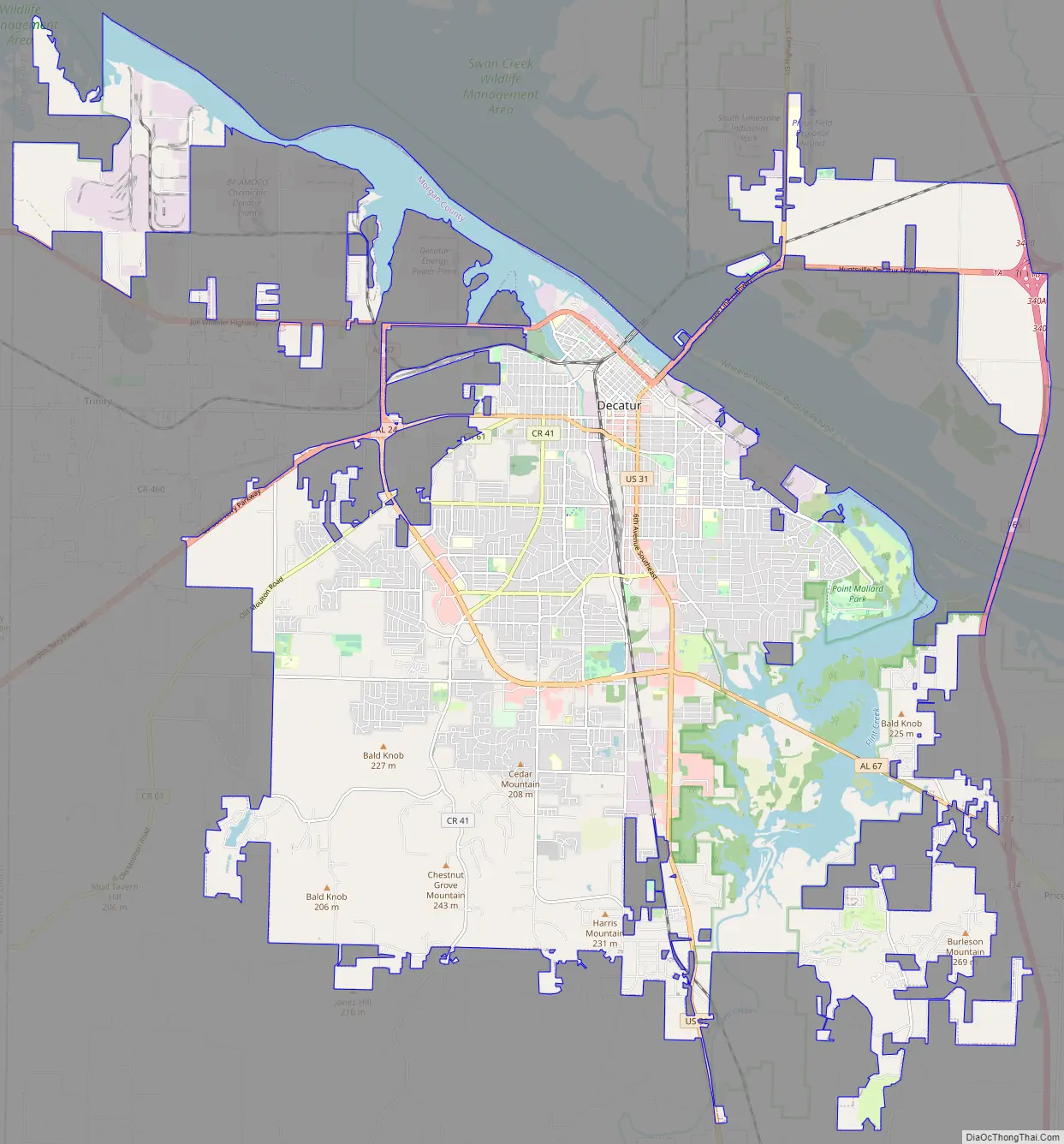
Online Interactive Map
Click on ![]() to view map in "full screen" mode.
to view map in "full screen" mode.
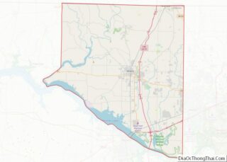
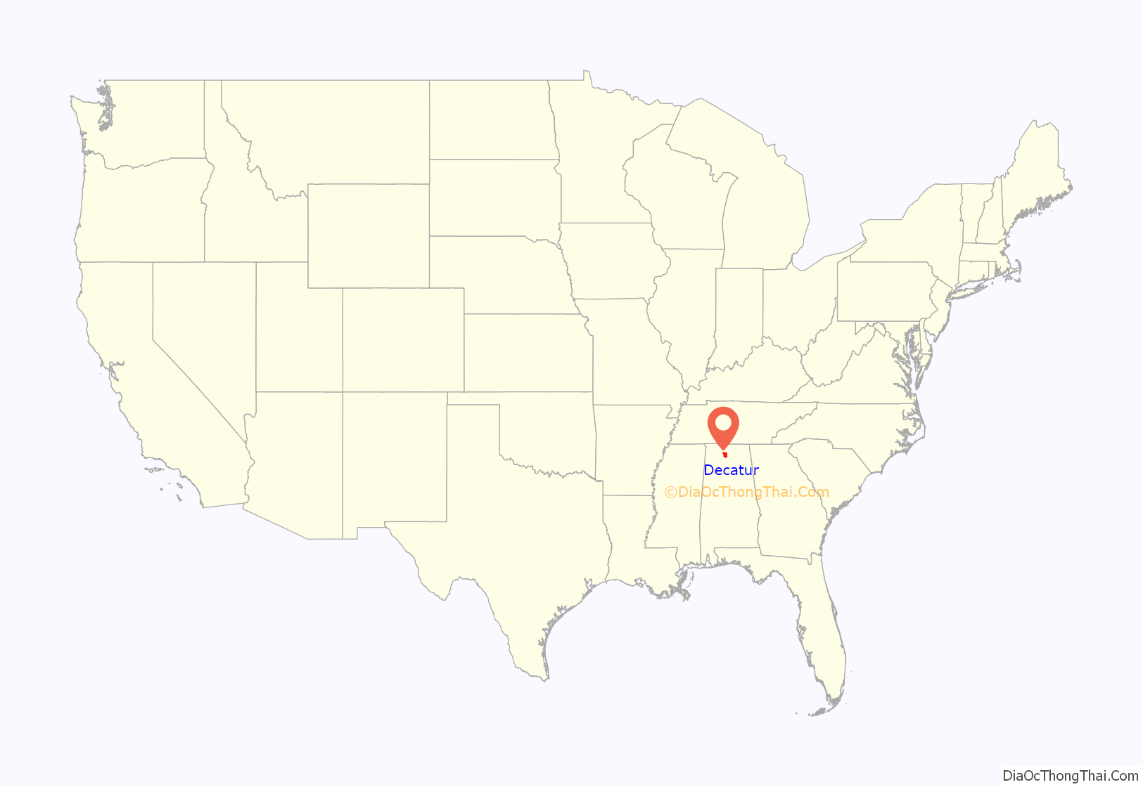
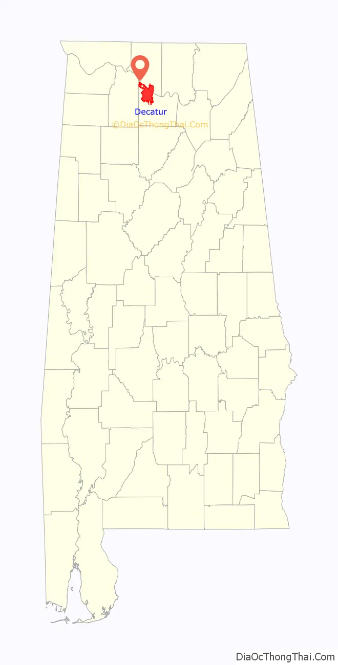
Decatur location map. Where is Decatur city?
History
Initially, the area was known as “Rhodes Ferry Landing”, named for Dr. Henry W. Rhodes, an early landowner who operated a ferry that crossed the Tennessee River in the 1810s at the present-day location of Rhodes Ferry Park. The city was incorporated as Decatur in 1821. It was named in honor of Stephen Decatur; after he was killed in a duel in 1820, President Monroe directed that the Alabama town be named for him.
In the early 1830s, Decatur was the eastern terminus of the Tuscumbia, Courtland and Decatur Railroad, the first railway built west of the Appalachian Mountains. In 1850 the Tuscumbia, Courtland and Decatur was incorporated into the Memphis & Charleston Railroad.
Because of its location on the Tennessee River at the strategically important crossing of two major railroads, Decatur was the site of several encounters during the American Civil War. When the Union Army occupied the city early in the war, the commanding general ordered all but four buildings in the town destroyed. Bricks from some of the churches in town were used to build stoves and chimneys for the buildings that housed soldiers. The four buildings that remained (and are still standing) are the Old State Bank, the Dancy-Polk House, the Todd House, and the Burleson-Hinds-McEntire House. After the Union victory in the Battle of Atlanta, a Confederate army under the command of General John Bell Hood briefly sparred with a vastly outmanned garrison during the 1864 Battle of Decatur, when the city was referred to as “A Tough Nut to Crack.”
While the city was under Confederate control, plans for the Battle of Shiloh were mapped out within the Burleson-Hinds-McEntire House. These activities make the house one of the most historic buildings in Decatur.
New Decatur was a city that rose out of the ashes of former Decatur west of the railroad tracks. New Decatur was founded in 1887 and incorporated in 1889. However, residents of the older Decatur resented the new town, founded and occupied by people who moved down from northern states. Animosity built until New Decatur renamed their town “Albany”, after Albany, New York, in September 1916. The impetus to meld the two towns came from the need for a bridge, instead of a ferry, across the Tennessee River. The Decatur Kiwanis Club was formed with an equal number of members from each town to organize efforts to get the state to build the bridge. In 1925, the two cities merged to form one City of Decatur. There is a noticeable difference between the two sides of town. The cities developed differently at different times, and still to this day have somewhat different cultures. Eastern portions of Decatur tend to act more suburban and traditional, while western portions tend to look more metropolitan and contemporary.
The Old State Bank, on the edge of downtown, is the oldest bank building in the State of Alabama, being 190 years old. The first wave pool in the United States was built in Decatur and is still in operation at the Point Mallard Aquatic Center. The city has the largest Victorian era home district in the state of Alabama. Decatur is also home to Alabama’s oldest opera house, the Cotaco Opera House, which still stands on Johnston Street.
In the past, its industries included repair shops of the Louisville and Nashville Railroad, car works, engine works, bottling plants, and manufacturers of lumber, sashes and blinds, tannic acid, fertilizers, cigars, flour, cottonseed oil, and various other products.
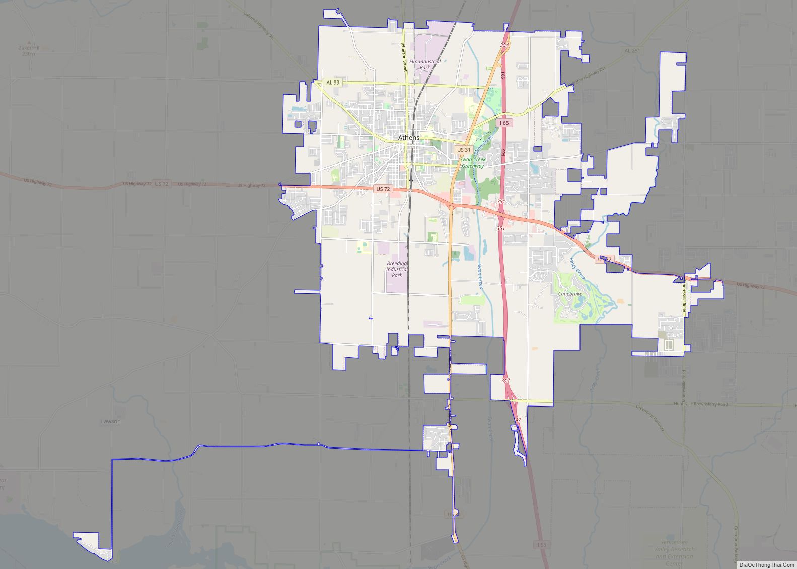
Decatur Road Map
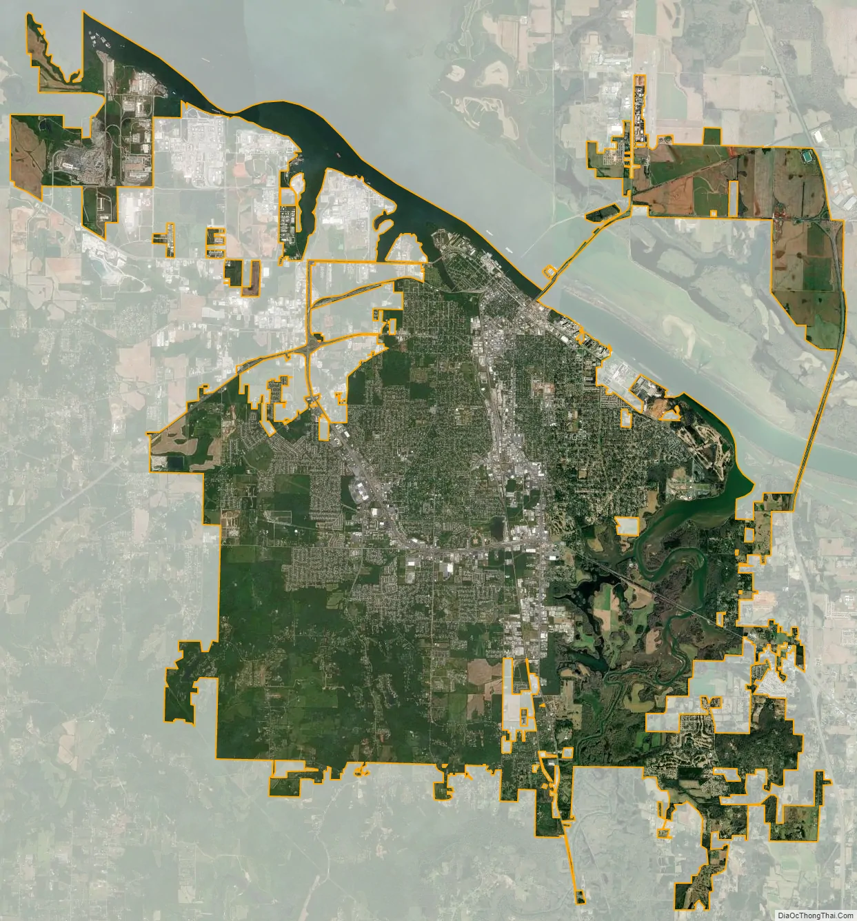
Decatur city Satellite Map
Geography
The Tennessee River has traditionally been the northern border of the city and Morgan County, but a small portion of the city extends across the river into Limestone County between U.S. 31 and I-65. Major bodies of water in the city include Wheeler Lake on the Tennessee River itself, plus Flint Creek, and Dry Branch, tributaries of the Tennessee River. The city extends to the other side of Flint Creek and the Refuge in the Indian Hills and Burningtree subdivision areas.
The northern portion of Decatur sits on top of a short hill that overlooks the Tennessee River; this creates a very steep dropoff to the river shore at Rhodes Ferry Park. This hill allows the “Steamboat Bill” Memorial Bridge to leave the mainland at grade without any major sloping required to cross the river while not interfering with Decatur’s heavy barge traffic. This hill extends from the banks of the river about 1.5 miles (2.4 km) south to the 14th St./Magnolia St. intersection with 6th Avenue (US 31).
South past the 14th St. and 6th Ave. intersection, land remains flat. South, and also west, past S.R. 67 there are a few minor ridges that sit within the city limits.
According to the U.S. Census Bureau, the city has a total area of 60.9 square miles (158 km), of which 54.4 square miles (141 km) are land and 6.5 square miles (17 km), or 10.68%, are water. Decatur is 25 miles (40 km) southwest of Huntsville, 86 miles (138 km) north of Birmingham, and 44 miles (71 km) east of Muscle Shoals.
Climate
Decatur has a humid subtropical climate (Köppen Cfa) with four distinct seasons.
Winters are generally mild, with a January daily average temperature of 40.6 °F (4.8 °C). On average, the low temperature falls to the freezing mark or below on 59 days a year, and to or below 20 °F (−7 °C) on 9.2 days. Winters usually do not produce much snow; a large amount of snow is rare within the city limits. A small, measurable amount of snow can be experienced a few times each year. In 2011, Decatur received up to 8 inches (20 cm) of snow in a single storm. It tied for the most since 1963.Summers are hot and humid with a July daily average temperature of 79.6 °F (26.4 °C). There are 51–52 days of 90 °F (32 °C)+ highs annually and 1.7 days of 100 °F (38 °C)+ highs. Thunderstorms are common during the summer months. The latter part of summer tends to be drier. Autumn, which spans from mid-September to early-December, tends to be similar to spring in terms of temperature and precipitation, although it begins relatively dry.
Precipitation averages about 53.4 inches per year and on average, is relatively (and uniformly) heavy from November to July, with December the single wettest month on average; August through October are slightly drier months on average. Occasionally, severe thunderstorms occur. These storms can produce damaging winds and large hail in addition to the usual hazards of lightning and very heavy rain. There is also the risk of tornadoes. Severe thunderstorms can occur at any time of the year, but are most common during the spring months. A secondary severe weather season peaks in November. Occasionally from July to October, the Decatur area experiences strong winds and/or heavy to excessive rain from tropical disturbances. These commonly make landfall along the Gulf Coast as hurricanes but lose intensity as they move inland.
The highest recorded temperature was 108 °F (42 °C) on July 28, 1952, and August 16, 1954, while the lowest recorded temperature was −19 °F (−28 °C) on January 30, 1966.
Neighboring cities/towns
- Athens (north) – Limestone County
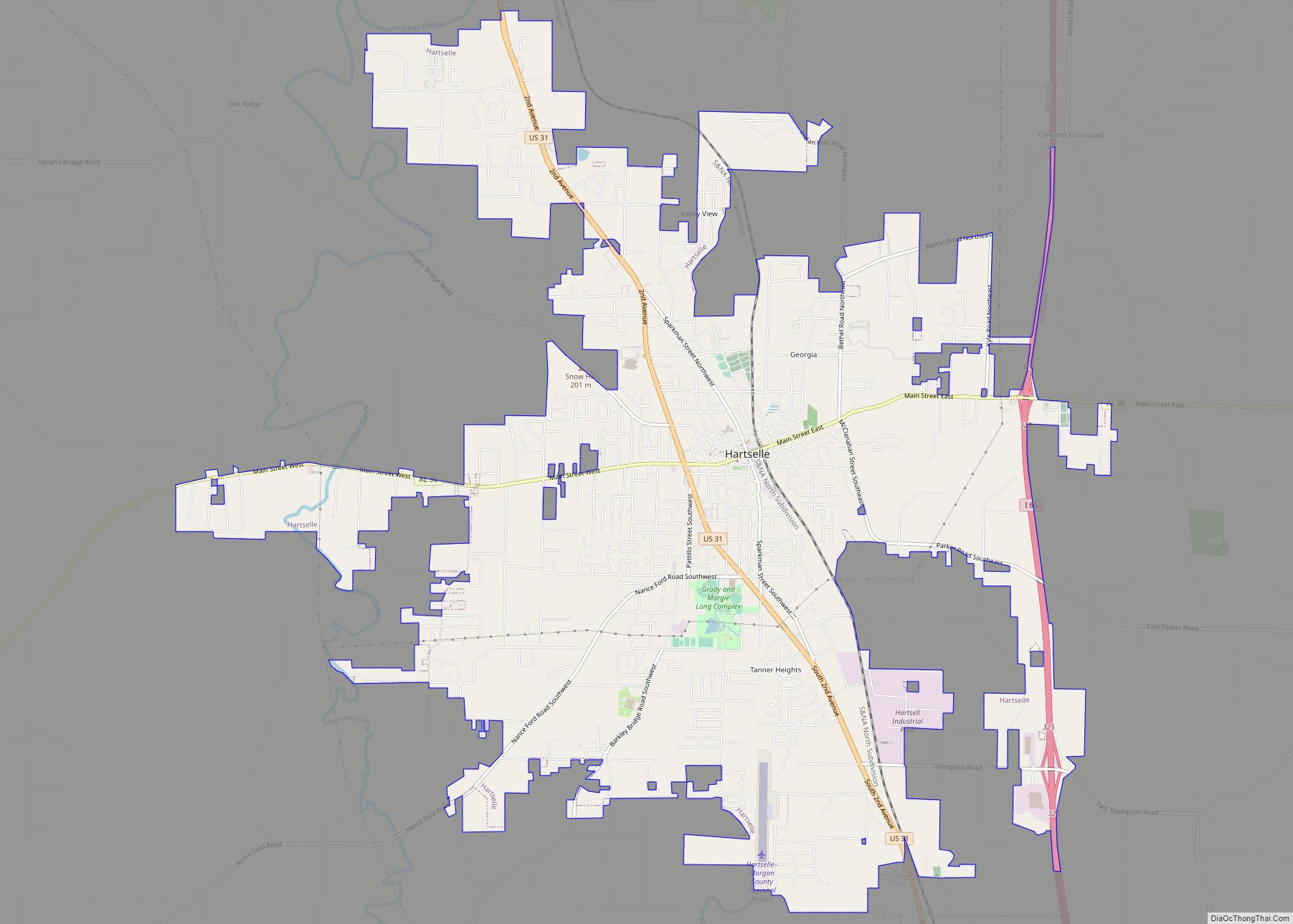
- Hartselle (south) – Morgan County
- Hillsboro (west) – Lawrence County
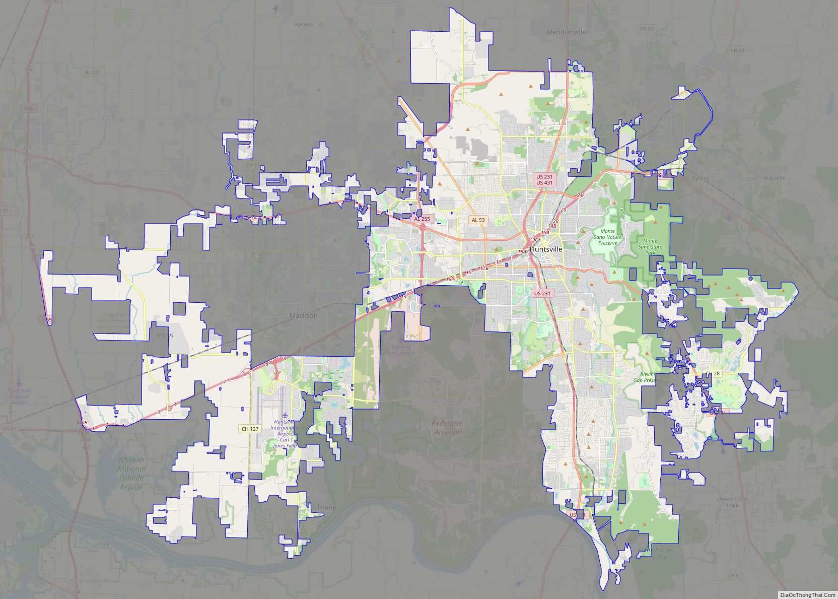
- Huntsville (northeast) – Madison/Limestone counties
- Madison (northeast) – Madison/Limestone counties (however Huntsville completely separates the two)
- Mooresville (northeast) – Limestone County
- Moulton (southwest) – Lawrence County
- Priceville (east) – Morgan County
- Trinity (west) – Morgan County
Neighborhoods
Decatur is divided into four different regions of town (Northeast, Southeast, Northwest, Southwest). Southeast and Northeast Decatur lie east of the CSX Railroad’s mainline. North of Lee Street, the dividing line is Bank Street which runs a block east of and parallel to the railroad. Northeast and Southeast and are divided by Moulton Street. Southwest consists of the area west of the CSX Railroad and south of Moulton Street. Northwest is bordered by Moulton Street, the CSX Railroad from Moulton Street to Lee Street and then by Bank Street from Lee Street to the Tennessee River. While there are few major cultural differences between the East and the West, minute differences such as street grid patterns, zoning patterns, and architectural styles are noticeable.
- West Decatur (the portion north of Moulton Street)
- Albany (New Decatur)
- Downtown Decatur
- East Acres
- Old Decatur
- Bank Street and Second Avenue (Downtown Shopping District)
- Harborview (Riverfront)
- Irvington (Limestone County)
- Whiteside (Limestone County)
- Bayside
- Brookmeade
- Burleson Mountain
- Burningtree Mountain
- Cedar Lake
- Fairview
- Flint
- Hickory Hills
- Indian Hills
- Point Mallard Estates
- Autumn Ridge
- Austinville
- Basham
- Braswell
- Cedar Ridge
- Chapel Hill
- Chula Vista
- City View Estates
- Deerfoot Estates
- Dogwood Estates
- Dunbarton
- Flint
- Graystone
- Griffin Addition
- Longleaf Estates
- Moulton Heights
- Oak Lea
- Oakworth
- Timberlake
- Russell Village
- Vestavia
- West Decatur (the portion south of Moulton Street)
- Westmeade
- Woodtrail
See also
Map of Alabama State and its subdivision:- Autauga
- Baldwin
- Barbour
- Bibb
- Blount
- Bullock
- Butler
- Calhoun
- Chambers
- Cherokee
- Chilton
- Choctaw
- Clarke
- Clay
- Cleburne
- Coffee
- Colbert
- Conecuh
- Coosa
- Covington
- Crenshaw
- Cullman
- Dale
- Dallas
- De Kalb
- Elmore
- Escambia
- Etowah
- Fayette
- Franklin
- Geneva
- Greene
- Hale
- Henry
- Houston
- Jackson
- Jefferson
- Lamar
- Lauderdale
- Lawrence
- Lee
- Limestone
- Lowndes
- Macon
- Madison
- Marengo
- Marion
- Marshall
- Mobile
- Monroe
- Montgomery
- Morgan
- Perry
- Pickens
- Pike
- Randolph
- Russell
- Saint Clair
- Shelby
- Sumter
- Talladega
- Tallapoosa
- Tuscaloosa
- Walker
- Washington
- Wilcox
- Winston
- Alabama
- Alaska
- Arizona
- Arkansas
- California
- Colorado
- Connecticut
- Delaware
- District of Columbia
- Florida
- Georgia
- Hawaii
- Idaho
- Illinois
- Indiana
- Iowa
- Kansas
- Kentucky
- Louisiana
- Maine
- Maryland
- Massachusetts
- Michigan
- Minnesota
- Mississippi
- Missouri
- Montana
- Nebraska
- Nevada
- New Hampshire
- New Jersey
- New Mexico
- New York
- North Carolina
- North Dakota
- Ohio
- Oklahoma
- Oregon
- Pennsylvania
- Rhode Island
- South Carolina
- South Dakota
- Tennessee
- Texas
- Utah
- Vermont
- Virginia
- Washington
- West Virginia
- Wisconsin
- Wyoming