Vincent, originally known as Propel, is a city in Shelby, St. Clair, and Talladega counties in the U.S. state of Alabama. At the 2020 census, the population was 1,982. The community was first known as Propel, but later named Vincent in honor of the Vincent family, who were early settlers of the area. It was incorporated in 1897.
| Name: | Vincent town |
|---|---|
| LSAD Code: | 43 |
| LSAD Description: | town (suffix) |
| State: | Alabama |
| County: | Shelby County, St. Clair County, Talladega County |
| Elevation: | 466 ft (142 m) |
| Total Area: | 20.96 sq mi (54.29 km²) |
| Land Area: | 20.58 sq mi (53.31 km²) |
| Water Area: | 0.38 sq mi (0.98 km²) |
| Total Population: | 1,982 |
| Population Density: | 96.29/sq mi (37.18/km²) |
| ZIP code: | 35178 |
| Area code: | 205, 659 |
| FIPS code: | 0179008 |
| GNISfeature ID: | 2406802 |
| Website: | www.townofvincent.com |
Online Interactive Map
Click on ![]() to view map in "full screen" mode.
to view map in "full screen" mode.
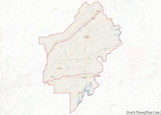
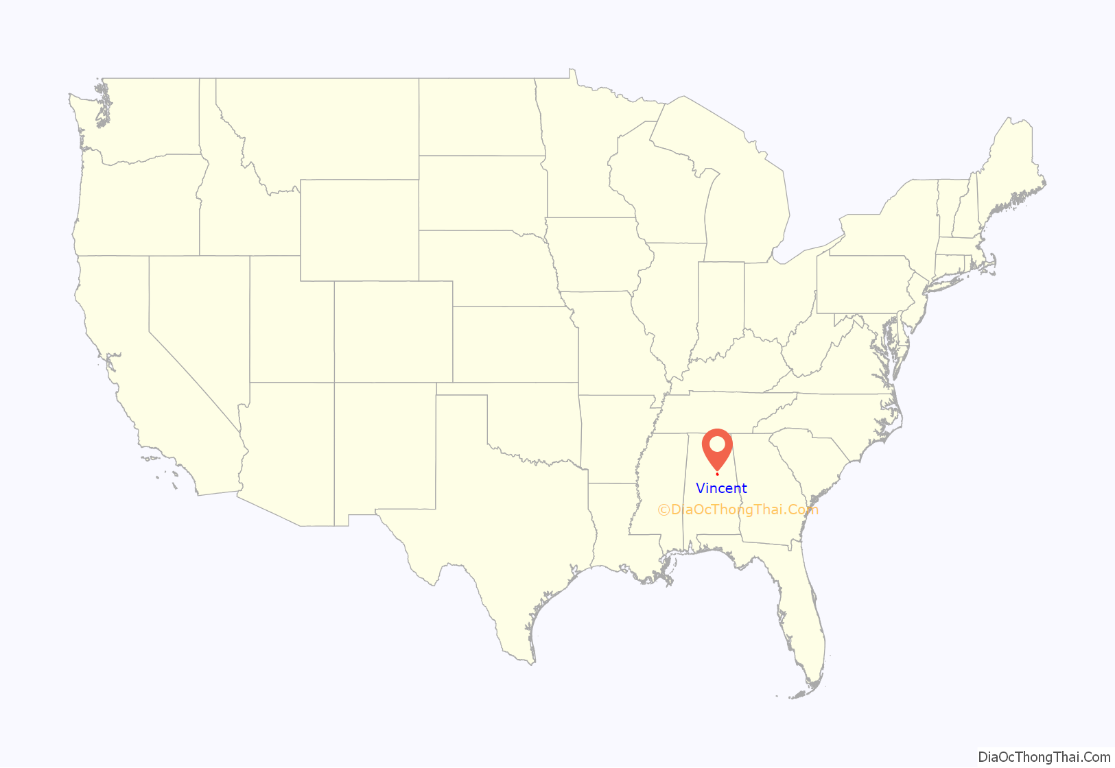
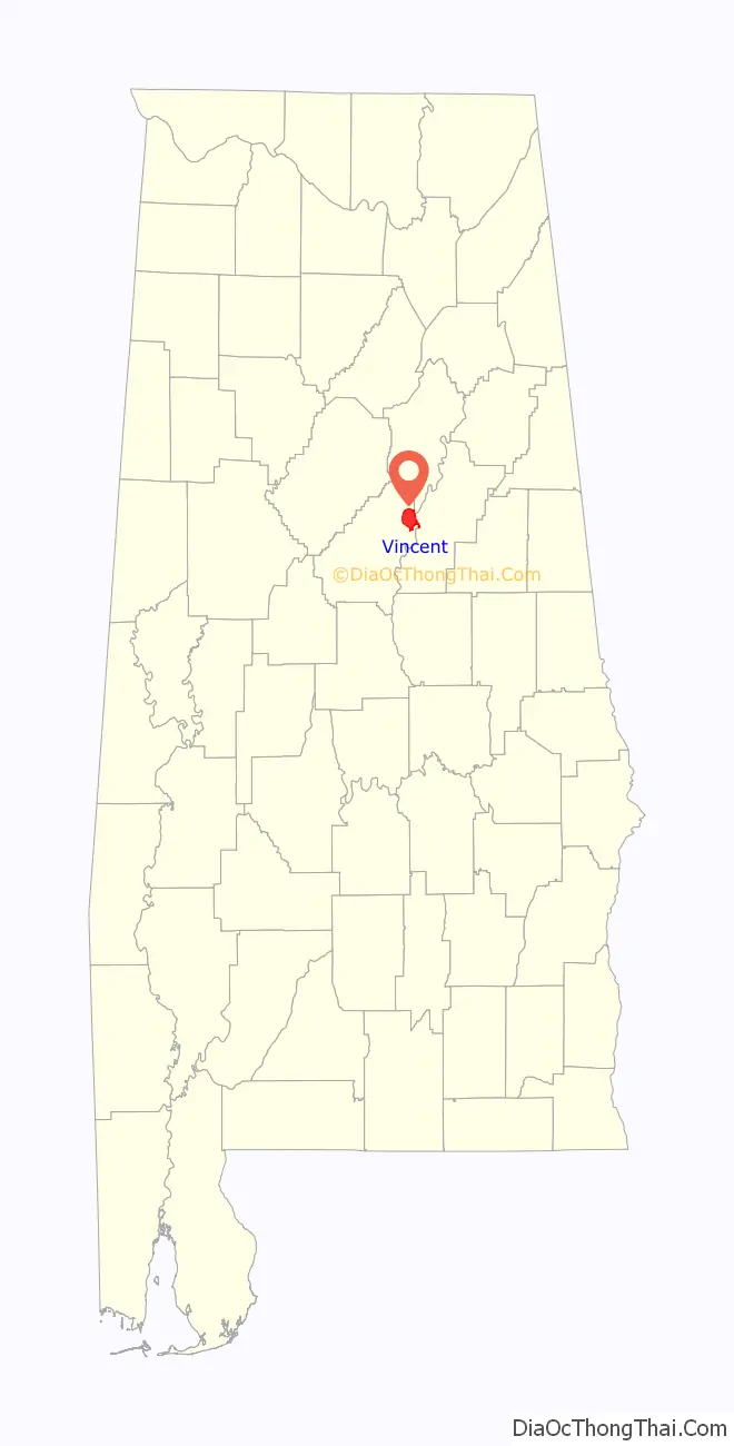
Vincent location map. Where is Vincent town?
Vincent Road Map
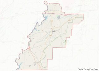
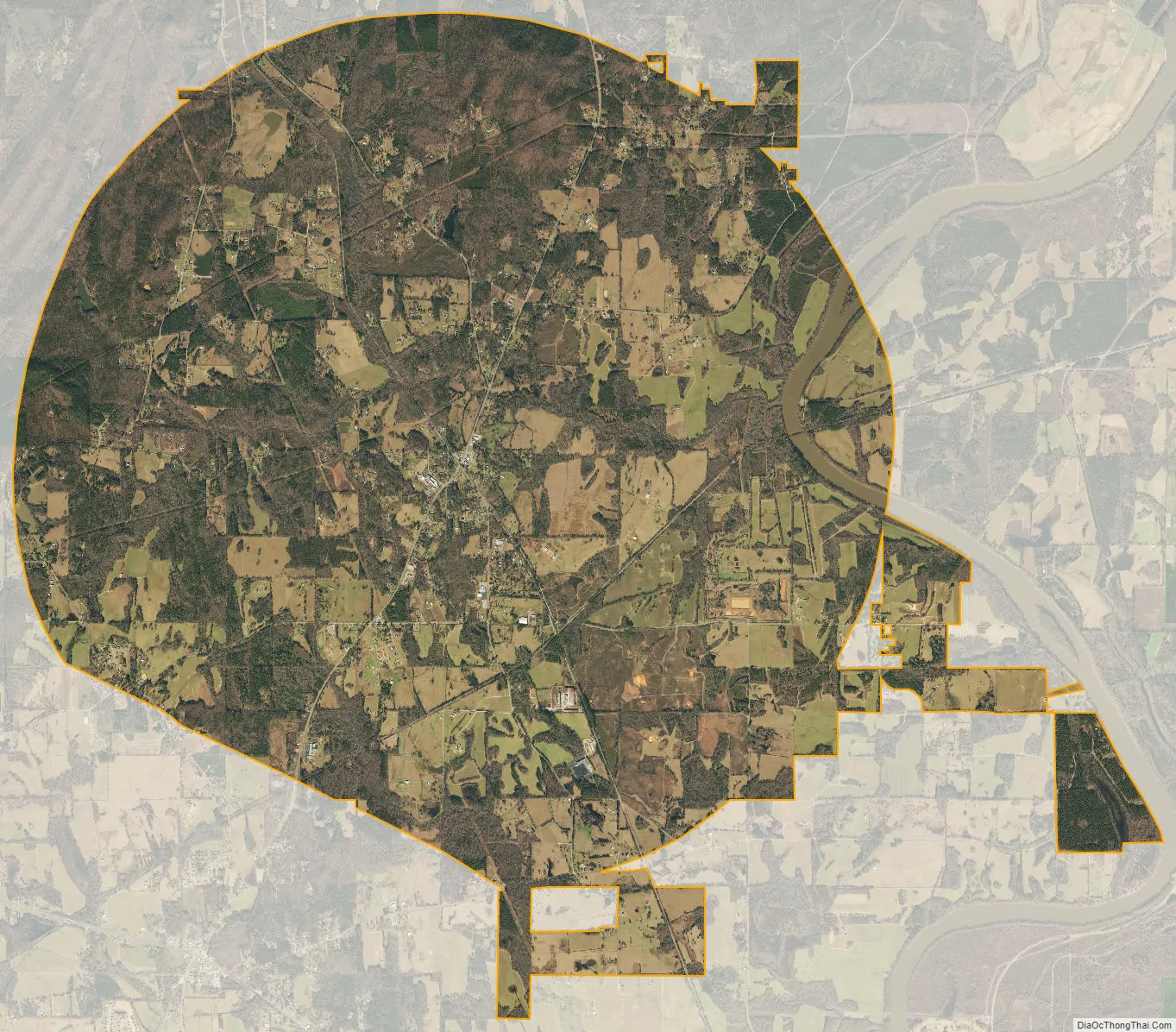
Vincent city Satellite Map
Geography
Vincent is located at 33°23′9″N 86°24′36″W / 33.38583°N 86.41000°W / 33.38583; -86.41000 (33.385719, -86.409919).
The city is located mostly in the northeastern part of Shelby County, with portions of the city limits extending into neighboring St. Clair and Talladega counties. U.S. Route 231 is the main highway through the city, leading northeast 17 mi (27 km) to Pell City and southwest 3 mi (5 km) to Harpersville. Alabama State Route 25 also runs through the city, splitting off from US 231 north of town and leading northwest 7 mi (11 km) to Sterrett.
According to the U.S. Census Bureau, the town has a total area of 20.0 square miles (51.7 km), of which 19.6 square miles (50.7 km) is land and 0.39 square miles (1.0 km), or 1.90%, is water.
See also
Map of Alabama State and its subdivision:- Autauga
- Baldwin
- Barbour
- Bibb
- Blount
- Bullock
- Butler
- Calhoun
- Chambers
- Cherokee
- Chilton
- Choctaw
- Clarke
- Clay
- Cleburne
- Coffee
- Colbert
- Conecuh
- Coosa
- Covington
- Crenshaw
- Cullman
- Dale
- Dallas
- De Kalb
- Elmore
- Escambia
- Etowah
- Fayette
- Franklin
- Geneva
- Greene
- Hale
- Henry
- Houston
- Jackson
- Jefferson
- Lamar
- Lauderdale
- Lawrence
- Lee
- Limestone
- Lowndes
- Macon
- Madison
- Marengo
- Marion
- Marshall
- Mobile
- Monroe
- Montgomery
- Morgan
- Perry
- Pickens
- Pike
- Randolph
- Russell
- Saint Clair
- Shelby
- Sumter
- Talladega
- Tallapoosa
- Tuscaloosa
- Walker
- Washington
- Wilcox
- Winston
- Alabama
- Alaska
- Arizona
- Arkansas
- California
- Colorado
- Connecticut
- Delaware
- District of Columbia
- Florida
- Georgia
- Hawaii
- Idaho
- Illinois
- Indiana
- Iowa
- Kansas
- Kentucky
- Louisiana
- Maine
- Maryland
- Massachusetts
- Michigan
- Minnesota
- Mississippi
- Missouri
- Montana
- Nebraska
- Nevada
- New Hampshire
- New Jersey
- New Mexico
- New York
- North Carolina
- North Dakota
- Ohio
- Oklahoma
- Oregon
- Pennsylvania
- Rhode Island
- South Carolina
- South Dakota
- Tennessee
- Texas
- Utah
- Vermont
- Virginia
- Washington
- West Virginia
- Wisconsin
- Wyoming