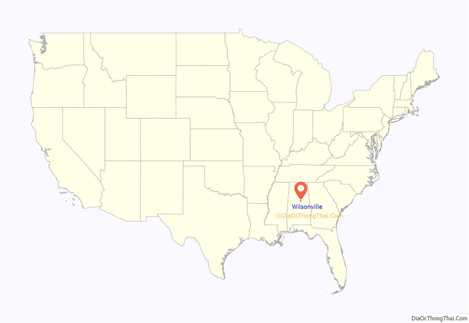
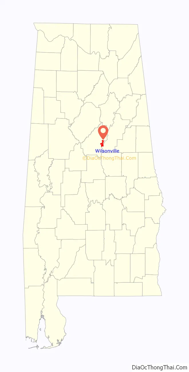
Wilsonville is a town in southeastern Shelby County, Alabama, United States, located northeast of Columbiana. At the 2020 census, the population was 1,857. Wilsonville is named after the earliest settler in the area, Elisha Wilson.
The town was incorporated in 1897. 3 years later in 1900, it had the distinction of being the largest community in Shelby County with 1,095, edging out the county seat of Columbiana by 20 people. It lost the distinction to Columbiana in 1910 and would not exceed its 1900 population again until 1990.
| Name: | Wilsonville town |
|---|---|
| LSAD Code: | 43 |
| LSAD Description: | town (suffix) |
| State: | Alabama |
| County: | Shelby County |
| Elevation: | 423 ft (129 m) |
| Total Area: | 10.86 sq mi (28.12 km²) |
| Land Area: | 10.63 sq mi (27.54 km²) |
| Water Area: | 0.22 sq mi (0.58 km²) |
| Total Population: | 1,857 |
| Population Density: | 174.66/sq mi (67.44/km²) |
| ZIP code: | 35186 |
| Area code: | 205, 659 |
| FIPS code: | 0182848 |
| GNISfeature ID: | 0129101 |
| Website: | www.wilsonvilleal.com |
Online Interactive Map
Click on ![]() to view map in "full screen" mode.
to view map in "full screen" mode.
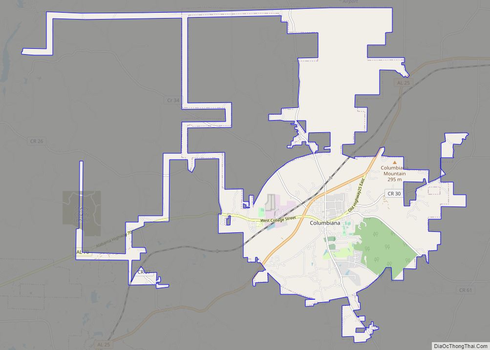
Wilsonville location map. Where is Wilsonville town?
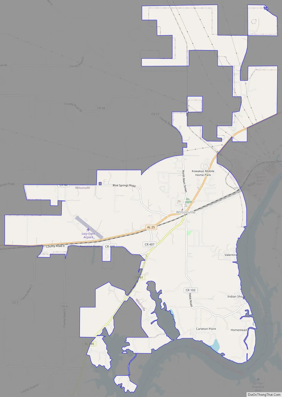
Wilsonville Road Map
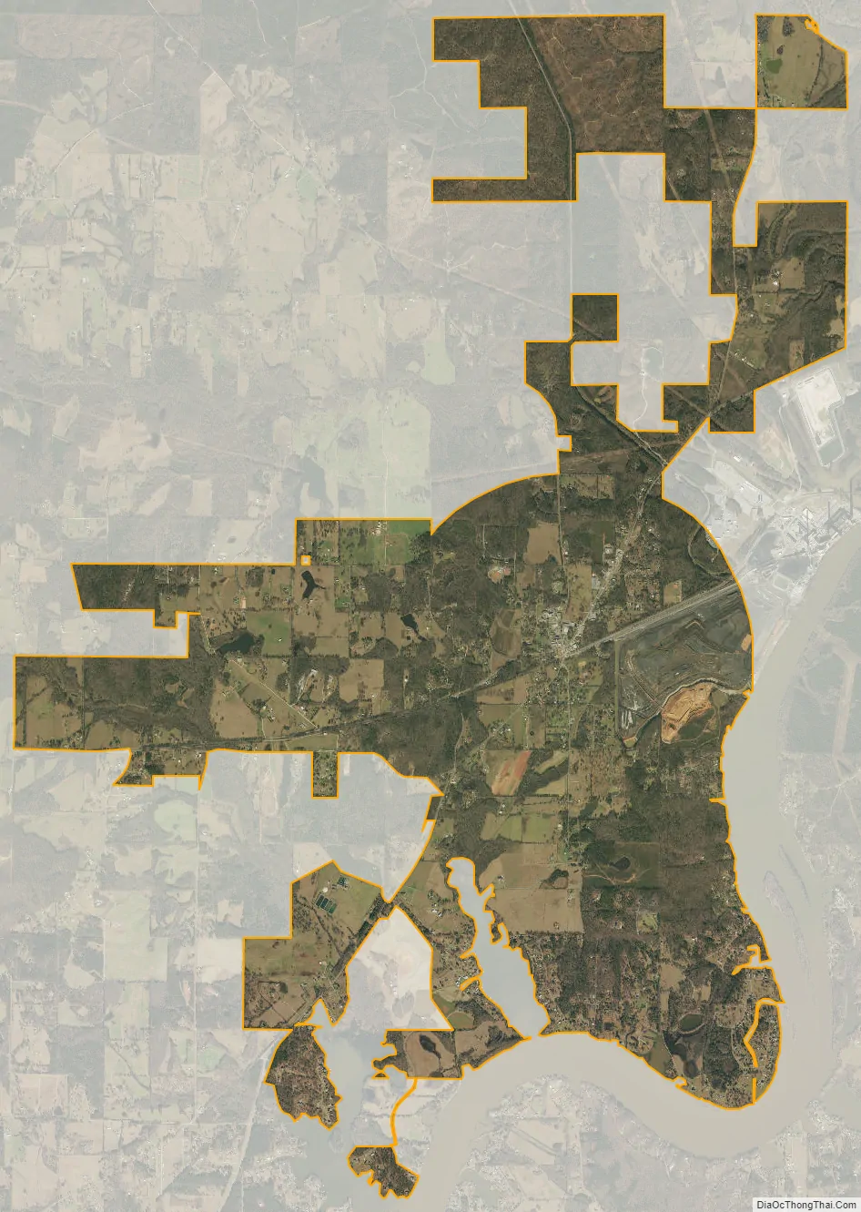
Wilsonville city Satellite Map
Geography
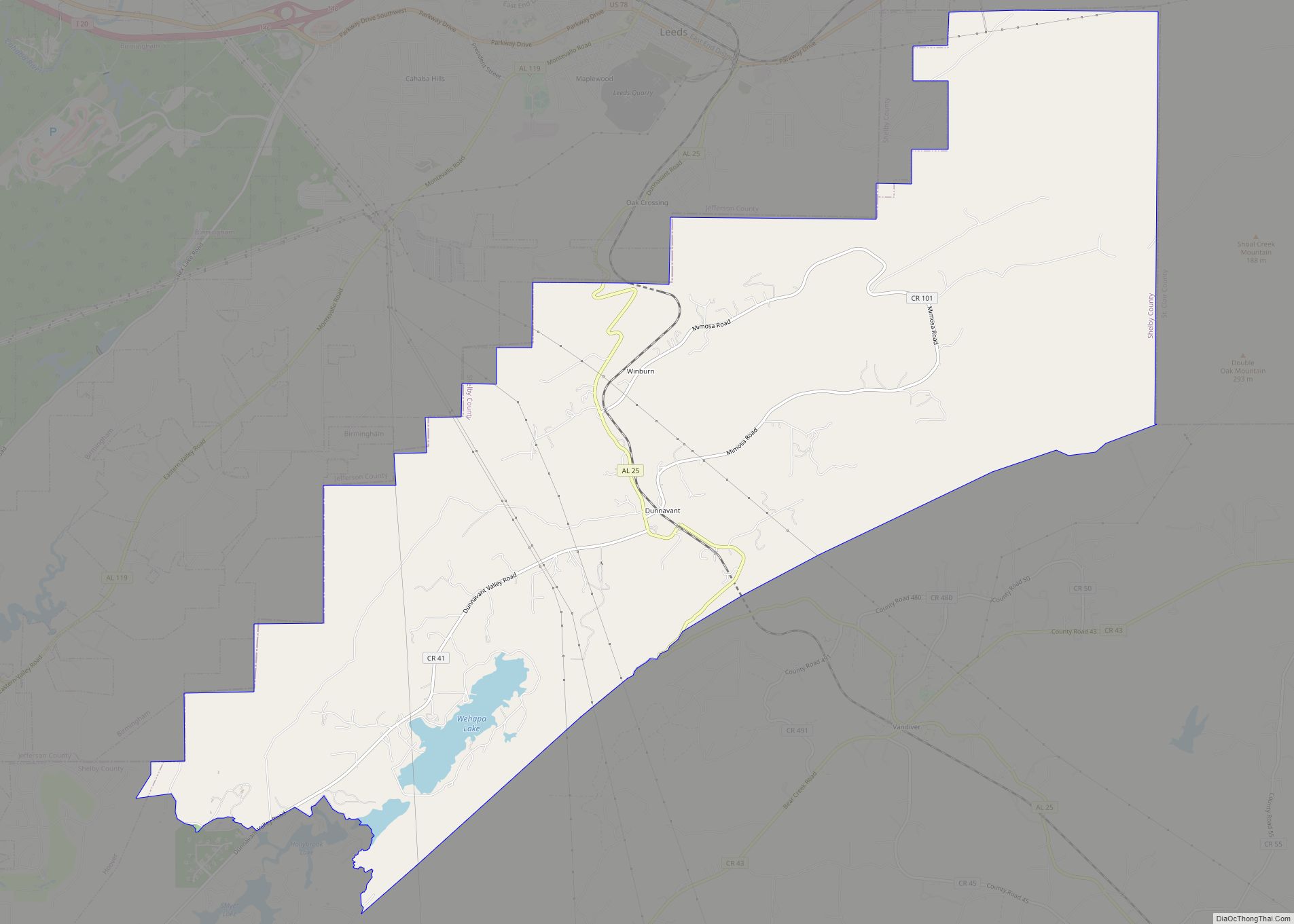
Wilsonville is located at 33°14′6″N 86°29′11″W / 33.23500°N 86.48639°W / 33.23500; -86.48639 (33.234924, -86.486283).
The town is located in the southeastern part of Shelby County, with parts of its city limits extending east to the western shore of the Coosa River. Alabama State Route 25 is the main highway through the town, running northeast to southwest through the downtown area. Via AL 25, Harpersville is 9 mi (14 km) northeast, and Columbiana, the Shelby County seat, is 9 mi (14 km) southwest.
According to the U.S. Census Bureau, the town has a total area of 11.0 square miles (28 km), of which 9.9 square miles (26 km) is land and 1.1 square miles (2.8 km) (10.21%) is water.
See also
Map of Alabama State and its subdivision:- Autauga
- Baldwin
- Barbour
- Bibb
- Blount
- Bullock
- Butler
- Calhoun
- Chambers
- Cherokee
- Chilton
- Choctaw
- Clarke
- Clay
- Cleburne
- Coffee
- Colbert
- Conecuh
- Coosa
- Covington
- Crenshaw
- Cullman
- Dale
- Dallas
- De Kalb
- Elmore
- Escambia
- Etowah
- Fayette
- Franklin
- Geneva
- Greene
- Hale
- Henry
- Houston
- Jackson
- Jefferson
- Lamar
- Lauderdale
- Lawrence
- Lee
- Limestone
- Lowndes
- Macon
- Madison
- Marengo
- Marion
- Marshall
- Mobile
- Monroe
- Montgomery
- Morgan
- Perry
- Pickens
- Pike
- Randolph
- Russell
- Saint Clair
- Shelby
- Sumter
- Talladega
- Tallapoosa
- Tuscaloosa
- Walker
- Washington
- Wilcox
- Winston
- Alabama
- Alaska
- Arizona
- Arkansas
- California
- Colorado
- Connecticut
- Delaware
- District of Columbia
- Florida
- Georgia
- Hawaii
- Idaho
- Illinois
- Indiana
- Iowa
- Kansas
- Kentucky
- Louisiana
- Maine
- Maryland
- Massachusetts
- Michigan
- Minnesota
- Mississippi
- Missouri
- Montana
- Nebraska
- Nevada
- New Hampshire
- New Jersey
- New Mexico
- New York
- North Carolina
- North Dakota
- Ohio
- Oklahoma
- Oregon
- Pennsylvania
- Rhode Island
- South Carolina
- South Dakota
- Tennessee
- Texas
- Utah
- Vermont
- Virginia
- Washington
- West Virginia
- Wisconsin
- Wyoming