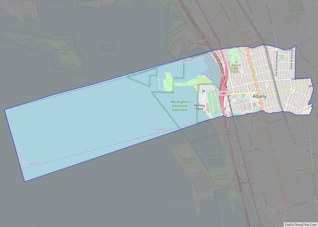
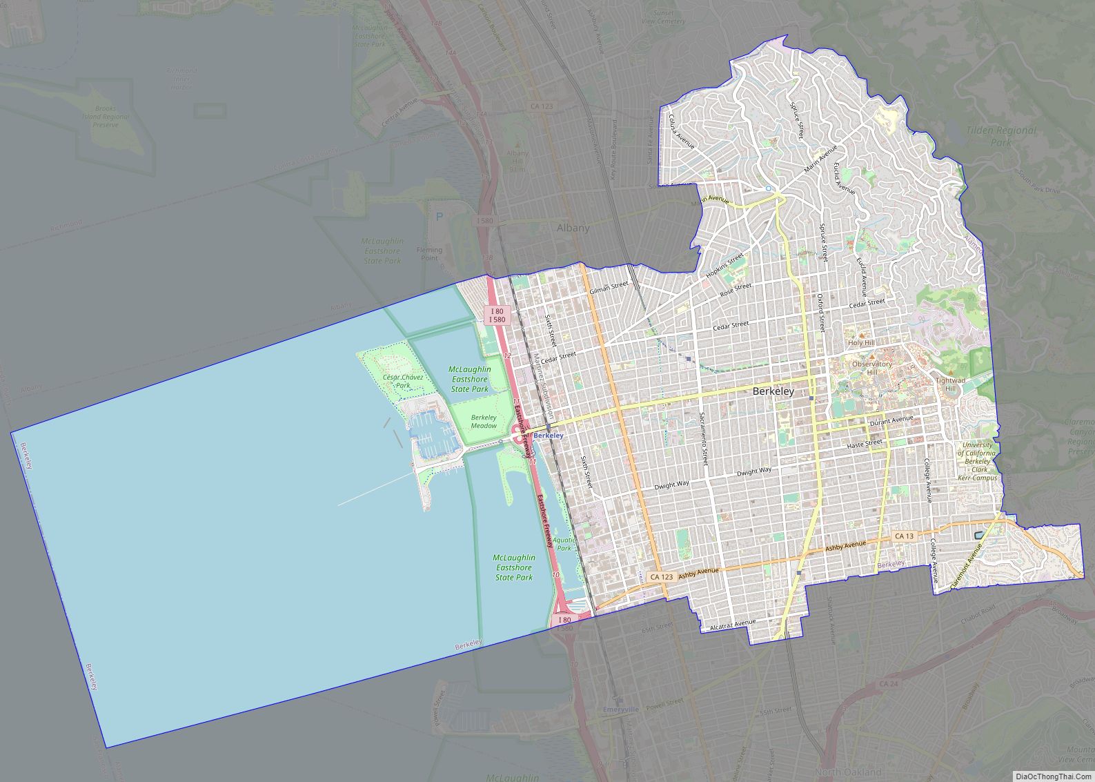
Albany (/ˈɔːlbəni/ (listen) AWL-bə-nee) is a city on the east shore of San Francisco Bay in northwestern Alameda County, California. The population was 20,271 at the 2020 census.
| Name: | Albany city |
|---|---|
| LSAD Code: | 25 |
| LSAD Description: | city (suffix) |
| State: | California |
| County: | Alameda County |
| Incorporated: | September 22, 1908 |
| Elevation: | 43 ft (13 m) |
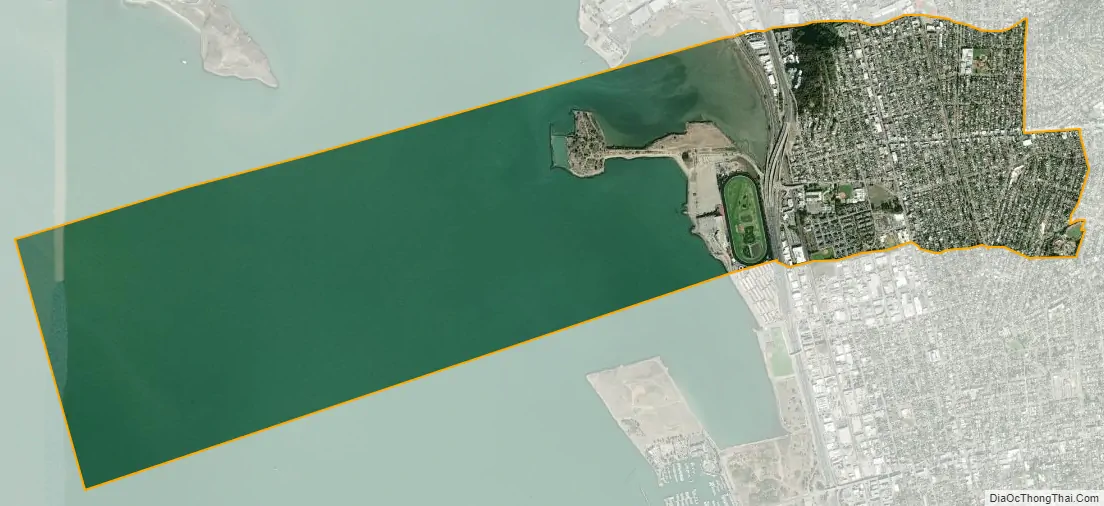
| Total Area: | 5.47 sq mi (14.16 km²) |
| Land Area: | 1.79 sq mi (4.64 km²) |
| Water Area: | 3.68 sq mi (9.52 km²) 67.28% |
| Total Population: | 20,271 |
| Population Density: | 11,324.58/sq mi (4,372.49/km²) |
| FIPS code: | 0600674 |
| Website: | www.albanyca.org |
Online Interactive Map
Click on ![]() to view map in "full screen" mode.
to view map in "full screen" mode.
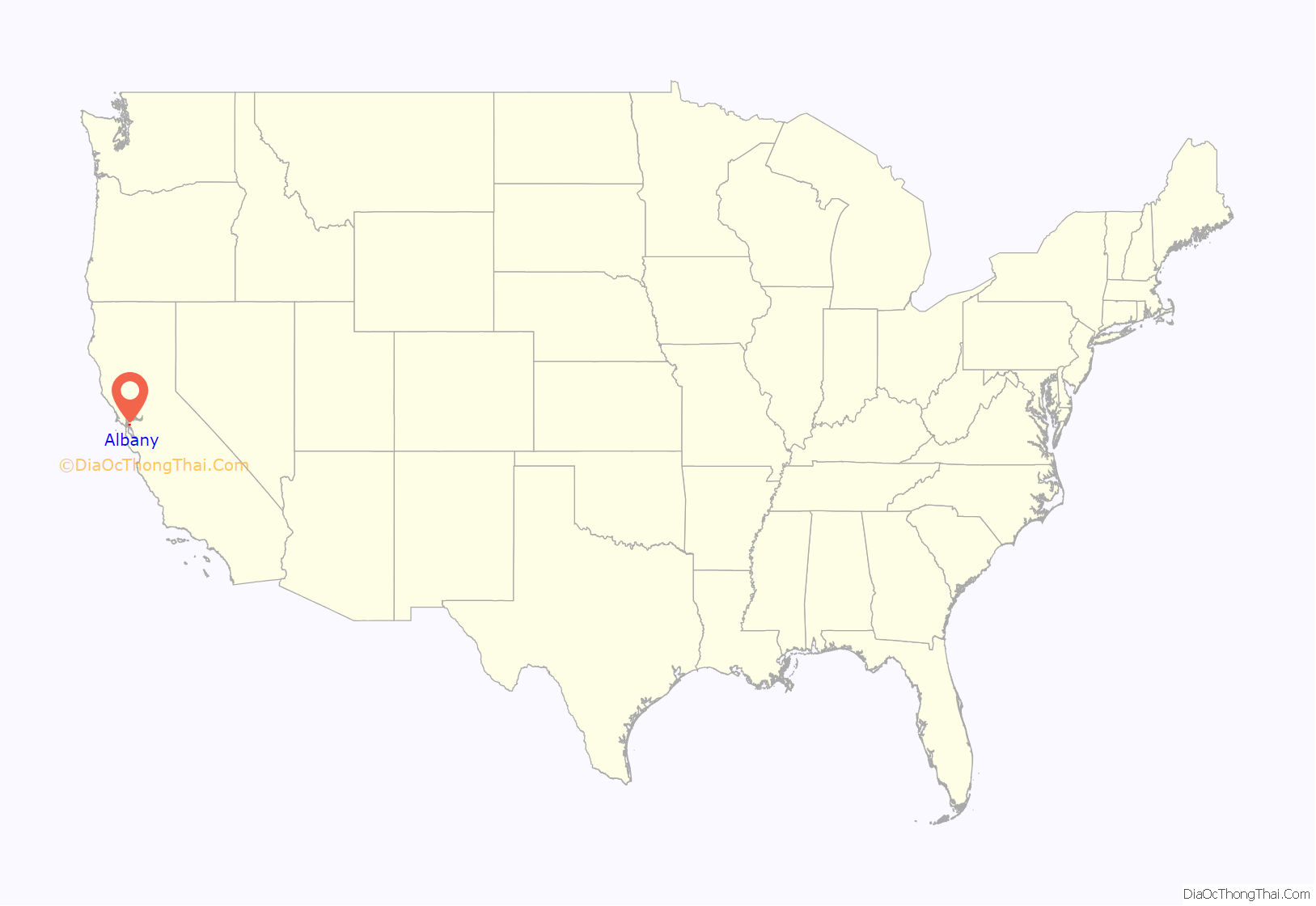
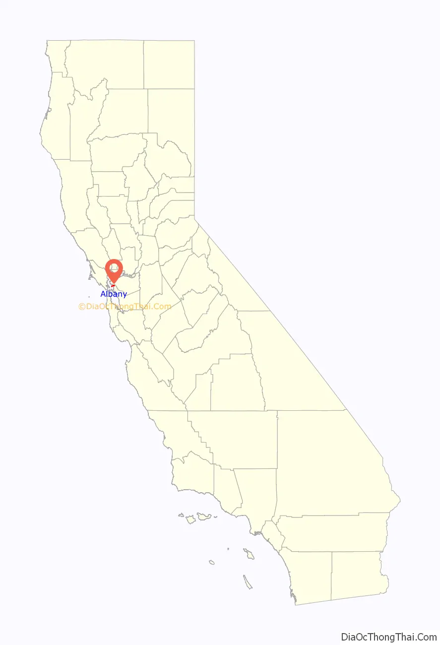
Albany location map. Where is Albany city?
History
In 1908, a group of local women protested the dumping of Berkeley garbage in their community. Armed with two shotguns and a twenty-two-caliber rifle, they confronted the drivers of the wagons near what is now the corner of San Pablo Avenue and Buchanan Street. The women told the drivers of the horse-drawn garbage wagons to go home, which they did quickly and without complaint. Shortly thereafter, the residents of the town voted to incorporate as the City of Ocean View. In 1909, voters changed the name of the city, primarily to distinguish the city from the adjacent section of Berkeley which had previously been named Ocean View. On a vote of 38 to 6 the city was renamed in honor of Albany, New York, the birthplace of the city’s first mayor, Frank Roberts.
Albany has a history of real estate discrimination, which made it difficult for non-white buyers to acquire property and build homes in Albany.
Albany Road Map
Albany city Satellite Map
Geography
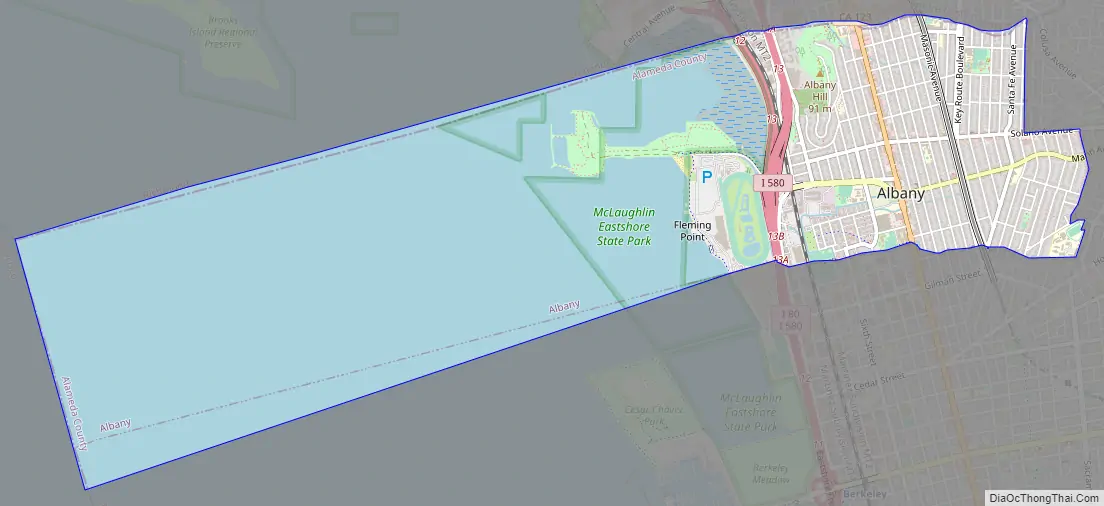
According to the United States Census Bureau, the city has a total area of 5.5 square miles (14 km), of which 1.8 square miles (4.7 km) is land and 3.7 square miles (9.6 km) (67.28%) is water.
The principal shopping street in Albany is Solano Avenue, which cuts across the city from west to east. Another important street is San Pablo Avenue, which travels from north to south.
Albany is located on the eastern shore of San Francisco Bay, bordering the city of Berkeley to the south and east, and the Contra Costa County cities of El Cerrito and Richmond to the north. Albany’s northern and southern borders are defined by two creeks, Codornices Creek on the south and Cerrito Creek on the north. Cerrito Creek takes its name from “El Cerrito de San Antonio”, now known as Albany Hill. The hill’s unusual location near the bay shore makes it a prominent landmark in the East Bay. The rest of the city is relatively flat by Bay Area standards, except for a small area near the base of the Berkeley Hills.
Albany’s waterfront has undergone significant man-made changes; the most prominent landform is now the Albany Bulb, a former garbage landfill jutting out into San Francisco Bay. The bulb was the site of a small art colony and shanty town until it was cleared to turn the area into part of the new Eastshore State Park.
University Village, a housing unit of the University of California Berkeley, is located in Albany.
See also
Map of California State and its subdivision:- Alameda
- Alpine
- Amador
- Butte
- Calaveras
- Colusa
- Contra Costa
- Del Norte
- El Dorado
- Fresno
- Glenn
- Humboldt
- Imperial
- Inyo
- Kern
- Kings
- Lake
- Lassen
- Los Angeles
- Madera
- Marin
- Mariposa
- Mendocino
- Merced
- Modoc
- Mono
- Monterey
- Napa
- Nevada
- Orange
- Placer
- Plumas
- Riverside
- Sacramento
- San Benito
- San Bernardino
- San Diego
- San Francisco
- San Joaquin
- San Luis Obispo
- San Mateo
- Santa Barbara
- Santa Clara
- Santa Cruz
- Shasta
- Sierra
- Siskiyou
- Solano
- Sonoma
- Stanislaus
- Sutter
- Tehama
- Trinity
- Tulare
- Tuolumne
- Ventura
- Yolo
- Yuba
- Alabama
- Alaska
- Arizona
- Arkansas
- California
- Colorado
- Connecticut
- Delaware
- District of Columbia
- Florida
- Georgia
- Hawaii
- Idaho
- Illinois
- Indiana
- Iowa
- Kansas
- Kentucky
- Louisiana
- Maine
- Maryland
- Massachusetts
- Michigan
- Minnesota
- Mississippi
- Missouri
- Montana
- Nebraska
- Nevada
- New Hampshire
- New Jersey
- New Mexico
- New York
- North Carolina
- North Dakota
- Ohio
- Oklahoma
- Oregon
- Pennsylvania
- Rhode Island
- South Carolina
- South Dakota
- Tennessee
- Texas
- Utah
- Vermont
- Virginia
- Washington
- West Virginia
- Wisconsin
- Wyoming