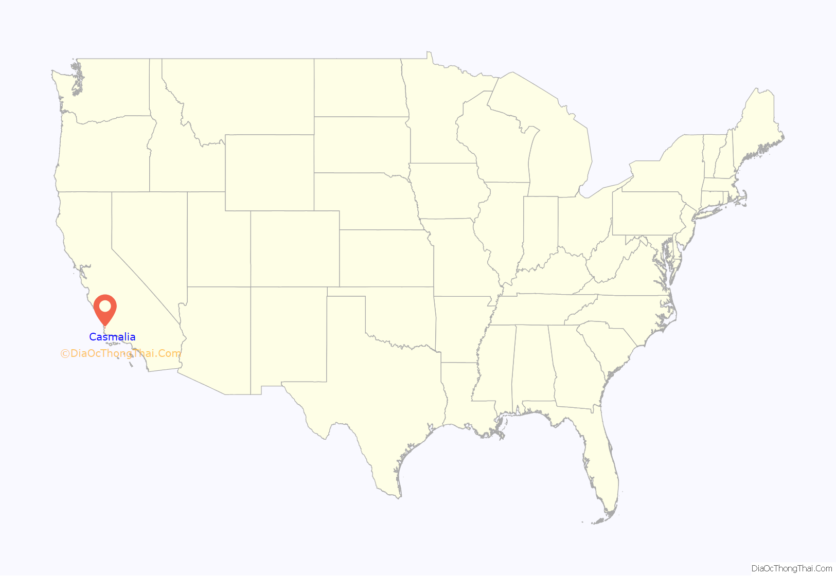
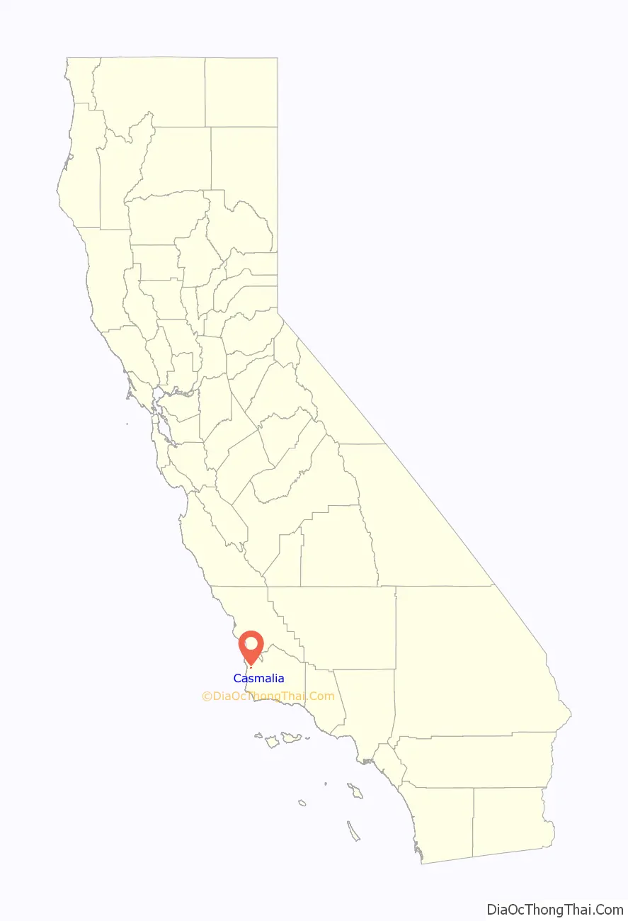
Casmalia (Chumash: Kasma’li, meaning “it is the last”) is a census-designated place (CDP) in Santa Barbara County, California located just outside the borders of Vandenberg Air Force Base about 5 miles (8.0 km) southwest of Santa Maria. The ZIP Code is 93429, and the community is inside area code 805. The population was 138 at the 2010 census.
| Name: | Casmalia CDP |
|---|---|
| LSAD Code: | 57 |
| LSAD Description: | CDP (suffix) |
| State: | California |
| County: | Santa Barbara County |
| Elevation: | 276 ft (84 m) |
| Total Area: | 0.17 sq mi (0.43 km²) |
| Land Area: | 0.17 sq mi (0.43 km²) |
| Water Area: | 0.00 sq mi (0.00 km²) 0% |
| Total Population: | 147 |
| Population Density: | 875.00/sq mi (338.73/km²) |
| ZIP code: | 93429 |
| Area code: | 805 |
| FIPS code: | 0611754 |
| GNISfeature ID: | 2582965 |
Online Interactive Map
Click on ![]() to view map in "full screen" mode.
to view map in "full screen" mode.
Casmalia location map. Where is Casmalia CDP?
History
Casmalia is located on the 1840 Mexican land grant, Rancho Casmalia. The formal town was founded by Antonio Tognazzini in the mid-1890s and was then named Someo, after the village of origin of the Tognazzini family, Someo, Switzerland. When the post office was opened, however, it was named Casmalia, rather than Someo, because of a name conflict with another California town and the name, Someo, was eventually dropped.
The new railroad town soon swelled to more than 1500 people in its early years. 100 years later, that population had shrunk to less than 200 because of the Casmalia Resources Hazardous Waste Landfill facility. During the heyday of the Casmalia Oil Field, the present town served as the red light district for the Union Oil Company workers who lived in the nearby Casmalia Hills.
1.2 miles (1.9 km) north of the town, this 252-acre (1.02 km) hazardous waste landfill began operating in 1973 and accepted toxic chemicals like PCBs, motor oil, and pesticides. In 1989, the facility was closed down following a number of permit violations. In 1992, it was taken over by the federal Environmental Protection Agency, which began the process of cleaning up and administering the site.
The soil and groundwater at the site were significantly contaminated and the former dump became a Superfund site. During its operation, 5.6 billion pounds of hazardous waste from up to 10,000 individuals, businesses and government agencies were buried at the site.
The public area of the hotel built by Antonio Tognazzini and operated by Frank A. Vandoit more than 100 years ago still exists, although the guest rooms were torn down in 1944. The building is now occupied by The Hitching Post barbecue restaurant, famous locally for their Santa Maria-style barbecue.
The superfund site still continues to be worked on over the hill, but the town has been able to return to reasonable normality.
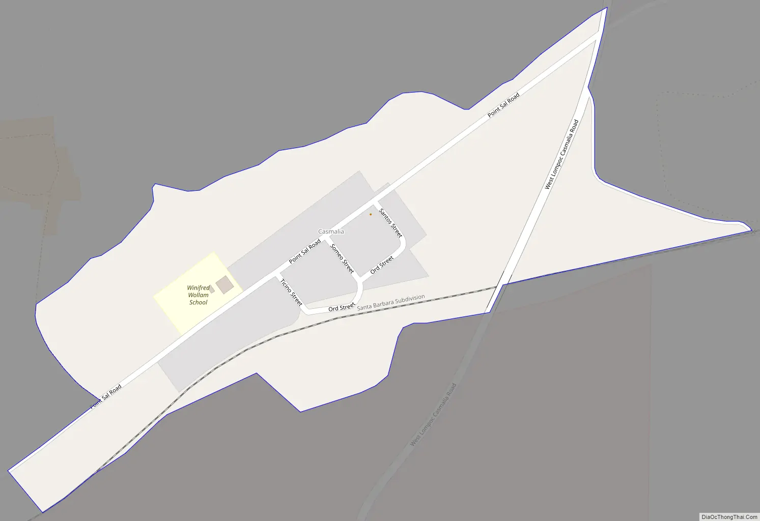
Casmalia Road Map
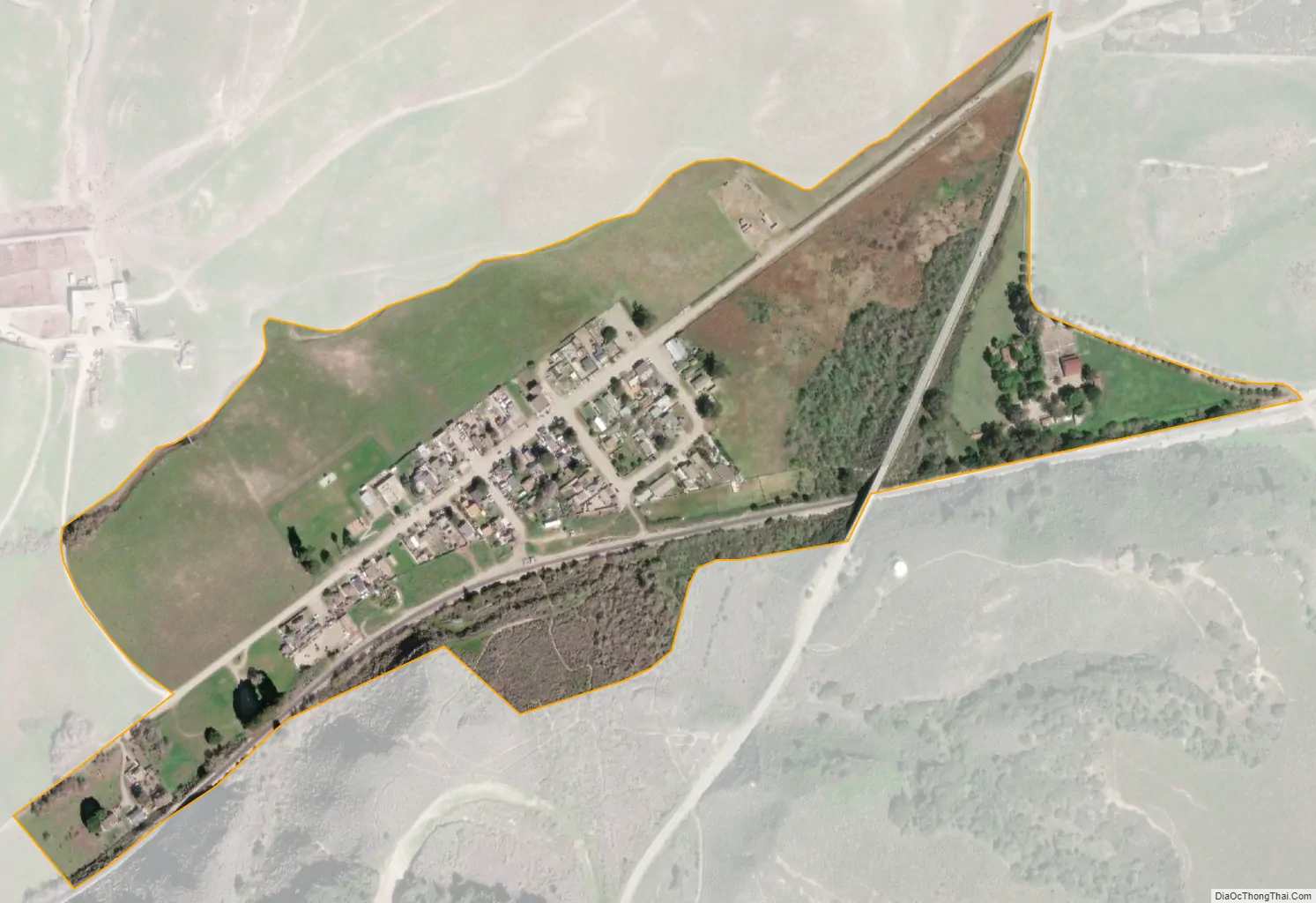
Casmalia city Satellite Map
Geography
According to the United States Census Bureau, the CDP covers an area of 0.2 square miles (0.5 km), all of it land.
Climate
This region experiences warm (but not hot) and dry summers, with no average monthly temperatures above 71.6 °F. According to the Köppen Climate Classification system, Casmalia has a warm-summer Mediterranean climate, abbreviated “Csb” on climate maps.
See also
Map of California State and its subdivision:- Alameda
- Alpine
- Amador
- Butte
- Calaveras
- Colusa
- Contra Costa
- Del Norte
- El Dorado
- Fresno
- Glenn
- Humboldt
- Imperial
- Inyo
- Kern
- Kings
- Lake
- Lassen
- Los Angeles
- Madera
- Marin
- Mariposa
- Mendocino
- Merced
- Modoc
- Mono
- Monterey
- Napa
- Nevada
- Orange
- Placer
- Plumas
- Riverside
- Sacramento
- San Benito
- San Bernardino
- San Diego
- San Francisco
- San Joaquin
- San Luis Obispo
- San Mateo
- Santa Barbara
- Santa Clara
- Santa Cruz
- Shasta
- Sierra
- Siskiyou
- Solano
- Sonoma
- Stanislaus
- Sutter
- Tehama
- Trinity
- Tulare
- Tuolumne
- Ventura
- Yolo
- Yuba
- Alabama
- Alaska
- Arizona
- Arkansas
- California
- Colorado
- Connecticut
- Delaware
- District of Columbia
- Florida
- Georgia
- Hawaii
- Idaho
- Illinois
- Indiana
- Iowa
- Kansas
- Kentucky
- Louisiana
- Maine
- Maryland
- Massachusetts
- Michigan
- Minnesota
- Mississippi
- Missouri
- Montana
- Nebraska
- Nevada
- New Hampshire
- New Jersey
- New Mexico
- New York
- North Carolina
- North Dakota
- Ohio
- Oklahoma
- Oregon
- Pennsylvania
- Rhode Island
- South Carolina
- South Dakota
- Tennessee
- Texas
- Utah
- Vermont
- Virginia
- Washington
- West Virginia
- Wisconsin
- Wyoming


