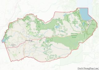
Pollock Pines is a census-designated place (CDP) in El Dorado County, California, United States. It is part of the Sacramento–Arden-Arcade–Roseville Metropolitan Statistical Area. Pollock Pines lies at an elevation of 3,980 feet (1,210 m) in the Sierra Nevada. The population was 7,112 at the 2020 census, up from 6,871 at the 2010 census.
| Name: | Pollock Pines CDP |
|---|---|
| LSAD Code: | 57 |
| LSAD Description: | CDP (suffix) |
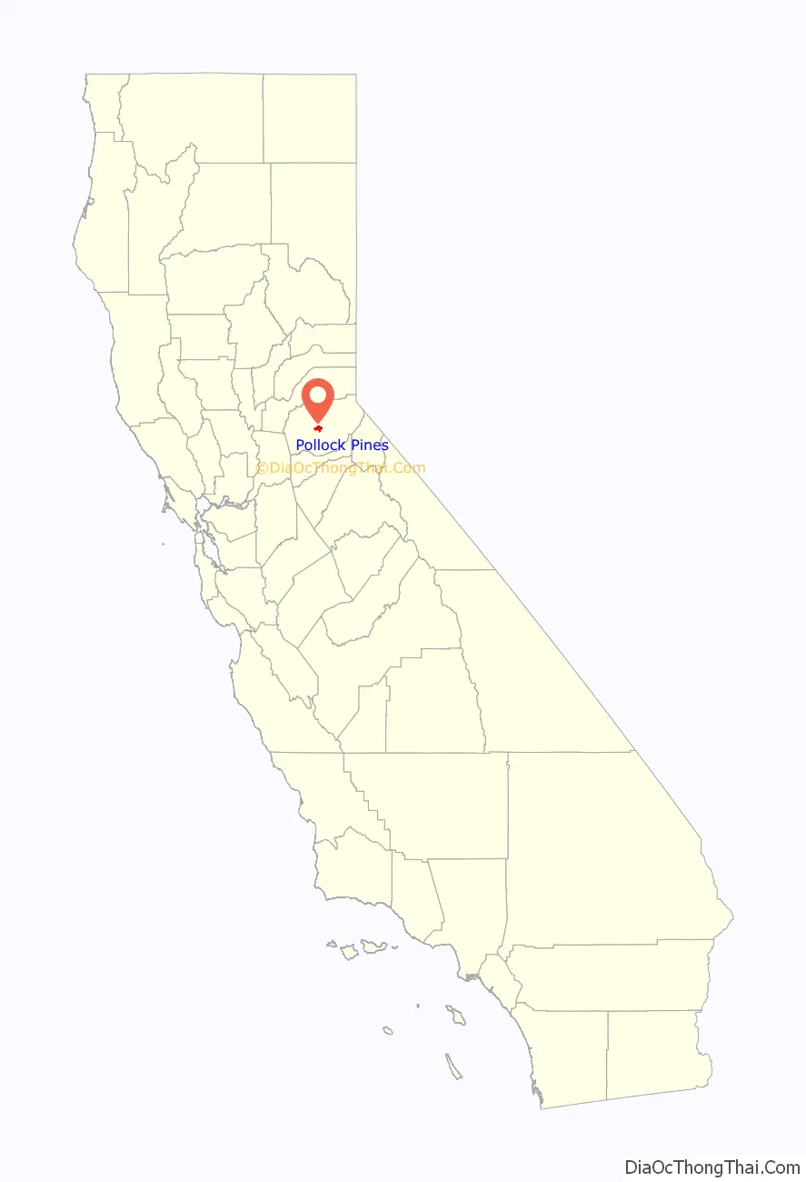
| State: | California |
| County: | El Dorado County |
| Elevation: | 3,980 ft (1,213 m) |
| Total Area: | 7.960 sq mi (20.617 km²) |
| Land Area: | 7.928 sq mi (20.533 km²) |
| Water Area: | 0.032 sq mi (0.084 km²) 0.4% |
| Total Population: | 7,112 |
| Population Density: | 890/sq mi (340/km²) |
| ZIP code: | 95726 |
| Area code: | 530 |
| FIPS code: | 0658030 |
| GNISfeature ID: | 1659419 |
Online Interactive Map
Click on ![]() to view map in "full screen" mode.
to view map in "full screen" mode.
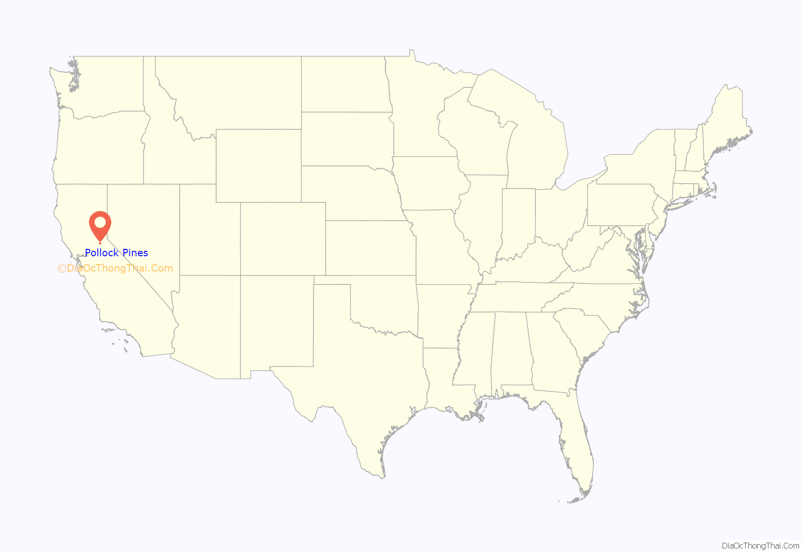
Pollock Pines location map. Where is Pollock Pines CDP?
History
One of the original Pony Express stations (Twelve Mile House) was located in Pollock Pines. The location was covered by the restaurant called Sportsman’s Hall. The “Hall”, which was originally opened in 1852 by John and James Blair, who had immigrated from Scotland, still operates today. It is the site of California Registered Historical Landmark #704, which reads: “This was the site of Sportsman’s Hall, also known as Twelve-Mile House, the hotel operated in the latter 1850s and 1860s by John and James Blair. A stopping place for stages and teams of the Comstock, it became a relay station of the Central Overland Pony Express. Here, at 7:40 A.M., April 4, 1860, pony rider William (Sam) Hamilton riding in from Placerville, handed the express mail to Warren Upson, who, two minutes later, sped on his way eastward.”
Pollock Pines was primarily a lumber community (the town is named for H.R. Pollock, who operated a lumber mill in the area in the early 1900s). The first post office opened in 1936. The name celebrates the Pollock family, who were early settlers.
In 2014 the King Fire burned 97,717 acres (39,545 ha) in the Eldorado National Forest and on private land, destroying 80 structures, including residences and outbuildings near Pollock Pines. The cause of the fire, which was started September 13 and was extinguished October 9, was determined to be arson. The fire threatened thousands of homes as well as reservoirs that provide water and electricity to portions of California. The fire and the post-burn area were extensively studied by NASA’s wildfires program which collected data on pre-burn forest conditions, fuel moisture, fire behavior, burned area and severity, post-fire forest structure, erosion, re-vegetation, and targeted mitigation for the fire science and management communities.
Pollock Pines Road Map
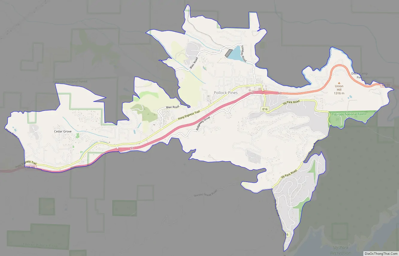
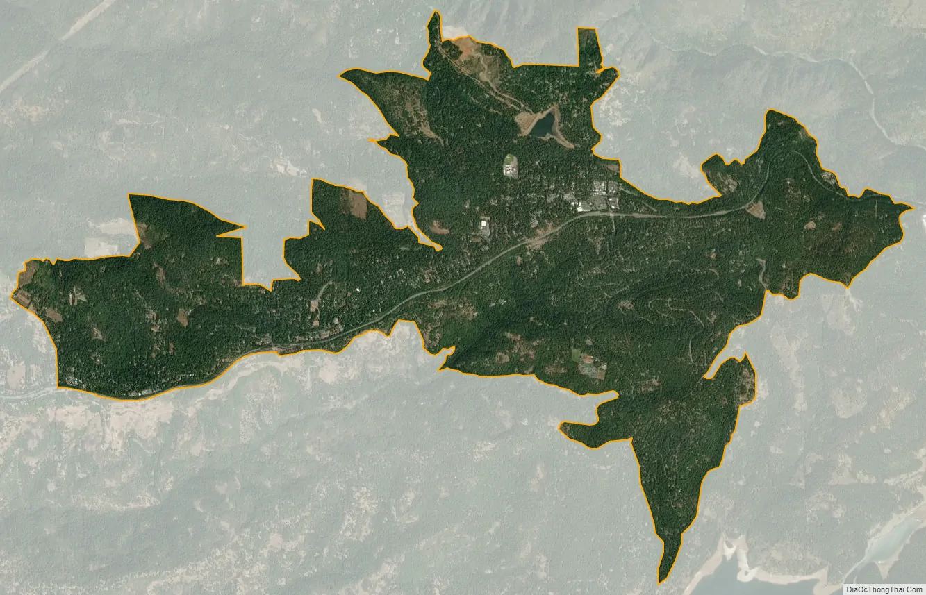
Pollock Pines city Satellite Map
Geography
Pollock Pines receives annual snowfall between 6 inches (150 mm) and 6 feet (1.8 m). The town sits on the west slope of the Sierra Nevada. According to the United States Census Bureau, the CDP has a total area of 8.0 square miles (21 km), over 99% of it land.
For the 2000 census, the CDP had a total area of 5.8 square miles (15 km), all of it land.
The area encompassing Pollock Pines is in a heavily timbered mountain region situated along the ridgetop on the south side of the South Fork of the American River. It is considered a “very high fire hazard severity zone”, although it received grants from the state’s cap and trade carbon trading program to trim vegetation on the ridgeline south of Highway 50.
It is approximately 13 miles (21 km) east of Placerville and 58 miles (93 km) east of Sacramento on U.S. Highway 50.
Climate
According to the Köppen Climate Classification system, Pollock Pines has a warm-summer Mediterranean climate, abbreviated “Csa” on climate maps.
See also
Map of California State and its subdivision:- Alameda
- Alpine
- Amador
- Butte
- Calaveras
- Colusa
- Contra Costa
- Del Norte
- El Dorado
- Fresno
- Glenn
- Humboldt
- Imperial
- Inyo
- Kern
- Kings
- Lake
- Lassen
- Los Angeles
- Madera
- Marin
- Mariposa
- Mendocino
- Merced
- Modoc
- Mono
- Monterey
- Napa
- Nevada
- Orange
- Placer
- Plumas
- Riverside
- Sacramento
- San Benito
- San Bernardino
- San Diego
- San Francisco
- San Joaquin
- San Luis Obispo
- San Mateo
- Santa Barbara
- Santa Clara
- Santa Cruz
- Shasta
- Sierra
- Siskiyou
- Solano
- Sonoma
- Stanislaus
- Sutter
- Tehama
- Trinity
- Tulare
- Tuolumne
- Ventura
- Yolo
- Yuba
- Alabama
- Alaska
- Arizona
- Arkansas
- California
- Colorado
- Connecticut
- Delaware
- District of Columbia
- Florida
- Georgia
- Hawaii
- Idaho
- Illinois
- Indiana
- Iowa
- Kansas
- Kentucky
- Louisiana
- Maine
- Maryland
- Massachusetts
- Michigan
- Minnesota
- Mississippi
- Missouri
- Montana
- Nebraska
- Nevada
- New Hampshire
- New Jersey
- New Mexico
- New York
- North Carolina
- North Dakota
- Ohio
- Oklahoma
- Oregon
- Pennsylvania
- Rhode Island
- South Carolina
- South Dakota
- Tennessee
- Texas
- Utah
- Vermont
- Virginia
- Washington
- West Virginia
- Wisconsin
- Wyoming