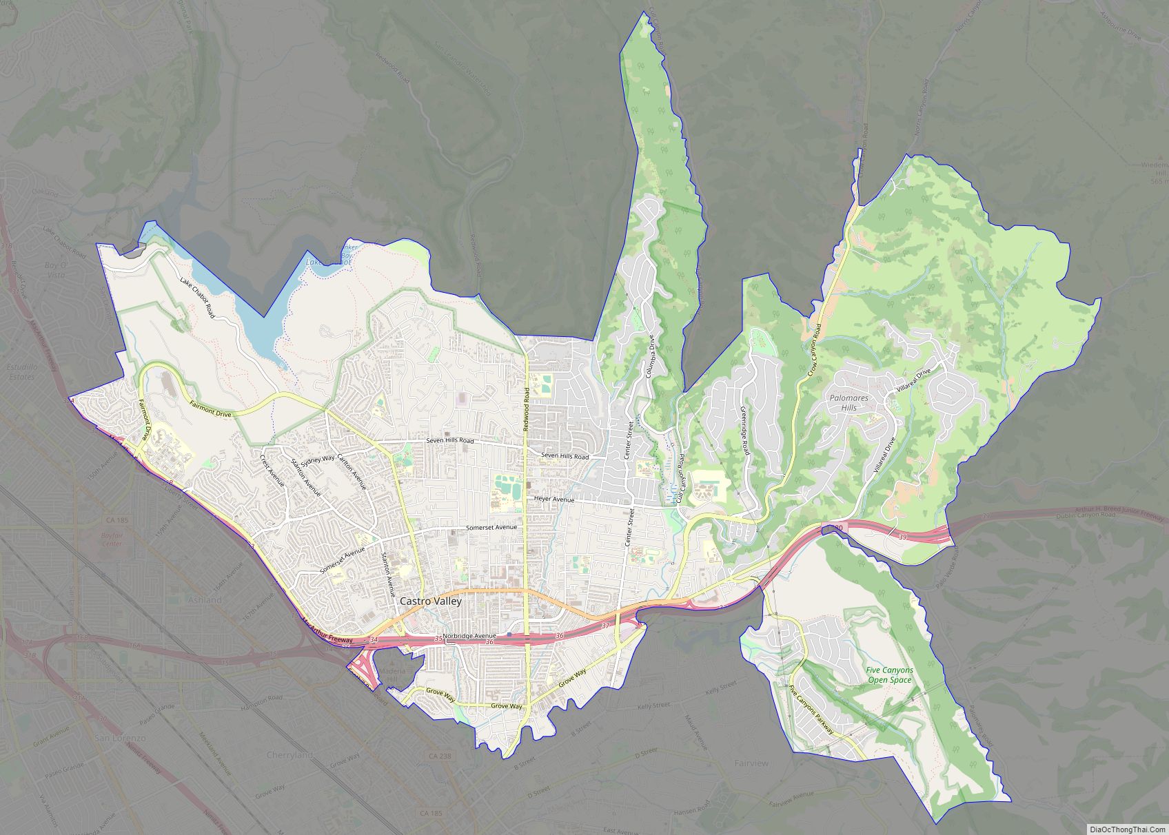
Pleasanton is a city in Alameda County, California, United States. Located in the Amador Valley, it is a suburb in the East Bay region of the San Francisco Bay Area. The population was 79,871 at the 2020 census. In 2005 and 2007, Pleasanton was ranked the wealthiest middle-sized city in the United States by the Census Bureau. Pleasanton is home to the headquarters of Safeway, Workday, Ellie Mae, Roche Molecular Diagnostics, Blackhawk Network Holdings, and Veeva Systems. Other major employers include Kaiser Permanente, Oracle and Macy’s. Although Oakland is the Alameda County seat, a few county offices are located in Pleasanton. The Alameda County Fairgrounds are located in Pleasanton, where the county fair is held during the last week of June and the first week of July. Pleasanton Ridge Regional Park is located on the west side of town.
| Name: | Pleasanton city |
|---|---|
| LSAD Code: | 25 |
| LSAD Description: | city (suffix) |
| State: | California |
| County: | Alameda County |
| Incorporated: | June 18, 1894 |
| Elevation: | 351 ft (107 m) |
| Total Area: | 24.27 sq mi (62.85 km²) |
| Land Area: | 24.12 sq mi (62.47 km²) |
| Water Area: | 0.15 sq mi (0.38 km²) 0.63% |
| Total Population: | 79,871 |
| Population Density: | 3,300/sq mi (1,300/km²) |
| Area code: | 925 |
| FIPS code: | 0657792 |
| Website: | www.cityofpleasantonca.gov |
Online Interactive Map
Click on ![]() to view map in "full screen" mode.
to view map in "full screen" mode.
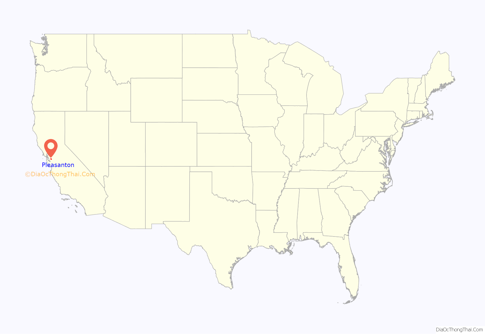
Pleasanton location map. Where is Pleasanton city?

History
Alisal
Before the establishment of Pleasanton in the 1850s, an earlier settlement in the location was called Alisal. It was located on the lands of the Rancho Santa Rita near the site of an Indian ranchera, around the Francisco Solano Alviso Adobe, called El Alisal (The Sycamores), one of the earliest houses built in the valley in 1844. It is still standing and serves as the centerpiece of the Alviso Adobe Community Park. Alisal, nicknamed “The Most Desperate Town in the West”, was one of the settlements located along La Vereda del Monte that was a haunt and refuge of bandits and desperados in the era following the beginning of the California Gold Rush. Main Street shootouts were not uncommon. Banditos such as Claudio Feliz and Joaquin Murrieta would ambush prospectors on their way back from the gold rush fields and then seek refuge in Alisal. In the 1860s Procopio, Narciso Bojorques and others took refuge there.
Pleasanton
Pleasanton is located on the lands of the Rancho Valle de San José and Rancho Santa Rita Mexican land grants. Its name was chosen in the 1860s by John W. Kottinger, an Alameda County justice of the peace, after his friend, Union army cavalry Major General Alfred Pleasonton. A typographical error by a recording clerk in Washington, D.C., apparently led to the current spelling.
In 1917, Pleasanton was the backdrop for the film Rebecca of Sunnybrook Farm, starring Mary Pickford. The town was once home to Phoebe Apperson Hearst, who lived in a 50-room mansion on a 2,000 acres (8.1 km) estate, now the site of Castlewood Country Club.
Radum Plant was a sand and gravel plant opened in 1931 by Henry J. Kaiser Co., at Radum train station, one mile east of Pleasanton.
Pleasanton Road Map

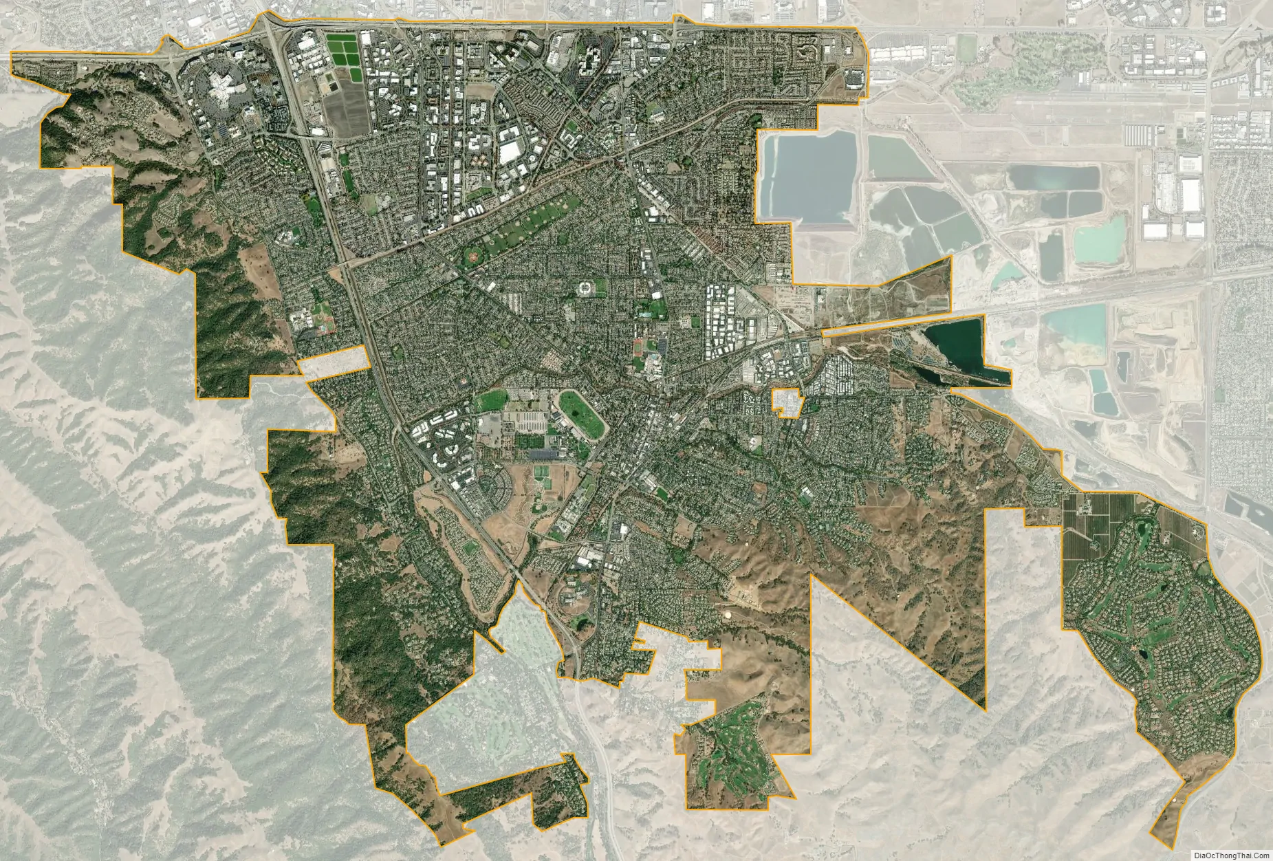
Pleasanton city Satellite Map
Geography
Pleasanton is adjacent to Hayward, Livermore, and Dublin. According to the United States Census Bureau, the city has a total area of 24.3 square miles (63 km), of which 24.1 square miles (62 km) is land and 0.2 square miles (0.52 km) (0.63%) is water. On the east side of town on Stanley Blvd. near the Livermore border is Shadow Cliffs Regional Park, a lake that permits swimming, fishing, and boating. On the west side is the Pleasanton Ridge with two parks, Pleasanton Ridge and Augustin Bernal Park. Much of Pleasanton is drained by the Arroyo Valle and Arroyo Mocho watercourses. Pleasanton lies along the route of the historic First transcontinental railroad.
Climate
Pleasanton features a Mediterranean climate, featuring hot, dry summers and mild to cool winters with occasional rainfall (Köppen climate classification Csa). The highest recorded temperature was 115 °F (46 °C) in 1950. The lowest recorded temperature was 17 °F (−8 °C) in 1990.
See also
Map of California State and its subdivision:- Alameda
- Alpine
- Amador
- Butte
- Calaveras
- Colusa
- Contra Costa
- Del Norte
- El Dorado
- Fresno
- Glenn
- Humboldt
- Imperial
- Inyo
- Kern
- Kings
- Lake
- Lassen
- Los Angeles
- Madera
- Marin
- Mariposa
- Mendocino
- Merced
- Modoc
- Mono
- Monterey
- Napa
- Nevada
- Orange
- Placer
- Plumas
- Riverside
- Sacramento
- San Benito
- San Bernardino
- San Diego
- San Francisco
- San Joaquin
- San Luis Obispo
- San Mateo
- Santa Barbara
- Santa Clara
- Santa Cruz
- Shasta
- Sierra
- Siskiyou
- Solano
- Sonoma
- Stanislaus
- Sutter
- Tehama
- Trinity
- Tulare
- Tuolumne
- Ventura
- Yolo
- Yuba
- Alabama
- Alaska
- Arizona
- Arkansas
- California
- Colorado
- Connecticut
- Delaware
- District of Columbia
- Florida
- Georgia
- Hawaii
- Idaho
- Illinois
- Indiana
- Iowa
- Kansas
- Kentucky
- Louisiana
- Maine
- Maryland
- Massachusetts
- Michigan
- Minnesota
- Mississippi
- Missouri
- Montana
- Nebraska
- Nevada
- New Hampshire
- New Jersey
- New Mexico
- New York
- North Carolina
- North Dakota
- Ohio
- Oklahoma
- Oregon
- Pennsylvania
- Rhode Island
- South Carolina
- South Dakota
- Tennessee
- Texas
- Utah
- Vermont
- Virginia
- Washington
- West Virginia
- Wisconsin
- Wyoming