Lake Forest is a city in Orange County, California. The population was 85,858 at the 2020 census.
Lake Forest incorporated as a city on December 20, 1991. Prior to incorporation, the community had been known as El Toro. Following a vote in 2000, Lake Forest expanded its city limits to include the master-planned developments of Foothill Ranch and Portola Hills. This expansion brought new homes and commercial centers to the northeastern boundary of the city.
Lake Forest has two lakes from which the city gets its name. The lakes are man-made, and condominiums and custom homes ranging from large to small line their shores. Neighborhood associations manage the lakes (Lake 1, known as the Lake Forest Beach and Tennis Club, and Lake 2, the Sun and Sail Club.) Each facility features tennis courts, gyms, basketball courts, barbecue pits, volleyball courts, multiple swimming pools, saunas, hot tubs and club houses for social events.
The “forest” for which the city is also named lies in the area between Ridge Route, Jeronimo, Lake Forest and Serrano roads, and consists mostly of Eucalyptus trees. It is also man-made, and was created in the first decade of the 1900s when a local landowner, Dwight Whiting, planted 400 acres (1.6 km) of Eucalyptus groves in the vicinity of Serrano Creek as part of a lumber operation intended to draw development to the area. In the late 1960s, the Occidental Petroleum company developed a residential community in and around the Eucalyptus groves, which had long since expanded and grown much more dense.
| Name: | Lake Forest city |
|---|---|
| LSAD Code: | 25 |
| LSAD Description: | city (suffix) |
| State: | California |
| County: | Orange County |
| Incorporated: | December 20, 1991 |
| Elevation: | 489 ft (148 m) |
| Total Area: | 16.79 sq mi (43.49 km²) |
| Land Area: | 16.71 sq mi (43.29 km²) |
| Water Area: | 0.08 sq mi (0.20 km²) 0.48% |
| Total Population: | 85,858 |
| Population Density: | 5,100/sq mi (2,000/km²) |
| ZIP code: | 92609, 92610, 92630, 92679 |
| Area code: | 949 |
| FIPS code: | 0639496 |
| Website: | www.lakeforestca.gov |
Online Interactive Map
Click on ![]() to view map in "full screen" mode.
to view map in "full screen" mode.
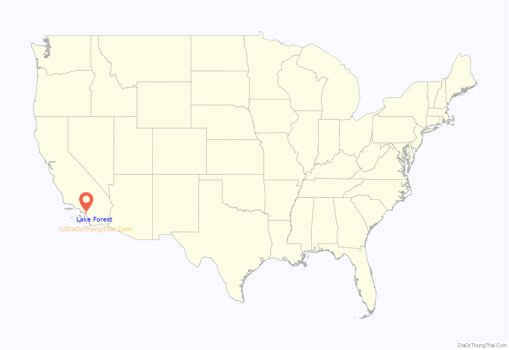
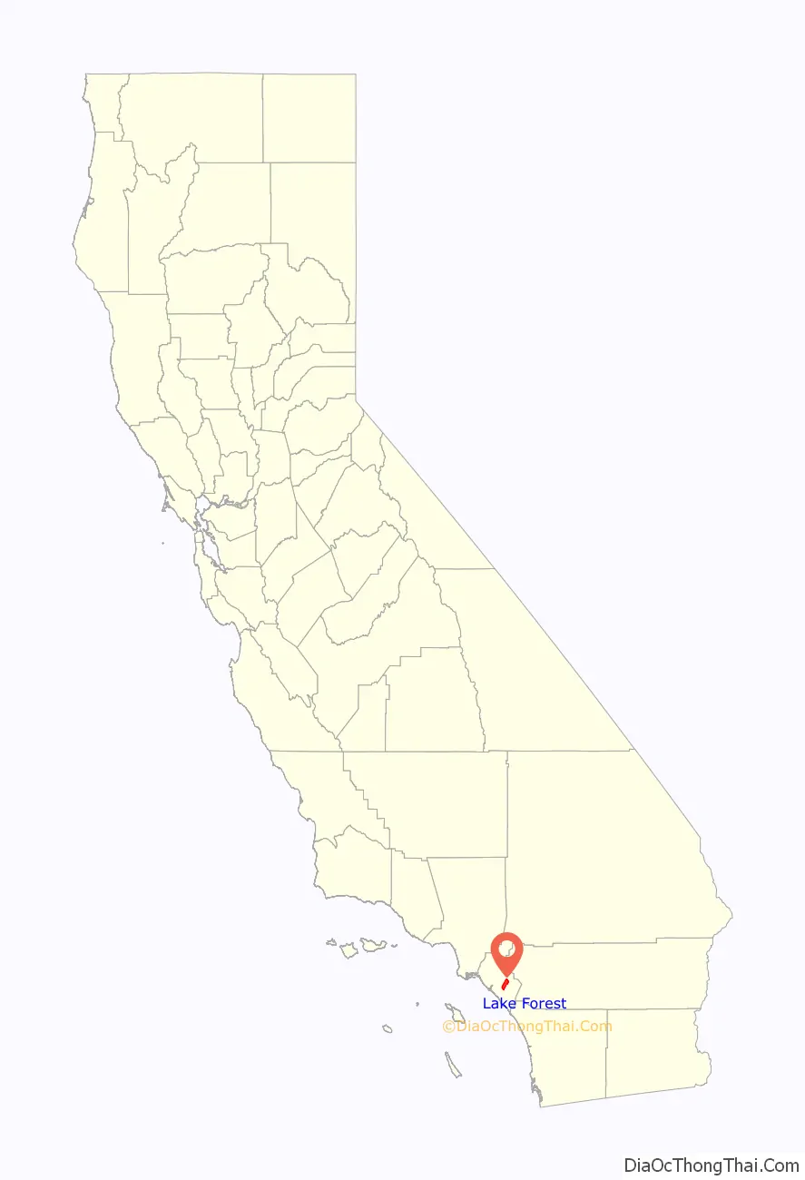
Lake Forest location map. Where is Lake Forest city?
History
From 1863, the community had been known as El Toro. In 1874 José Serrano and his family occupied eleven thousand acres of the Rancho Cañada de los Alisos that had been granted to them by the Government of Mexico, and that eventually reached the hands of Dwight Whiting. Whiting was instrumental in bringing the Santa Fe rail line through the region. The Rancho Niguel was granted to Juan B. Alvarado, Juan Avila and his sister Conception, the widow of one Pedro Sánchez. From them it passed to other owners and was divided into plots, including Yorba. In 1874, most of it was owned by Cyrus B. Rawson. Jonathan E. Bacon also owned 1600 acres. In addition to the Serranos, established in Aliso Canyon, there was a group of pioneers who lived in the foothills and several miles above El Toro, many of whom were among the first settlers of this neighborhood.
El Toro Road at the I-5 Freeway was the epicenter of the Saddleback Valley from the late 19th century to the end of the 2nd millennium. However, the area gradually deteriorated, and most of the shops closed or moved to other cities. After years of planning, the city has worked with the property owners of some aging strip malls and developed the “Arbor at Lake Forest” commercial district. The new center now competes with large shopping centers in cities that surround Lake Forest.
In 1991, residents chose to incorporate, and chose the name “Lake Forest” in a referendum. Controversy ensued for months, as residents of the newer subdivisions arguing that “Lake Forest” sounded better than “El Toro”, while long-time residents complained that the name change aimed to erase the town’s history in favor of an artificial name that referred to man-made lakes. El Toro High School kept its name and continues to do so to this day. In subsequent years as the city came to be referred to as Lake Forest, mentions of “El Toro” in the press usually referred to the Marine Corps Air Station El Toro, decommissioned in 1999 and later repurposed.
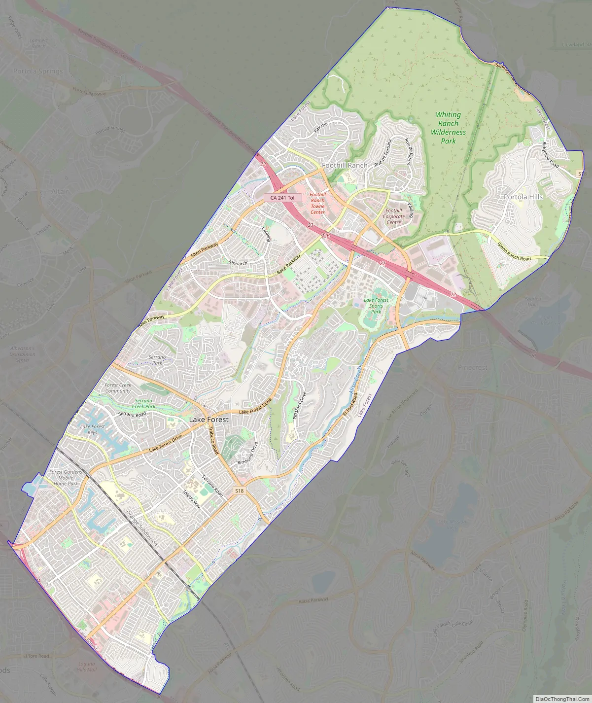
Lake Forest Road Map
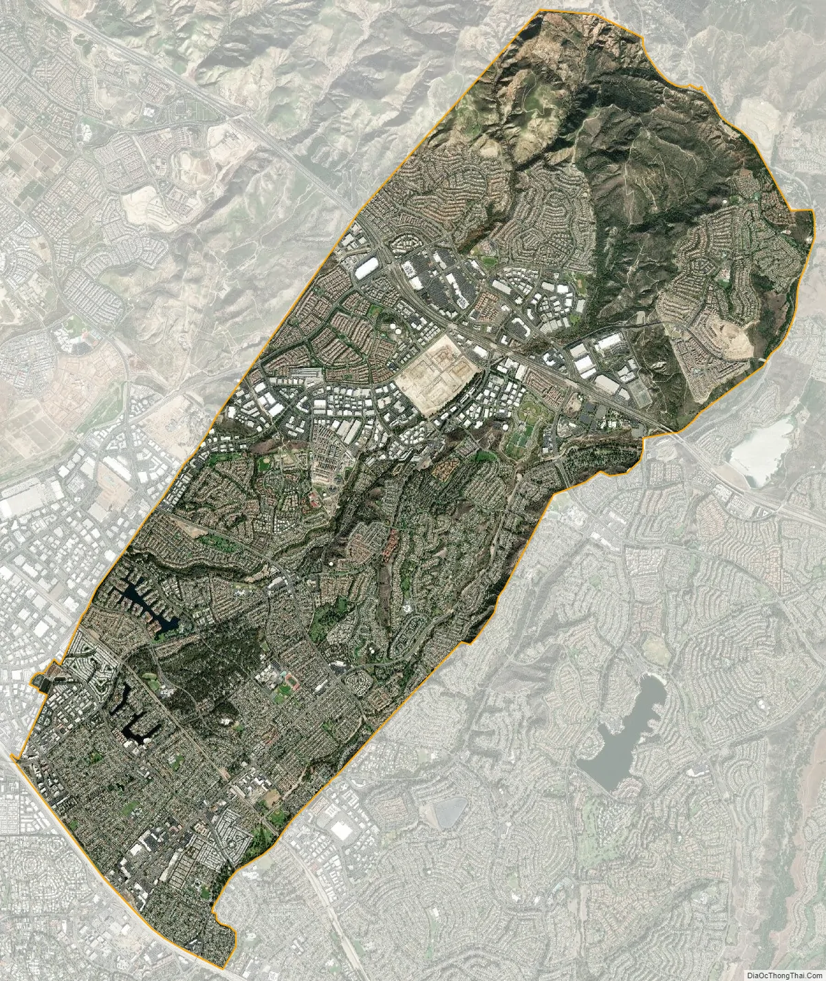
Lake Forest city Satellite Map
Geography
According to the United States Census Bureau, the city has a total area of 17.9 square miles (46 km). 17.8 square miles (46 km) of it is land and 0.1 square miles (0.26 km) of it (0.48%) is water.
Lake Forest is bordered by Irvine on the west and northwest, Laguna Hills and Laguna Woods on the southwest, Mission Viejo on the southeast, Trabuco Canyon and Silverado Canyon on the east, and Limestone Canyon Regional Park on the north.
Lake Forest is located in the heart of the Saddleback Valley, the north-east end located in the Foothills of the Santa Ana Mountains. It is also in the northern section of South Orange County.
It has two man-made lakes identified by the clubhouses on the lakes — the Beach and Tennis Club (Hidden Lakes, formerly Lake I) and the Sun and Sail Club (Lake II).
See also
Map of California State and its subdivision:- Alameda
- Alpine
- Amador
- Butte
- Calaveras
- Colusa
- Contra Costa
- Del Norte
- El Dorado
- Fresno
- Glenn
- Humboldt
- Imperial
- Inyo
- Kern
- Kings
- Lake
- Lassen
- Los Angeles
- Madera
- Marin
- Mariposa
- Mendocino
- Merced
- Modoc
- Mono
- Monterey
- Napa
- Nevada
- Orange
- Placer
- Plumas
- Riverside
- Sacramento
- San Benito
- San Bernardino
- San Diego
- San Francisco
- San Joaquin
- San Luis Obispo
- San Mateo
- Santa Barbara
- Santa Clara
- Santa Cruz
- Shasta
- Sierra
- Siskiyou
- Solano
- Sonoma
- Stanislaus
- Sutter
- Tehama
- Trinity
- Tulare
- Tuolumne
- Ventura
- Yolo
- Yuba
- Alabama
- Alaska
- Arizona
- Arkansas
- California
- Colorado
- Connecticut
- Delaware
- District of Columbia
- Florida
- Georgia
- Hawaii
- Idaho
- Illinois
- Indiana
- Iowa
- Kansas
- Kentucky
- Louisiana
- Maine
- Maryland
- Massachusetts
- Michigan
- Minnesota
- Mississippi
- Missouri
- Montana
- Nebraska
- Nevada
- New Hampshire
- New Jersey
- New Mexico
- New York
- North Carolina
- North Dakota
- Ohio
- Oklahoma
- Oregon
- Pennsylvania
- Rhode Island
- South Carolina
- South Dakota
- Tennessee
- Texas
- Utah
- Vermont
- Virginia
- Washington
- West Virginia
- Wisconsin
- Wyoming


