Westlake Village is a city in Los Angeles County on its western border with Ventura County. It incorporated in 1981 becoming the 82nd municipality of Los Angeles County. The population of the city was 8,029 at the 2020 census, down from 8,270 at the 2010 census.
The city is named after the master-planned community of Westlake that was later called Westlake Village to avoid confusion with the Los Angeles neighborhood of the same name. With a lake at the center, the community straddles the line between Los Angeles and Ventura counties. Roughly two-thirds of the community was previously annexed into the city of Thousand Oaks.
| Name: | Westlake Village city |
|---|---|
| LSAD Code: | 25 |
| LSAD Description: | city (suffix) |
| State: | California |
| County: | Los Angeles County |
| Elevation: | 880 ft (268 m) |
| Total Area: | 5.51 sq mi (14.26 km²) |
| Land Area: | 5.19 sq mi (13.43 km²) |
| Water Area: | 0.32 sq mi (0.83 km²) 5.80% |
| Total Population: | 8,029 |
| Population Density: | 1,500/sq mi (560/km²) |
| ZIP code: | 91359, 91361, 91362 |
| Area code: | 747/818 |
| FIPS code: | 0684438 |
| Website: | www.wlv.org |
Online Interactive Map
Click on ![]() to view map in "full screen" mode.
to view map in "full screen" mode.
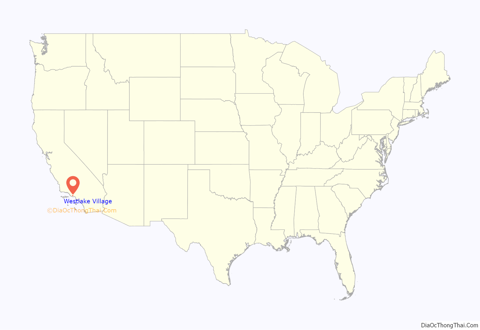
Westlake Village location map. Where is Westlake Village city?

History
About 3,000 years ago, Chumash Indians moved into the region and lived by hunting rabbits and other game, and gathering grains and acorns. On-going excavations, archaeological sites, and polychrome rock paintings in the area provide a glimpse into the social and economic complexity of the ancient Chumash world.
It is unknown when the first people settled in the area. A Chumash village was settled here in 500 BCE, known as Hipuc. The Chumash Indians gathered and prepared acorns and other seeds. These were collected in the fall. The Chumash also hunted wild animals, fish and gathered plants. Their diet consisted of acorns, gophers, cottontail rabbits, skunks, jack rabbits, rats, mice, and seeds. They made their clothing from the skins of animals such as rabbits, deer, and sea otters. Women wore long skirts woven from grass or soft bark, while men wore pieces of deerskin tied around their waists. Both men and women painted designs on their bodies and wore shell beads.
On a return trip from Northern California in January 1770, a group of men led by Gaspar de Portolá are believed to be the first Europeans to encounter the Chumash Indians in the Conejo Valley. Father Juan Crespí, chaplain and diarist of the expedition, wrote about El Triumfo, a Chumash village. He wrote that there was plenty of water and firewood in the village, and that the land was covered with pastures. He wrote: “We are on a plain of considerable extent and much beauty, forested on all parts by live oaks and oak trees, with much pasturage and water.” Crespí named the place El triunfo del Dulcísimo Nombre de Jesús (in English: The Triumph of the Sweetest Name of Jesus) to a camping place by a creek.
Other villages were found throughout the valley, including Satwiwa and two villages near Ventu Park Road in Newbury Park. These Chumash villages are believed by archeologists to have first been settled over 2,000 years ago. Another village was located by Lake Sherwood.
In 1795, the area became part of one of the first Spanish land grants, Rancho Simi, given to the Pico family of California. When Mexico won independence from Spain in 1821, Alta California became Mexican territory, and the Rancho Simi grant was confirmed in 1842.
At the time California was admitted to the union in 1850, most of the land that later became Ventura County was divided among only 19 families. Rising knolls, arroyos, barrancas and ancient oaks were found on two Mexican land grants: Rancho El Conejo and Rancho Las Virgenes.
In 1881, the Russell brothers purchased a large portion of the land for cattle ranching. According to Patricia Allen, historian and family descendant, Andrew Russell beat the competition in buying the land by racing across 6,000 acres (24 km) on a fifteen-minute trip in a buckboard and sealed the deal with a $20 gold piece. The price per acre was $2.50. The area continued to be known as the Russell Ranch although it was sold in 1925 to William Randolph Hearst and again in 1943 to Fred Albertson. The Russell family leased back part of the land to continue its successful cattle ranch operation while the Albertson Company used the vast area as a movie ranch. Many movies and television shows were filmed in the Conejo Valley, including Robin Hood, King Rat, Laredo, and various episodes of Tarzan, Buck Rogers, Gunsmoke and Bonanza. The 1940 film Danger Ahead was filmed on Westlake Boulevard.
In 1963, Daniel K. Ludwig’s American-Hawaiian Steamship Company bought the 12,000 acre (49 km) ranch for $32 million and, in partnership with Prudential Insurance Company, commissioned the preparation of a master plan by architectural and planning firm A. C. Martin and Associates. This new “city in the country” planned to have a firm economic base including commercial areas, residential neighborhoods, and ample green space with the lake as a focal point. Prominent architects, engineers, and land planners participated in designing the new community, a distinctive example of planned 1960s-style suburbanism.
The original tract was divided by the Los Angeles/Ventura county line. In 1968 and 1972, two portions of the Westlake development consisting of 8,544 acres (35 km) on the Ventura County side were annexed into the city of Thousand Oaks. In 1981, the Los Angeles County portion (3,456 acres (13.99 km) or roughly 1/3) of the Westlake master-planned community was incorporated as the City of Westlake Village. California state law prevents a city from existing in two separate counties.
Westlake Village Road Map

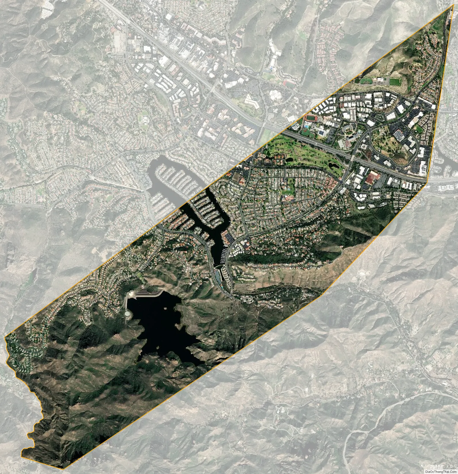
Westlake Village city Satellite Map
Geography
In addition to being a bedroom community for Los Angeles via the Ventura (101) Freeway, it is also home to many large commercial offices and the headquarters of the Dole Food Company, K-Swiss and J.D. Power and Associates. The western region office (Region 5) of Anheuser-Busch Inc. is also located in the community. Pacific Coast Highway, and the Ronald Reagan (118) Freeway also run nearby. It is a short drive to the nearest mall in Thousand Oaks.
Much of Westlake Village is surrounded by open space, including hiking and horse trails, as well as the vast Santa Monica Mountains National Recreation Area. The town is in the northwestern Santa Monica Mountains area, and is 9 miles (14 km) inland from the Pacific Ocean. The area is within a wildlife corridor linking the Santa Monica Mountains with other undeveloped habitat. Mountain lions have been seen roaming the neighborhoods. The lake lies within the watershed of Malibu Creek. Water from the lake must be released into the creek in compliance with an agreement between the California State Water Resources Control Board and the Westlake Lake Management Association, a private entity that oversees the operation of the lake.
Westlake Village has several golf courses and country clubs: the Westlake Golf Course, Sherwood Country Club, and North Ranch Country Club.
Over one half of the original “Westlake” development lies west across the county line, wholly within the city limits of Thousand Oaks. This boundary which divides the Incorporated City of Westlake Village, and Thousand Oaks portion of Westlake Village, crosses over the Westlake Golf Course, halfway between Lakeview Canyon and Lindero Canyon roads, and half of the Lake itself. Lake Sherwood is nearby.
The City of Westlake Village is located approximately 40 miles (64 km) West of downtown Los Angeles in the Conejo Valley. Other communities in the surrounding area include Thousand Oaks, Oak Park, Agoura Hills, Calabasas, Newbury Park, and Malibu.
Climate
Coastal breezes seep through canyons to allow Westlake to sometimes be up to 10 degrees cooler and considerably less hazy than nearby San Fernando Valley during the summer months. However, it generally remains 10 degrees hotter than the coastal plains below the Conejo Grade, in the communities of Santa Rosa Valley, Camarillo, and Ventura among others.
See also
Map of California State and its subdivision:- Alameda
- Alpine
- Amador
- Butte
- Calaveras
- Colusa
- Contra Costa
- Del Norte
- El Dorado
- Fresno
- Glenn
- Humboldt
- Imperial
- Inyo
- Kern
- Kings
- Lake
- Lassen
- Los Angeles
- Madera
- Marin
- Mariposa
- Mendocino
- Merced
- Modoc
- Mono
- Monterey
- Napa
- Nevada
- Orange
- Placer
- Plumas
- Riverside
- Sacramento
- San Benito
- San Bernardino
- San Diego
- San Francisco
- San Joaquin
- San Luis Obispo
- San Mateo
- Santa Barbara
- Santa Clara
- Santa Cruz
- Shasta
- Sierra
- Siskiyou
- Solano
- Sonoma
- Stanislaus
- Sutter
- Tehama
- Trinity
- Tulare
- Tuolumne
- Ventura
- Yolo
- Yuba
- Alabama
- Alaska
- Arizona
- Arkansas
- California
- Colorado
- Connecticut
- Delaware
- District of Columbia
- Florida
- Georgia
- Hawaii
- Idaho
- Illinois
- Indiana
- Iowa
- Kansas
- Kentucky
- Louisiana
- Maine
- Maryland
- Massachusetts
- Michigan
- Minnesota
- Mississippi
- Missouri
- Montana
- Nebraska
- Nevada
- New Hampshire
- New Jersey
- New Mexico
- New York
- North Carolina
- North Dakota
- Ohio
- Oklahoma
- Oregon
- Pennsylvania
- Rhode Island
- South Carolina
- South Dakota
- Tennessee
- Texas
- Utah
- Vermont
- Virginia
- Washington
- West Virginia
- Wisconsin
- Wyoming


