Mission Viejo (/viˈeɪhoʊ/ vee-AY-hoh; corruption of Misión Vieja, Spanish for “Old Mission”) is a commuter city in the Saddleback Valley in Orange County, California, United States. Mission Viejo is considered one of the largest master-planned communities ever built under a single project in the United States and is rivaled only by Highlands Ranch in size. Its population as of 2020 was 93,653.
Mission Viejo is suburban in nature and culture, and consists of residential properties, offices and businesses. The city is noted for its tree-lined neighborhoods, receiving recognition from the National Arbor Day Foundation. The city’s name is a reference to Rancho Mission Viejo, a large Spanish land grant from which the community was founded.
The United States Census Bureau defines an urban area of Orange County cities not part of Los Angeles’s urban area with Mission Viejo as the principal city: the Mission Viejo–Lake Forest–Laguna Niguel, CA urban area had a population of 646,843 as of the 2020 census, ranked 65th in the United States.
| Name: | Mission Viejo city |
|---|---|
| LSAD Code: | 25 |
| LSAD Description: | city (suffix) |
| State: | California |
| County: | Orange County |
| Incorporated: | March 31, 1988 |
| Elevation: | 410 ft (125 m) |
| Land Area: | 17.66 sq mi (45.74 km²) |
| Water Area: | 0.37 sq mi (0.96 km²) 2.12% |
| Population Density: | 5,344.64/sq mi (2,047.51/km²) |
| ZIP code: | 92691–92692, 92694 |
| Area code: | 949 |
| FIPS code: | 0648256 |
| Website: | cityofmissionviejo.org |
Online Interactive Map
Click on ![]() to view map in "full screen" mode.
to view map in "full screen" mode.
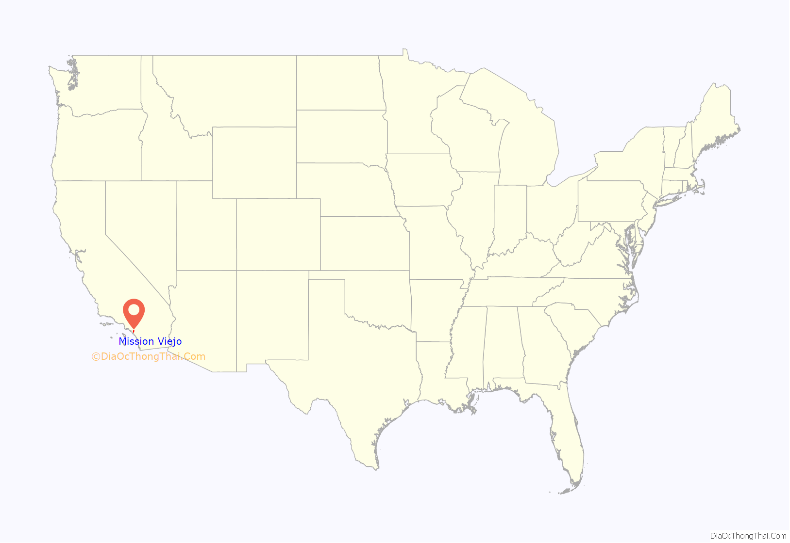
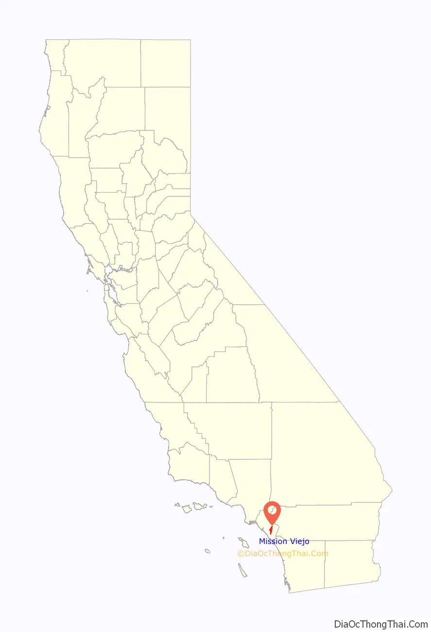
Mission Viejo location map. Where is Mission Viejo city?
History
Rancho Mission Viejo was purchased by Don Juan Forster, an English-born Mexican ranchero. During the Mexican–American War, Forster provided fresh horses to United States military forces which were used on the march of San Diego to invade Los Angeles.
Mission Viejo was a hilly region primarily used as cattle and sheep grazing land, since it was of little use to farmers. This city was one of the last regions of Orange County to be urbanized due to its geologic complexity. In 1960, early developers dismissed most of the land in Mission Viejo as simply “undevelopable”.
Donald Bren, an urban planner who later became the president of the Irvine Company, drafted a master plan which placed roads in the valleys and houses on the hills, and contoured to the geography of the area. The plan worked, and by 1980 much of the city of Mission Viejo was completed. During the late 1970s and the 1980s, houses in Mission Viejo were in such high demand that housing tracts often sold out before construction even began on them. The houses and shopping centers in the city are almost uniformly designed in a Spanish mission style, with “adobe”-like stucco walls and barrel-tile roofs. Many point to Mission Viejo as the first and largest manifestation of Bren’s obsession with Spanish architecture. Bren’s company was also the creator of the developments in Irvine and Newport Beach. The company expanded its operations and went on to build the Lakes project in Tempe, Arizona, Mission Viejo Aurora in Colorado and was the initial master planner of Highlands Ranch, both in the Denver Metropolitan area.
The seal of the city of Mission Viejo was designed and drawn by Carl Glassford, an artist and former resident of the city.
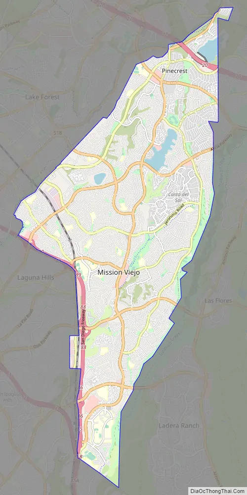
Mission Viejo Road Map
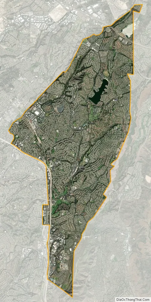
Mission Viejo city Satellite Map
Geography
According to the United States Census Bureau, the city has a total area of 18.1 square miles (47 km), 17.7 square miles (46 km) of which is land and 0.4 square miles (1.0 km) (2.12%) is water. A significant portion of the surface water is held in Lake Mission Viejo, an artificial lake stretching approximately one mile from Olympiad Road to Alicia Parkway along Marguerite Parkway.
Mission Viejo is located 49 mi (79 km) southeast of Los Angeles, and 73 mi (117 km) northwest of San Diego. It is bordered by Lake Forest on the northwest, Trabuco Canyon on the northeast, Rancho Santa Margarita and Ladera Ranch on the east, San Juan Capistrano on the south, and Laguna Niguel and Laguna Hills on the west.
Climate
Mission Viejo enjoys a borderline semi-arid/Mediterranean climate (Köppen climate classification BSh/Csa), with mild temperatures and plentiful sunshine year-round. Rainfall totals, which average around 14 inches (360 millimetres) annually are focused primarily in the months from November to March. Summer is very dry and virtually rainless. Due to the city’s proximity to the ocean, nighttime and morning clouds are fairly common, especially in May and June, a weather phenomenon commonly known as June Gloom or May Gray.
Like most of Southern California, the city is prone to dry Santa Ana winds, bringing hot air from inland and punctuating the normally mild temperatures with noticeable jumps. For example, temperatures have reached highs of 90 °F (32 °C) and above throughout many months of the year, occasionally into autumn. From 2012 to 2016, California experienced the worst drought in a century. In 2016, California experienced more rainfall than expected and ended most of the drought. Orange County was the last to have drought restrictions lifted.
See also
Map of California State and its subdivision:- Alameda
- Alpine
- Amador
- Butte
- Calaveras
- Colusa
- Contra Costa
- Del Norte
- El Dorado
- Fresno
- Glenn
- Humboldt
- Imperial
- Inyo
- Kern
- Kings
- Lake
- Lassen
- Los Angeles
- Madera
- Marin
- Mariposa
- Mendocino
- Merced
- Modoc
- Mono
- Monterey
- Napa
- Nevada
- Orange
- Placer
- Plumas
- Riverside
- Sacramento
- San Benito
- San Bernardino
- San Diego
- San Francisco
- San Joaquin
- San Luis Obispo
- San Mateo
- Santa Barbara
- Santa Clara
- Santa Cruz
- Shasta
- Sierra
- Siskiyou
- Solano
- Sonoma
- Stanislaus
- Sutter
- Tehama
- Trinity
- Tulare
- Tuolumne
- Ventura
- Yolo
- Yuba
- Alabama
- Alaska
- Arizona
- Arkansas
- California
- Colorado
- Connecticut
- Delaware
- District of Columbia
- Florida
- Georgia
- Hawaii
- Idaho
- Illinois
- Indiana
- Iowa
- Kansas
- Kentucky
- Louisiana
- Maine
- Maryland
- Massachusetts
- Michigan
- Minnesota
- Mississippi
- Missouri
- Montana
- Nebraska
- Nevada
- New Hampshire
- New Jersey
- New Mexico
- New York
- North Carolina
- North Dakota
- Ohio
- Oklahoma
- Oregon
- Pennsylvania
- Rhode Island
- South Carolina
- South Dakota
- Tennessee
- Texas
- Utah
- Vermont
- Virginia
- Washington
- West Virginia
- Wisconsin
- Wyoming


