Piedmont is a small city located in Alameda County, California, United States, completely surrounded by the city of Oakland. Its residential population was 11,270 at the 2020 census. The name comes from the region of Piedmont in Italy, and it means ‘foothill’. Piedmont was incorporated in 1907, and was developed significantly in the 1920s and 1930s.
| Name: | Piedmont city |
|---|---|
| LSAD Code: | 25 |
| LSAD Description: | city (suffix) |
| State: | California |
| County: | Alameda County |
| Incorporated: | January 31, 1907 |
| Elevation: | 331 ft (101 m) |
| Total Area: | 1.70 sq mi (4.40 km²) |
| Land Area: | 1.70 sq mi (4.40 km²) |
| Water Area: | 0.00 sq mi (0.00 km²) 0% |
| Total Population: | 11,270 |
| Population Density: | 6,600/sq mi (2,600/km²) |
| ZIP code: | 94602, 94610, 94611, 94618 |
| Area code: | 510, 341 |
| FIPS code: | 0656938 |
| Website: | www.ci.piedmont.ca.us |
Online Interactive Map
Click on ![]() to view map in "full screen" mode.
to view map in "full screen" mode.
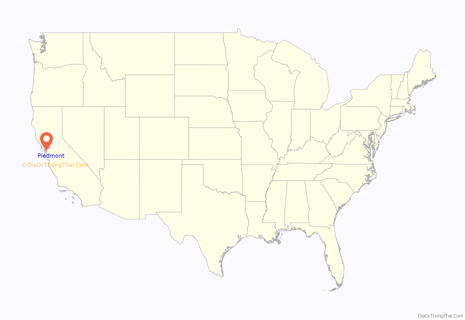
Piedmont location map. Where is Piedmont city?
History
The original neighborhood of Piedmont was larger than the current municipality of Piedmont, with the Mountain View Cemetery considered full part of the Piedmont neighborhood.
Residents initially sought incorporation in 1907. Two elections were held among the citizens of Piedmont in 1907, both of which narrowly upheld the decision for Piedmont to become a separate city, rather than become a neighborhood within the city of Oakland.
Like surrounding Oakland, Piedmont has a history of racial segregation. In 1924, the city’s first African-American homeowners, Sidney and Irene Dearing, got around the city’s restrictive housing covenants by purchasing a home using a white family member as a proxy. They could not count on the city of Piedmont to protect them from violent threats against their lives—the chief of police at the time, Burton Becker, was an active member of the Ku Klux Klan. While the Dearings initially refused to leave, bombs were left around their property. They sold it to the city for $25,000 after a mob surrounded their home and demanded that they leave.
Before 1968, restrictive housing covenants and redlining were used to exclude non-whites in the city for many years. The American sociologist and historian James W. Loewen identified Piedmont as a “probable” sundown town, meaning that non-whites were not welcome after dusk and could face violence and intimidation. While surrounding Oakland is one of the most ethnically and culturally diverse cities in the United States, Piedmont has a less racially diverse population than Oakland. Attempts to ethnically and culturally diversify the city and allow for higher density and affordable housing are typically met with resistance from the city’s residents.
In early 2021, the city council indicated that it intended “to move forward with public acknowledgement and an apology for the abhorrent treatment Sidney Dearing and his family received in 1924.”
According to the city’s Web page, “In the Roaring Twenties, Piedmont was known as the ‘City of Millionaires’ because there were more millionaires per square mile than in any city in the United States.” Many of these millionaires built mansions that still stand, notably on Sea View Avenue and Sotelo Avenue/Glen Alpine Road in ‘Alta’ Piedmont. Piedmont became a charter city under the laws of the state of California on December 18, 1922. On February 27, 1923, voters adopted the charter, which can only be changed by another vote of the people.
Piedmont celebrated the year 2007 as its Centennial Anniversary since incorporation. The Centennial Committee hosted celebratory events along a trail that ran through downtown Piedmont and denoted historical landmarks in the city. The Committee also created a float for the city’s Fourth of July parade.
The historical exhibit “A Deluxe Autonomy: Piedmont’s First 100 Years” was on display in the Oakland Public Library from January 5 to March 31, 2007.
In August 2017, the mayor of Piedmont, Jeffrey Wieler, resigned after it was revealed he had made disparaging Facebook posts about Black Lives Matter and transgender people.
Piedmont Road Map
Piedmont city Satellite Map
Geography
Piedmont is located at 37°49′19″N 122°13′53″W / 37.821994°N 122.231405°W / 37.821994; -122.231405.
It is located near the Hayward Fault, a geological fault line that runs through the East Bay region.
According to the United States Census Bureau, the city has a total area of 1.7 square miles (4.4 km), all land.
Borders
Piedmont is surrounded on all sides by the city of Oakland. Specifically, Piedmont’s northwestern border is adjacent to Oakland’s Piedmont Ave commercial district. Piedmont borders Oakland’s historic Grand Lake District (Lakeshore and Grand Avenue commercial districts) to the southwest, the quaint and rustic Montclair District to the northeast, and the Crocker Highlands and Glenview Districts to the south.
Major streets
Piedmont’s major streets include Oakland Avenue, which runs east-west through Piedmont’s small city center; Highland Avenue, which divides Piedmont into upper and lower sections; Moraga Avenue, which runs along the city’s northern border; and Grand Avenue, which runs near Piedmont’s western border and further distinguishes ‘Lower’ Piedmont (west of Highland Ave) from ‘Baja’ Piedmont (west of Grand Ave). Lots in upper Piedmont are, on average, larger than lots in lower Piedmont. A nearby shopping district on Piedmont Avenue is located in Oakland, not Piedmont. A small shopping hamlet had been located on Highland Avenue near the Exedra at Piedmont Park for many years, but in the last few decades has dwindled in number to a small, local grocer-deli (Mulberry’s Market), a service station and three banks. No major highways run within Piedmont’s borders, but entrances to CA Highway 13 and CA I-580 are quite near.
Housing
Piedmont is almost entirely zoned for single-family dwelling residential use. Piedmont has minimal commerce compared with statistically similar cities and relies primarily on property taxes and fees for public revenues to support public services. The city also has relatively few multi-family or second (in-law) units. The city has a very small number of businesses in its commercial district on Highland Avenue and a very small number of businesses on Grand Avenue near Piedmont’s western border with Oakland.
Emergency services
Piedmont provides its own fire, police, parks, and recreational services but does not have its own public library nor federal post office; these services are shared with Oakland. Special, incremental property tax assessments on Piedmont real estate for schools and some public services are not shared with Oakland.
See also
Map of California State and its subdivision:- Alameda
- Alpine
- Amador
- Butte
- Calaveras
- Colusa
- Contra Costa
- Del Norte
- El Dorado
- Fresno
- Glenn
- Humboldt
- Imperial
- Inyo
- Kern
- Kings
- Lake
- Lassen
- Los Angeles
- Madera
- Marin
- Mariposa
- Mendocino
- Merced
- Modoc
- Mono
- Monterey
- Napa
- Nevada
- Orange
- Placer
- Plumas
- Riverside
- Sacramento
- San Benito
- San Bernardino
- San Diego
- San Francisco
- San Joaquin
- San Luis Obispo
- San Mateo
- Santa Barbara
- Santa Clara
- Santa Cruz
- Shasta
- Sierra
- Siskiyou
- Solano
- Sonoma
- Stanislaus
- Sutter
- Tehama
- Trinity
- Tulare
- Tuolumne
- Ventura
- Yolo
- Yuba
- Alabama
- Alaska
- Arizona
- Arkansas
- California
- Colorado
- Connecticut
- Delaware
- District of Columbia
- Florida
- Georgia
- Hawaii
- Idaho
- Illinois
- Indiana
- Iowa
- Kansas
- Kentucky
- Louisiana
- Maine
- Maryland
- Massachusetts
- Michigan
- Minnesota
- Mississippi
- Missouri
- Montana
- Nebraska
- Nevada
- New Hampshire
- New Jersey
- New Mexico
- New York
- North Carolina
- North Dakota
- Ohio
- Oklahoma
- Oregon
- Pennsylvania
- Rhode Island
- South Carolina
- South Dakota
- Tennessee
- Texas
- Utah
- Vermont
- Virginia
- Washington
- West Virginia
- Wisconsin
- Wyoming
