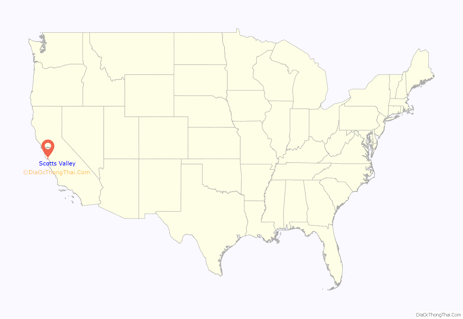
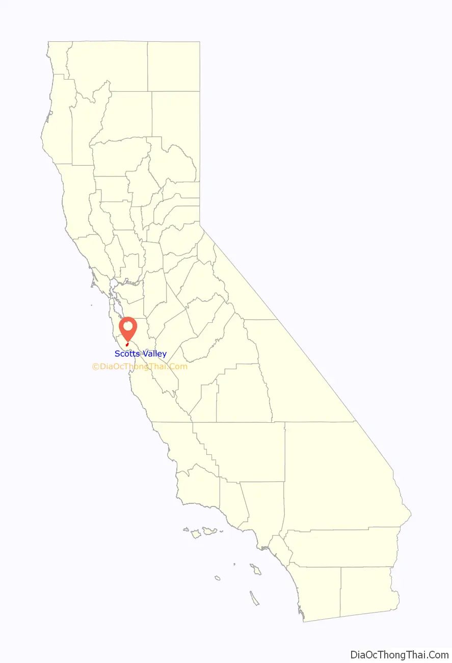
Scotts Valley is a small city in Santa Cruz County, California, United States, about thirty miles (48 km) south of downtown San Jose and six miles (9.7 km) north of the city of Santa Cruz, in the upland slope of the Santa Cruz Mountains. As of the 2020 census, the city population was 12,224. Principal access to the city is supplied by State Route 17 that connects San Jose and Santa Cruz. The city was incorporated in 1966.
| Name: | Scotts Valley city |
|---|---|
| LSAD Code: | 25 |
| LSAD Description: | city (suffix) |
| State: | California |
| County: | Santa Cruz County |
| Incorporated: | August 2, 1966 |
| Elevation: | 561 ft (171 m) |
| Total Area: | 4.62 sq mi (11.96 km²) |
| Land Area: | 4.62 sq mi (11.96 km²) |
| Water Area: | 0.00 sq mi (0.00 km²) 0% |
| Total Population: | 12,224 |
| Population Density: | 2,663.18/sq mi (1,028.70/km²) |
| ZIP code: | 95060, 95066, 95067 |
| Area code: | 831 |
| FIPS code: | 0670588 |
| GNISfeature ID: | 0277598 |
Online Interactive Map
Click on ![]() to view map in "full screen" mode.
to view map in "full screen" mode.
Scotts Valley location map. Where is Scotts Valley city?
History
Approximately ten thousand years ago there was a lake in the lowest elevation of Scotts Valley. Archeological excavations of site CA-SCR-177 (Scotts Valley Site) in 1983 and 1987 support dates for human settlement of this area as between 9,000 and 12,000 years before present (YBP). The lake drained during the Mid-Holocene warming period (4 -5 YBP) forming what is now known as Carbonera Creek. When the lake drained, the people moved downslope following the lake water’s transformation as in became the creek. Around 2000 BC, Ohlone people occupied areas along the remaining creeks, spring and seep areas, along with permanent and seasonal drainages, and on flat ridges and terraces. Permanent villages were usually placed on elevations above seasonal flood levels. Surrounding areas were used for hunting and seed, acorn, and grass gathering. Therefore, areas along watercourses are considered likely locations for prehistoric cultural resources. Several watercourses, including portions of Carbonera Creek, Bean Creek, and MacKenzie Creek, are within the city.
Scotts Valley was named after Hiram Daniel Scott, who purchased Rancho San Agustin, including the valley, in 1850 from Joseph Ladd Majors. Before Majors, the property was owned by José Bolcoff. Bolcoff was the original settler and first European to claim title and live in what was to be Scotts Valley. He was born Osip Volkov around 1794 in Petropavlovsk-Kamchatsky, Siberia. Working as a fur trader around 1815, Bolcoff jumped ship on the Monterey Bay shoreline, quickly assimilated into the Spanish culture, and was well received by the Spanish authorities. Volkov had his Russian Orthodox baptism validated in Mission Soledad in 1817, and was given the Spanish name José Antonio Bolcoff. Bolcoff lived with and traveled with Alta California’s governor Pablo Vicente de Solá, acting as an interpreter.
Becoming a Mexican citizen in 1833, Bolcoff moved his family to his 4,400-acre (18 km) land grant building, an adobe casa historians speculate was located near present-day Kings Village Shopping Center. Bolcoff relinquished his interest in the Rancho San Augustin, selling and accepting $400 from Joseph Ladd Majors, also known as Don Juan José Mechacas. July 7, 1846, marked the shift of power in the region from Mexico to the United States.
Hiram Scott built the Greek revival style Scott House in 1853. Situated behind City Hall, it is a Santa Cruz County Historical Trust Landmark and is on the National Register of Historic Places. The house originally stood on Scotts Valley Drive, near where a Bank of America branch is now located.
From the 1840s, money-making activity in Scotts Valley centered on several industries: lumber, grain, the milling of grain, and most importantly the tanning of hides and working of leather. Beginning in the 1930s, peat moss was removed from Scotts Valley and taken to San Francisco to supply soil for difficult indoor plants such as gardenias. When the peat ran out, sand and gravel were quarried and sold.
The area was the site of Santa’s Village, a Christmas-themed amusement park which opened on May 30, 1957, on a 25-acre (10 ha) site which was formerly Lawridge Farm, part of the former Rancho San Augustin. “Residents” of the park included Santa, Mrs. Santa, and elves and gnomes who operated the rides and sold tickets. There was a petting zoo, a bobsled ride, a whirling Christmas tree ride, and a train ride, as well as a Fairy Tale Land. The park was sold in 1966 but continued to be operated under lease by the Santa’s Village Corporation. When that corporation went bankrupt in 1977. the owner considered launching a Knott’s Berry Farm type of complex but was denied a permit by the city of Scotts Valley, and the park closed for good in 1979.
Scotts Valley’s most famous resident was film director Alfred Hitchcock, who lived in a mountaintop estate above the Vine Hill area from 1940 to 1972. Florence Owens Thompson, made famous by Dorothea Lange’s Migrant Mother photograph, died in Scotts Valley in 1983.
Netflix was founded in Scotts Valley by Reed Hastings and Marc Randolph in 1997.
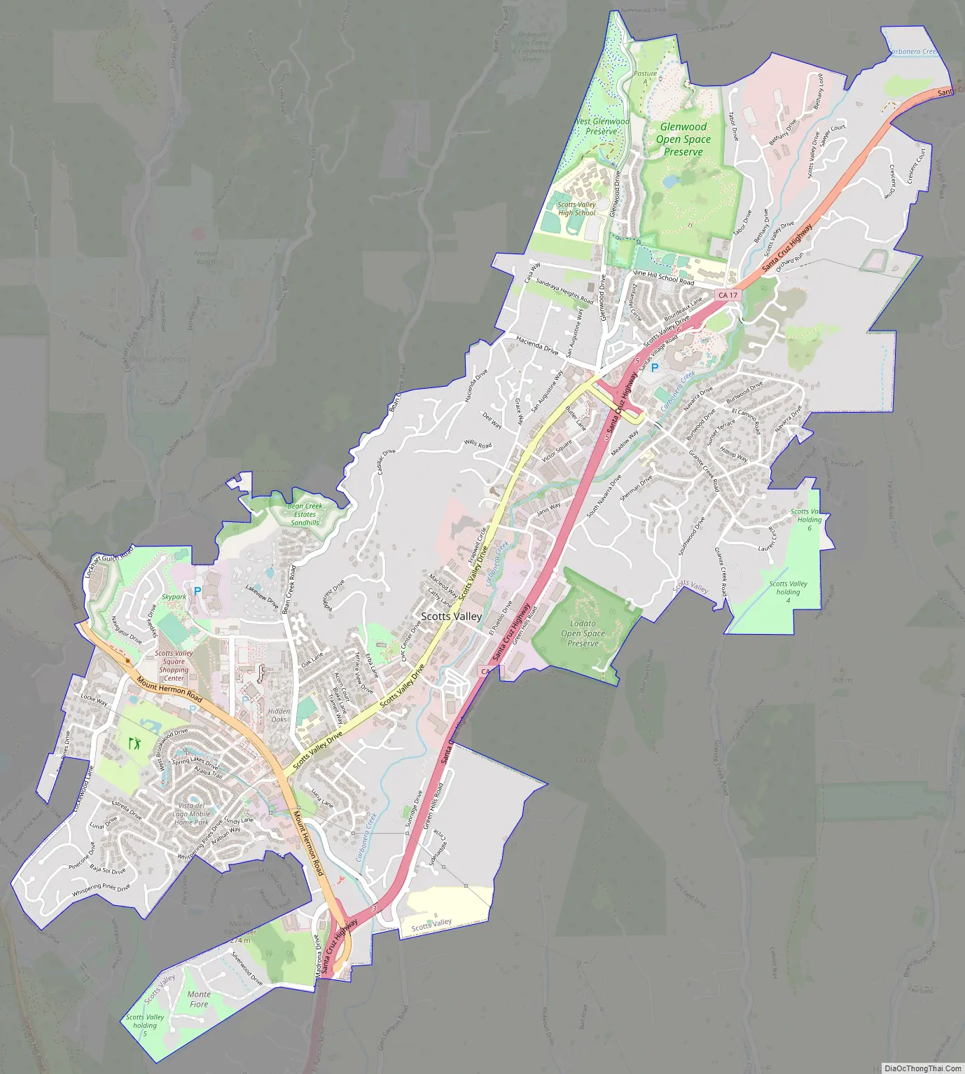
Scotts Valley Road Map
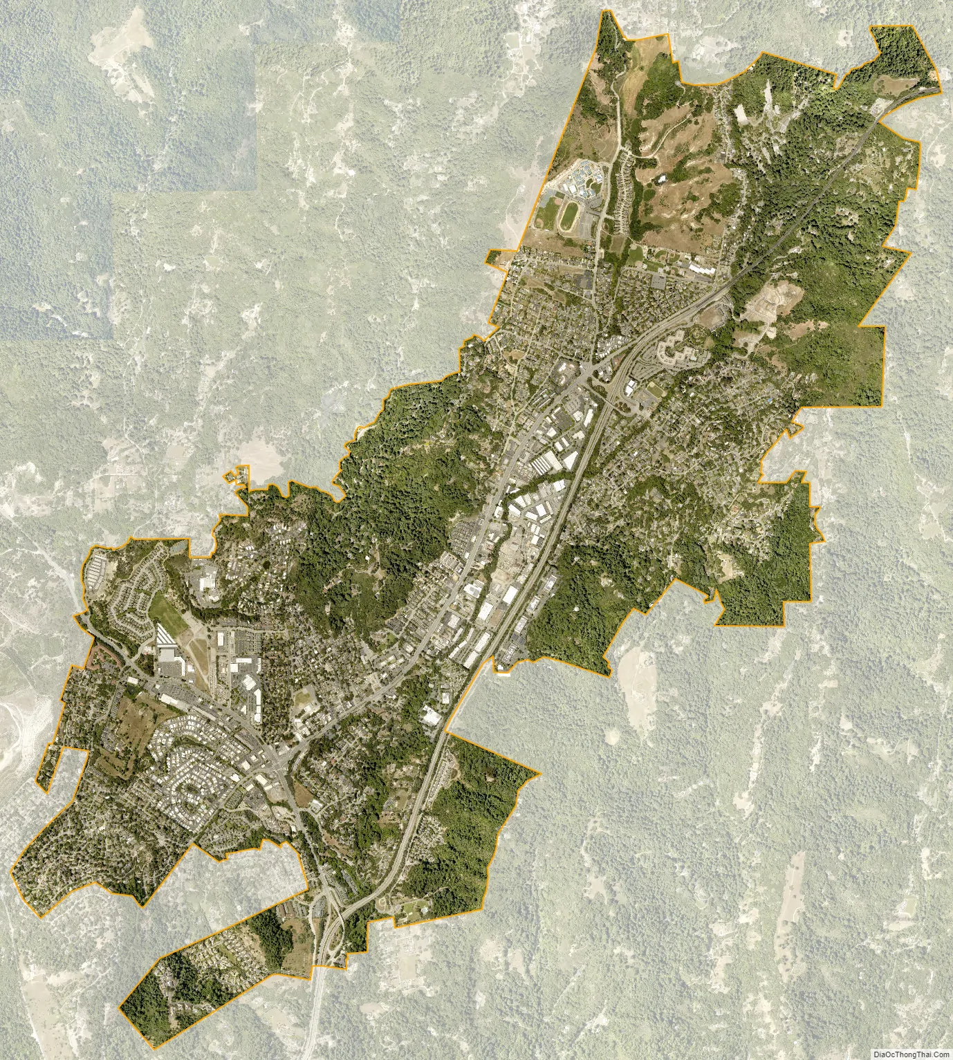
Scotts Valley city Satellite Map
Geography
Scotts Valley is in the west hills of the Santa Cruz Mountains. State Route 17 connects Scotts Valley to Santa Cruz to the south and to Los Gatos, San Jose, and the South Bay area to the north.
Scotts Valley is located at the southern end of the WWF-designated Northern California coastal forests ecoregion.
According to the United States Census Bureau, it has a total area of 4.6 square miles (12 km), all land. It is in central Santa Cruz County, in the northern portion of the North Central Coast Air Basin.
Climate
Air in Scotts Valley is typically maritime in origin, as it moves over the land from the Pacific Ocean. Summers are warm and dry, while winters are mild and generally rainy. Most rain falls as a result of winter Pacific storms between the months of November and April. Sound levels in Scotts Valley are typically in the range of 57 to 65 dBA, except for somewhat higher levels within 150 feet (46 m) from Highway 17.
Scotts Valley has mild weather throughout the year, enjoying a Mediterranean climate (Köppen Csb) characterized by cool, wet winters and warm, mostly dry summers. Due to its proximity to Monterey Bay, fog and low overcast are common during the night and morning hours, especially in the summer.
See also
Map of California State and its subdivision:- Alameda
- Alpine
- Amador
- Butte
- Calaveras
- Colusa
- Contra Costa
- Del Norte
- El Dorado
- Fresno
- Glenn
- Humboldt
- Imperial
- Inyo
- Kern
- Kings
- Lake
- Lassen
- Los Angeles
- Madera
- Marin
- Mariposa
- Mendocino
- Merced
- Modoc
- Mono
- Monterey
- Napa
- Nevada
- Orange
- Placer
- Plumas
- Riverside
- Sacramento
- San Benito
- San Bernardino
- San Diego
- San Francisco
- San Joaquin
- San Luis Obispo
- San Mateo
- Santa Barbara
- Santa Clara
- Santa Cruz
- Shasta
- Sierra
- Siskiyou
- Solano
- Sonoma
- Stanislaus
- Sutter
- Tehama
- Trinity
- Tulare
- Tuolumne
- Ventura
- Yolo
- Yuba
- Alabama
- Alaska
- Arizona
- Arkansas
- California
- Colorado
- Connecticut
- Delaware
- District of Columbia
- Florida
- Georgia
- Hawaii
- Idaho
- Illinois
- Indiana
- Iowa
- Kansas
- Kentucky
- Louisiana
- Maine
- Maryland
- Massachusetts
- Michigan
- Minnesota
- Mississippi
- Missouri
- Montana
- Nebraska
- Nevada
- New Hampshire
- New Jersey
- New Mexico
- New York
- North Carolina
- North Dakota
- Ohio
- Oklahoma
- Oregon
- Pennsylvania
- Rhode Island
- South Carolina
- South Dakota
- Tennessee
- Texas
- Utah
- Vermont
- Virginia
- Washington
- West Virginia
- Wisconsin
- Wyoming


