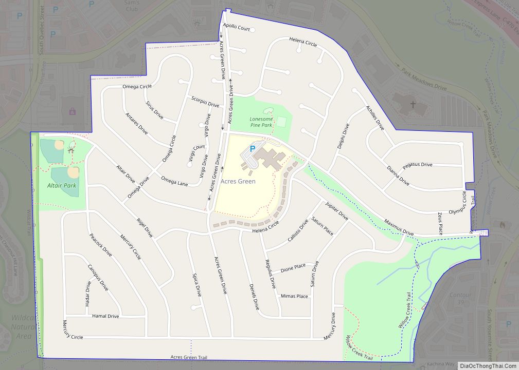
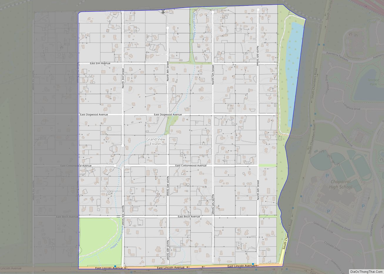
Acres Green is an unincorporated community and a census-designated place (CDP) located in and governed by Douglas County, Colorado, United States. The CDP is a part of the Denver–Aurora–Lakewood, CO Metropolitan Statistical Area. The population of the Acres Green CDP was 2,922 at the 2020 United States Census. The community lies in ZIP Code 80124.
| Name: | Acres Green CDP |
|---|---|
| LSAD Code: | 57 |
| LSAD Description: | CDP (suffix) |
| State: | Colorado |
| County: | Douglas County |
| Elevation: | 5,846 ft (1,782 m) |
| Total Area: | 0.60 sq mi (1.56 km²) |
| Land Area: | 0.60 sq mi (1.56 km²) |
| Water Area: | 0.00 sq mi (0.00 km²) |
| Total Population: | 2,922 |
| Population Density: | 4,900/sq mi (1,900/km²) |
| ZIP code: | 80124 |
| FIPS code: | 0800320 |
Online Interactive Map
Click on ![]() to view map in "full screen" mode.
to view map in "full screen" mode.
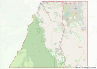
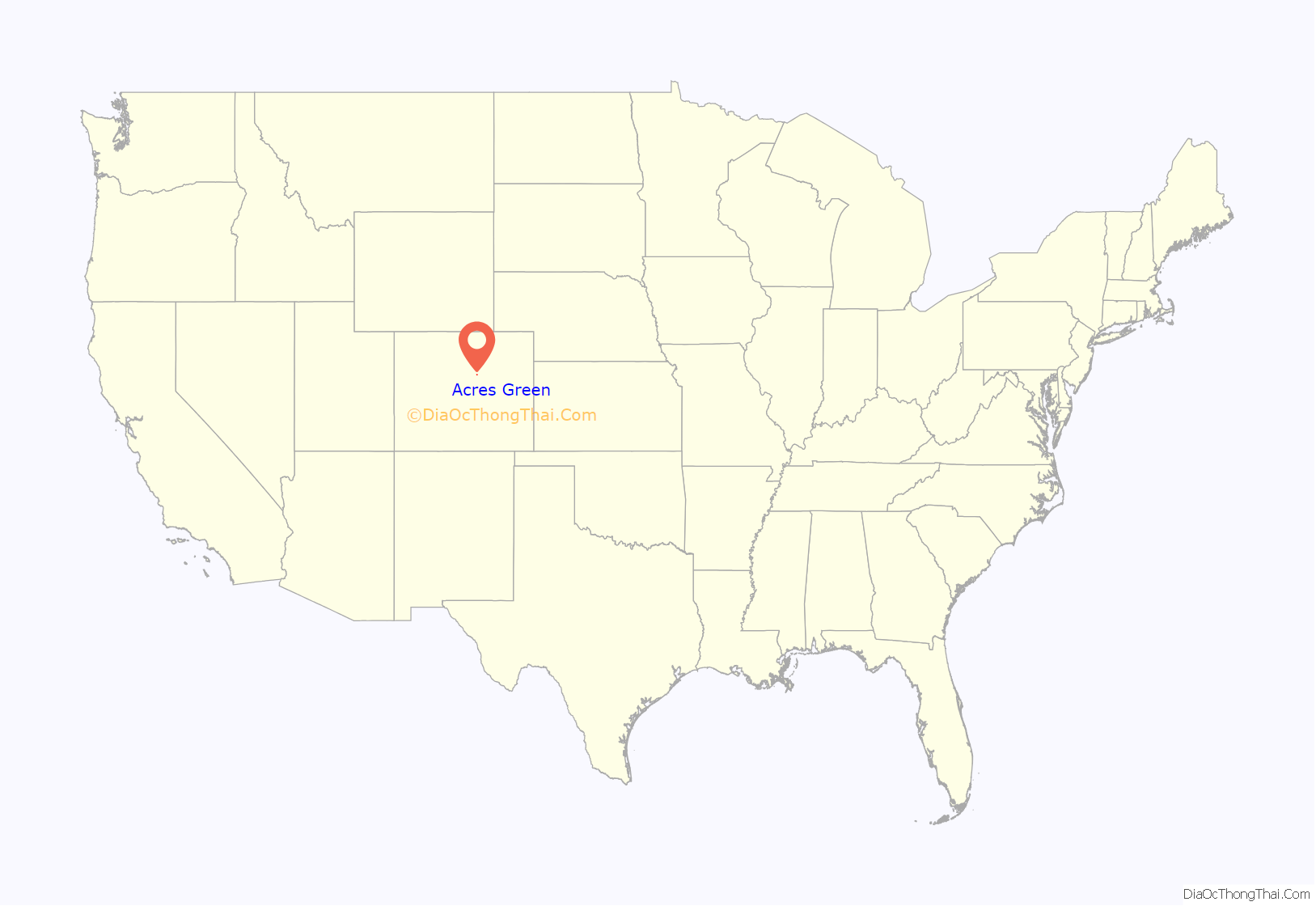
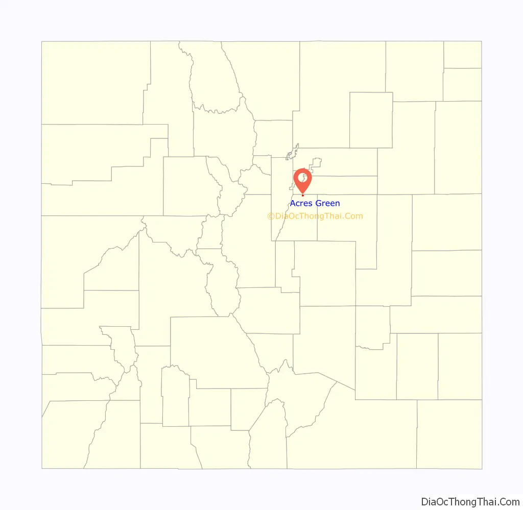
Acres Green location map. Where is Acres Green CDP?
History
The Acres Green subdivision was built by the Morris General contractors with construction beginning on a former pasture south of County Line Road near Interstate 25 in 1971
This was the first housing development in northern Douglas County. Construction on the sixth and final filling would be completed 12 years later.
The subdivision was being built up as Denver began to prosper with an economic boom because of the energy industry. Although the subdivision is about 20 miles (32 km) from downtown, the Denver Technological Center was growing a few miles to the north along I-25 while the Inverness office complex just to the east of the interstate was in its infancy. By the time of the late 1970s, the subdivision contained a park, elementary school and library.
As Denver grew to the south along the I-25 corridor during this time, there was a need for additional housing. However, the area around the Acres Green community would remain largely isolated for many years. The nearest development was in southern Arapahoe County was over two miles (3 km) north of Acres Green until development extended south to County Line Road in the early-1980s. The majority of Acres Green was complete before the Highlands Ranch community had even begun to the west around the same time. Development of that community would not reach the area west Acres Green until the early-1990s. The SH 470 highway was built between the homes of Acres Green and County Line Road in the mid-1980s. The library, which was built in 1979 was leveled because it stood in the path of the highway.
In the mid-1990s, Denver began another economic boom because of the technology industry. As the decade progressed, the long-time empty land around the Acres Green began to disappear. The Meridian office complex was developed to the southeast. Also, the Park Meadows shopping mall spurred large scale retail development all around the development. Many other subdivisions were built to the south of Acres Green which became known as Lone Tree.
Acres Green Road Map
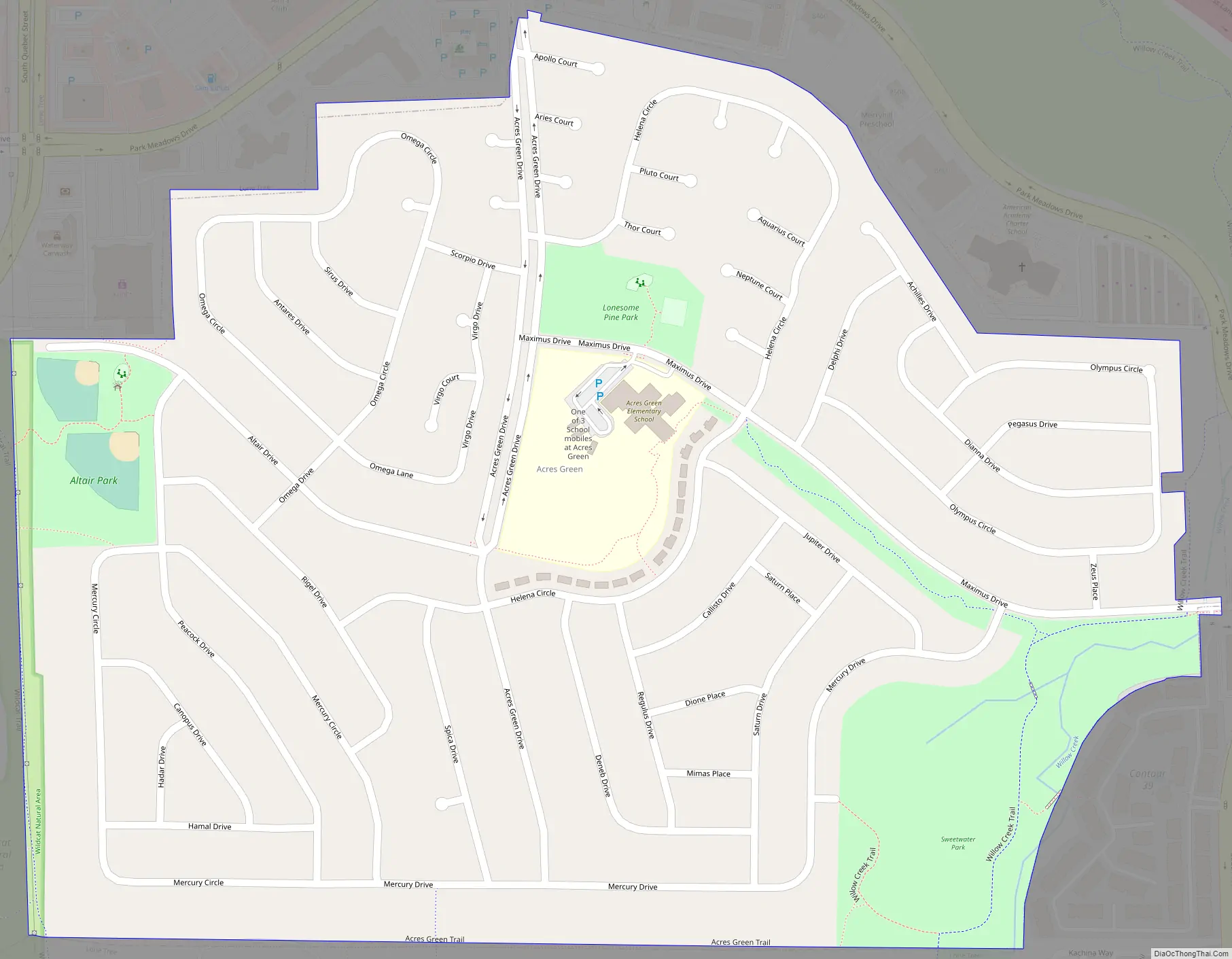
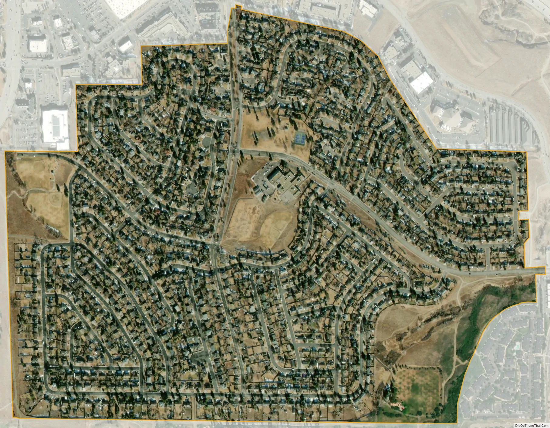
Acres Green city Satellite Map
Geography
The Acres Green CDP has an area of 385 acres (1.557 km), all land.
See also
Map of Colorado State and its subdivision:- Adams
- Alamosa
- Arapahoe
- Archuleta
- Baca
- Bent
- Boulder
- Broomfield
- Chaffee
- Cheyenne
- Clear Creek
- Conejos
- Costilla
- Crowley
- Custer
- Delta
- Denver
- Dolores
- Douglas
- Eagle
- El Paso
- Elbert
- Fremont
- Garfield
- Gilpin
- Grand
- Gunnison
- Hinsdale
- Huerfano
- Jackson
- Jefferson
- Kiowa
- Kit Carson
- La Plata
- Lake
- Larimer
- Las Animas
- Lincoln
- Logan
- Mesa
- Mineral
- Moffat
- Montezuma
- Montrose
- Morgan
- Otero
- Ouray
- Park
- Phillips
- Pitkin
- Prowers
- Pueblo
- Rio Blanco
- Rio Grande
- Routt
- Saguache
- San Juan
- San Miguel
- Sedgwick
- Summit
- Teller
- Washington
- Weld
- Yuma
- Alabama
- Alaska
- Arizona
- Arkansas
- California
- Colorado
- Connecticut
- Delaware
- District of Columbia
- Florida
- Georgia
- Hawaii
- Idaho
- Illinois
- Indiana
- Iowa
- Kansas
- Kentucky
- Louisiana
- Maine
- Maryland
- Massachusetts
- Michigan
- Minnesota
- Mississippi
- Missouri
- Montana
- Nebraska
- Nevada
- New Hampshire
- New Jersey
- New Mexico
- New York
- North Carolina
- North Dakota
- Ohio
- Oklahoma
- Oregon
- Pennsylvania
- Rhode Island
- South Carolina
- South Dakota
- Tennessee
- Texas
- Utah
- Vermont
- Virginia
- Washington
- West Virginia
- Wisconsin
- Wyoming