The Town of Eaton is a Statutory Town located in Weld County, Colorado, United States. The town population was 5,802 at the 2020 United States Census, a +32.92% increase since the 2010 United States Census. Eaton is a part of the Greeley, CO Metropolitan Statistical Area and the Front Range Urban Corridor.
| Name: | Eaton town |
|---|---|
| LSAD Code: | 43 |
| LSAD Description: | town (suffix) |
| State: | Colorado |
| County: | Weld County |
| Elevation: | 4,839 ft (1,475 m) |
| Total Area: | 3.160 sq mi (8.185 km²) |
| Land Area: | 3.160 sq mi (8.185 km²) |
| Water Area: | 0.000 sq mi (0.000 km²) |
| Total Population: | 5,802 |
| Population Density: | 1,836/sq mi (709/km²) |
| ZIP code: | 80615 |
| Area code: | 970 |
| FIPS code: | 0822860 |
| GNISfeature ID: | 0204691 |
| Website: | townofeaton.colorado.gov |
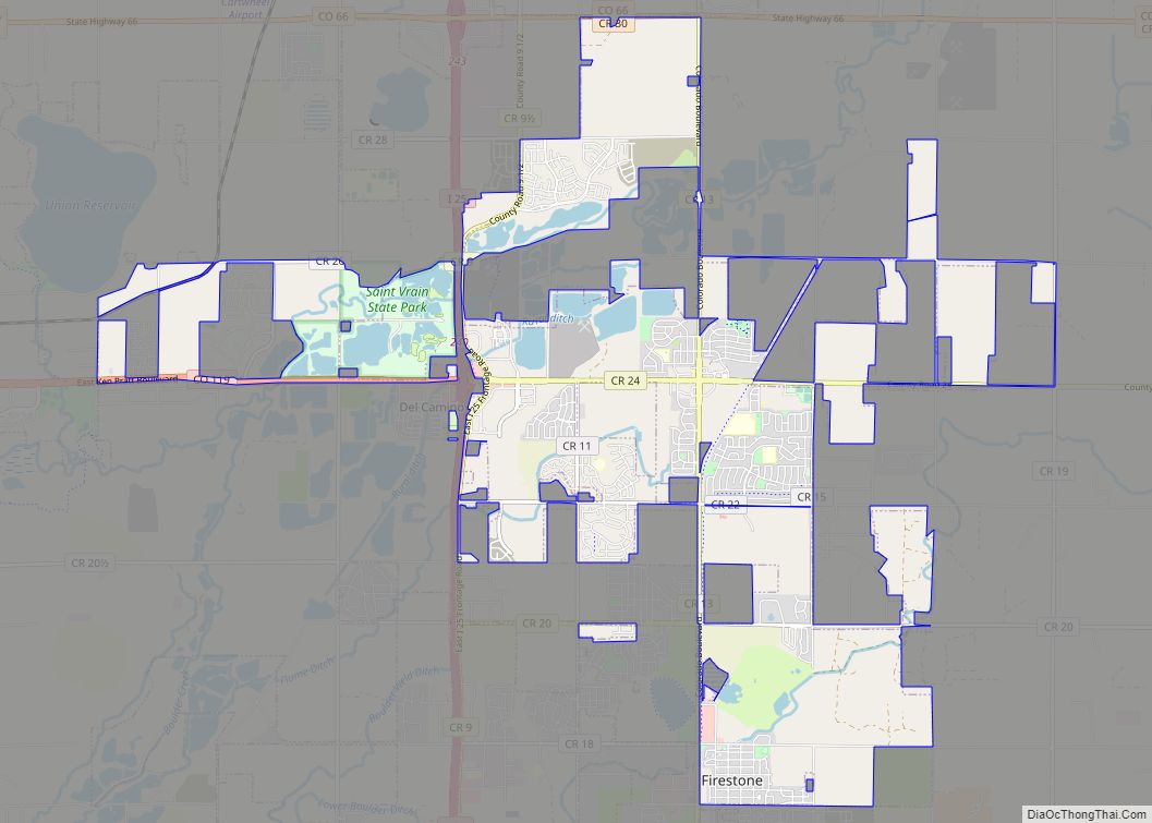
Online Interactive Map
Click on ![]() to view map in "full screen" mode.
to view map in "full screen" mode.
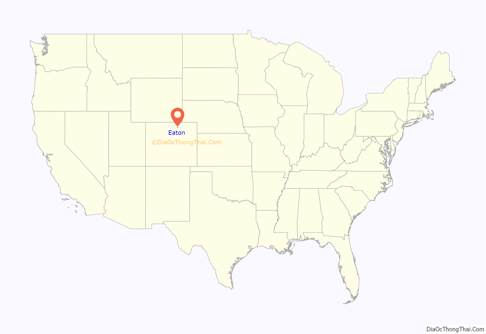
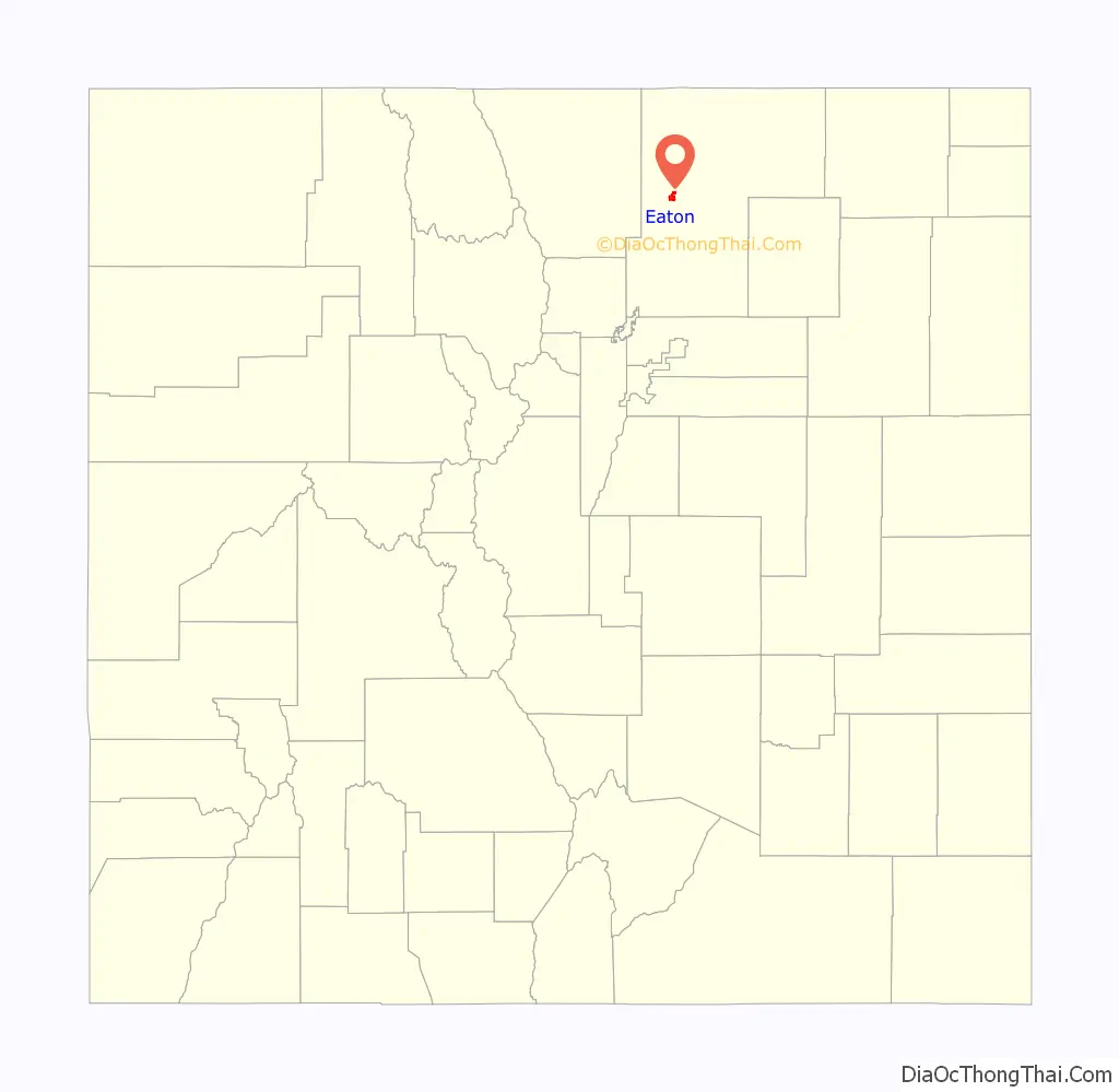
Eaton location map. Where is Eaton town?
History
The town is named after Benjamin Harrison Eaton, a pioneer of irrigation who played a leading role in transforming the arid prairie of the Great Plains east of Colorado’s Front Range into a thriving agricultural region with water brought from the nearby Rocky Mountains in the late 19th century. Much of the farming country around Eaton, Colorado continues to depend on the irrigation systems engineered by Eaton and others to this day. Eaton later served as Governor of Colorado from 1885 to 1887. The town of Eaton was incorporated in 1892. Eaton was first named Eatonton to avoid conflict with the Easton post office in El Paso county. When Easton had changed its name to Eastonville, the last syllable of Eatonton was dropped, and the town has since been known as Eaton.
The first citizens of Eaton began to settle in 1880. One of the only occupations available was working on irrigation ditches from Eaton to Greeley.
On September 28, 1892, a petition was submitted to the county judge requesting that Eaton be incorporated. The petition had been signed by 36 residents, including Benjamin Eaton himself. The county judge ordered that an election be held to decide whether or not the remaining residents desired Eaton to be incorporated. 50 votes were cast, every one of them in favor of incorporation. Eaton’s incorporation was affected on October 27, 1892.
Eaton Road Map
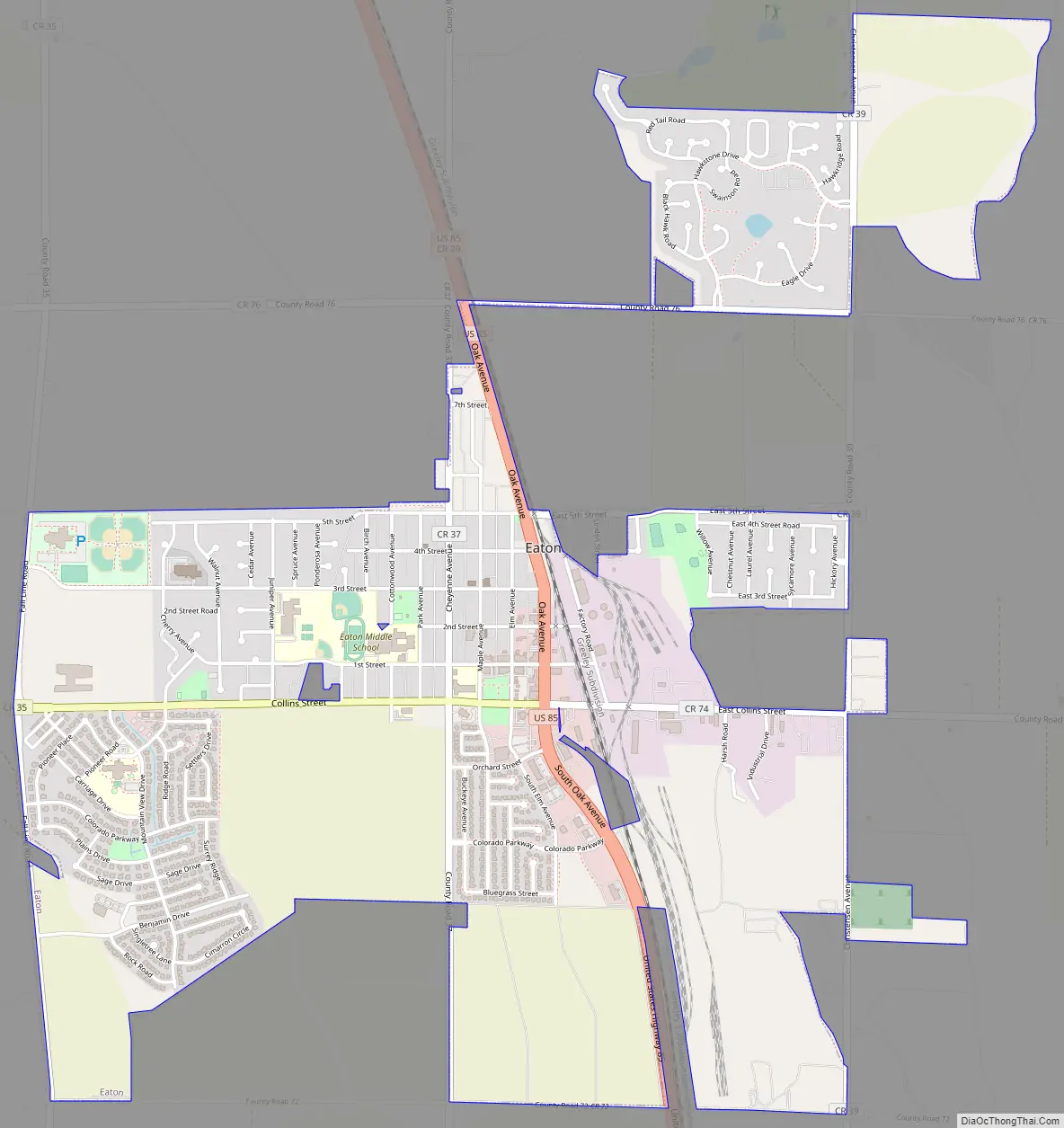
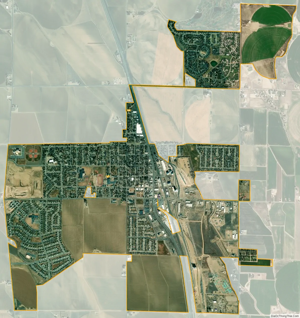
Eaton city Satellite Map
Geography
Eaton is located at 40°31′46″N 104°42′47″W / 40.52944°N 104.71306°W / 40.52944; -104.71306 (40.529481, -104.713177), on the Denver, Colorado-Cheyenne, Wyoming mainline of the Union Pacific Railroad, and along U.S. Route 85, approximately 7 miles north of Greeley, Colorado.
At the 2020 United States Census, the town had a total area of 2,023 acres (8.185 km), all of it land.
See also
Map of Colorado State and its subdivision:- Adams
- Alamosa
- Arapahoe
- Archuleta
- Baca
- Bent
- Boulder
- Broomfield
- Chaffee
- Cheyenne
- Clear Creek
- Conejos
- Costilla
- Crowley
- Custer
- Delta
- Denver
- Dolores
- Douglas
- Eagle
- El Paso
- Elbert
- Fremont
- Garfield
- Gilpin
- Grand
- Gunnison
- Hinsdale
- Huerfano
- Jackson
- Jefferson
- Kiowa
- Kit Carson
- La Plata
- Lake
- Larimer
- Las Animas
- Lincoln
- Logan
- Mesa
- Mineral
- Moffat
- Montezuma
- Montrose
- Morgan
- Otero
- Ouray
- Park
- Phillips
- Pitkin
- Prowers
- Pueblo
- Rio Blanco
- Rio Grande
- Routt
- Saguache
- San Juan
- San Miguel
- Sedgwick
- Summit
- Teller
- Washington
- Weld
- Yuma
- Alabama
- Alaska
- Arizona
- Arkansas
- California
- Colorado
- Connecticut
- Delaware
- District of Columbia
- Florida
- Georgia
- Hawaii
- Idaho
- Illinois
- Indiana
- Iowa
- Kansas
- Kentucky
- Louisiana
- Maine
- Maryland
- Massachusetts
- Michigan
- Minnesota
- Mississippi
- Missouri
- Montana
- Nebraska
- Nevada
- New Hampshire
- New Jersey
- New Mexico
- New York
- North Carolina
- North Dakota
- Ohio
- Oklahoma
- Oregon
- Pennsylvania
- Rhode Island
- South Carolina
- South Dakota
- Tennessee
- Texas
- Utah
- Vermont
- Virginia
- Washington
- West Virginia
- Wisconsin
- Wyoming