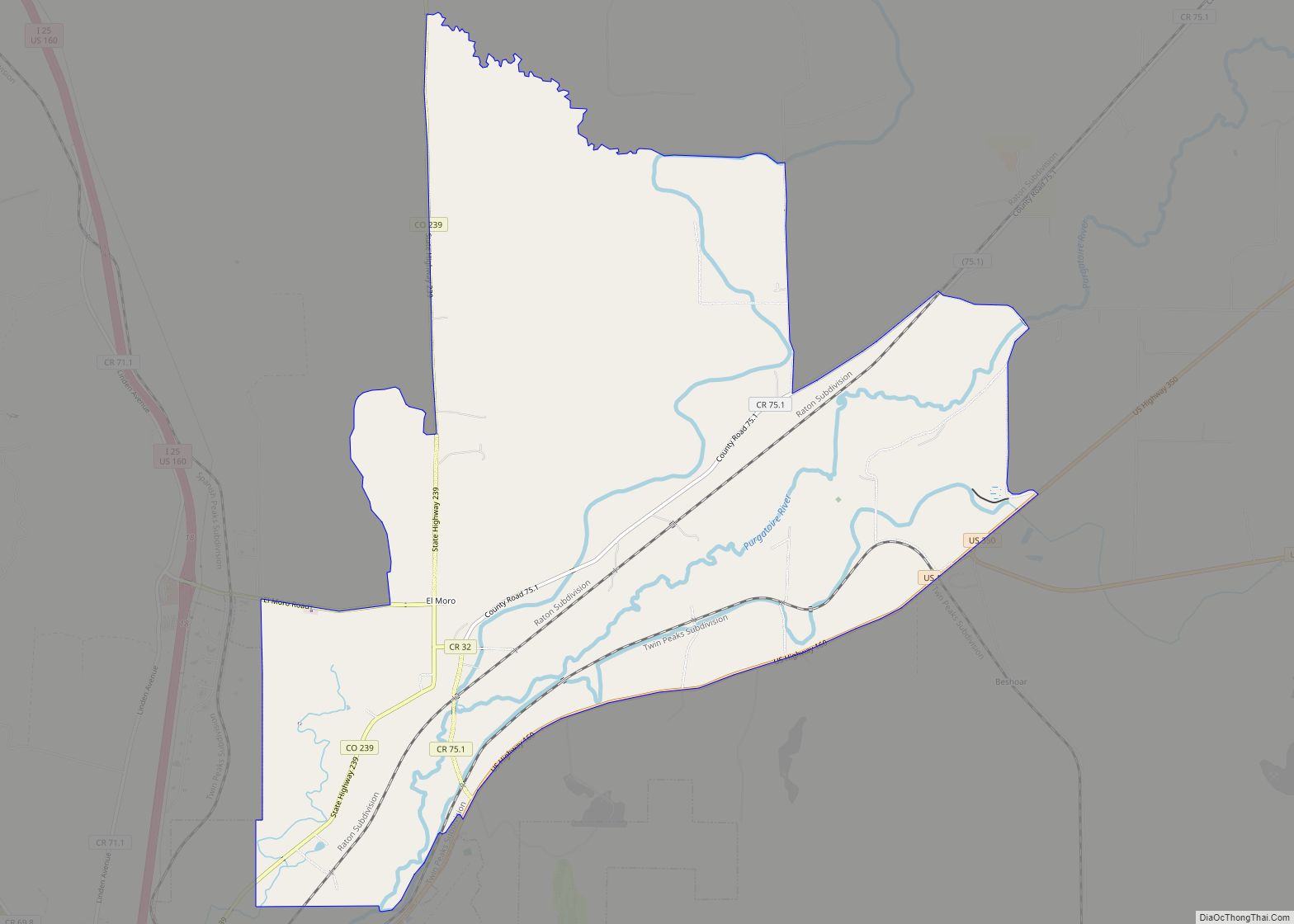
El Moro is an unincorporated community and a census-designated place (CDP) located in and governed by Las Animas County, Colorado, United States. The population of the El Moro CDP was 216 at the United States Census 2020. The Trinidad post office (Zip Code 81082) serves the area.
| Name: | El Moro CDP |
|---|---|
| LSAD Code: | 57 |
| LSAD Description: | CDP (suffix) |
| State: | Colorado |
| County: | Las Animas County |
| Elevation: | 5,879 ft (1,792 m) |
| Total Area: | 11.116 sq mi (28.791 km²) |
| Land Area: | 11.091 sq mi (28.725 km²) |
| Water Area: | 0.025 sq mi (0.066 km²) |
| Total Population: | 216 |
| Population Density: | 19/sq mi (7.5/km²) |
| ZIP code: | Trinidad 81082 |
| Area code: | 719 |
| FIPS code: | 0824290 |
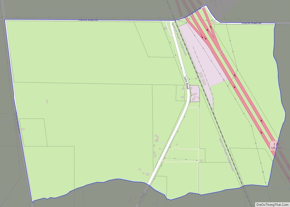
Online Interactive Map
Click on ![]() to view map in "full screen" mode.
to view map in "full screen" mode.
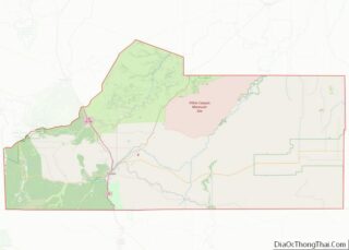
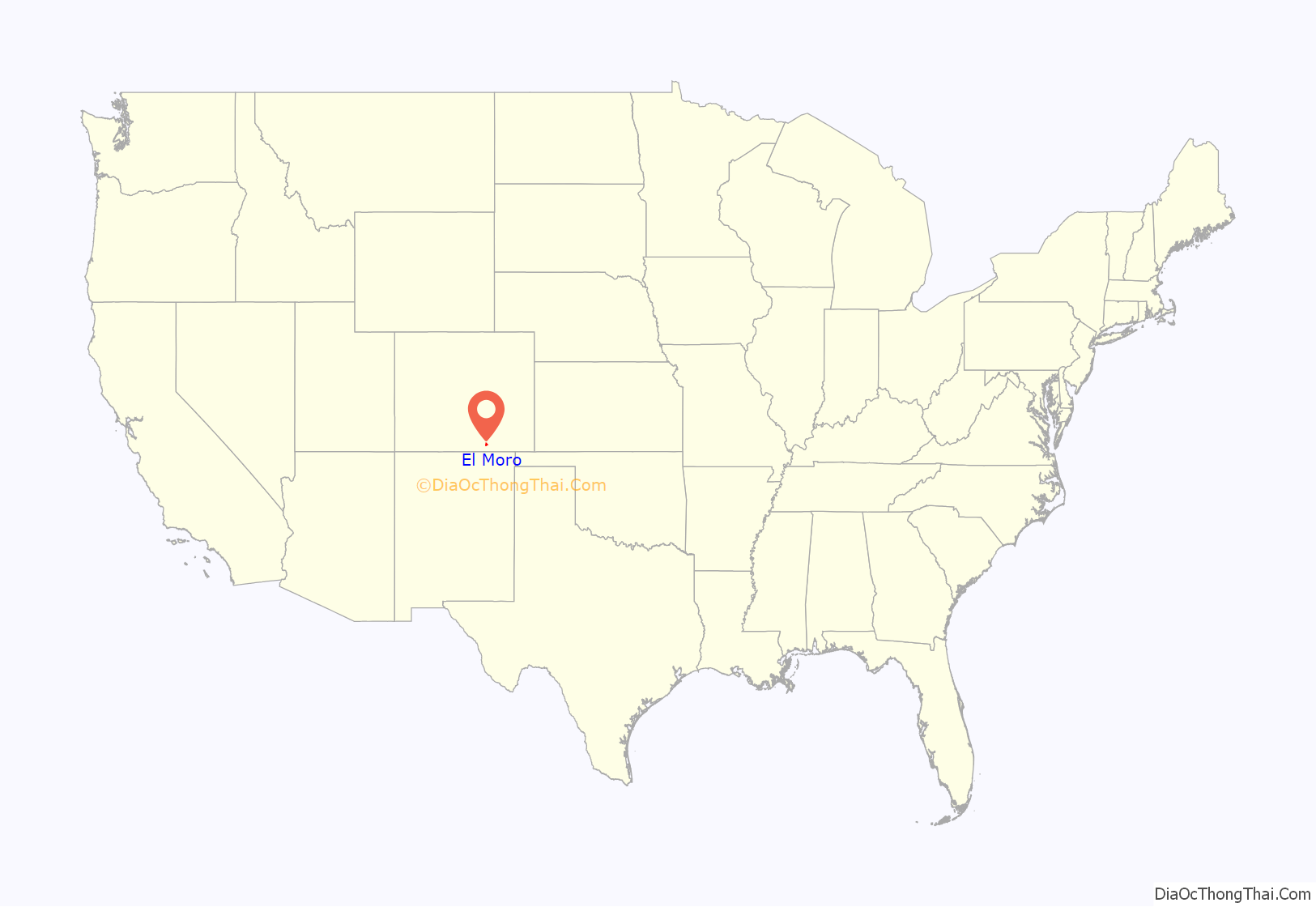
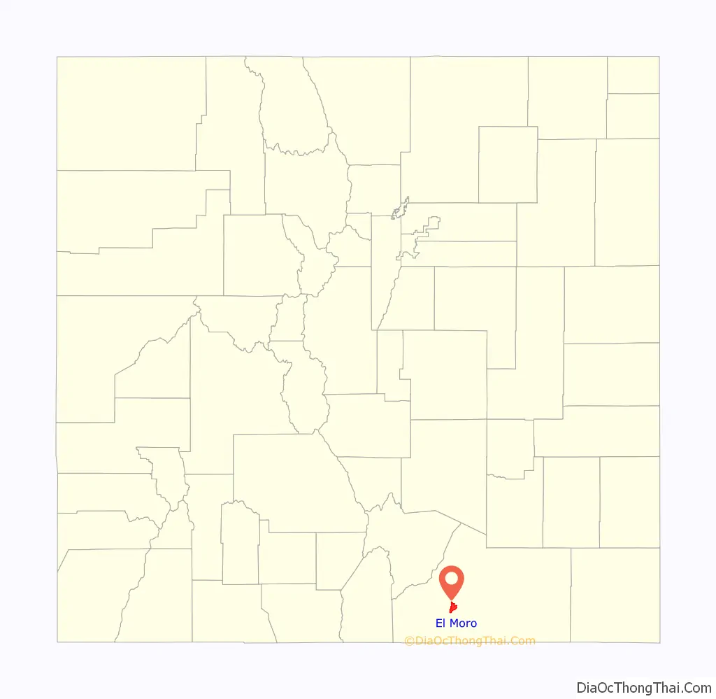
El Moro location map. Where is El Moro CDP?
History
The El Moro post office was established in 1876, and remained in operation until 1933. El Moro is a name derived from Spanish meaning “the Moor”. After the company was established in 1892, Colorado Fuel & Iron took over the El Moro operation. During its years of operation, 8,063,076 tons of coal were shipped from El Moro on CF&I’s narrow gauge railway, connecting them with the Colorado & Southern line.
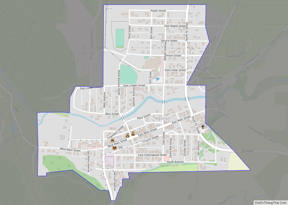
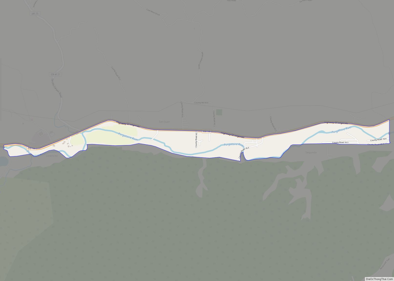
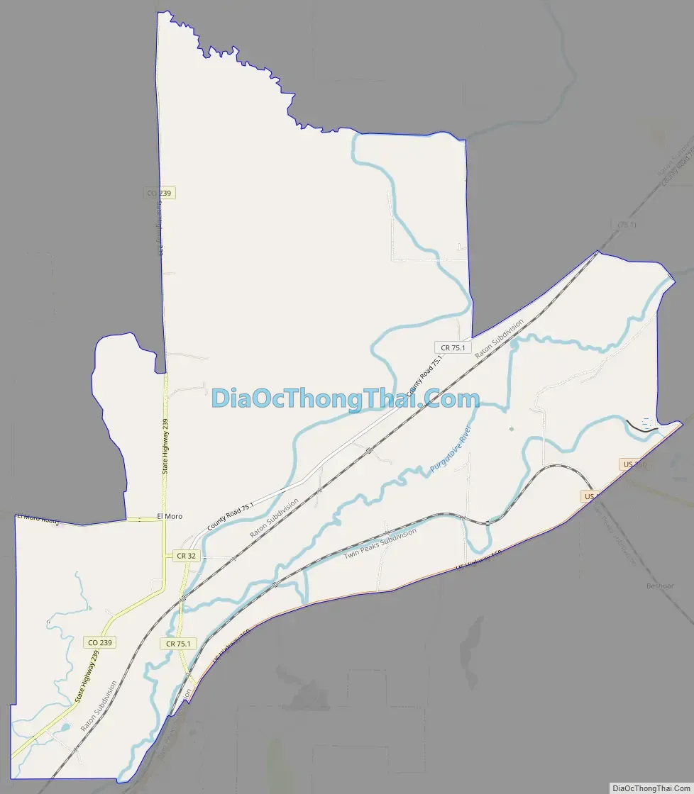
El Moro Road Map
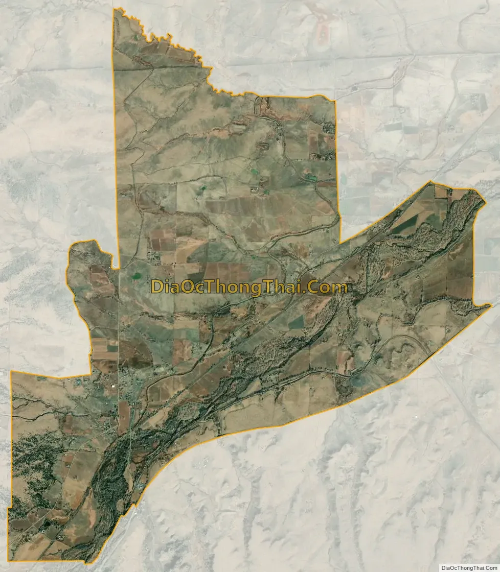
El Moro city Satellite Map
Geography
El Moro is in west-central Las Animas County, bordering the northeast side of the city of Trinidad, the county seat. U.S. Route 160 runs along the southeast edge of the CDP, leading southwest 3.5 miles (5.6 km) to the center of Trinidad and east 119 miles (192 km) to Springfield. U.S. Route 350 branches off from US 160 at the eastern edge of El Moro and leads northeast 73 miles (117 km) to La Junta. The city of Pueblo is 81 miles (130 km) to the north via Interstate 25, which runs just west of the El Moro CDP. The Purgatoire River runs through the community, flowing northeast toward the Arkansas River.
The El Moro CDP has an area of 7,114 acres (28.791 km), including 16 acres (0.066 km) of water.
See also
Map of Colorado State and its subdivision:- Adams
- Alamosa
- Arapahoe
- Archuleta
- Baca
- Bent
- Boulder
- Broomfield
- Chaffee
- Cheyenne
- Clear Creek
- Conejos
- Costilla
- Crowley
- Custer
- Delta
- Denver
- Dolores
- Douglas
- Eagle
- El Paso
- Elbert
- Fremont
- Garfield
- Gilpin
- Grand
- Gunnison
- Hinsdale
- Huerfano
- Jackson
- Jefferson
- Kiowa
- Kit Carson
- La Plata
- Lake
- Larimer
- Las Animas
- Lincoln
- Logan
- Mesa
- Mineral
- Moffat
- Montezuma
- Montrose
- Morgan
- Otero
- Ouray
- Park
- Phillips
- Pitkin
- Prowers
- Pueblo
- Rio Blanco
- Rio Grande
- Routt
- Saguache
- San Juan
- San Miguel
- Sedgwick
- Summit
- Teller
- Washington
- Weld
- Yuma
- Alabama
- Alaska
- Arizona
- Arkansas
- California
- Colorado
- Connecticut
- Delaware
- District of Columbia
- Florida
- Georgia
- Hawaii
- Idaho
- Illinois
- Indiana
- Iowa
- Kansas
- Kentucky
- Louisiana
- Maine
- Maryland
- Massachusetts
- Michigan
- Minnesota
- Mississippi
- Missouri
- Montana
- Nebraska
- Nevada
- New Hampshire
- New Jersey
- New Mexico
- New York
- North Carolina
- North Dakota
- Ohio
- Oklahoma
- Oregon
- Pennsylvania
- Rhode Island
- South Carolina
- South Dakota
- Tennessee
- Texas
- Utah
- Vermont
- Virginia
- Washington
- West Virginia
- Wisconsin
- Wyoming