The Town of Erie is a Statutory Town located in Weld and Boulder counties, Colorado, United States. The town population was 30,038 at the 2020 United States Census, a +65.64% increase since the 2010 United States Census. At the 2020 census, 17,387 (58%) Erie residents lived in Weld County and 12,651 (42%) lived in Boulder County. Erie is a part of the Denver-Aurora, CO Combined Statistical Area and the Front Range Urban Corridor.
Erie is located just west of Interstate 25, with easy access to Interstate 70, Denver International Airport and Colorado’s entire Front Range. Erie’s Planning Area spans 48 square miles (120 km), extending from the north side of State Highway 52 south to State Highway 7, and between US 287 on the west and Interstate 25 to the east. Erie is approximately 35 minutes from Denver International Airport, 25 minutes from Denver and 20 minutes from Boulder.
The town was named after Erie, Pennsylvania, the former home of early settler Richard Van Valkenburg.
| Name: | Erie town |
|---|---|
| LSAD Code: | 43 |
| LSAD Description: | town (suffix) |
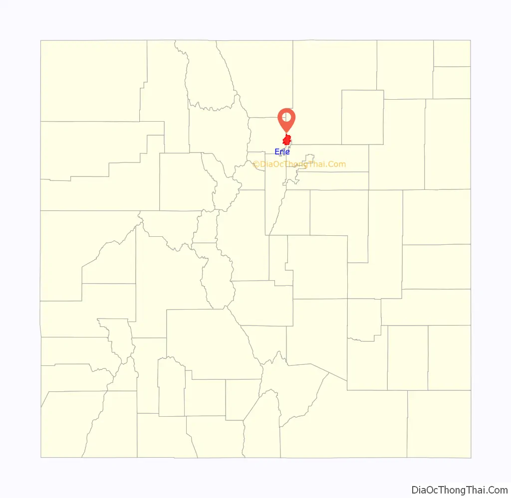
| State: | Colorado |
| County: | Boulder County, Weld County |
| Incorporated: | November 16, 1874 |
| Elevation: | 5,130 ft (1,564 m) |
| Total Area: | 19.838 sq mi (51.379 km²) |
| Land Area: | 19.737 sq mi (51.118 km²) |
| Water Area: | 0.101 sq mi (0.261 km²) |
| Total Population: | 30,038 |
| Population Density: | 1,500/sq mi (580/km²) |
| ZIP code: | 80514 & 80516 |
| Area code: | Both 303 and 720 |
| FIPS code: | 0824950 |
| GNISfeature ID: | 0178731 |
| Website: | www.erieco.gov |
Online Interactive Map
Click on ![]() to view map in "full screen" mode.
to view map in "full screen" mode.
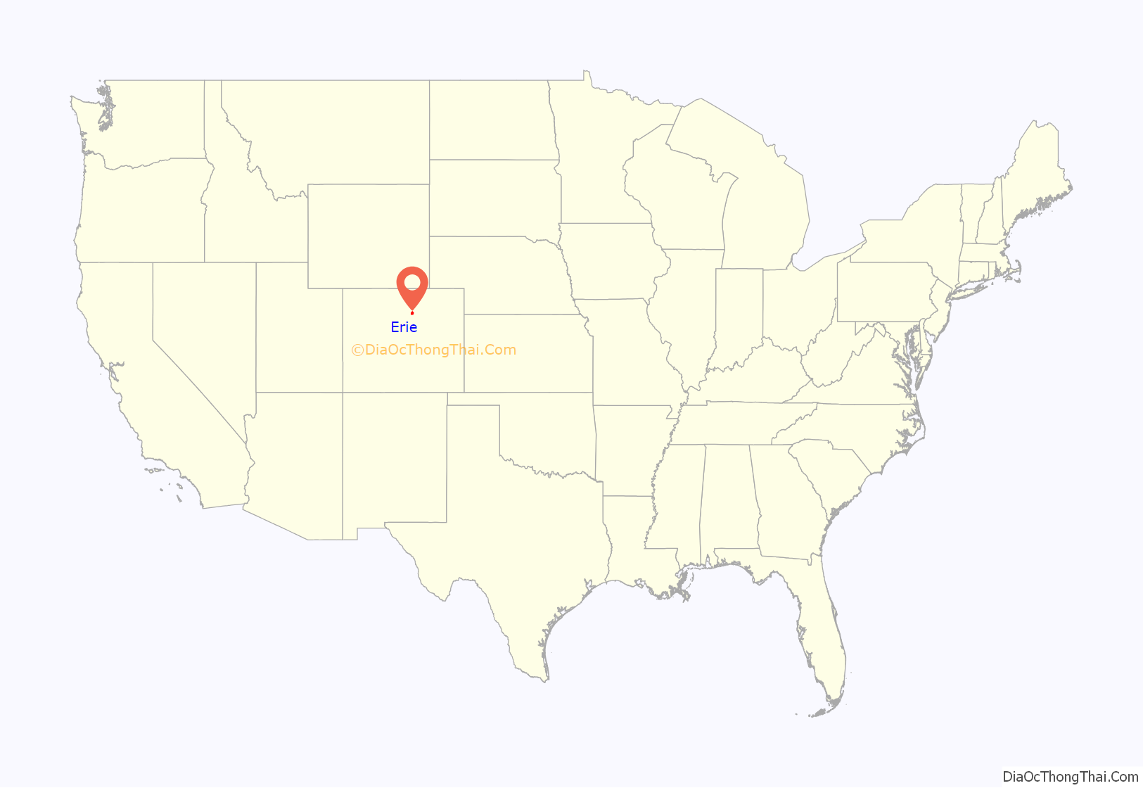
Erie location map. Where is Erie town?
History
Although it was settled and named in 1867, Erie was not officially incorporated until November 16, 1874. The first board of trustees consisted of five permanent and prominent members of the community; George Meller, Richard Van Valkenburg, John T. Williams, Joseph J. Wharton and John A. Rowe. Erie was unique among local coal mining towns because the local coal miners actually owned land or houses in town, instead of setting up temporary camps.
Coal was discovered in the region in the 1860s, and by 1870, railway service was established by the Denver-Pacific Spur Railroad. In 1871, the Denver & Boulder Valley Railroad was built through the area, connecting Boulder and Brighton. The railroad made it much easier to transport coal to the surrounding communities and to Denver, helping the town grow quickly. Although the locals were mining coal in the surrounding area starting in the 1860s, the first official mine in Erie opened in 1876; operated by Ira Austin.
The first school was established in 1874, with 33 students enrolling. The first school building was erected in 1881, with 100 students enrolled. In 1907, the school was replaced by the larger brick Lincoln School, which soon became inadequate due to the town’s growth, and four new rooms had to be added in 1920. The over crowding was alleviated in 1929, with the construction of the new high school. Eventually, the Lincoln School was abandoned all together, and a new elementary school was constructed in 1966.
The first church was established in 1883, the Welsh Presbyterian Church, with services conducted in Welsh. By 1888, there was a United Methodist Church and in 1898, the St. Scholasticas Catholic Church was dedicated. In 1884, the first newspaper was founded by Charles D. Bell; called the Erie-Canfield Independent, it continued publishing until 1896. The Erie Herald was established in 1907 and published for far longer than other short lived newspapers, serving the community until 1948.
Erie was one of the only “wet” towns in the area and by 1895, boasted eleven saloons on Briggs Street. This resulted in the need for a jail, constructed in 1876, and a constable. The earliest known constable in Erie was B.C. “Bud” Pitchford. Erie was hit by major floods in 1890, 1921, and 1972. The floods devastated the town, and a dike was built around nearby Coal Creek after the 1972 flood. Erie was also hard-hit by the Panic of 1893 and the Great Depression, the latter of which led to a decline in coal output. Demand for coal dropped after World War II, and most of the mines in the Erie area were closed by 1960, with the Eagle Mine closing in 1978.
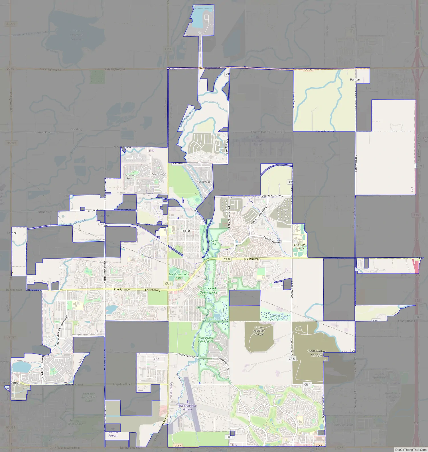
Erie Road Map
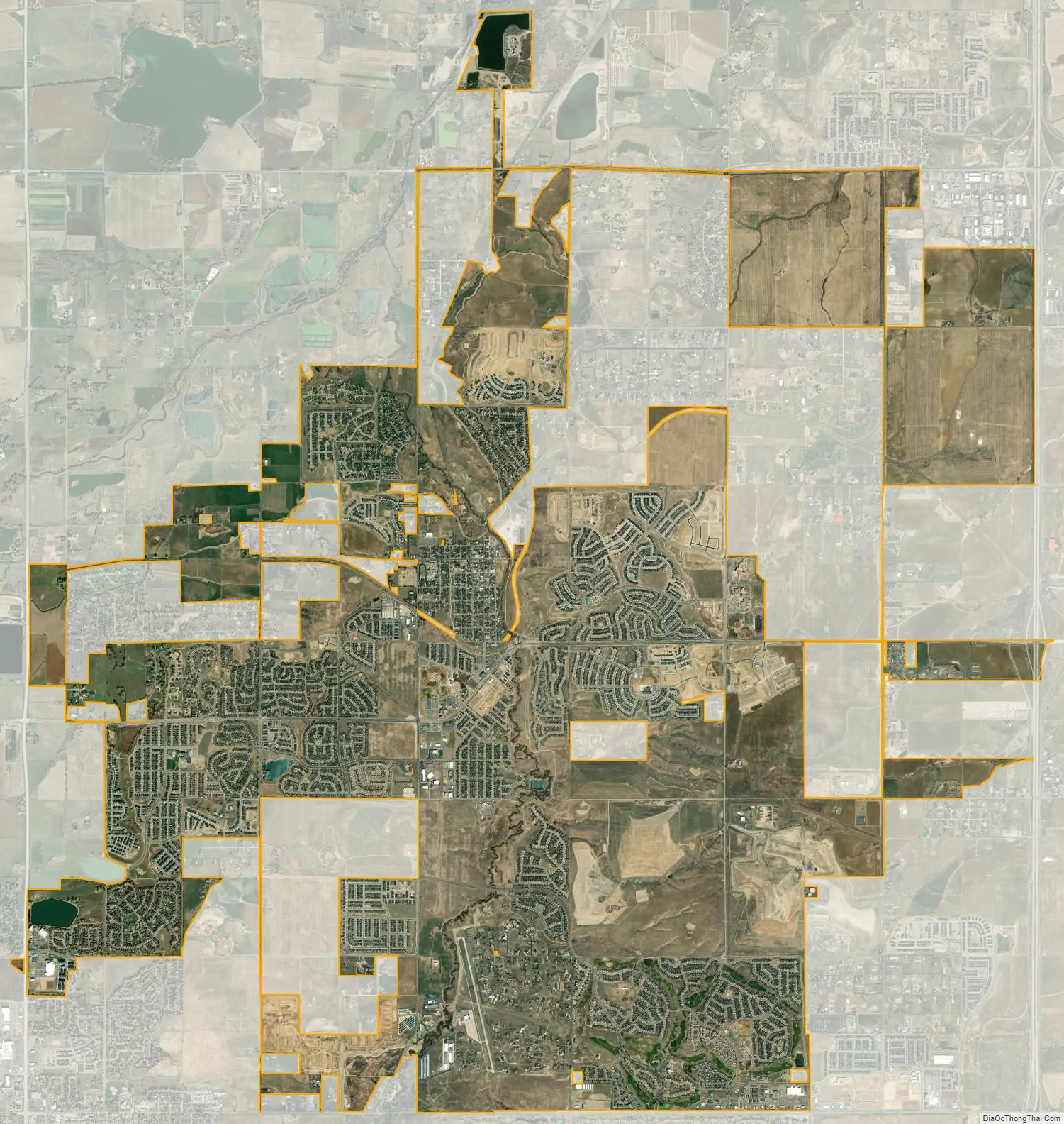
Erie city Satellite Map
Geography
Erie is located in the southwest corner of Weld County, at 40°2′25″N 105°3′28″W / 40.04028°N 105.05778°W / 40.04028; -105.05778 and extends west into eastern Boulder County. It is bordered to the south by the city of Broomfield and to the southwest by the city of Lafayette. Interstate 25 forms part of the eastern border of the town, leading south 22 miles (35 km) to downtown Denver and north 41 miles (66 km) to Fort Collins. Erie is served by Exit 232 off I-25.
At the 2020 United States Census, the town had a total area of 12,696 acres (51.379 km) including 64 acres (0.261 km) of water.
See also
Map of Colorado State and its subdivision:- Adams
- Alamosa
- Arapahoe
- Archuleta
- Baca
- Bent
- Boulder
- Broomfield
- Chaffee
- Cheyenne
- Clear Creek
- Conejos
- Costilla
- Crowley
- Custer
- Delta
- Denver
- Dolores
- Douglas
- Eagle
- El Paso
- Elbert
- Fremont
- Garfield
- Gilpin
- Grand
- Gunnison
- Hinsdale
- Huerfano
- Jackson
- Jefferson
- Kiowa
- Kit Carson
- La Plata
- Lake
- Larimer
- Las Animas
- Lincoln
- Logan
- Mesa
- Mineral
- Moffat
- Montezuma
- Montrose
- Morgan
- Otero
- Ouray
- Park
- Phillips
- Pitkin
- Prowers
- Pueblo
- Rio Blanco
- Rio Grande
- Routt
- Saguache
- San Juan
- San Miguel
- Sedgwick
- Summit
- Teller
- Washington
- Weld
- Yuma
- Alabama
- Alaska
- Arizona
- Arkansas
- California
- Colorado
- Connecticut
- Delaware
- District of Columbia
- Florida
- Georgia
- Hawaii
- Idaho
- Illinois
- Indiana
- Iowa
- Kansas
- Kentucky
- Louisiana
- Maine
- Maryland
- Massachusetts
- Michigan
- Minnesota
- Mississippi
- Missouri
- Montana
- Nebraska
- Nevada
- New Hampshire
- New Jersey
- New Mexico
- New York
- North Carolina
- North Dakota
- Ohio
- Oklahoma
- Oregon
- Pennsylvania
- Rhode Island
- South Carolina
- South Dakota
- Tennessee
- Texas
- Utah
- Vermont
- Virginia
- Washington
- West Virginia
- Wisconsin
- Wyoming


