Wellington is a statutory town in Larimer County, Colorado, United States. The population was 11,047 at the 2020 census.
| Name: | Wellington town |
|---|---|
| LSAD Code: | 43 |
| LSAD Description: | town (suffix) |
| State: | Colorado |
| County: | Larimer County |
| Founded: | 1902 |
| Incorporated: | November 10, 1905 |
| Elevation: | 5,200 ft (1,585 m) |
| Total Area: | 3.63 sq mi (9.41 km²) |
| Land Area: | 3.63 sq mi (9.40 km²) |
| Water Area: | 0.00 sq mi (0.01 km²) 0.0% |
| Total Population: | 11,047 |
| Population Density: | 3,000/sq mi (1,200/km²) |
| ZIP code: | 80549 |
| Area code: | 970 |
| FIPS code: | 0883230 |
| GNISfeature ID: | 0202441 |
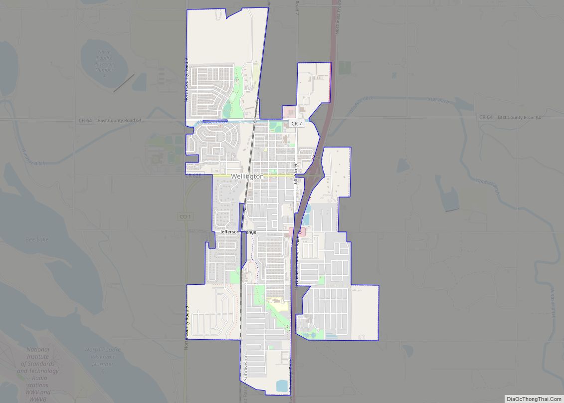
Online Interactive Map
Click on ![]() to view map in "full screen" mode.
to view map in "full screen" mode.
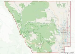
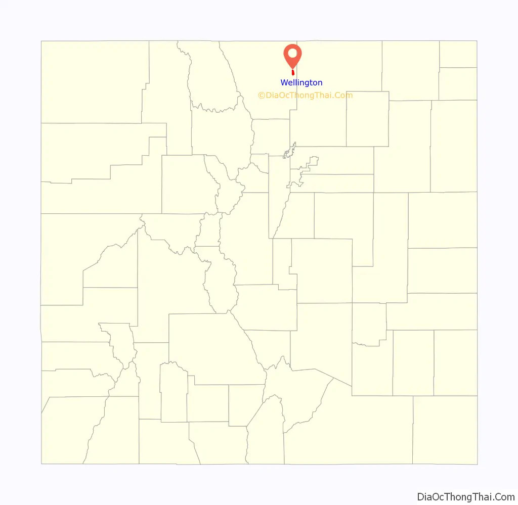
Wellington location map. Where is Wellington town?

History
Founded in 1902, incorporated in 1905, and named for C. L. Wellington (an employee of the Colorado and Southern Railroad). U.S. Supreme Court Justice Byron White lived in Wellington as a child. He made a point of returning to Wellington on an annual basis for his high school reunions up until 1999 when his physical health worsened significantly.
In the early 20th century, especially during the years of prohibition, Wellington doubled as a place to drink and a service town for drivers commuting from Cheyenne to Fort Collins and vice versa. The town, more or less, sustained a population of 500 throughout the century which proceeded to build homes, restaurants, churches, and various other elements of small-town life.
In 2000, woolly mammoth remains were discovered by a construction crew while digging home foundations. Colorado State University sent a team to carefully excavate and preserve the bones of the extinct animals; Wellington residents watched attentively. Unfortunately, upon hoisting the remains out of the excavation site the tusks crumbled inside of the protective forms that were previously built around them. Rear molars and parts of the skull of the mammoth are housed at CSU after being donated by the Burrus family (the developers of the project), who also kept molars of the animal. The subdivision where the bones were found named one of its streets in remembrance of the excitement.
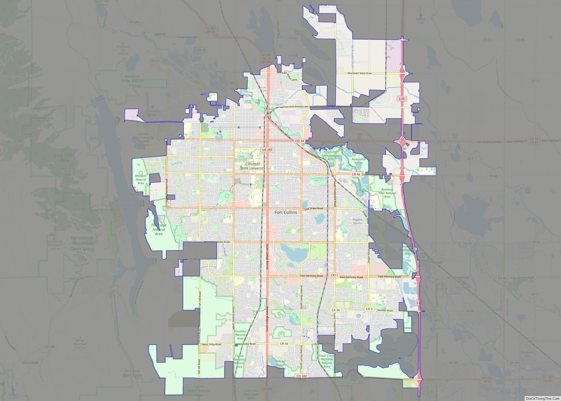
Though population remained steady throughout the 20th century, Wellington experienced moderate growth in the 1990s and 2000s, rendering it a sort of bedroom community for the city of Fort Collins, which lies 10 miles to the South.
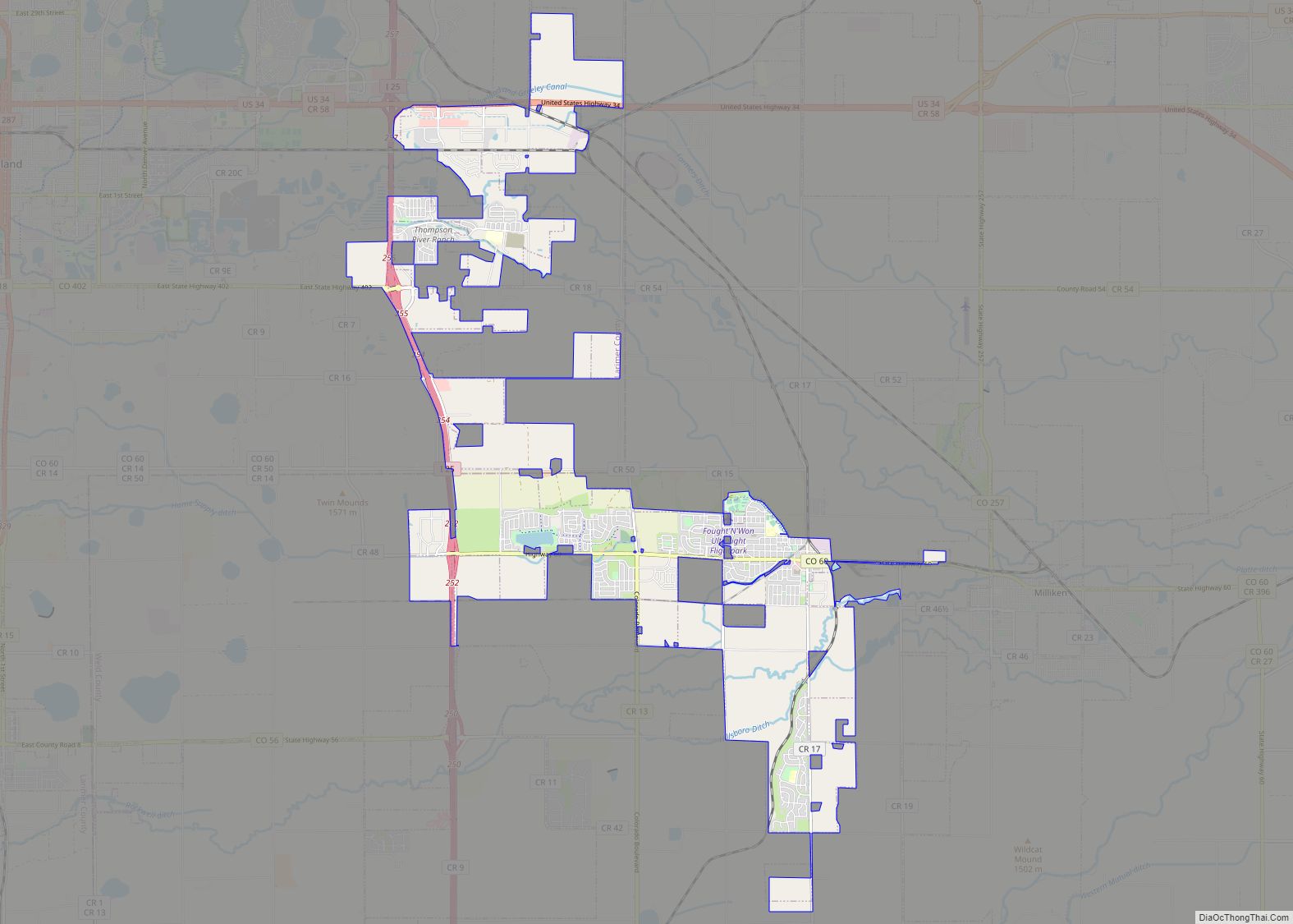
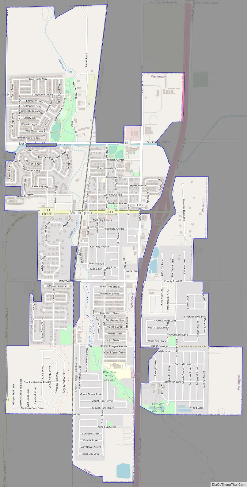
Wellington Road Map
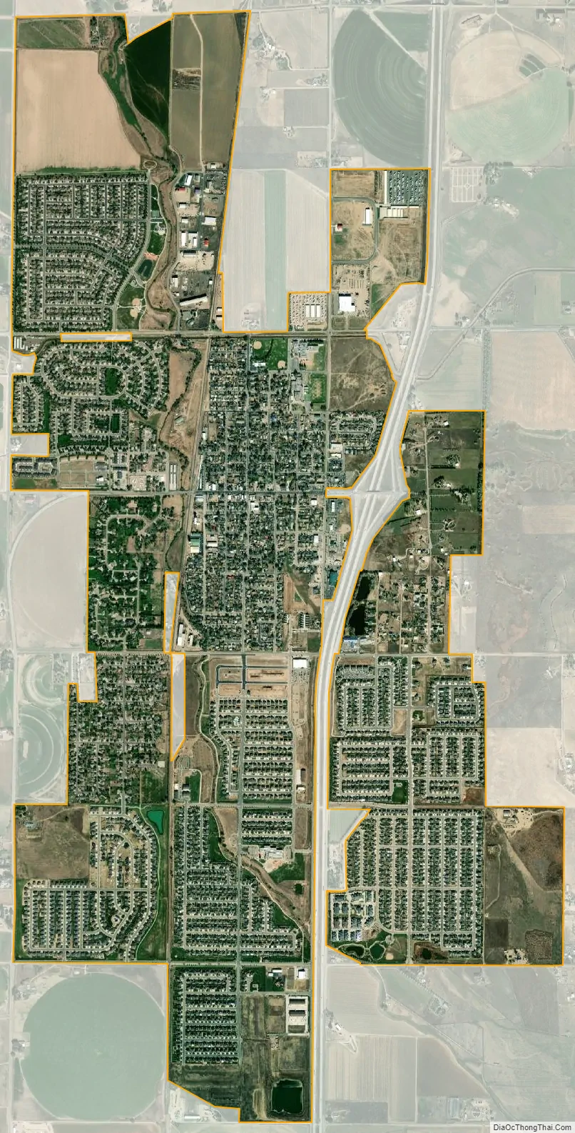
Wellington city Satellite Map
Geography
Wellington is located at 40°42′8″N 105°0′20″W / 40.70222°N 105.00556°W / 40.70222; -105.00556 (40.702324, -105.005497).
According to the United States Census Bureau, the town has a total area of 1.8 square miles (4.7 km), all of it land.
Wellington is I-25’s northernmost Colorado town.
See also
Map of Colorado State and its subdivision:- Adams
- Alamosa
- Arapahoe
- Archuleta
- Baca
- Bent
- Boulder
- Broomfield
- Chaffee
- Cheyenne
- Clear Creek
- Conejos
- Costilla
- Crowley
- Custer
- Delta
- Denver
- Dolores
- Douglas
- Eagle
- El Paso
- Elbert
- Fremont
- Garfield
- Gilpin
- Grand
- Gunnison
- Hinsdale
- Huerfano
- Jackson
- Jefferson
- Kiowa
- Kit Carson
- La Plata
- Lake
- Larimer
- Las Animas
- Lincoln
- Logan
- Mesa
- Mineral
- Moffat
- Montezuma
- Montrose
- Morgan
- Otero
- Ouray
- Park
- Phillips
- Pitkin
- Prowers
- Pueblo
- Rio Blanco
- Rio Grande
- Routt
- Saguache
- San Juan
- San Miguel
- Sedgwick
- Summit
- Teller
- Washington
- Weld
- Yuma
- Alabama
- Alaska
- Arizona
- Arkansas
- California
- Colorado
- Connecticut
- Delaware
- District of Columbia
- Florida
- Georgia
- Hawaii
- Idaho
- Illinois
- Indiana
- Iowa
- Kansas
- Kentucky
- Louisiana
- Maine
- Maryland
- Massachusetts
- Michigan
- Minnesota
- Mississippi
- Missouri
- Montana
- Nebraska
- Nevada
- New Hampshire
- New Jersey
- New Mexico
- New York
- North Carolina
- North Dakota
- Ohio
- Oklahoma
- Oregon
- Pennsylvania
- Rhode Island
- South Carolina
- South Dakota
- Tennessee
- Texas
- Utah
- Vermont
- Virginia
- Washington
- West Virginia
- Wisconsin
- Wyoming