Crawfordsville is a city in Washington County, Iowa, United States. It is part of the Iowa City, Iowa Metropolitan Statistical Area. The population was 277 at the 2020 census.
| Name: | Crawfordsville city |
|---|---|
| LSAD Code: | 25 |
| LSAD Description: | city (suffix) |
| State: | Iowa |
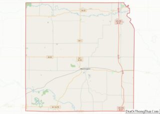
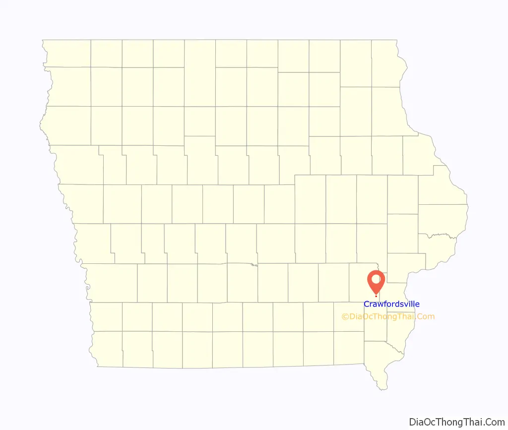
| County: | Washington County |
| Incorporated: | March 26, 1891 |
| Elevation: | 709 ft (216 m) |
| Total Area: | 0.37 sq mi (0.95 km²) |
| Land Area: | 0.37 sq mi (0.95 km²) |
| Water Area: | 0.00 sq mi (0.00 km²) |
| Total Population: | 277 |
| Population Density: | 754.77/sq mi (291.05/km²) |
| ZIP code: | 52621 |
| Area code: | 319 |
| FIPS code: | 1917130 |
| GNISfeature ID: | 0455707 |
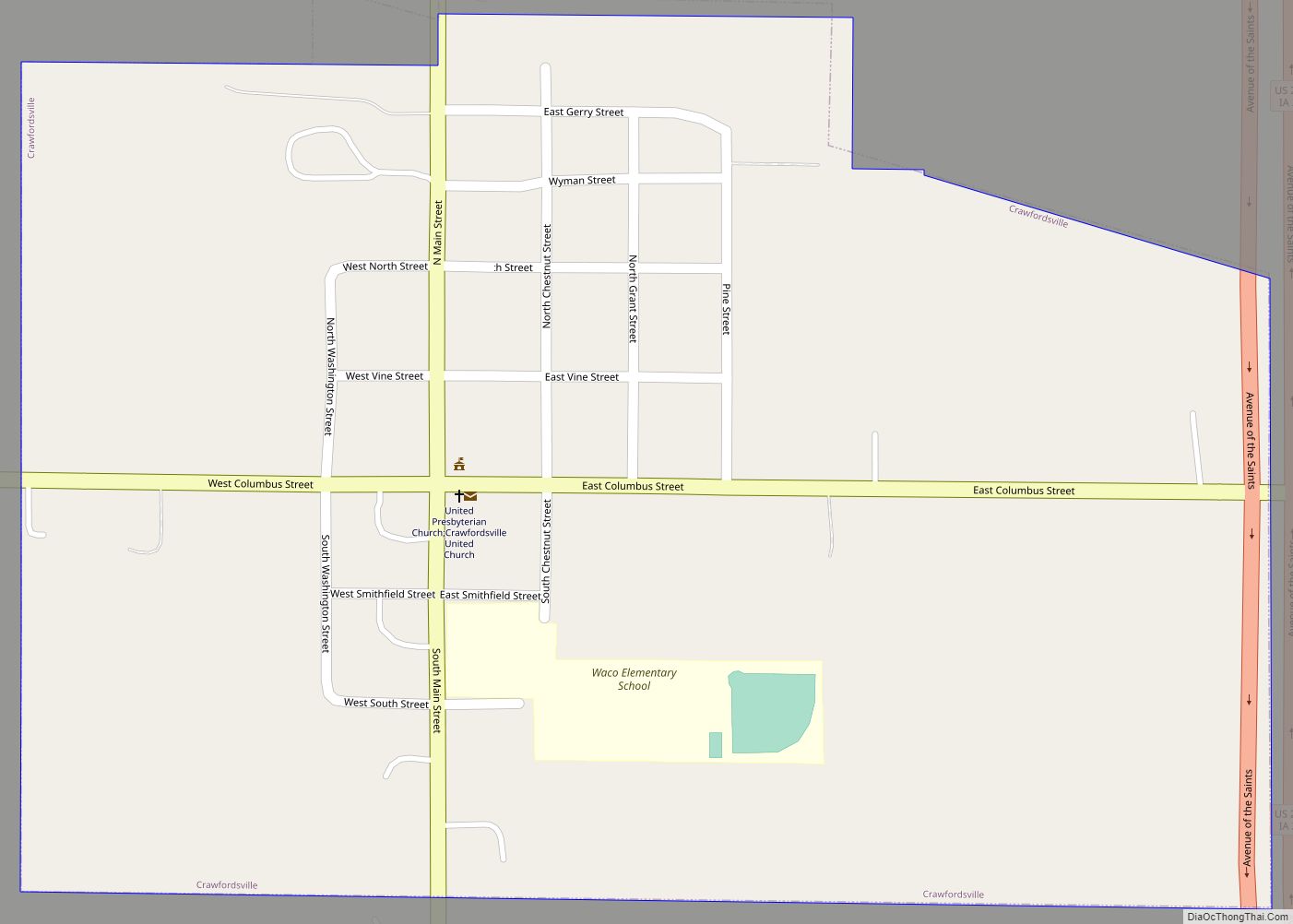
Online Interactive Map
Click on ![]() to view map in "full screen" mode.
to view map in "full screen" mode.
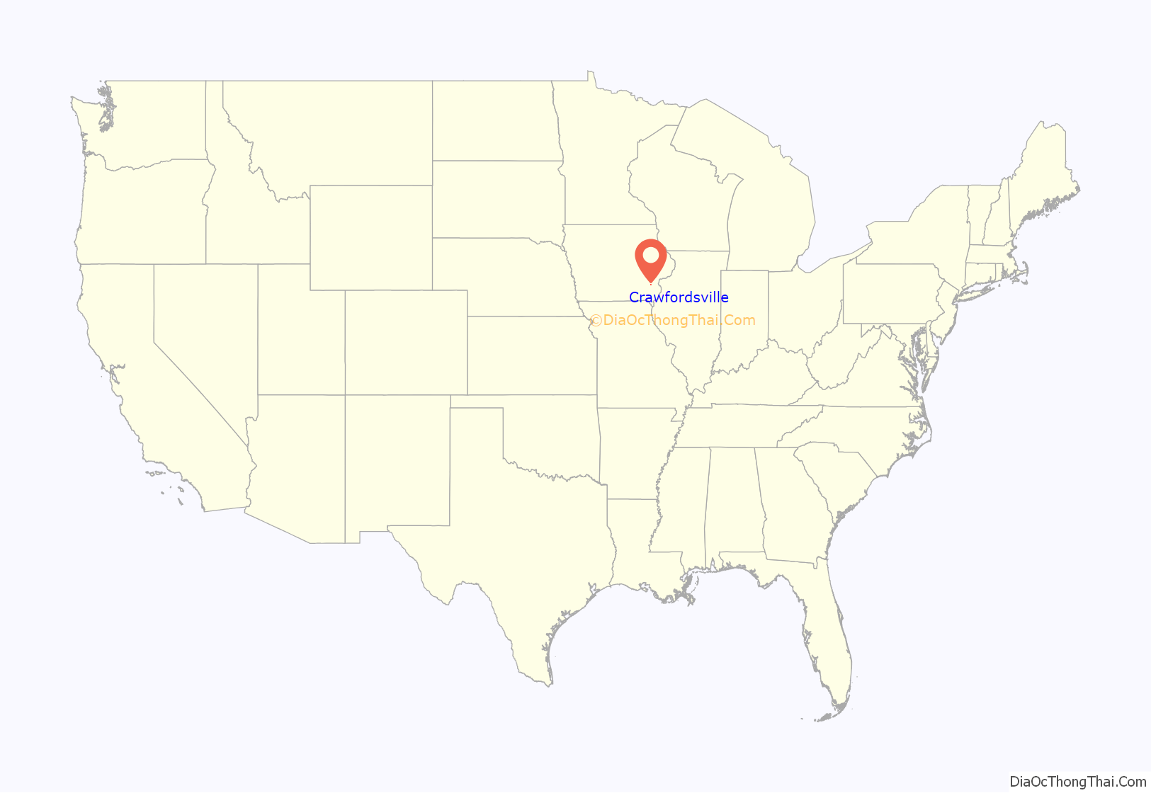
Crawfordsville location map. Where is Crawfordsville city?
History
Crawfordsville is named for the Crawford family of pioneer settlers.
The first private meeting of what would become the Republican Party came when Whig Party defectors met privately in Crawfordsville in February, 1854. The meeting was to lay the groundwork for the creation of a new political party. The first public meeting was held in Ripon, Wisconsin one month later.
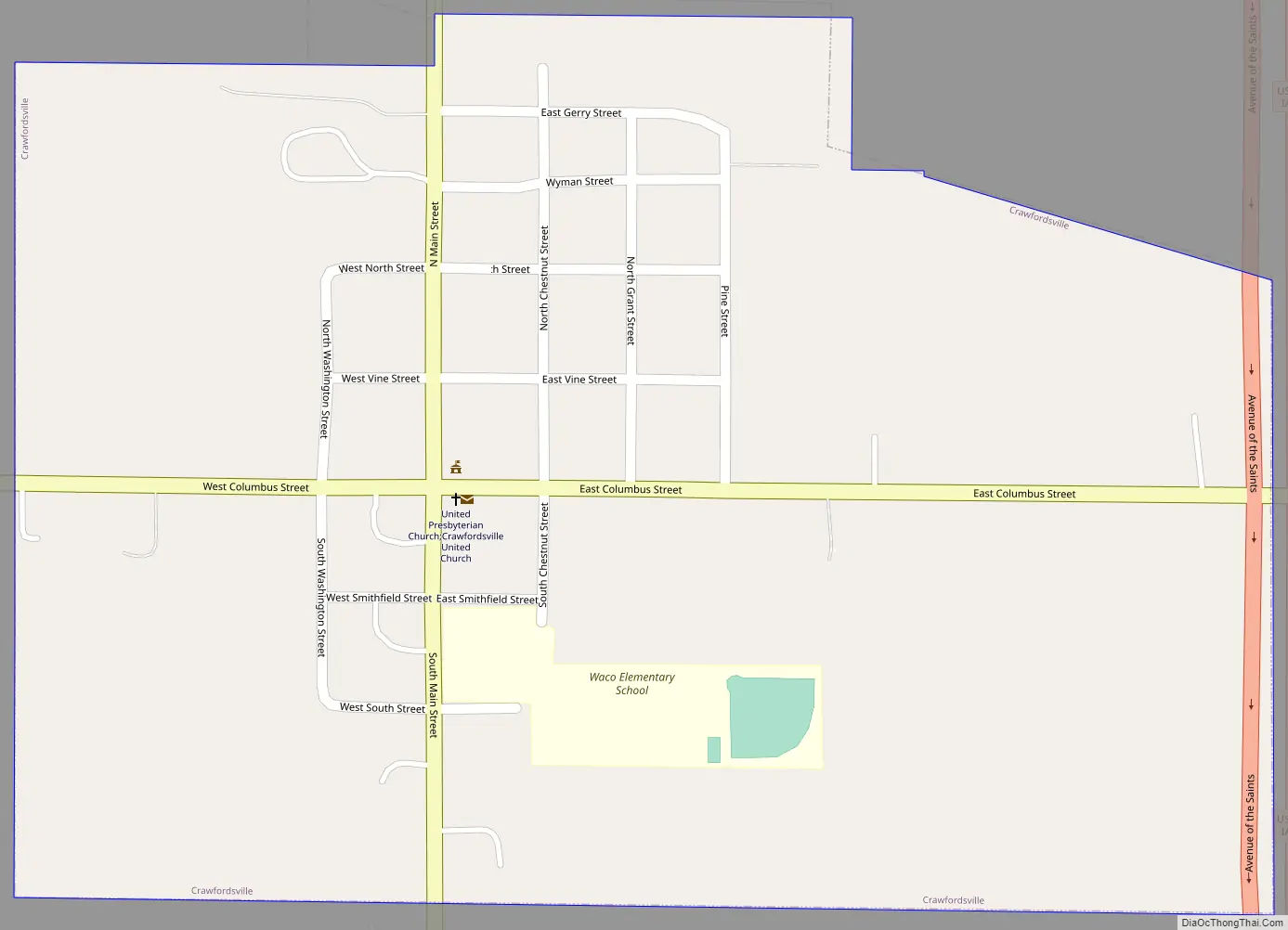
Crawfordsville Road Map
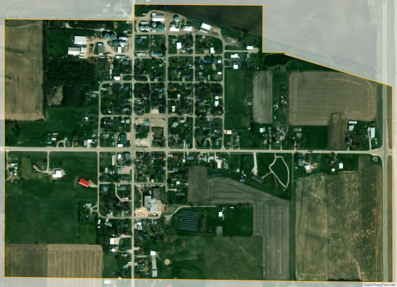
Crawfordsville city Satellite Map
Geography
Crawfordsville is located at 41°12′55″N 91°32′16″W / 41.21528°N 91.53778°W / 41.21528; -91.53778 (41.215393, -91.537844).
According to the United States Census Bureau, the city has a total area of 0.35 square miles (0.91 km), all of it land.
See also
Map of Iowa State and its subdivision:- Adair
- Adams
- Allamakee
- Appanoose
- Audubon
- Benton
- Black Hawk
- Boone
- Bremer
- Buchanan
- Buena Vista
- Butler
- Calhoun
- Carroll
- Cass
- Cedar
- Cerro Gordo
- Cherokee
- Chickasaw
- Clarke
- Clay
- Clayton
- Clinton
- Crawford
- Dallas
- Davis
- Decatur
- Delaware
- Des Moines
- Dickinson
- Dubuque
- Emmet
- Fayette
- Floyd
- Franklin
- Fremont
- Greene
- Grundy
- Guthrie
- Hamilton
- Hancock
- Hardin
- Harrison
- Henry
- Howard
- Humboldt
- Ida
- Iowa
- Jackson
- Jasper
- Jefferson
- Johnson
- Jones
- Keokuk
- Kossuth
- Lee
- Linn
- Louisa
- Lucas
- Lyon
- Madison
- Mahaska
- Marion
- Marshall
- Mills
- Mitchell
- Monona
- Monroe
- Montgomery
- Muscatine
- O'Brien
- Osceola
- Page
- Palo Alto
- Plymouth
- Pocahontas
- Polk
- Pottawattamie
- Poweshiek
- Ringgold
- Sac
- Scott
- Shelby
- Sioux
- Story
- Tama
- Taylor
- Union
- Van Buren
- Wapello
- Warren
- Washington
- Wayne
- Webster
- Winnebago
- Winneshiek
- Woodbury
- Worth
- Wright
- Alabama
- Alaska
- Arizona
- Arkansas
- California
- Colorado
- Connecticut
- Delaware
- District of Columbia
- Florida
- Georgia
- Hawaii
- Idaho
- Illinois
- Indiana
- Iowa
- Kansas
- Kentucky
- Louisiana
- Maine
- Maryland
- Massachusetts
- Michigan
- Minnesota
- Mississippi
- Missouri
- Montana
- Nebraska
- Nevada
- New Hampshire
- New Jersey
- New Mexico
- New York
- North Carolina
- North Dakota
- Ohio
- Oklahoma
- Oregon
- Pennsylvania
- Rhode Island
- South Carolina
- South Dakota
- Tennessee
- Texas
- Utah
- Vermont
- Virginia
- Washington
- West Virginia
- Wisconsin
- Wyoming