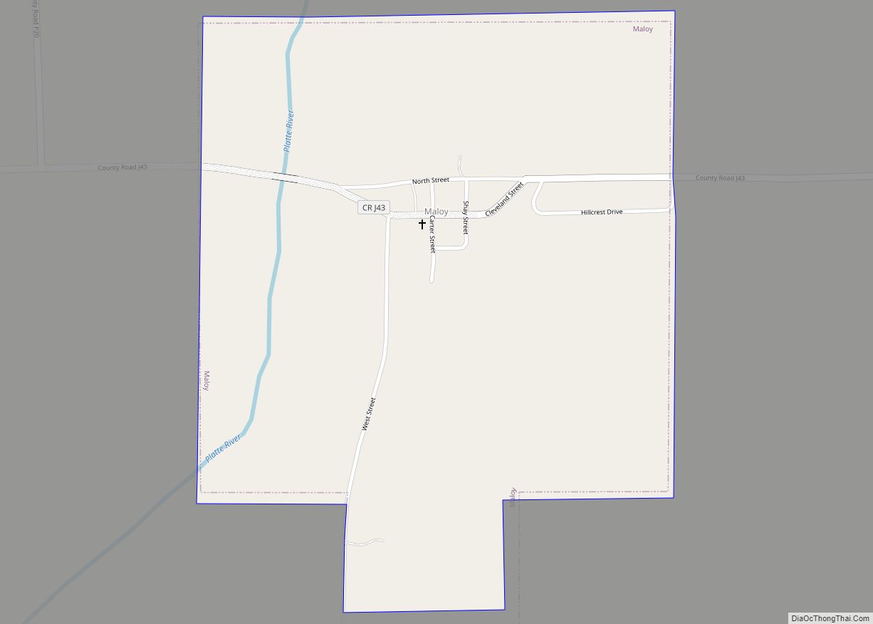
Maloy is a city in southwest Ringgold County, Iowa, United States, along the Platte River. The population was 22 at the time of the 2020 census.
| Name: | Maloy city |
|---|---|
| LSAD Code: | 25 |
| LSAD Description: | city (suffix) |
| State: | Iowa |
| County: | Ringgold County |
| Elevation: | 1,106 ft (337 m) |
| Total Area: | 0.63 sq mi (1.62 km²) |
| Land Area: | 0.62 sq mi (1.61 km²) |
| Water Area: | 0.01 sq mi (0.01 km²) |
| Total Population: | 22 |
| Population Density: | 35.43/sq mi (13.68/km²) |
| FIPS code: | 1948675 |
| GNISfeature ID: | 0458746 |
Online Interactive Map
Click on ![]() to view map in "full screen" mode.
to view map in "full screen" mode.
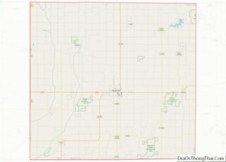
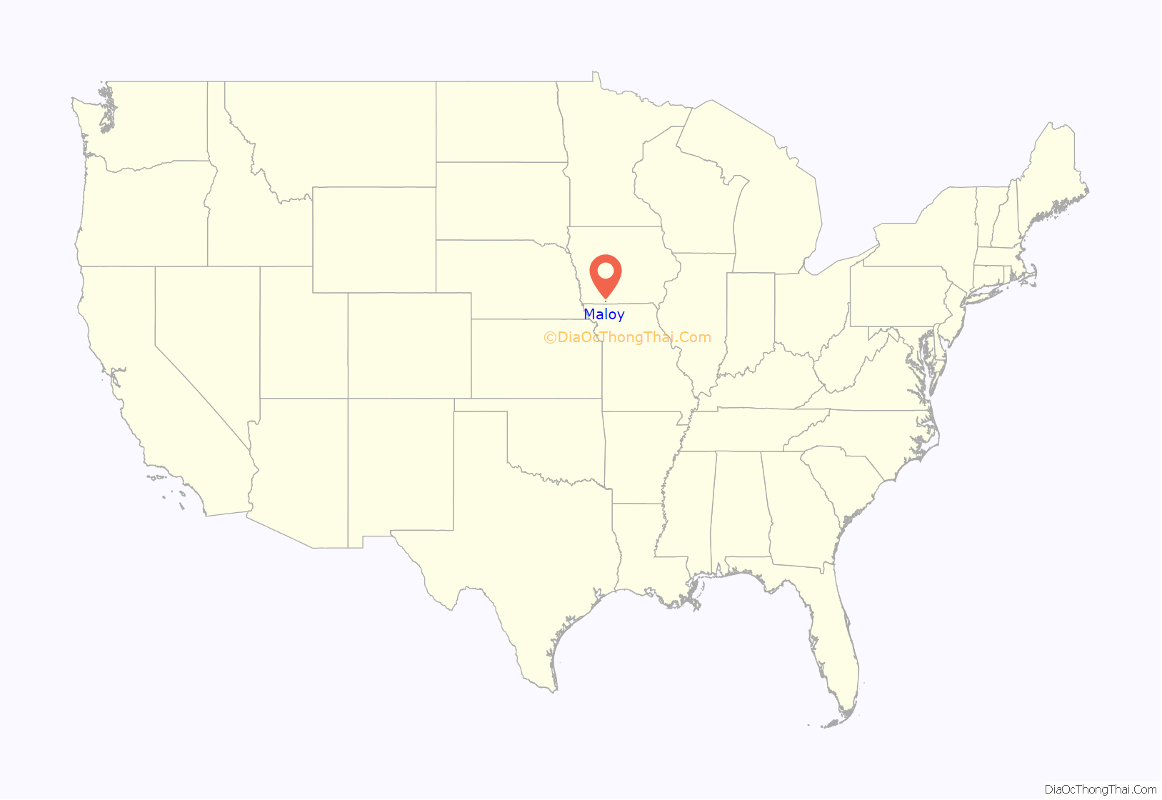
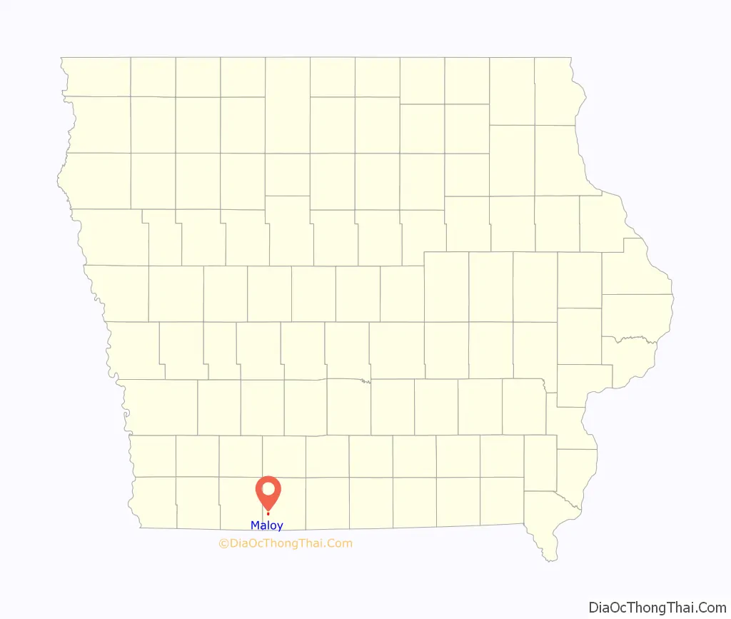
Maloy location map. Where is Maloy city?
History
Settlement of the western part of Ringgold County began in the 1850s. Maloy was platted in 1887, in the same year as the railroad arrived. Maloy was incorporated as a city in 1901. In 1917, the two-story brick Maloy High School was built; after serving from 1920 to 1952, it became an elementary school in the Mount Ayr Community School District.
A major fire on June 17, 1931, razed the Catholic Church, five businesses, a house, and a barn. The school closed in 1972 and was torn down in 1987. The railroad, which once offered both freight and passenger service, was dismantled in 1985.
Today, the city is governed by a mayor and three-member city council.
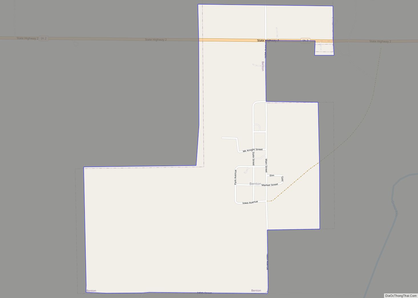
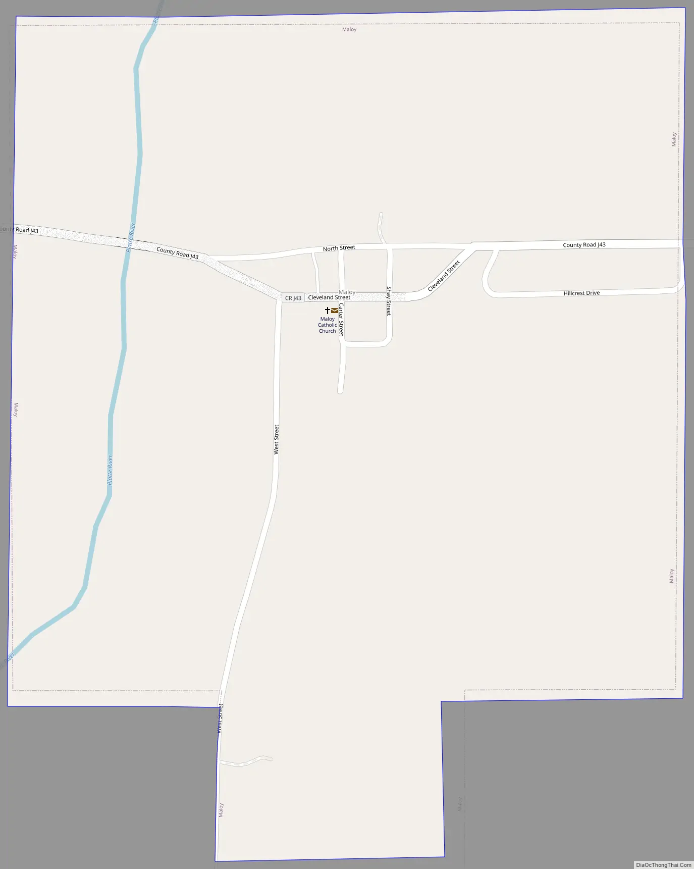
Maloy Road Map
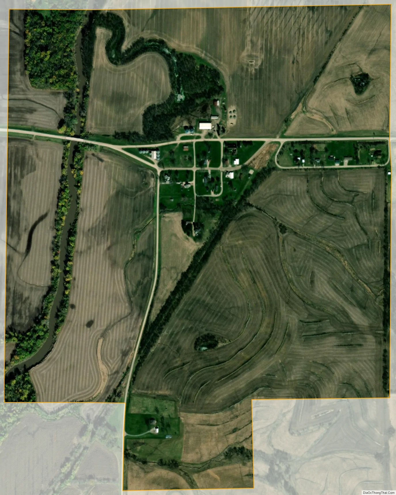
Maloy city Satellite Map
Geography
Maloy is on Iowa County Road J43 approximately ten miles west-southwest of Mount Ayr. The Platte River flows past the west side of the community.
According to the United States Census Bureau, the city has a total area of 0.62 square miles (1.61 km), all land.
See also
Map of Iowa State and its subdivision:- Adair
- Adams
- Allamakee
- Appanoose
- Audubon
- Benton
- Black Hawk
- Boone
- Bremer
- Buchanan
- Buena Vista
- Butler
- Calhoun
- Carroll
- Cass
- Cedar
- Cerro Gordo
- Cherokee
- Chickasaw
- Clarke
- Clay
- Clayton
- Clinton
- Crawford
- Dallas
- Davis
- Decatur
- Delaware
- Des Moines
- Dickinson
- Dubuque
- Emmet
- Fayette
- Floyd
- Franklin
- Fremont
- Greene
- Grundy
- Guthrie
- Hamilton
- Hancock
- Hardin
- Harrison
- Henry
- Howard
- Humboldt
- Ida
- Iowa
- Jackson
- Jasper
- Jefferson
- Johnson
- Jones
- Keokuk
- Kossuth
- Lee
- Linn
- Louisa
- Lucas
- Lyon
- Madison
- Mahaska
- Marion
- Marshall
- Mills
- Mitchell
- Monona
- Monroe
- Montgomery
- Muscatine
- O'Brien
- Osceola
- Page
- Palo Alto
- Plymouth
- Pocahontas
- Polk
- Pottawattamie
- Poweshiek
- Ringgold
- Sac
- Scott
- Shelby
- Sioux
- Story
- Tama
- Taylor
- Union
- Van Buren
- Wapello
- Warren
- Washington
- Wayne
- Webster
- Winnebago
- Winneshiek
- Woodbury
- Worth
- Wright
- Alabama
- Alaska
- Arizona
- Arkansas
- California
- Colorado
- Connecticut
- Delaware
- District of Columbia
- Florida
- Georgia
- Hawaii
- Idaho
- Illinois
- Indiana
- Iowa
- Kansas
- Kentucky
- Louisiana
- Maine
- Maryland
- Massachusetts
- Michigan
- Minnesota
- Mississippi
- Missouri
- Montana
- Nebraska
- Nevada
- New Hampshire
- New Jersey
- New Mexico
- New York
- North Carolina
- North Dakota
- Ohio
- Oklahoma
- Oregon
- Pennsylvania
- Rhode Island
- South Carolina
- South Dakota
- Tennessee
- Texas
- Utah
- Vermont
- Virginia
- Washington
- West Virginia
- Wisconsin
- Wyoming