Mason City is a city and the county seat of Cerro Gordo County, Iowa, United States. The population was 27,338 in the 2020 census, a decline from 29,172 in the 2000 census. The Mason City Micropolitan Statistical Area includes all of Cerro Gordo and Worth counties. It is commonly referred to as the “River City”, as the city grew up centered on the Winnebago River.
| Name: | Mason City city |
|---|---|
| LSAD Code: | 25 |
| LSAD Description: | city (suffix) |
| State: | Iowa |
| County: | Cerro Gordo County |
| Elevation: | 1,129 ft (344 m) |
| Total Area: | 28.16 sq mi (72.92 km²) |
| Land Area: | 27.86 sq mi (72.15 km²) |
| Water Area: | 0.30 sq mi (0.78 km²) |
| Total Population: | 27,338 |
| Population Density: | 981.40/sq mi (378.93/km²) |
| Area code: | 641 |
| FIPS code: | 1950160 |
| GNISfeature ID: | 0458840 |
| Website: | www.masoncity.net |
Online Interactive Map
Click on ![]() to view map in "full screen" mode.
to view map in "full screen" mode.
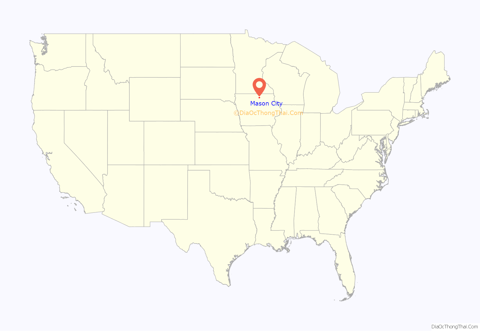
Mason City location map. Where is Mason City city?
History
The region around what would later be first called Shibboleth was a summer home to the Sioux and Winnebago nations. The first settlement that became Shibboleth was established in 1853 at the confluence of the Winnebago River and Calmus Creek. The town had several names: Shibboleth, Masonic Grove, and Masonville until Mason City was adopted in 1855, in honor of a founder’s son, Mason Long.
In 1854, John McMillin opened the first store, and Dr. Silas Card opened the first medical practice in the area. Lizzie Thompson established the first schoolhouse in a log cabin in 1856. The United States Post Office Department started service to the town in 1857. Mason City was named the county seat in 1858. In 1870, Mason City, Iowa was officially incorporated as a town with Darius B. Mason as the first mayor.
Musical heritage
Mason City is known for its musical heritage, consistently producing successful performers and educators. The city’s “favorite son,” Meredith Willson, grew up in Mason City and played in the Mason City Symphonic Band as a high school student. Willson’s crowning achievement was the famous stage musical The Music Man. Many of the characters in it were based on people Willson knew from his childhood in Mason City. And it also features the Parker’s Opera House.
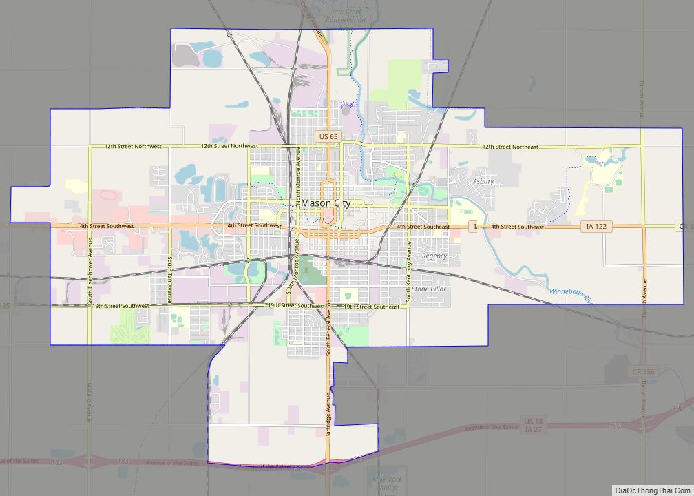
Mason City Road Map
Mason City city Satellite Map
Geography
According to the United States Census Bureau, the city has a total area of 28.10 square miles (72.78 km), of which 27.81 square miles (72.03 km) is land and 0.29 square miles (0.75 km) is water.
Climate
Mason City has a warm-summer humid continental climate (Köppen: Dfb), bordering closely on the hot-summer variant.
See also
Map of Iowa State and its subdivision:- Adair
- Adams
- Allamakee
- Appanoose
- Audubon
- Benton
- Black Hawk
- Boone
- Bremer
- Buchanan
- Buena Vista
- Butler
- Calhoun
- Carroll
- Cass
- Cedar
- Cerro Gordo
- Cherokee
- Chickasaw
- Clarke
- Clay
- Clayton
- Clinton
- Crawford
- Dallas
- Davis
- Decatur
- Delaware
- Des Moines
- Dickinson
- Dubuque
- Emmet
- Fayette
- Floyd
- Franklin
- Fremont
- Greene
- Grundy
- Guthrie
- Hamilton
- Hancock
- Hardin
- Harrison
- Henry
- Howard
- Humboldt
- Ida
- Iowa
- Jackson
- Jasper
- Jefferson
- Johnson
- Jones
- Keokuk
- Kossuth
- Lee
- Linn
- Louisa
- Lucas
- Lyon
- Madison
- Mahaska
- Marion
- Marshall
- Mills
- Mitchell
- Monona
- Monroe
- Montgomery
- Muscatine
- O'Brien
- Osceola
- Page
- Palo Alto
- Plymouth
- Pocahontas
- Polk
- Pottawattamie
- Poweshiek
- Ringgold
- Sac
- Scott
- Shelby
- Sioux
- Story
- Tama
- Taylor
- Union
- Van Buren
- Wapello
- Warren
- Washington
- Wayne
- Webster
- Winnebago
- Winneshiek
- Woodbury
- Worth
- Wright
- Alabama
- Alaska
- Arizona
- Arkansas
- California
- Colorado
- Connecticut
- Delaware
- District of Columbia
- Florida
- Georgia
- Hawaii
- Idaho
- Illinois
- Indiana
- Iowa
- Kansas
- Kentucky
- Louisiana
- Maine
- Maryland
- Massachusetts
- Michigan
- Minnesota
- Mississippi
- Missouri
- Montana
- Nebraska
- Nevada
- New Hampshire
- New Jersey
- New Mexico
- New York
- North Carolina
- North Dakota
- Ohio
- Oklahoma
- Oregon
- Pennsylvania
- Rhode Island
- South Carolina
- South Dakota
- Tennessee
- Texas
- Utah
- Vermont
- Virginia
- Washington
- West Virginia
- Wisconsin
- Wyoming
