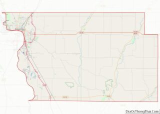
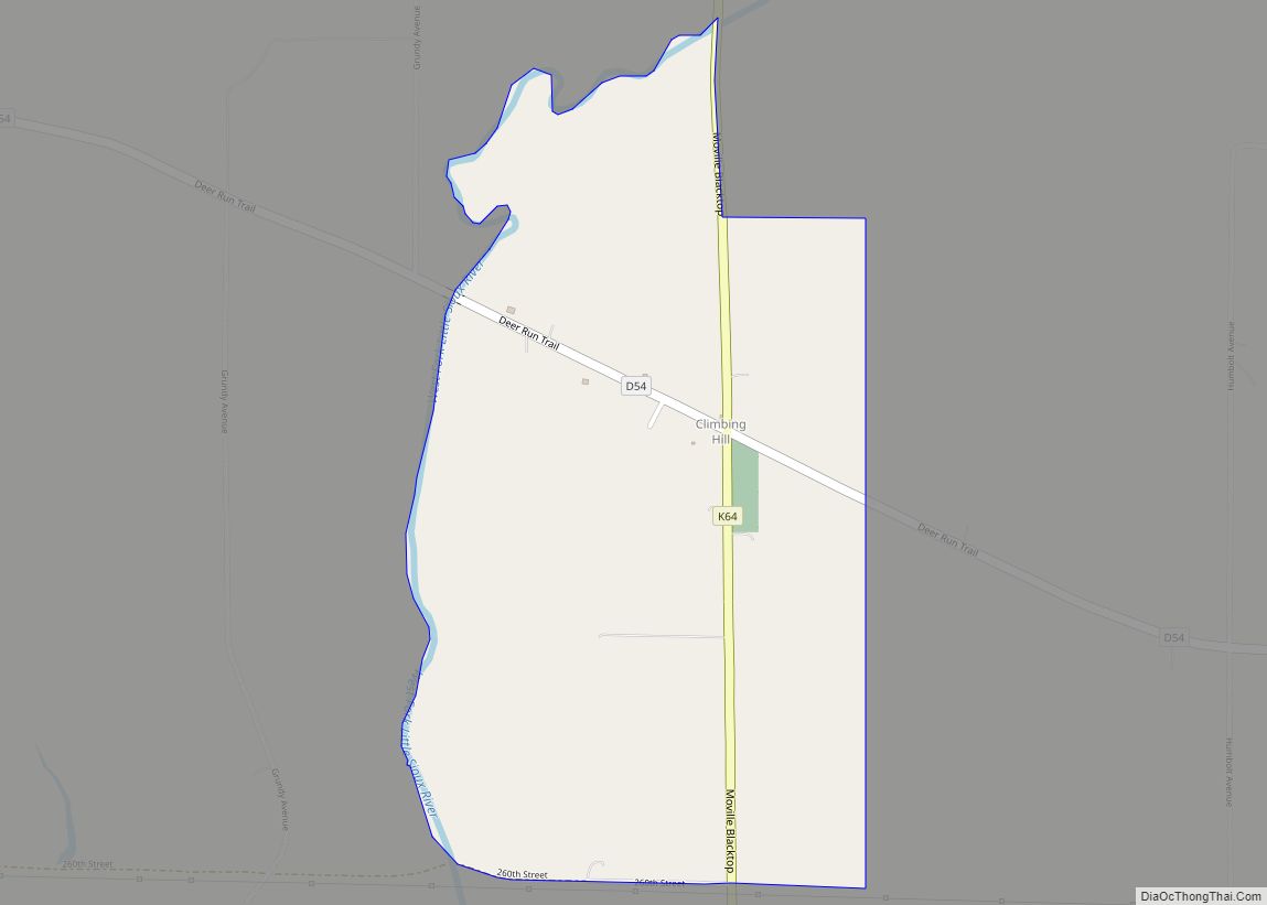
Moville is a city in Woodbury County, Iowa, United States. It is part of the Sioux City, IA–NE–SD Metropolitan Statistical Area. The population was 1,687 in the 2020 census, an increase from 1,583 in 2000.
| Name: | Moville city |
|---|---|
| LSAD Code: | 25 |
| LSAD Description: | city (suffix) |
| State: | Iowa |
| County: | Woodbury County |
| Incorporated: | August 13, 1889 |
| Elevation: | 1,178 ft (359 m) |
| Total Area: | 0.92 sq mi (2.38 km²) |
| Land Area: | 0.92 sq mi (2.38 km²) |
| Water Area: | 0.00 sq mi (0.00 km²) |
| Total Population: | 1,687 |
| Population Density: | 1,837.69/sq mi (709.17/km²) |
| ZIP code: | 51039 |
| Area code: | 712 |
| FIPS code: | 1954930 |
| GNISfeature ID: | 0459367 |
| Website: | www.visitmoville.com |
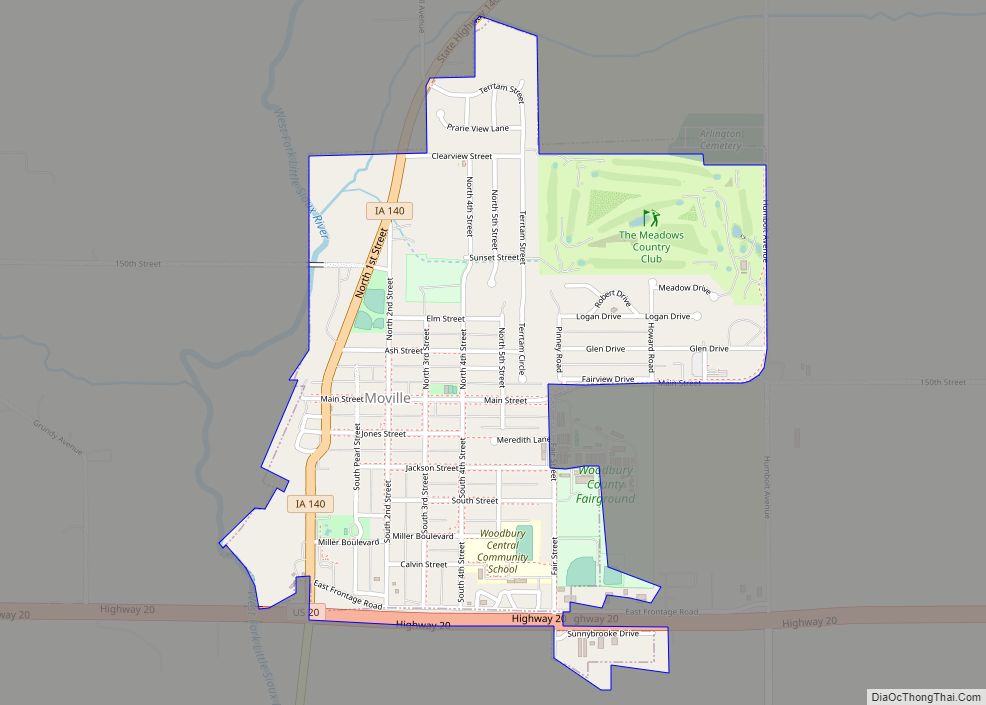
Online Interactive Map
Click on ![]() to view map in "full screen" mode.
to view map in "full screen" mode.
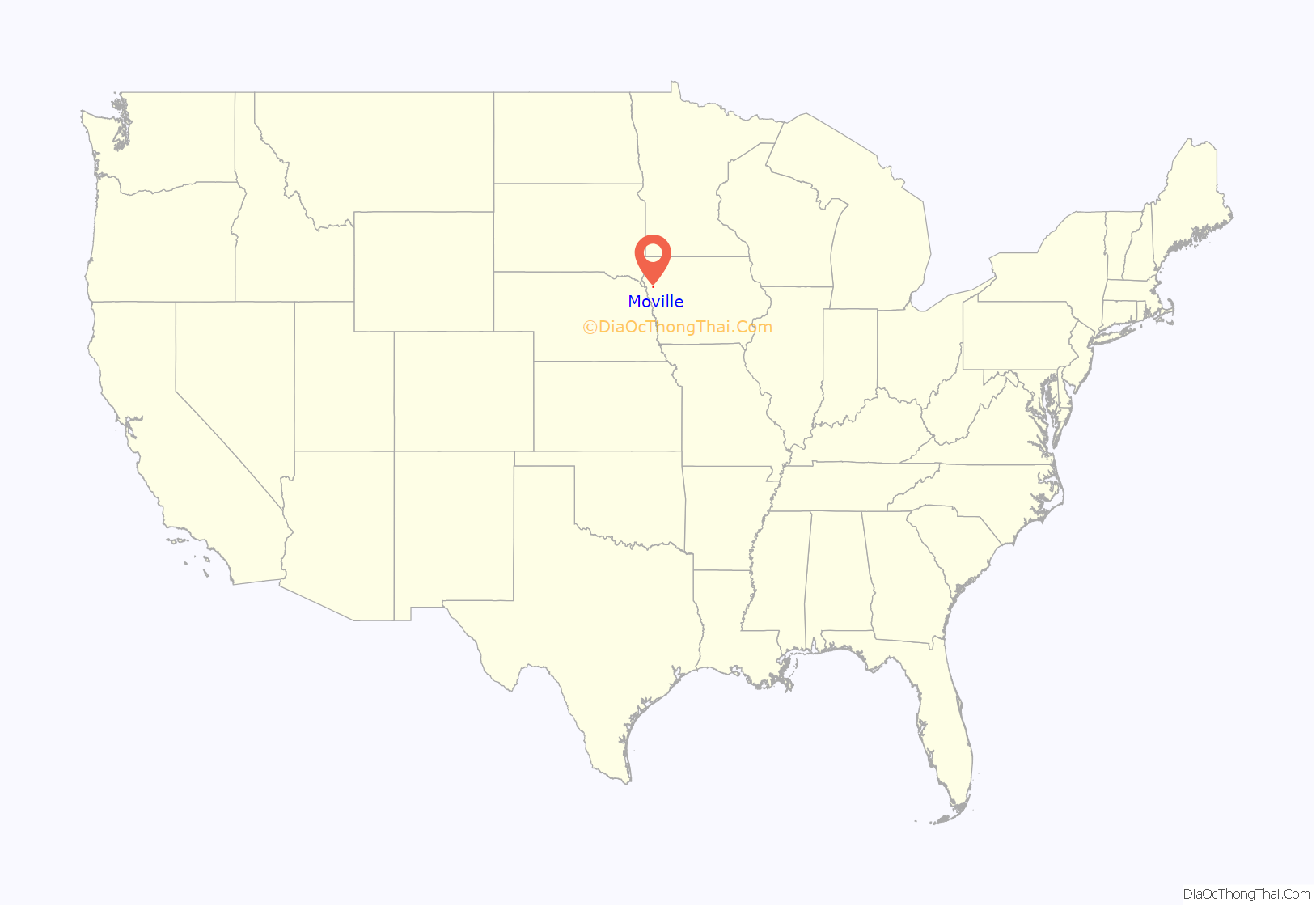
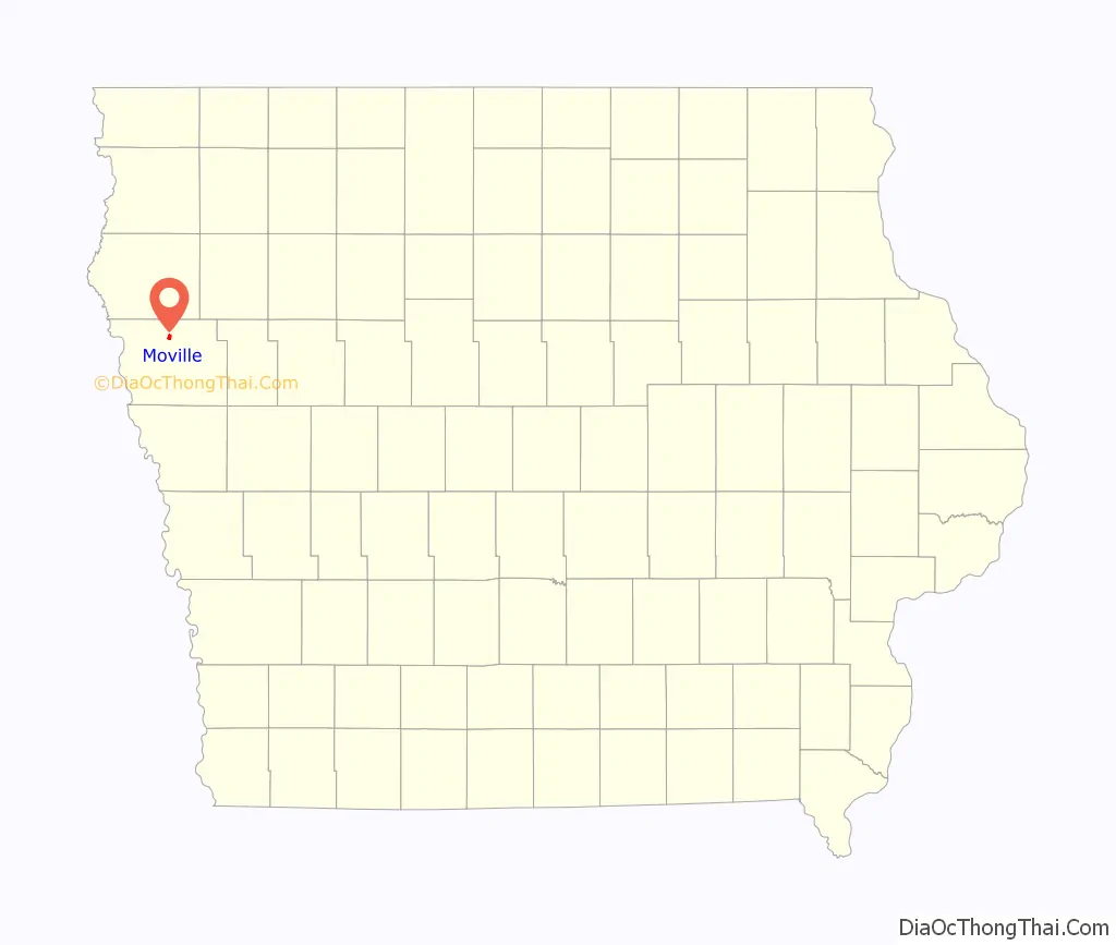
Moville location map. Where is Moville city?
History
John B McDermott is credited with naming the town of Moville after his birthplace in Moville, Ireland (County Donegal). In 1868, he and other men from the area established a post office at the McDermott home. Because McDermott and his wife Martha housed the post office, they chose to name their new town “Moville.” Only two Movilles exist in the world. It is pronounced “MOH-vil.”
On April 23, 1887, the West Town Lot Company filed at the Woodbury County Courthouse a platted map to be known as the town of Moville, Iowa. Moville citizens approved incorporation of the town in a special election held Aug. 10, 1889. The Articles of Incorporation were filed and approved on Aug. 13, 1889 by the clerk of district court, Woodbury County. Townspeople celebrated its centennial June 19–21, 1987 and celebrated its quasquicentennial (125 years) in 2012.
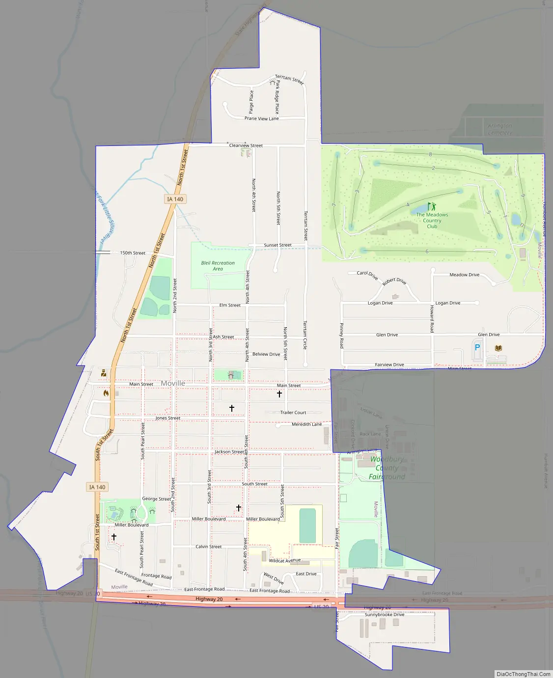
Moville Road Map
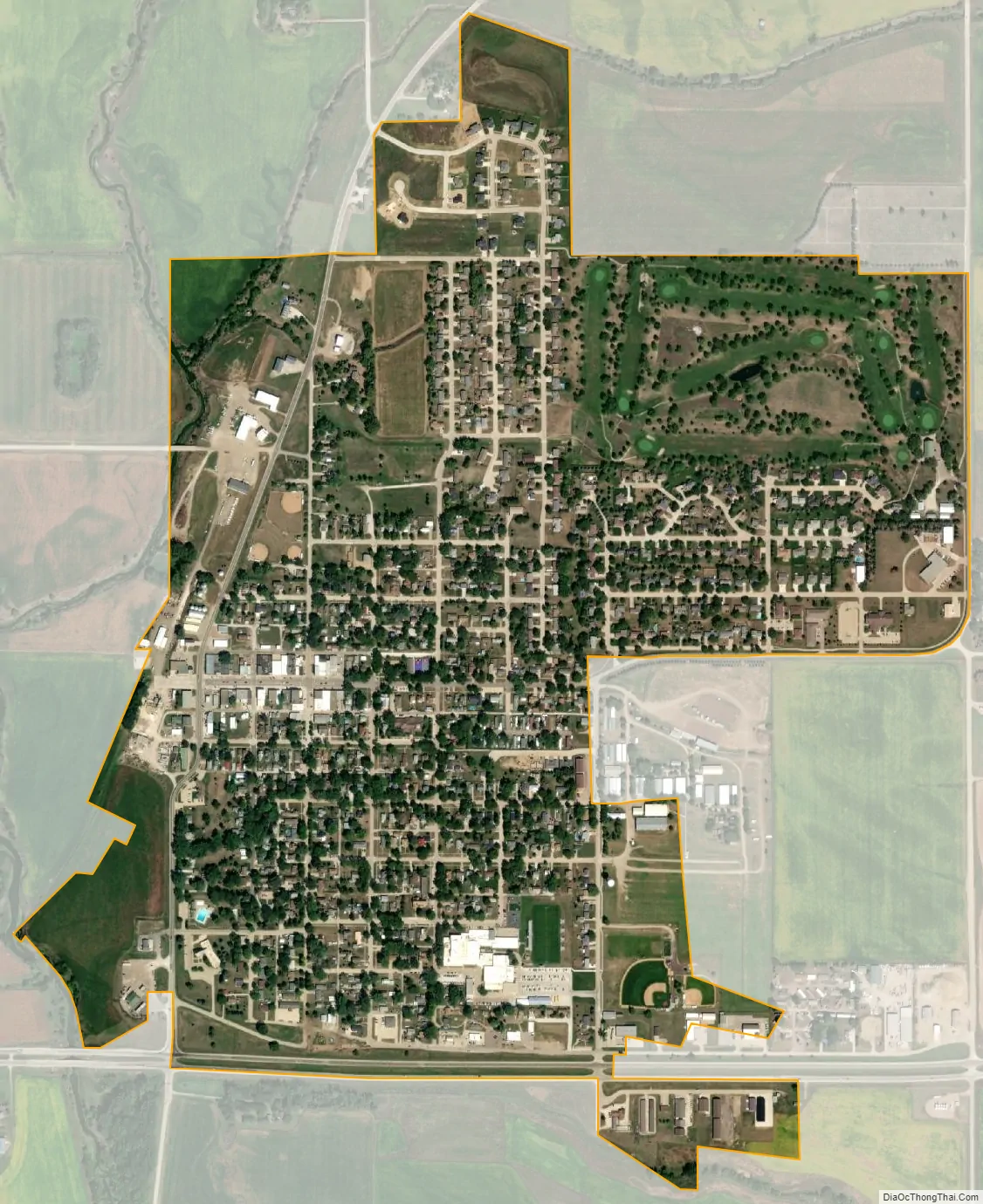
Moville city Satellite Map
Geography
Moville is located at 42°29′18″N 96°4′12″W / 42.48833°N 96.07000°W / 42.48833; -96.07000 (42.488210, -96.069997).
According to the United States Census Bureau, the city has a total area of 0.89 square miles (2.31 km), all land.
Moville is located just north of U.S. Route 20, approximately 15 miles (24 km) east of Sioux City.
See also
Map of Iowa State and its subdivision:- Adair
- Adams
- Allamakee
- Appanoose
- Audubon
- Benton
- Black Hawk
- Boone
- Bremer
- Buchanan
- Buena Vista
- Butler
- Calhoun
- Carroll
- Cass
- Cedar
- Cerro Gordo
- Cherokee
- Chickasaw
- Clarke
- Clay
- Clayton
- Clinton
- Crawford
- Dallas
- Davis
- Decatur
- Delaware
- Des Moines
- Dickinson
- Dubuque
- Emmet
- Fayette
- Floyd
- Franklin
- Fremont
- Greene
- Grundy
- Guthrie
- Hamilton
- Hancock
- Hardin
- Harrison
- Henry
- Howard
- Humboldt
- Ida
- Iowa
- Jackson
- Jasper
- Jefferson
- Johnson
- Jones
- Keokuk
- Kossuth
- Lee
- Linn
- Louisa
- Lucas
- Lyon
- Madison
- Mahaska
- Marion
- Marshall
- Mills
- Mitchell
- Monona
- Monroe
- Montgomery
- Muscatine
- O'Brien
- Osceola
- Page
- Palo Alto
- Plymouth
- Pocahontas
- Polk
- Pottawattamie
- Poweshiek
- Ringgold
- Sac
- Scott
- Shelby
- Sioux
- Story
- Tama
- Taylor
- Union
- Van Buren
- Wapello
- Warren
- Washington
- Wayne
- Webster
- Winnebago
- Winneshiek
- Woodbury
- Worth
- Wright
- Alabama
- Alaska
- Arizona
- Arkansas
- California
- Colorado
- Connecticut
- Delaware
- District of Columbia
- Florida
- Georgia
- Hawaii
- Idaho
- Illinois
- Indiana
- Iowa
- Kansas
- Kentucky
- Louisiana
- Maine
- Maryland
- Massachusetts
- Michigan
- Minnesota
- Mississippi
- Missouri
- Montana
- Nebraska
- Nevada
- New Hampshire
- New Jersey
- New Mexico
- New York
- North Carolina
- North Dakota
- Ohio
- Oklahoma
- Oregon
- Pennsylvania
- Rhode Island
- South Carolina
- South Dakota
- Tennessee
- Texas
- Utah
- Vermont
- Virginia
- Washington
- West Virginia
- Wisconsin
- Wyoming