Ocheyedan is a city in Osceola County, Iowa, United States. The population was 439 at the time of the 2020 census.
| Name: | Ocheyedan city |
|---|---|
| LSAD Code: | 25 |
| LSAD Description: | city (suffix) |
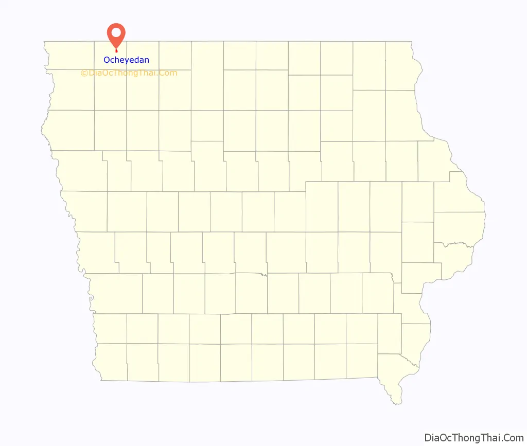
| State: | Iowa |
| County: | Osceola County |
| Elevation: | 1,575 ft (480 m) |
| Total Area: | 1.13 sq mi (2.93 km²) |
| Land Area: | 1.13 sq mi (2.93 km²) |
| Water Area: | 0.00 sq mi (0.00 km²) |
| Total Population: | 439 |
| Population Density: | 387.81/sq mi (149.76/km²) |
| ZIP code: | 51349, 51354 |
| Area code: | 712 |
| FIPS code: | 1958530 |
| GNISfeature ID: | 0459794 |
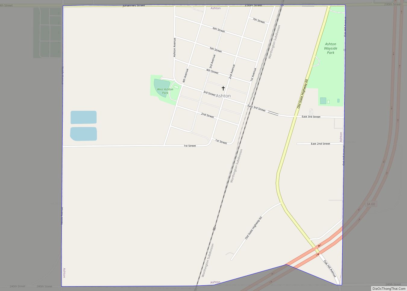
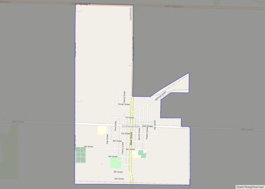
Online Interactive Map
Click on ![]() to view map in "full screen" mode.
to view map in "full screen" mode.
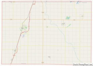
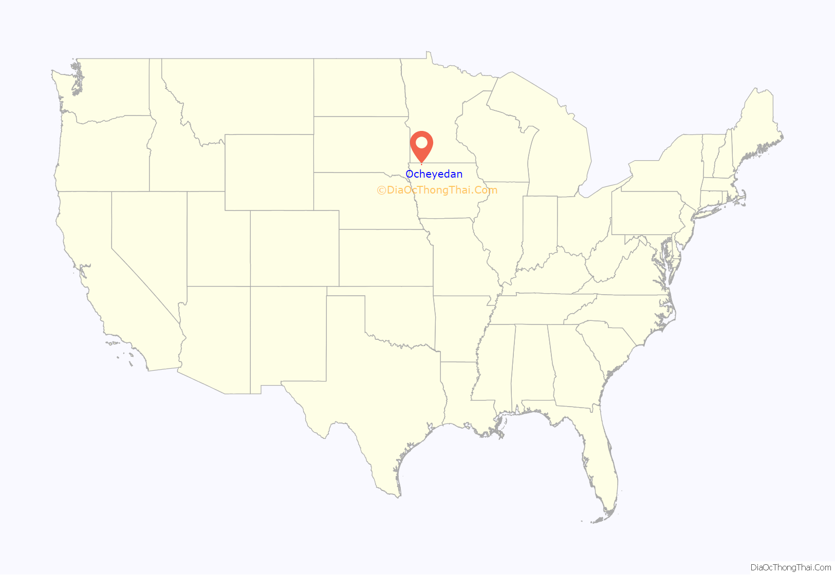
Ocheyedan location map. Where is Ocheyedan city?
History
Ocheyedan had its start in the year 1884 by the building of the Burlington, Cedar Rapids & Northern Railroad through that territory.
Ocheyedan was declared the “most difficult to pronounce” place name in the state of Iowa by Reader’s Digest. There is no standard pronunciation of the name, but the most widely known and generally accepted pronunciation is “oh-CHEED-en.”
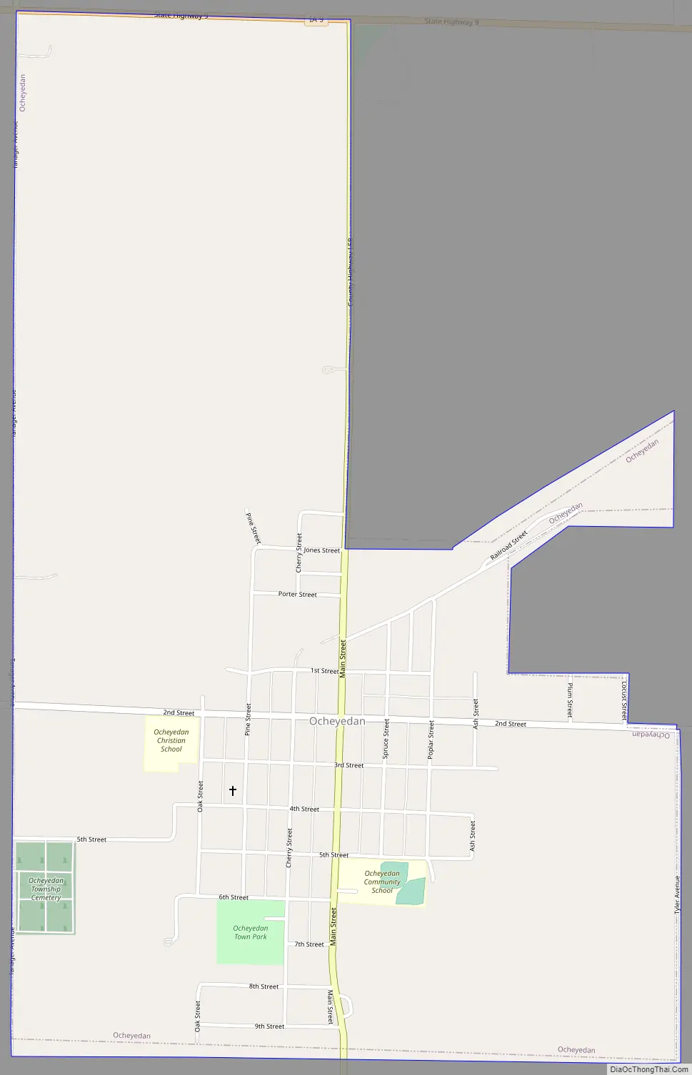
Ocheyedan Road Map
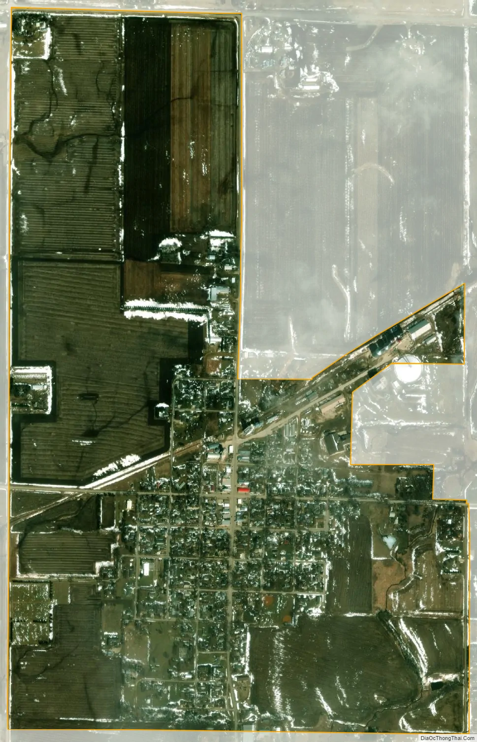
Ocheyedan city Satellite Map
Geography
Ocheyedan is located at 43°24′52″N 95°32′7″W / 43.41444°N 95.53528°W / 43.41444; -95.53528 (43.414497, -95.535274).
According to the United States Census Bureau, the city has a total area of 1.16 square miles (3.00 km), all land.
There is a common misconception that the highest point in Iowa is the Ocheyedan Mound, located near Ocheyedan. The Ocheyedan Mound rises to 1,655 feet above sea level, just fifteen feet short of the actual highest point in Iowa, Hawkeye Point, which has an elevation of 1,670 feet.
The Ocheyedan River flows southwest of the city.
See also
Map of Iowa State and its subdivision:- Adair
- Adams
- Allamakee
- Appanoose
- Audubon
- Benton
- Black Hawk
- Boone
- Bremer
- Buchanan
- Buena Vista
- Butler
- Calhoun
- Carroll
- Cass
- Cedar
- Cerro Gordo
- Cherokee
- Chickasaw
- Clarke
- Clay
- Clayton
- Clinton
- Crawford
- Dallas
- Davis
- Decatur
- Delaware
- Des Moines
- Dickinson
- Dubuque
- Emmet
- Fayette
- Floyd
- Franklin
- Fremont
- Greene
- Grundy
- Guthrie
- Hamilton
- Hancock
- Hardin
- Harrison
- Henry
- Howard
- Humboldt
- Ida
- Iowa
- Jackson
- Jasper
- Jefferson
- Johnson
- Jones
- Keokuk
- Kossuth
- Lee
- Linn
- Louisa
- Lucas
- Lyon
- Madison
- Mahaska
- Marion
- Marshall
- Mills
- Mitchell
- Monona
- Monroe
- Montgomery
- Muscatine
- O'Brien
- Osceola
- Page
- Palo Alto
- Plymouth
- Pocahontas
- Polk
- Pottawattamie
- Poweshiek
- Ringgold
- Sac
- Scott
- Shelby
- Sioux
- Story
- Tama
- Taylor
- Union
- Van Buren
- Wapello
- Warren
- Washington
- Wayne
- Webster
- Winnebago
- Winneshiek
- Woodbury
- Worth
- Wright
- Alabama
- Alaska
- Arizona
- Arkansas
- California
- Colorado
- Connecticut
- Delaware
- District of Columbia
- Florida
- Georgia
- Hawaii
- Idaho
- Illinois
- Indiana
- Iowa
- Kansas
- Kentucky
- Louisiana
- Maine
- Maryland
- Massachusetts
- Michigan
- Minnesota
- Mississippi
- Missouri
- Montana
- Nebraska
- Nevada
- New Hampshire
- New Jersey
- New Mexico
- New York
- North Carolina
- North Dakota
- Ohio
- Oklahoma
- Oregon
- Pennsylvania
- Rhode Island
- South Carolina
- South Dakota
- Tennessee
- Texas
- Utah
- Vermont
- Virginia
- Washington
- West Virginia
- Wisconsin
- Wyoming