Goodland is a city in and the county seat of Sherman County, Kansas, United States. As of the 2020 census, the population of the city was 4,465. It was named after Goodland, Indiana. Goodland is home to Northwest Kansas Technical College.
| Name: | Goodland city |
|---|---|
| LSAD Code: | 25 |
| LSAD Description: | city (suffix) |
| State: | Kansas |
| County: | Sherman County |
| Founded: | 1887 |
| Incorporated: | 1887 |
| Elevation: | 3,681 ft (1,122 m) |
| Total Area: | 4.51 sq mi (11.67 km²) |
| Land Area: | 4.50 sq mi (11.66 km²) |
| Water Area: | 0.01 sq mi (0.02 km²) |
| Total Population: | 4,465 |
| Population Density: | 990/sq mi (380/km²) |
| ZIP code: | 67735 |
| Area code: | 785 |
| FIPS code: | 2026875 |
| Website: | cityofgoodland.org |
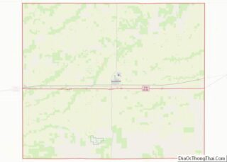
Online Interactive Map
Click on ![]() to view map in "full screen" mode.
to view map in "full screen" mode.
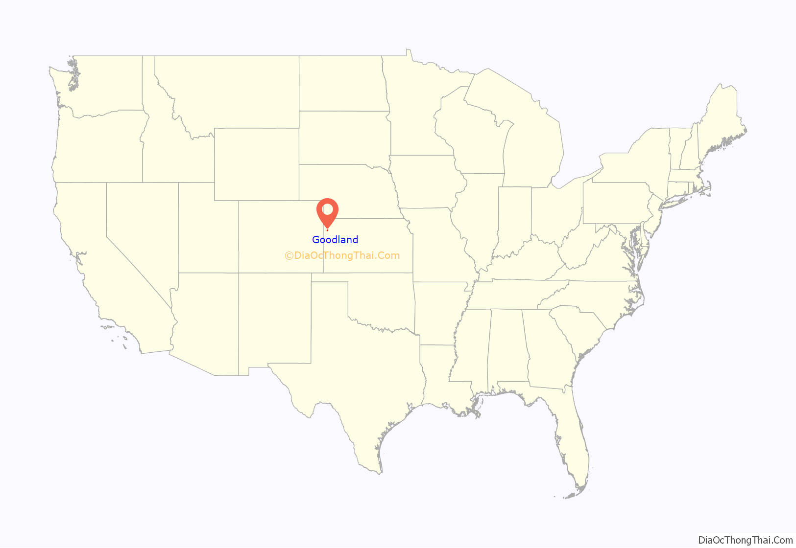
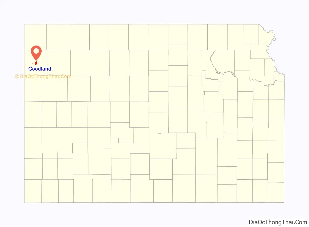
Goodland location map. Where is Goodland city?
History
One of the earliest pieces of recorded history relating to Goodland concerns the Kidder Massacre. On July 2, 1867, a detachment of the 2nd Cavalry Regiment (United States) was massacred; second lieutenant Lyman S. Kidder in command of the party, a sergeant, a corporal, eight privates and an Indian guide lost their lives. They were carrying dispatches for Lieutenant Colonel George Custer. Later, Custer found evidence of a running battle along Beaver Creek, which led to a ravine where the remains were found. They had been killed by Cheyenne and/or Sioux Indians.
In 1886, there were four communities vying to become county seat for Sherman County: Itasca, Voltaire, Sherman Center and Eustis. A man named Clark showed up in the county in 1887 proposing to create a new town to settle the dispute. The new town was to be named Goodland. A vote for the county seat was held among the county population and Goodland won with 872 of the 1495 votes cast while with Eustis received 611 and Voltaire received 12. Citizens of Eustis declared that the votes were unfair but the state department said that nothing could be done as all the voting was complete. The Supreme Court of Kansas considered various proceedings but did not change the outcome of the vote. Eustis refused to yield the county records it held until January 13, 1888, when an armed group from Goodland seized the records and sent them to the new county seat.
Goodland sprang up around the Chicago, Rock Island and Pacific Railroad that had been built through it. The town was named after Goodland, Indiana.
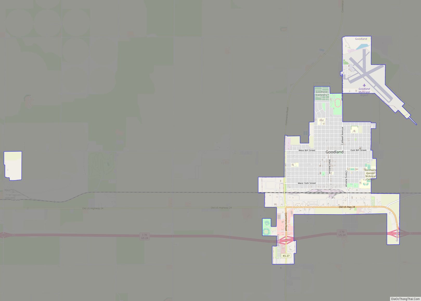
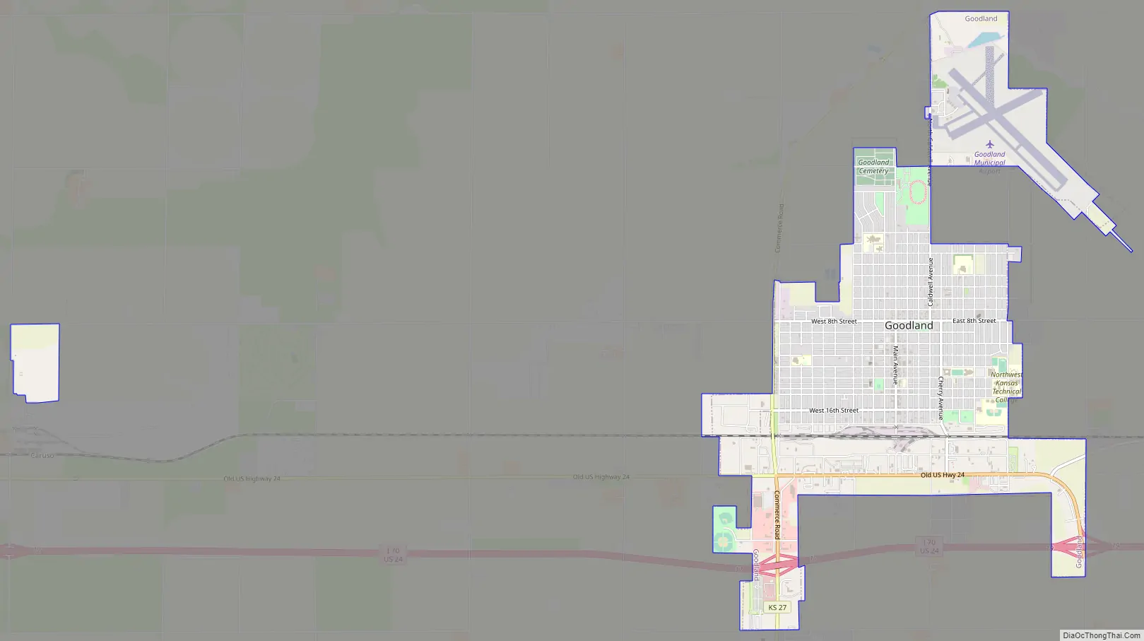
Goodland Road Map
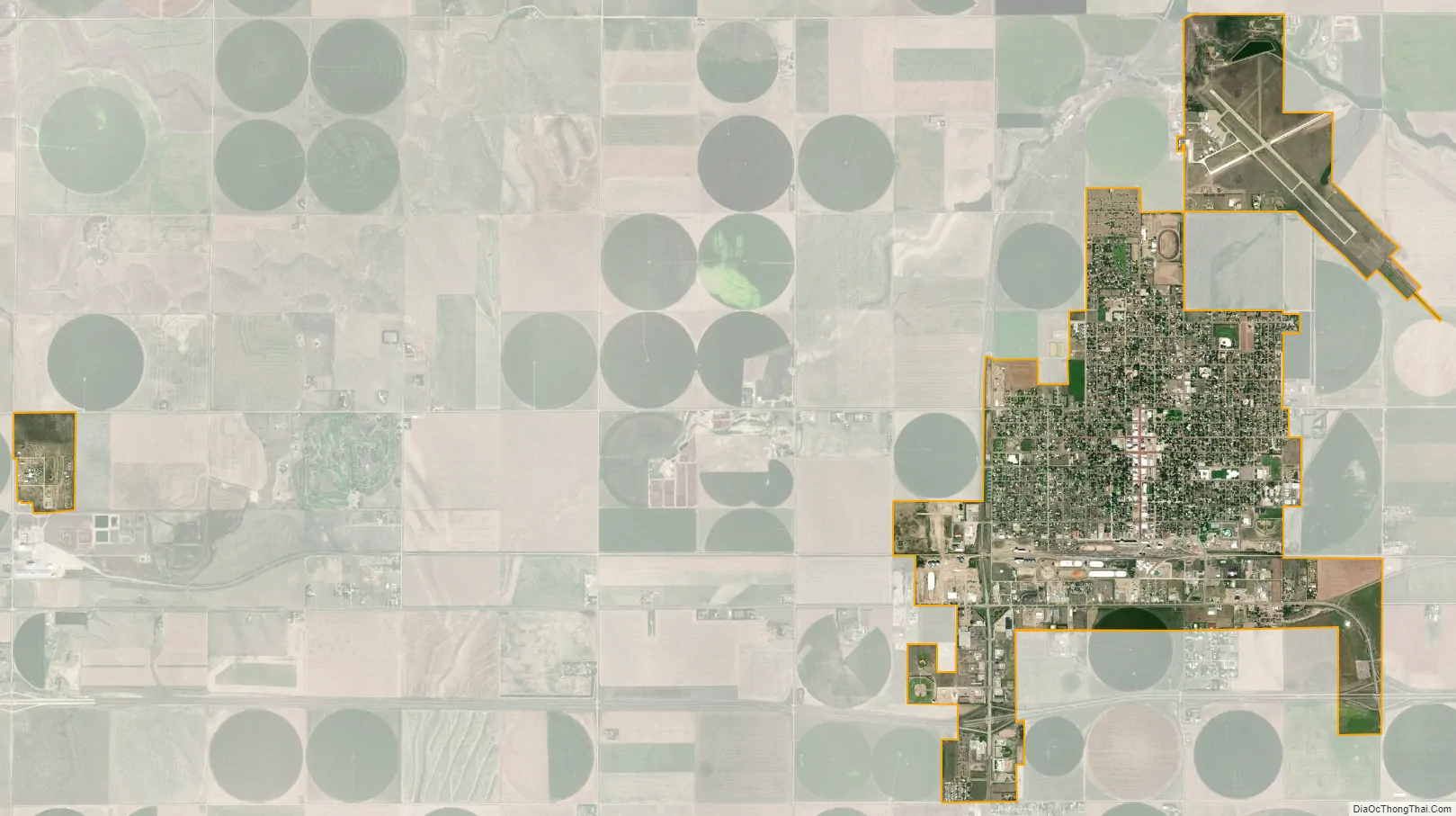
Goodland city Satellite Map
Geography
Goodland is located at 39°21′3″N 101°42′37″W / 39.35083°N 101.71028°W / 39.35083; -101.71028 (39.3508330, −101.7101722) at an elevation of 3,681 feet (1,122 m). It lies on the south side of the Middle Fork of Sappa Creek, part of the Republican River watershed, in the High Plains region of the Great Plains. Located at the intersection of Interstate 70 and K-27 in northwest Kansas, Goodland is roughly 17 miles (27 km) east of the Colorado state line, 176 miles east-southeast of Denver, 265 miles (426 km) northwest of Wichita, and 383 miles (616 km) west of Kansas City.
According to the United States Census Bureau, the city has a total area of 4.37 square miles (11.32 km), of which 4.36 square miles (11.29 km) is land and 0.01 square miles (0.03 km) is water.
Climate
Goodland’s climate is officially classed as humid continental (Koppen Dfa); although it only just misses a semi-arid (BSk) classification and is also close to a wet-summer continental climate (Dwa). Winters are generally cold and dry, summers hot and moderately wet. The average temperature for the year is 51 °F or 10.6 °C with temperatures exceeding 90 °F or 32.2 °C an average of fifty afternoons a year and dropping below 32 °F or 0 °C an average of 159 mornings a year. Due to its higher elevation, Goodland experiences stronger wind and higher snowfall totals than other locations in Kansas. Wind speed averages 13 mph (21 km/h). On average, Goodland receives 19.75 inches or 502 millimetres of precipitation annually, and snowfall averages 41.9 inches or 1.06 metres per year. On average, January is the coolest month, and July is both the warmest month and the wettest month. The hottest temperature recorded in Goodland was 111 °F or 43.9 °C in 1940; the coldest temperature recorded was −27 °F or −32.8 °C in 1989.
See also
Map of Kansas State and its subdivision:- Allen
- Anderson
- Atchison
- Barber
- Barton
- Bourbon
- Brown
- Butler
- Chase
- Chautauqua
- Cherokee
- Cheyenne
- Clark
- Clay
- Cloud
- Coffey
- Comanche
- Cowley
- Crawford
- Decatur
- Dickinson
- Doniphan
- Douglas
- Edwards
- Elk
- Ellis
- Ellsworth
- Finney
- Ford
- Franklin
- Geary
- Gove
- Graham
- Grant
- Gray
- Greeley
- Greenwood
- Hamilton
- Harper
- Harvey
- Haskell
- Hodgeman
- Jackson
- Jefferson
- Jewell
- Johnson
- Kearny
- Kingman
- Kiowa
- Labette
- Lane
- Leavenworth
- Lincoln
- Linn
- Logan
- Lyon
- Marion
- Marshall
- McPherson
- Meade
- Miami
- Mitchell
- Montgomery
- Morris
- Morton
- Nemaha
- Neosho
- Ness
- Norton
- Osage
- Osborne
- Ottawa
- Pawnee
- Phillips
- Pottawatomie
- Pratt
- Rawlins
- Reno
- Republic
- Rice
- Riley
- Rooks
- Rush
- Russell
- Saline
- Scott
- Sedgwick
- Seward
- Shawnee
- Sheridan
- Sherman
- Smith
- Stafford
- Stanton
- Stevens
- Sumner
- Thomas
- Trego
- Wabaunsee
- Wallace
- Washington
- Wichita
- Wilson
- Woodson
- Wyandotte
- Alabama
- Alaska
- Arizona
- Arkansas
- California
- Colorado
- Connecticut
- Delaware
- District of Columbia
- Florida
- Georgia
- Hawaii
- Idaho
- Illinois
- Indiana
- Iowa
- Kansas
- Kentucky
- Louisiana
- Maine
- Maryland
- Massachusetts
- Michigan
- Minnesota
- Mississippi
- Missouri
- Montana
- Nebraska
- Nevada
- New Hampshire
- New Jersey
- New Mexico
- New York
- North Carolina
- North Dakota
- Ohio
- Oklahoma
- Oregon
- Pennsylvania
- Rhode Island
- South Carolina
- South Dakota
- Tennessee
- Texas
- Utah
- Vermont
- Virginia
- Washington
- West Virginia
- Wisconsin
- Wyoming