Oberlin is a city in and the county seat of Decatur County, Kansas, United States. As of the 2020 census, its population was 1,644.
| Name: | Oberlin city |
|---|---|
| LSAD Code: | 25 |
| LSAD Description: | city (suffix) |
| State: | Kansas |
| County: | Decatur County |
| Founded: | 1872 |
| Incorporated: | 1885 |
| Elevation: | 2,562 ft (781 m) |
| Total Area: | 1.91 sq mi (4.95 km²) |
| Land Area: | 1.91 sq mi (4.95 km²) |
| Water Area: | 0.00 sq mi (0.00 km²) |
| Total Population: | 1,644 |
| Population Density: | 860/sq mi (330/km²) |
| ZIP code: | 67749 |
| Area code: | 785 |
| FIPS code: | 2052000 |
| Website: | oberlin-kansas.com |
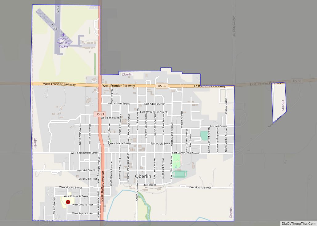
Online Interactive Map
Click on ![]() to view map in "full screen" mode.
to view map in "full screen" mode.
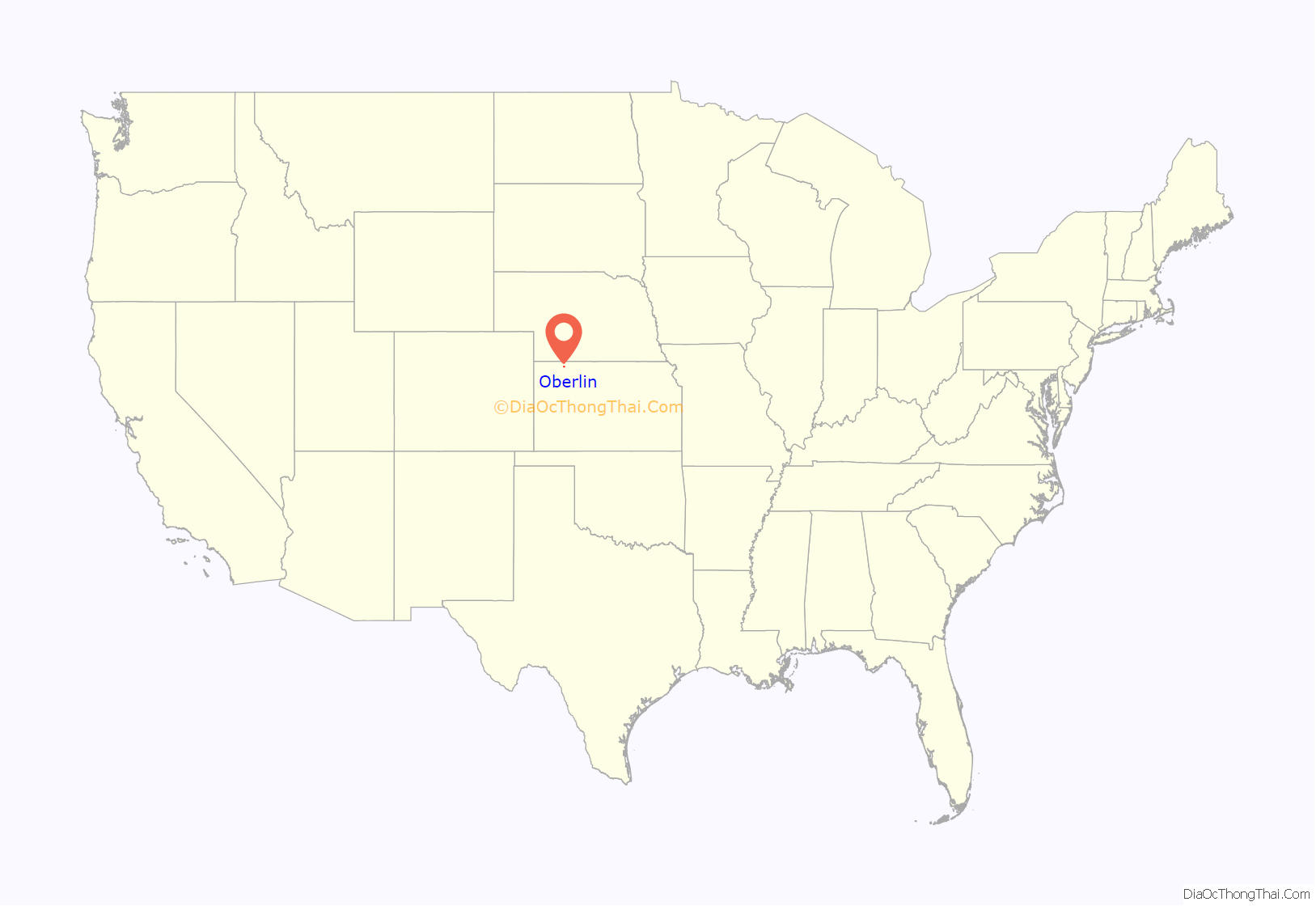
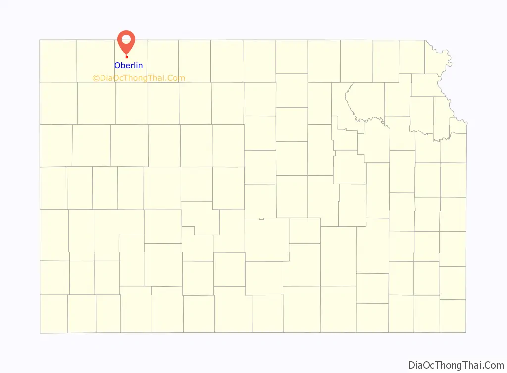
Oberlin location map. Where is Oberlin city?
History
Oberlin was platted in 1878. It was named after Oberlin, Ohio. Its first post office was established in April, 1878, and the city was incorporated in 1885.
On September 30, 1878, Northern Cheyenne, fleeing from Indian Territory to their homes in the north during the Northern Cheyenne Exodus, attacked homesteaders near Oberlin, then a tiny hamlet. The raid’s victims are commemorated in the “Last Indian Raid in Kansas” room of the Decatur County Museum, and by a monument in the town cemetery.
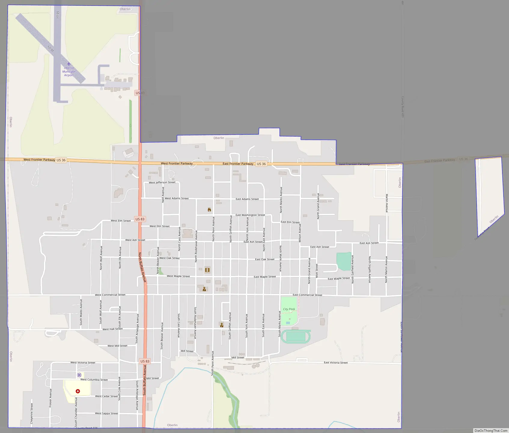
Oberlin Road Map
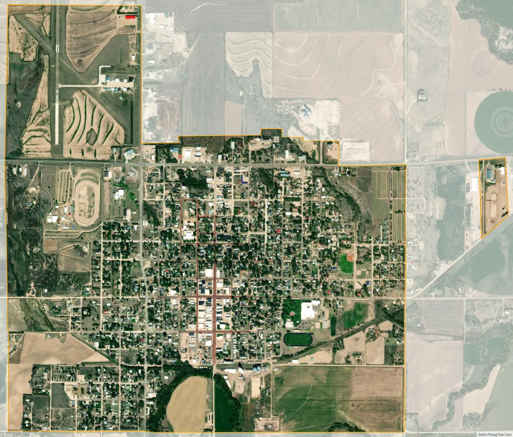
Oberlin city Satellite Map
Geography
Oberlin is located at 39°49′16″N 100°31′42″W / 39.82111°N 100.52833°W / 39.82111; -100.52833 (39.821235, -100.528369) at an elevation of 2,562 feet (781 m). It lies on the northwest side of Sappa Creek, a tributary of the Republican River, in the High Plains region of the Great Plains. Located at the intersection of U.S. Route 36 and U.S. Route 83 in northwest Kansas, it is 228 miles (367 km) northwest of Wichita, 238 miles (383 km) east of Denver, and 320 miles (510 km) west-northwest of Kansas City.
According to the United States Census Bureau, it has a total area of 1.91 square miles (4.95 km), all land.
Climate
Oberlin has a humid continental climate (Köppen Dfa), with hot, dry summers and cold, dry winters. The average temperature is 52 °F (11 °C) with temperatures exceeding 90 °F (32 °C) an average of 62 days a year and dropping below 32 °F (0 °C) an average of 158 days a year. It typically experiences precipitation 66 days a year and snowfall 11 days a year. Precipitation averages 23 inches (574 mm) per year, and snowfall averages 32 inches (80 cm) per year. On average, January is the coldest month, and July is both the hottest month and the wettest month. The hottest temperature recorded there was 111 °F (44 °C) in 1954; the coldest temperature recorded was -31 °F (-35 °C) in 1989.
See also
Map of Kansas State and its subdivision:- Allen
- Anderson
- Atchison
- Barber
- Barton
- Bourbon
- Brown
- Butler
- Chase
- Chautauqua
- Cherokee
- Cheyenne
- Clark
- Clay
- Cloud
- Coffey
- Comanche
- Cowley
- Crawford
- Decatur
- Dickinson
- Doniphan
- Douglas
- Edwards
- Elk
- Ellis
- Ellsworth
- Finney
- Ford
- Franklin
- Geary
- Gove
- Graham
- Grant
- Gray
- Greeley
- Greenwood
- Hamilton
- Harper
- Harvey
- Haskell
- Hodgeman
- Jackson
- Jefferson
- Jewell
- Johnson
- Kearny
- Kingman
- Kiowa
- Labette
- Lane
- Leavenworth
- Lincoln
- Linn
- Logan
- Lyon
- Marion
- Marshall
- McPherson
- Meade
- Miami
- Mitchell
- Montgomery
- Morris
- Morton
- Nemaha
- Neosho
- Ness
- Norton
- Osage
- Osborne
- Ottawa
- Pawnee
- Phillips
- Pottawatomie
- Pratt
- Rawlins
- Reno
- Republic
- Rice
- Riley
- Rooks
- Rush
- Russell
- Saline
- Scott
- Sedgwick
- Seward
- Shawnee
- Sheridan
- Sherman
- Smith
- Stafford
- Stanton
- Stevens
- Sumner
- Thomas
- Trego
- Wabaunsee
- Wallace
- Washington
- Wichita
- Wilson
- Woodson
- Wyandotte
- Alabama
- Alaska
- Arizona
- Arkansas
- California
- Colorado
- Connecticut
- Delaware
- District of Columbia
- Florida
- Georgia
- Hawaii
- Idaho
- Illinois
- Indiana
- Iowa
- Kansas
- Kentucky
- Louisiana
- Maine
- Maryland
- Massachusetts
- Michigan
- Minnesota
- Mississippi
- Missouri
- Montana
- Nebraska
- Nevada
- New Hampshire
- New Jersey
- New Mexico
- New York
- North Carolina
- North Dakota
- Ohio
- Oklahoma
- Oregon
- Pennsylvania
- Rhode Island
- South Carolina
- South Dakota
- Tennessee
- Texas
- Utah
- Vermont
- Virginia
- Washington
- West Virginia
- Wisconsin
- Wyoming