Wilson is a city in Ellsworth County, Kansas, United States. The community promotes itself as the “Czech Capital of Kansas” due to the role of Czech immigrant settlers in its early history. As of the 2020 census, the population of the city was 859.
| Name: | Wilson city |
|---|---|
| LSAD Code: | 25 |
| LSAD Description: | city (suffix) |
| State: | Kansas |
| County: | Ellsworth County |
| Founded: | 1871 |
| Incorporated: | 1883 |
| Elevation: | 1,686 ft (514 m) |
| Total Area: | 0.60 sq mi (1.55 km²) |
| Land Area: | 0.60 sq mi (1.55 km²) |
| Water Area: | 0.00 sq mi (0.00 km²) |
| Total Population: | 859 |
| Population Density: | 1,400/sq mi (550/km²) |
| ZIP code: | 67490 |
| Area code: | 785 |
| FIPS code: | 2079675 |
| Website: | wilsonkansas.com |
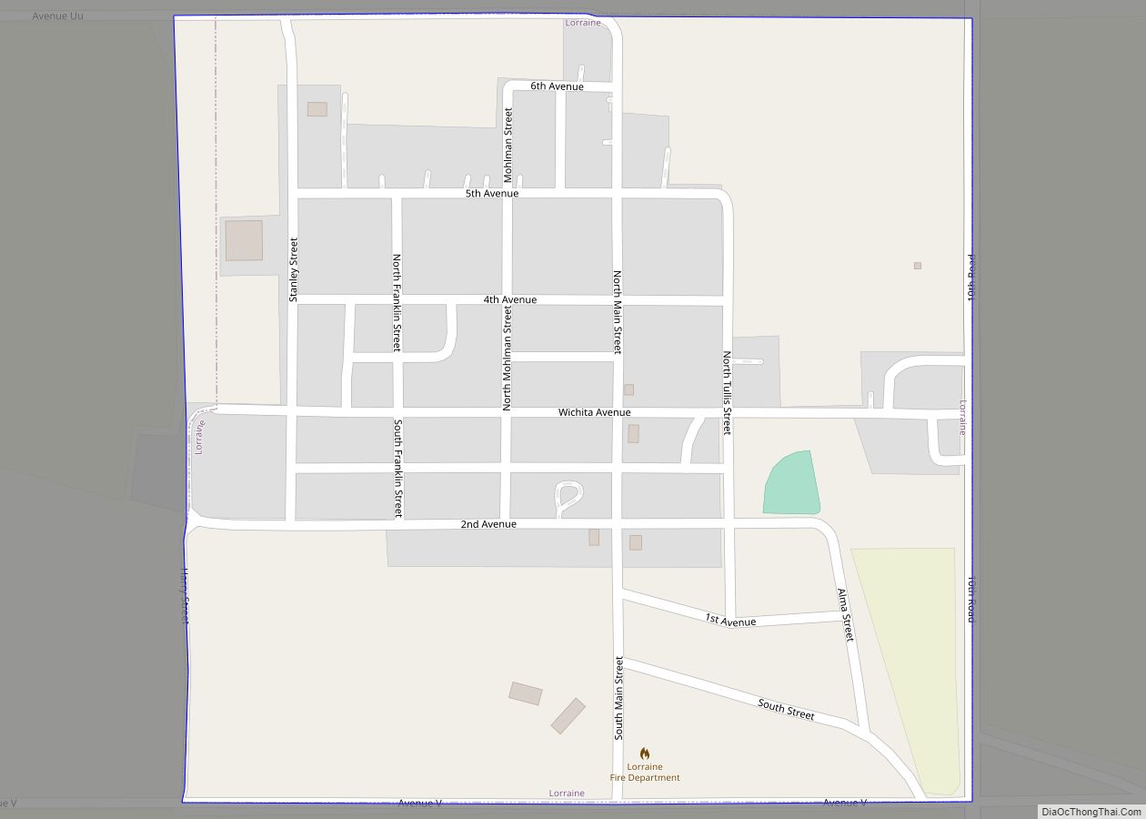
Online Interactive Map
Click on ![]() to view map in "full screen" mode.
to view map in "full screen" mode.
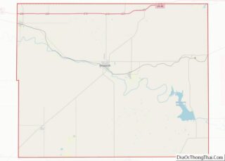
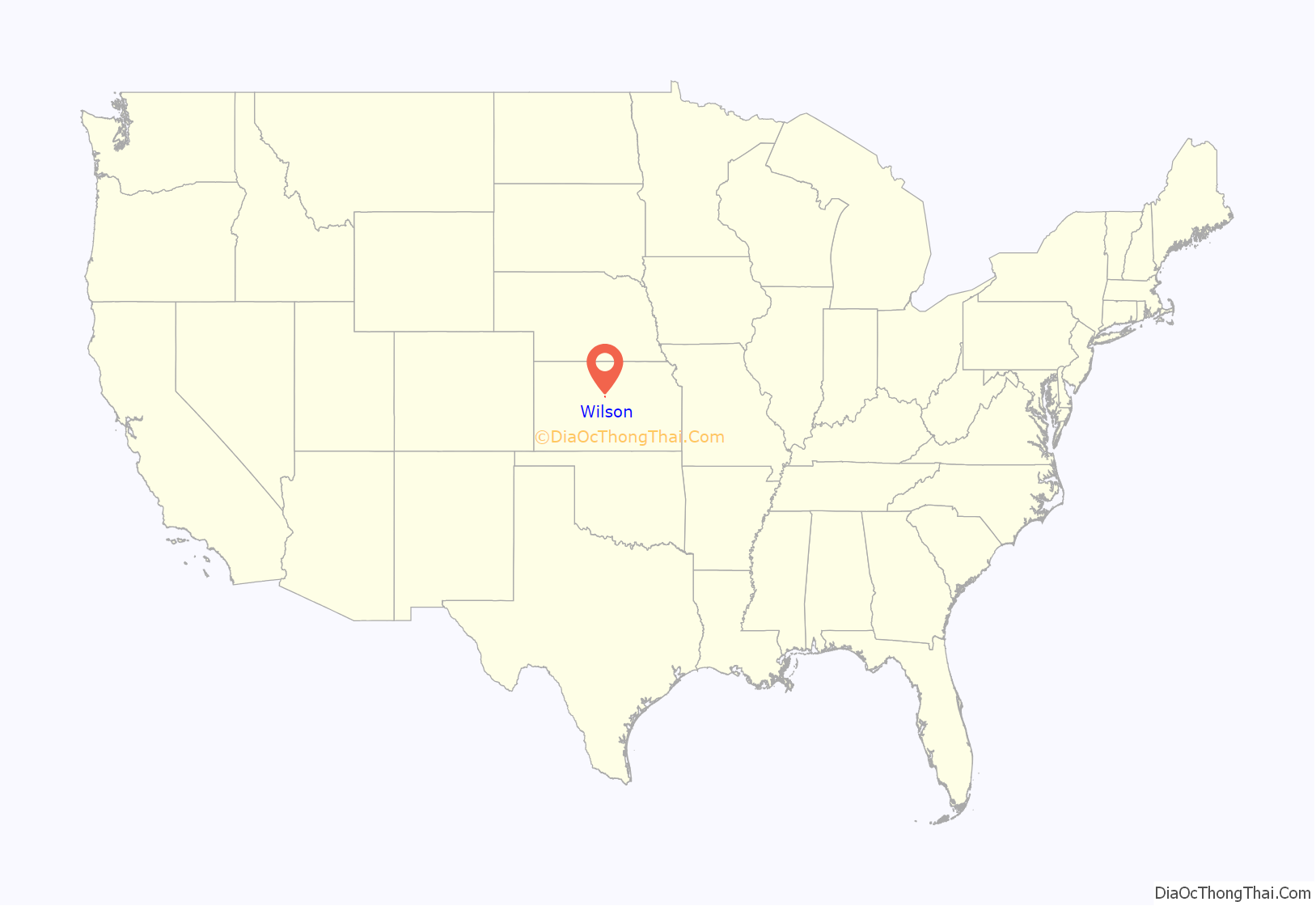
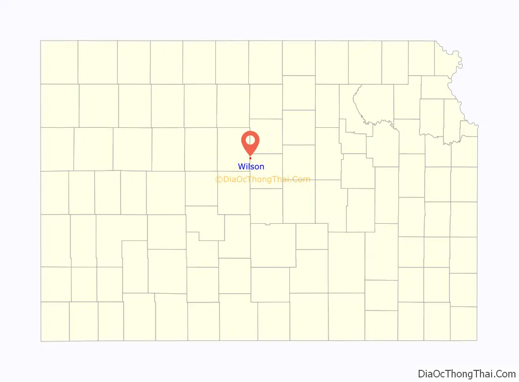
Wilson location map. Where is Wilson city?
History
The Butterfield Overland Despatch built a stagecoach station one-half mile south of present-day Wilson in 1865. Three years later, the Kansas Pacific Railway built Wilson Station, named after the surrounding township, at the modern town site. In 1871, The National Land Company surveyed and planned the first town there, naming it Bosland in the hopes of attracting the cattle trade. Settlers from Pennsylvania, including some Pennsylvania Dutch, arrived over the following year. The settlement never became a center of the cattle trade, however, and continued to be known as Wilson, a name the U.S. Post Office officially codified in 1873.
Beginning in 1874, Czech immigrants from Bohemia came to Wilson to work on the railroad, establishing the town as an area center of Czech culture.
Wilson was incorporated as a city in 1883.
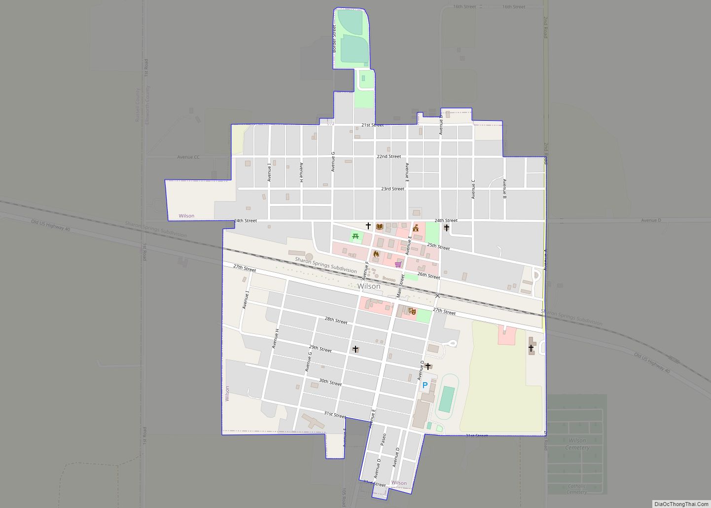
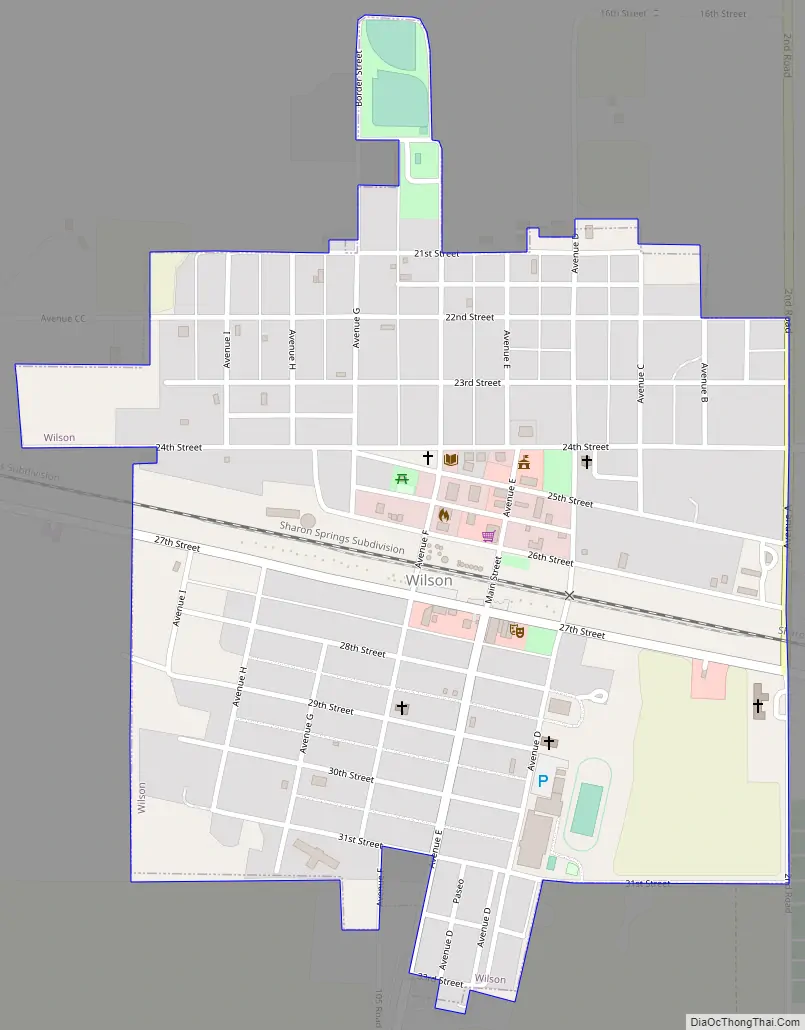
Wilson Road Map
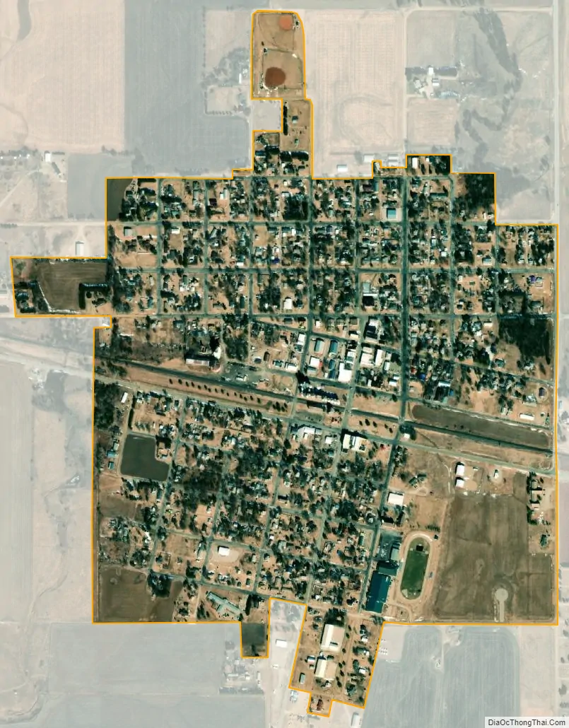
Wilson city Satellite Map
Geography
Wilson is located at 38°49′32″N 98°28′29″W / 38.82556°N 98.47472°W / 38.82556; -98.47472 (38.825619, -98.474748) at an elevation of 1,686 feet (513 m). Located in north-central Kansas 1.5 miles (2.4 km) south of the intersection of Interstate 70 and Kansas Highway 232 (K-232), Wilson is 95 miles (153 km) northwest of Wichita, 205 miles (330 km) west of Kansas City, and 15 miles (24 km) northwest of Ellsworth, the county seat.
Wilson lies in the Smoky Hills region of the Great Plains approximately 2 miles (3.2 km) north of the Smoky Hill River and 6 miles (9.7 km) south of Wilson Lake. Wilson Creek, a tributary of the Smoky Hill, flows south along the east side of the city.
According to the United States Census Bureau, the city has a total area of 0.60 square miles (1.55 km), all of it land.
See also
Map of Kansas State and its subdivision:- Allen
- Anderson
- Atchison
- Barber
- Barton
- Bourbon
- Brown
- Butler
- Chase
- Chautauqua
- Cherokee
- Cheyenne
- Clark
- Clay
- Cloud
- Coffey
- Comanche
- Cowley
- Crawford
- Decatur
- Dickinson
- Doniphan
- Douglas
- Edwards
- Elk
- Ellis
- Ellsworth
- Finney
- Ford
- Franklin
- Geary
- Gove
- Graham
- Grant
- Gray
- Greeley
- Greenwood
- Hamilton
- Harper
- Harvey
- Haskell
- Hodgeman
- Jackson
- Jefferson
- Jewell
- Johnson
- Kearny
- Kingman
- Kiowa
- Labette
- Lane
- Leavenworth
- Lincoln
- Linn
- Logan
- Lyon
- Marion
- Marshall
- McPherson
- Meade
- Miami
- Mitchell
- Montgomery
- Morris
- Morton
- Nemaha
- Neosho
- Ness
- Norton
- Osage
- Osborne
- Ottawa
- Pawnee
- Phillips
- Pottawatomie
- Pratt
- Rawlins
- Reno
- Republic
- Rice
- Riley
- Rooks
- Rush
- Russell
- Saline
- Scott
- Sedgwick
- Seward
- Shawnee
- Sheridan
- Sherman
- Smith
- Stafford
- Stanton
- Stevens
- Sumner
- Thomas
- Trego
- Wabaunsee
- Wallace
- Washington
- Wichita
- Wilson
- Woodson
- Wyandotte
- Alabama
- Alaska
- Arizona
- Arkansas
- California
- Colorado
- Connecticut
- Delaware
- District of Columbia
- Florida
- Georgia
- Hawaii
- Idaho
- Illinois
- Indiana
- Iowa
- Kansas
- Kentucky
- Louisiana
- Maine
- Maryland
- Massachusetts
- Michigan
- Minnesota
- Mississippi
- Missouri
- Montana
- Nebraska
- Nevada
- New Hampshire
- New Jersey
- New Mexico
- New York
- North Carolina
- North Dakota
- Ohio
- Oklahoma
- Oregon
- Pennsylvania
- Rhode Island
- South Carolina
- South Dakota
- Tennessee
- Texas
- Utah
- Vermont
- Virginia
- Washington
- West Virginia
- Wisconsin
- Wyoming