Ellsworth is a city in and the county seat of Ellsworth County, Kansas, United States. As of the 2020 census, the population of the city was 3,066. Known as a cow town in the 1870s, when the Kansas Pacific Railroad operated a stockyard here for shipping cattle to eastern markets, in the 21st century, it serves as the trading center of the rural county.
| Name: | Ellsworth city |
|---|---|
| LSAD Code: | 25 |
| LSAD Description: | city (suffix) |
| State: | Kansas |
| County: | Ellsworth County |
| Founded: | 1860s |
| Incorporated: | 1867 |
| Elevation: | 1,539 ft (469 m) |
| Total Area: | 2.39 sq mi (6.20 km²) |
| Land Area: | 2.39 sq mi (6.20 km²) |
| Water Area: | 0.00 sq mi (0.00 km²) |
| Total Population: | 3,066 |
| Population Density: | 1,300/sq mi (490/km²) |
| ZIP code: | 67439 |
| Area code: | 785 |
| FIPS code: | 2020500 |
| Website: | ellsworthks.net |
Online Interactive Map
Click on ![]() to view map in "full screen" mode.
to view map in "full screen" mode.
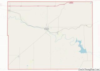
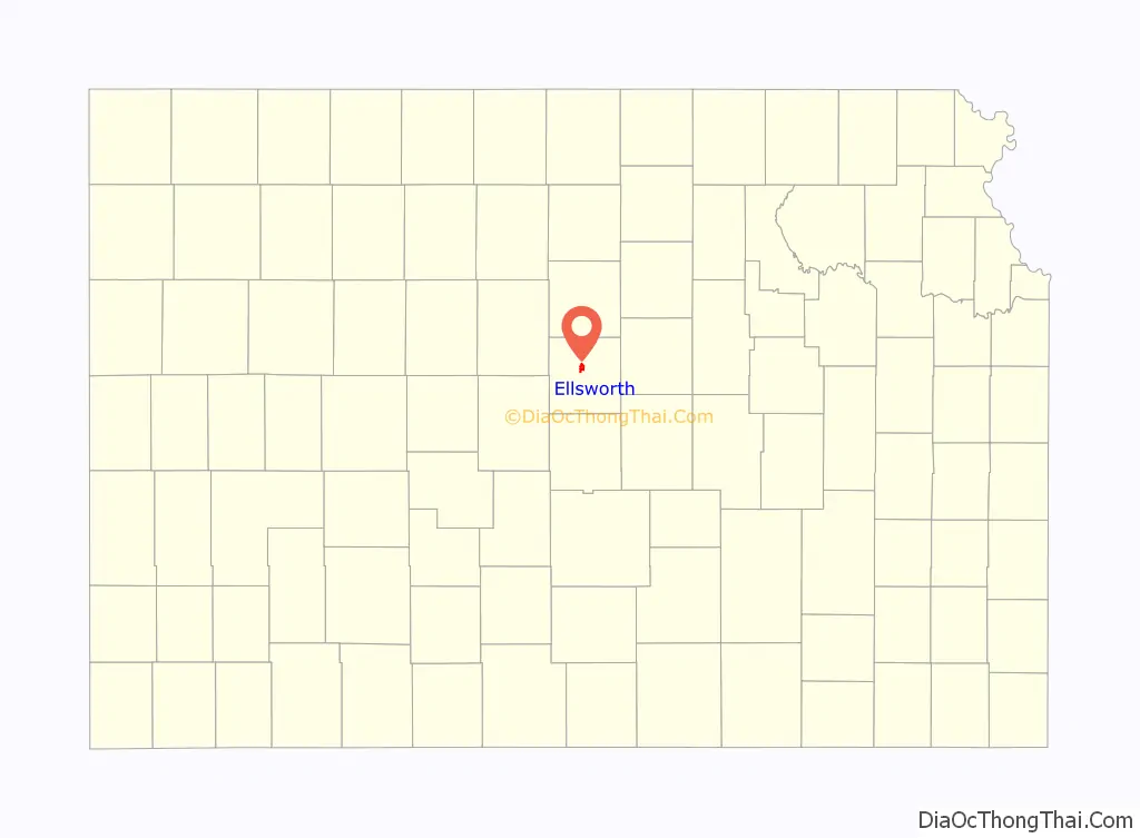
Ellsworth location map. Where is Ellsworth city?

History
19th century
Once called “The Wickedest Cattletown in Kansas”, the city is named for Fort Ellsworth, which was built in 1864. Due to speculation on imminent railroad construction, the population of Ellsworth boomed to over two thousand by the time it was incorporated in 1867. It has since been said, “Abilene, the first, Dodge City, the last, but Ellsworth the wickedest”.
Ellsworth was a bustling cattle town for a time during the late 1860s, when the Kansas Pacific Railroad had a stop and stockyards there. Cattle were driven up from Texas to this point, and then shipped to major markets. Often cowboys had the run of the town. In 1875 Kansas Pacific closed its cattle pens, moving to another location. The cattle trade dwindled to almost nothing by the mid-1880s.
During the late 1860s into the 1870s, Ellsworth was known for being one of the “wickedest” cattle towns, the scene of numerous killings following shootouts between drunken cowboys. The town sported numerous saloons, brothels and gambling halls, with prostitution being rampant. Wild Bill Hickok ran for Ellsworth County Sheriff in 1868, but was defeated by veteran Union Army soldier E. W. Kingsbury. Kingsbury was an effective lawman, but relied on local marshals to patrol the town, as he also had to police the county. Violence in Ellsworth was commonplace among the cowboys and people associated with them. Ellsworth marshal Will Semans was shot and killed on September 26, 1869, while attempting to disarm a rowdy man in a dance hall.
For a time during this period, two small-time outlaws known only as Craig and Johnson began bullying people around the community, often committing armed robbery. After Semans’ murder, they operated openly. Before long, citizens formed a vigilance squad and captured both men, hanging them in a lynching near the Smoky Hill River. Chauncey Whitney, a deputy to Kingsbury, took over following Sheriff Kingsbury’s departure. Whitney quickly gained a reputation as being both tough and respectable, and was well liked. The scale of business is shown by construction of the Drovers Cottage in 1872. It could accommodate 175 guests, and stable 50 carriages and 100 horses.
Lawman Wyatt Earp claimed to have served in Ellsworth for a short time. He also later claimed to have arrested gunman Ben Thompson there. But Thompson was arrested by Deputy Ed Hogue after his brother Billy Thompson accidentally shot and killed Ellsworth County Sheriff Chauncey Whitney in 1873. Billy Thompson fled, fearing that he would be lynched for the death of the popular sheriff. Thompson was eventually captured and put on trial, but was acquitted in the shooting. Sheriff Whitney, a friend to both Thompsons, had told bystanders before his death that the shooting was an accident.
By the late 1870s the crime rate had dropped dramatically, as fewer cowboys came through after Kansas Pacific closed its stockyard here. Cattle drives were directed to other market cities, such as Dodge City. Ellsworth suffered economically.
In 1888, the Kansas Midland Railway Company built between Wichita and Ellsworth. The line was purchased in 1900 by the St. Louis-San Francisco Railway (the “Frisco”). The Frisco operated the line for many years, but it has since been abandoned.
21st century
Ellsworth has been developing heritage tourism related to its unique 19th-century history. The city and activists have plans to restore Ellsworth’s Signature Insurance Building for use as the National Drovers Hall of Fame. Funds for the project are being raised party from an annual cattle drive down Main Street and Douglas Avenue; it is one of the few in the United States that is historically accurate.
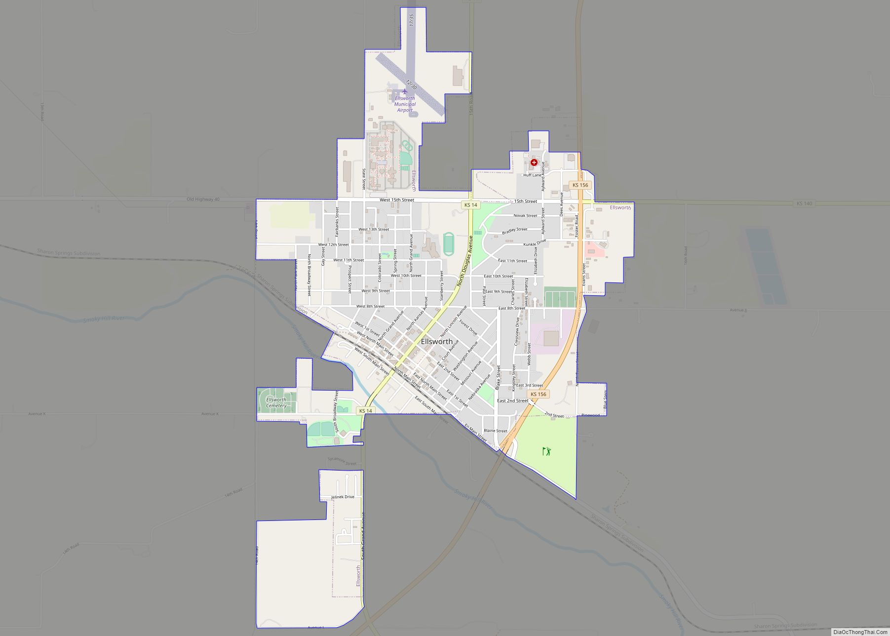
Ellsworth Road Map
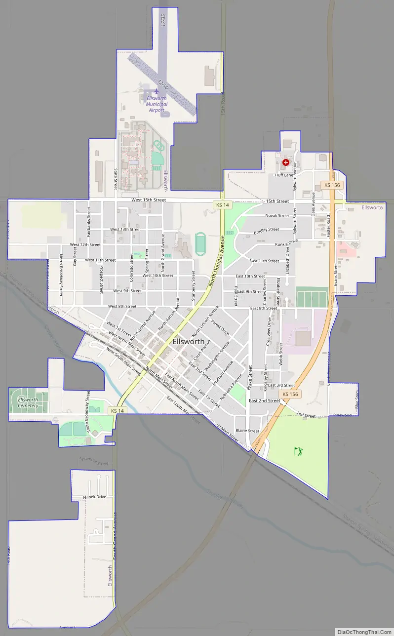
Ellsworth city Satellite Map

Geography
Ellsworth is located at 38°43′55″N 98°13′45″W / 38.73194°N 98.22917°W / 38.73194; -98.22917 (38.731924, -98.229204) at an elevation of 1,539 feet (469 m). The city lies on the north side of the Smoky Hill River in the Smoky Hills region of the Great Plains. Oak Creek, a tributary of the Smoky Hill, flows south past the eastern side of the city to its confluence with the river southeast of the city.
Ellsworth is located at the intersection of K-14, K-140, and K-156 in central Kansas roughly 27 miles (43 km) west-southwest of Salina, Kansas. Ellsworth is approximately 110 miles (180 km) northwest of Wichita and 212 miles (341 km) west-southwest of Kansas City. According to the United States Census Bureau, the city has a total area of 2.43 square miles (6.29 km), all land.
Climate
Under the Köppen climate classification, Ellsworth falls within either a hot-summer humid continental climate (Dfa) if the 0 °C (32 °F) isotherm is used or a humid subtropical climate (Cfa) if the −3 °C (27 °F) isotherm is used. Summers are hot and humid and winters are moderately cold with wide variations in temperature. The average annual temperature is 53.3 °F (11.8 °C), and the average yearly precipitation is 30.87 inches (78.4 cm). Snowfall averages 16.2 inches (41 cm) per year. On average, July is the warmest month, January is the coldest month and driest, and May is the wettest month. The hottest temperature recorded in Ellsworth was 117 °F (47 °C) in 1936; the coldest temperature recorded was −30 °F (−34 °C) in 1913.
See also
Map of Kansas State and its subdivision:- Allen
- Anderson
- Atchison
- Barber
- Barton
- Bourbon
- Brown
- Butler
- Chase
- Chautauqua
- Cherokee
- Cheyenne
- Clark
- Clay
- Cloud
- Coffey
- Comanche
- Cowley
- Crawford
- Decatur
- Dickinson
- Doniphan
- Douglas
- Edwards
- Elk
- Ellis
- Ellsworth
- Finney
- Ford
- Franklin
- Geary
- Gove
- Graham
- Grant
- Gray
- Greeley
- Greenwood
- Hamilton
- Harper
- Harvey
- Haskell
- Hodgeman
- Jackson
- Jefferson
- Jewell
- Johnson
- Kearny
- Kingman
- Kiowa
- Labette
- Lane
- Leavenworth
- Lincoln
- Linn
- Logan
- Lyon
- Marion
- Marshall
- McPherson
- Meade
- Miami
- Mitchell
- Montgomery
- Morris
- Morton
- Nemaha
- Neosho
- Ness
- Norton
- Osage
- Osborne
- Ottawa
- Pawnee
- Phillips
- Pottawatomie
- Pratt
- Rawlins
- Reno
- Republic
- Rice
- Riley
- Rooks
- Rush
- Russell
- Saline
- Scott
- Sedgwick
- Seward
- Shawnee
- Sheridan
- Sherman
- Smith
- Stafford
- Stanton
- Stevens
- Sumner
- Thomas
- Trego
- Wabaunsee
- Wallace
- Washington
- Wichita
- Wilson
- Woodson
- Wyandotte
- Alabama
- Alaska
- Arizona
- Arkansas
- California
- Colorado
- Connecticut
- Delaware
- District of Columbia
- Florida
- Georgia
- Hawaii
- Idaho
- Illinois
- Indiana
- Iowa
- Kansas
- Kentucky
- Louisiana
- Maine
- Maryland
- Massachusetts
- Michigan
- Minnesota
- Mississippi
- Missouri
- Montana
- Nebraska
- Nevada
- New Hampshire
- New Jersey
- New Mexico
- New York
- North Carolina
- North Dakota
- Ohio
- Oklahoma
- Oregon
- Pennsylvania
- Rhode Island
- South Carolina
- South Dakota
- Tennessee
- Texas
- Utah
- Vermont
- Virginia
- Washington
- West Virginia
- Wisconsin
- Wyoming