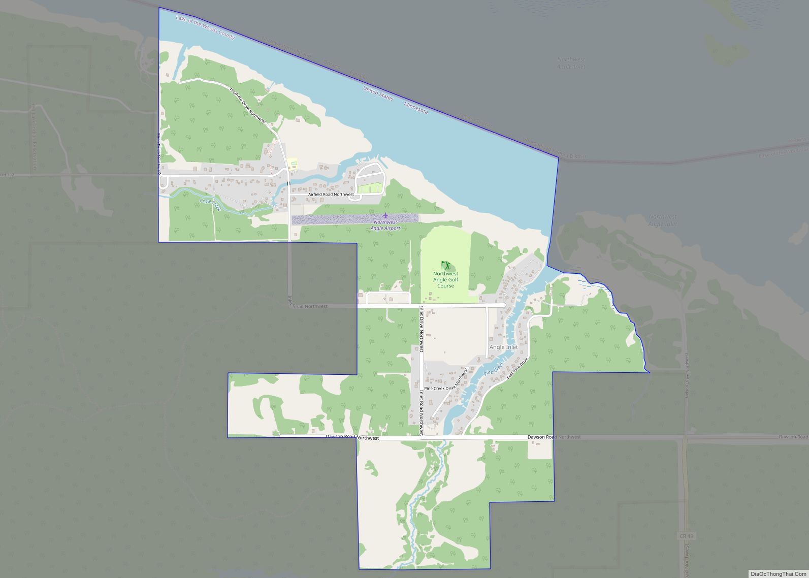
Angle Inlet is a census-designated place (CDP) and unincorporated community in Angle Township, Lake of the Woods County, Minnesota, United States. Its population was 54 as of the 2020 census. The community is part of the Northwest Angle, the only place in the contiguous United States north of the 49th parallel; it is the northernmost census-designated place in the contiguous United States. The French built Fort Saint Charles nearby in 1732.
Angle Inlet has the last one-room school in the state and a post office with a sign stating that it is the “Most Northerly P.O. in Contiguous U.S.” To travel to Angle Inlet from other parts of Minnesota by road requires driving through Manitoba, Canada.
| Name: | Angle Inlet CDP |
|---|---|
| LSAD Code: | 57 |
| LSAD Description: | CDP (suffix) |
| State: | Minnesota |
| County: | Lake of the Woods County |
| Elevation: | 1,063 ft (324 m) |
| Total Area: | 2.03 sq mi (5.25 km²) |
| Land Area: | 1.74 sq mi (4.50 km²) |
| Water Area: | 0.29 sq mi (0.75 km²) |
| Total Population: | 54 |
| Population Density: | 31.07/sq mi (12.00/km²) |
| Area code: | 218 |
| FIPS code: | 2701558 |
| GNISfeature ID: | 639371 |
Online Interactive Map
Click on ![]() to view map in "full screen" mode.
to view map in "full screen" mode.
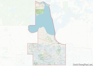
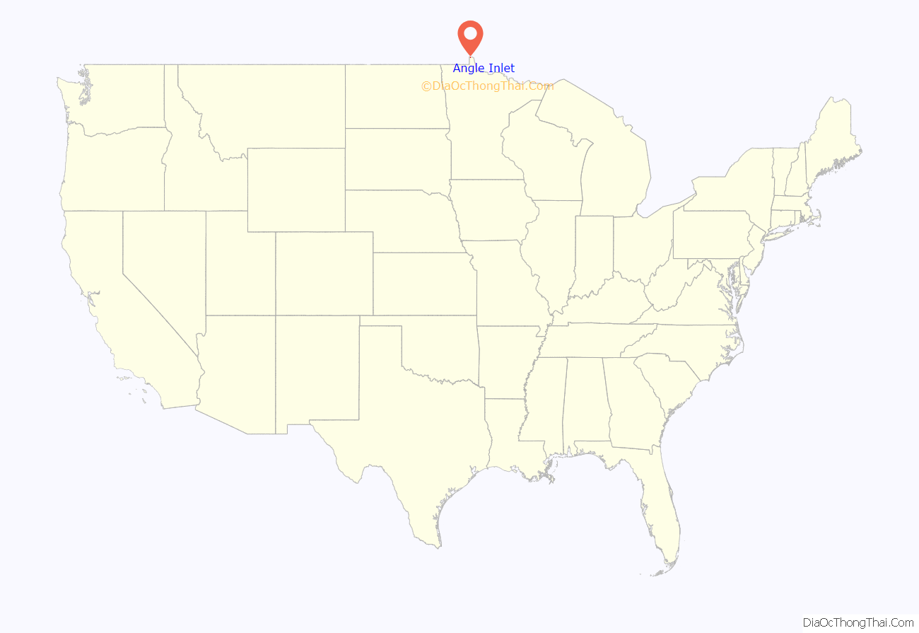
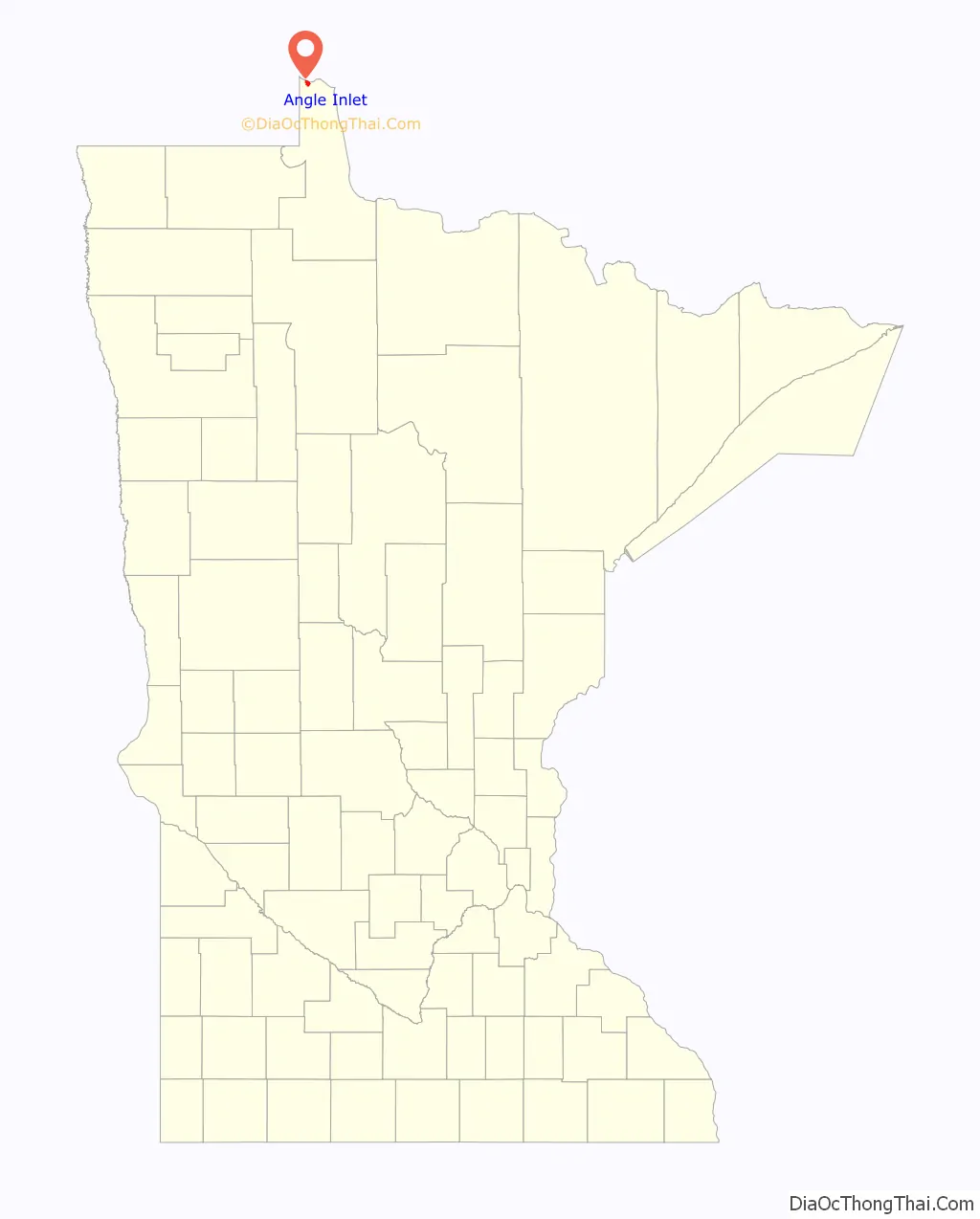
Angle Inlet location map. Where is Angle Inlet CDP?
Angle Inlet Road Map
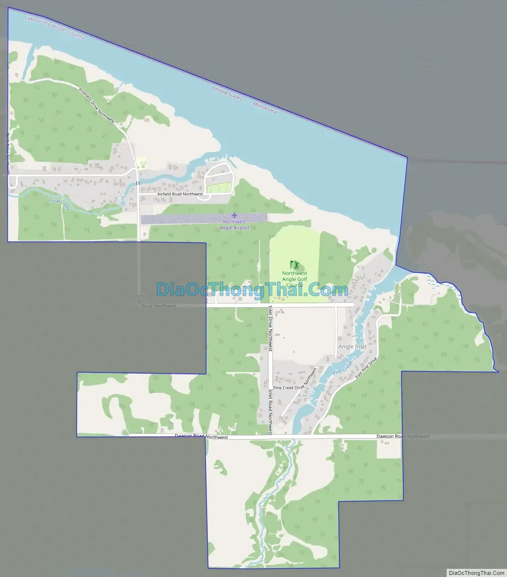
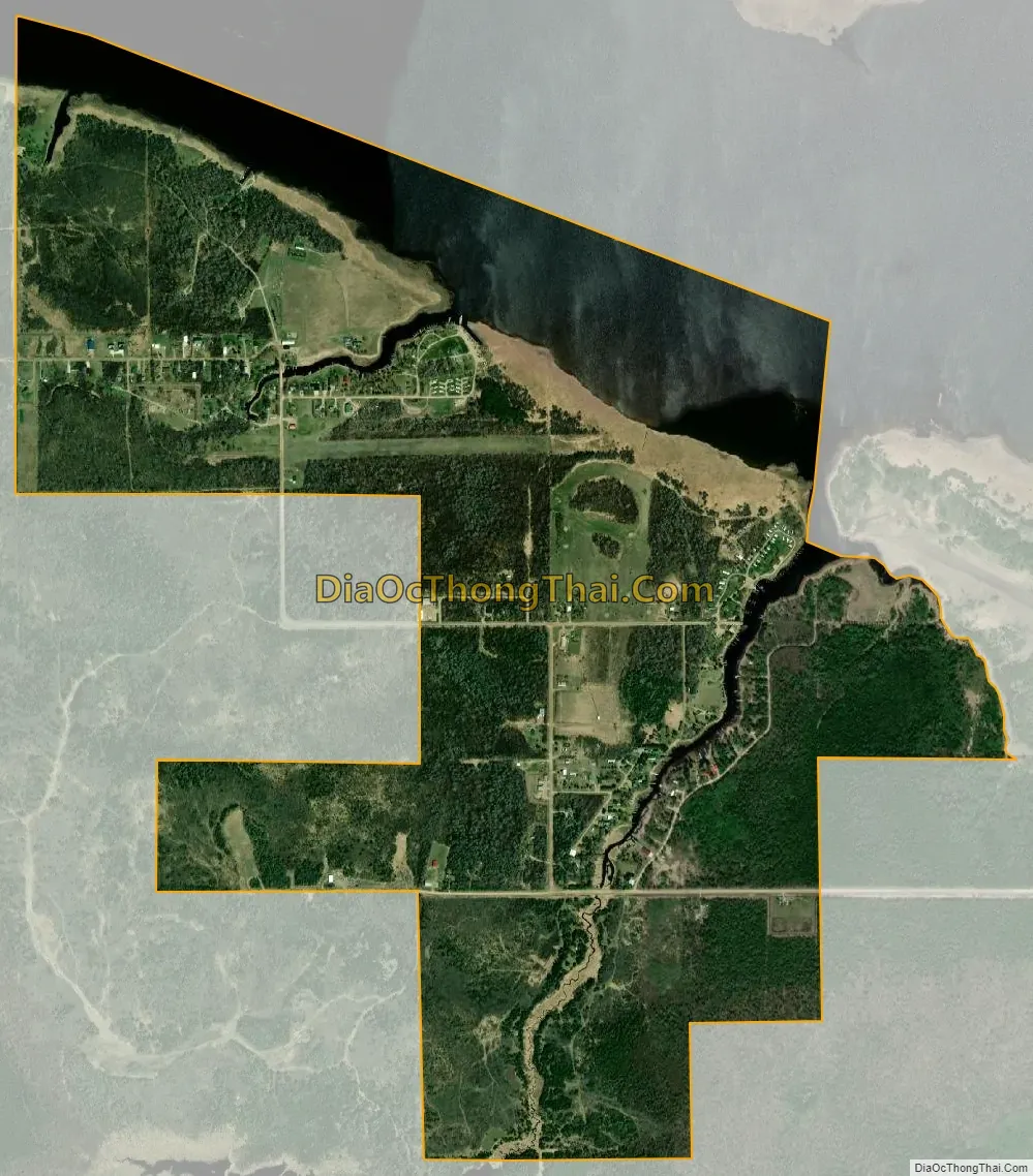
Angle Inlet city Satellite Map
See also
Map of Minnesota State and its subdivision:- Aitkin
- Anoka
- Becker
- Beltrami
- Benton
- Big Stone
- Blue Earth
- Brown
- Carlton
- Carver
- Cass
- Chippewa
- Chisago
- Clay
- Clearwater
- Cook
- Cottonwood
- Crow Wing
- Dakota
- Dodge
- Douglas
- Faribault
- Fillmore
- Freeborn
- Goodhue
- Grant
- Hennepin
- Houston
- Hubbard
- Isanti
- Itasca
- Jackson
- Kanabec
- Kandiyohi
- Kittson
- Koochiching
- Lac qui Parle
- Lake
- Lake of the Woods
- Lake Superior
- Le Sueur
- Lincoln
- Lyon
- Mahnomen
- Marshall
- Martin
- McLeod
- Meeker
- Mille Lacs
- Morrison
- Mower
- Murray
- Nicollet
- Nobles
- Norman
- Olmsted
- Otter Tail
- Pennington
- Pine
- Pipestone
- Polk
- Pope
- Ramsey
- Red Lake
- Redwood
- Renville
- Rice
- Rock
- Roseau
- Saint Louis
- Scott
- Sherburne
- Sibley
- Stearns
- Steele
- Stevens
- Swift
- Todd
- Traverse
- Wabasha
- Wadena
- Waseca
- Washington
- Watonwan
- Wilkin
- Winona
- Wright
- Yellow Medicine
- Alabama
- Alaska
- Arizona
- Arkansas
- California
- Colorado
- Connecticut
- Delaware
- District of Columbia
- Florida
- Georgia
- Hawaii
- Idaho
- Illinois
- Indiana
- Iowa
- Kansas
- Kentucky
- Louisiana
- Maine
- Maryland
- Massachusetts
- Michigan
- Minnesota
- Mississippi
- Missouri
- Montana
- Nebraska
- Nevada
- New Hampshire
- New Jersey
- New Mexico
- New York
- North Carolina
- North Dakota
- Ohio
- Oklahoma
- Oregon
- Pennsylvania
- Rhode Island
- South Carolina
- South Dakota
- Tennessee
- Texas
- Utah
- Vermont
- Virginia
- Washington
- West Virginia
- Wisconsin
- Wyoming