Baxter is a city in Crow Wing County, Minnesota, United States. The population was 7,610 at the 2010 census. It is part of the Brainerd Micropolitan Statistical Area.
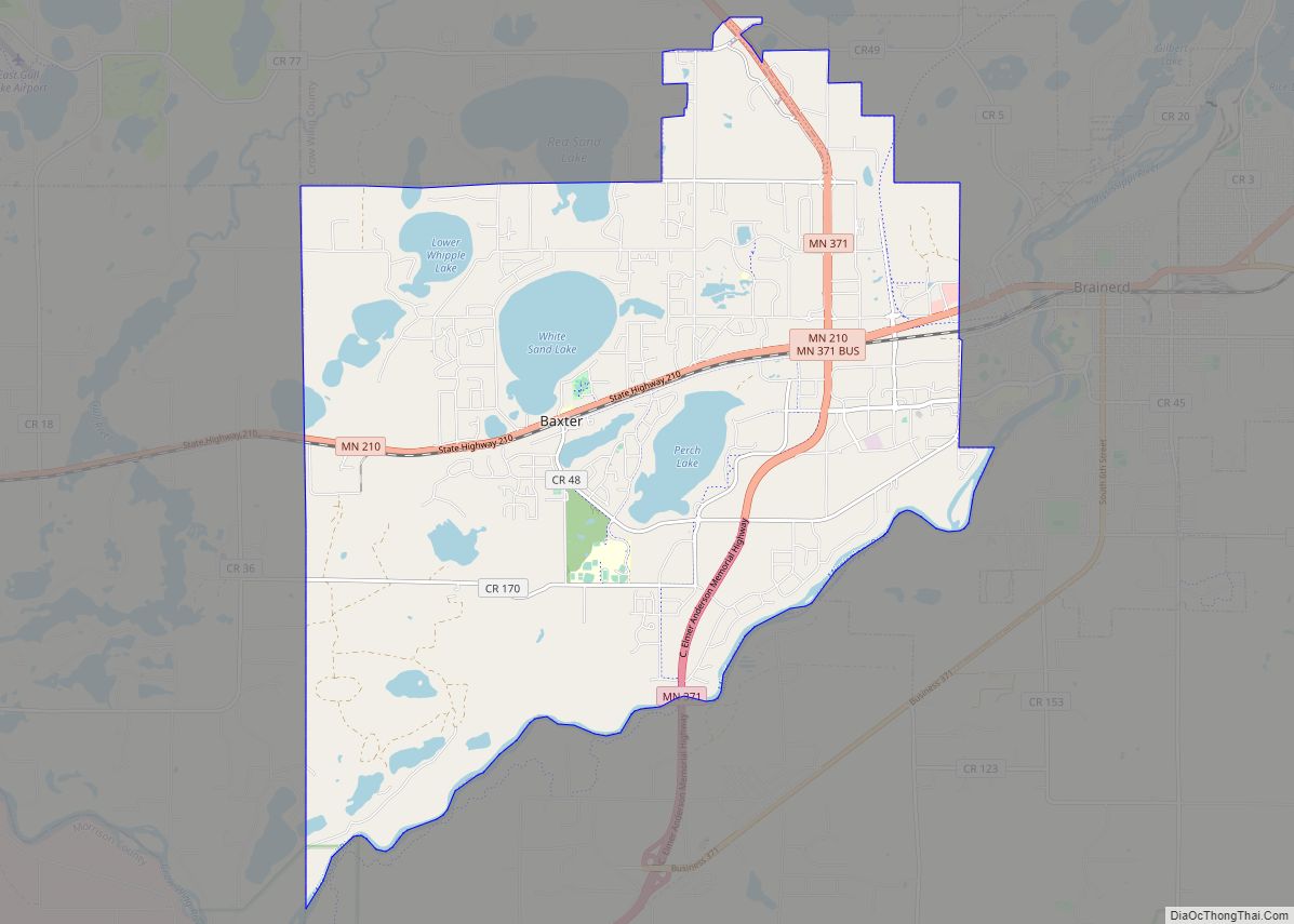
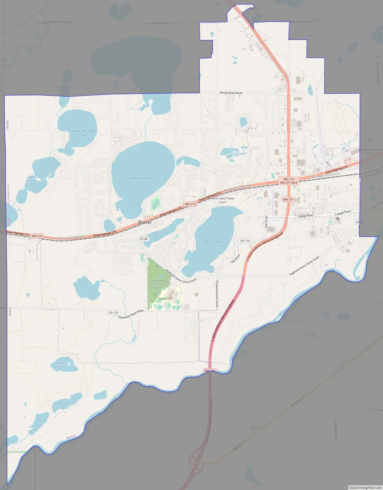
Minnesota State Highways 210 and 371 are two of the main routes in the city.
| Name: | Baxter city |
|---|---|
| LSAD Code: | 25 |
| LSAD Description: | city (suffix) |
| State: | Minnesota |
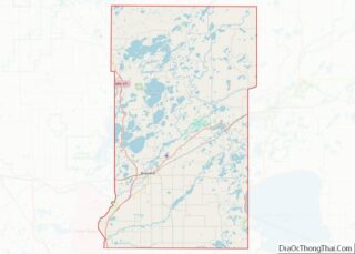
| County: | Crow Wing County |
| Elevation: | 1,207 ft (368 m) |
| Total Area: | 21.11 sq mi (54.67 km²) |
| Land Area: | 18.85 sq mi (48.83 km²) |
| Water Area: | 2.25 sq mi (5.84 km²) |
| Total Population: | 8,612 |
| Population Density: | 456.82/sq mi (176.38/km²) |
| ZIP code: | 56401, 56425 |
| Area code: | 218 |
| FIPS code: | 2704042 |
| GNISfeature ID: | 0639737 |
| Website: | www.ci.baxter.mn.us |
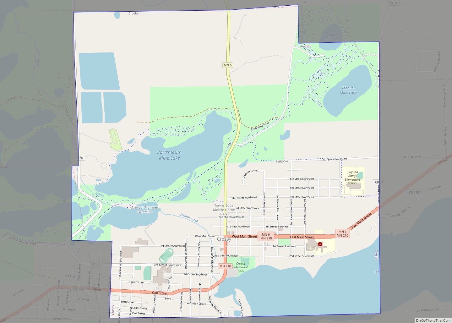
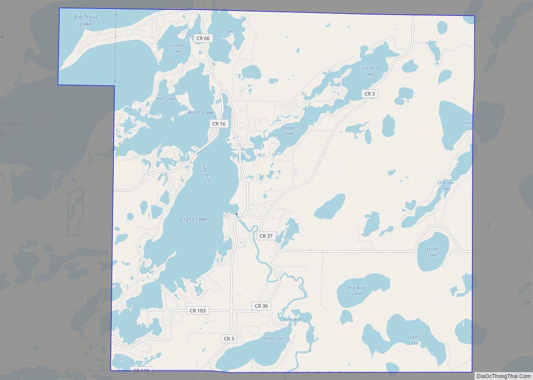
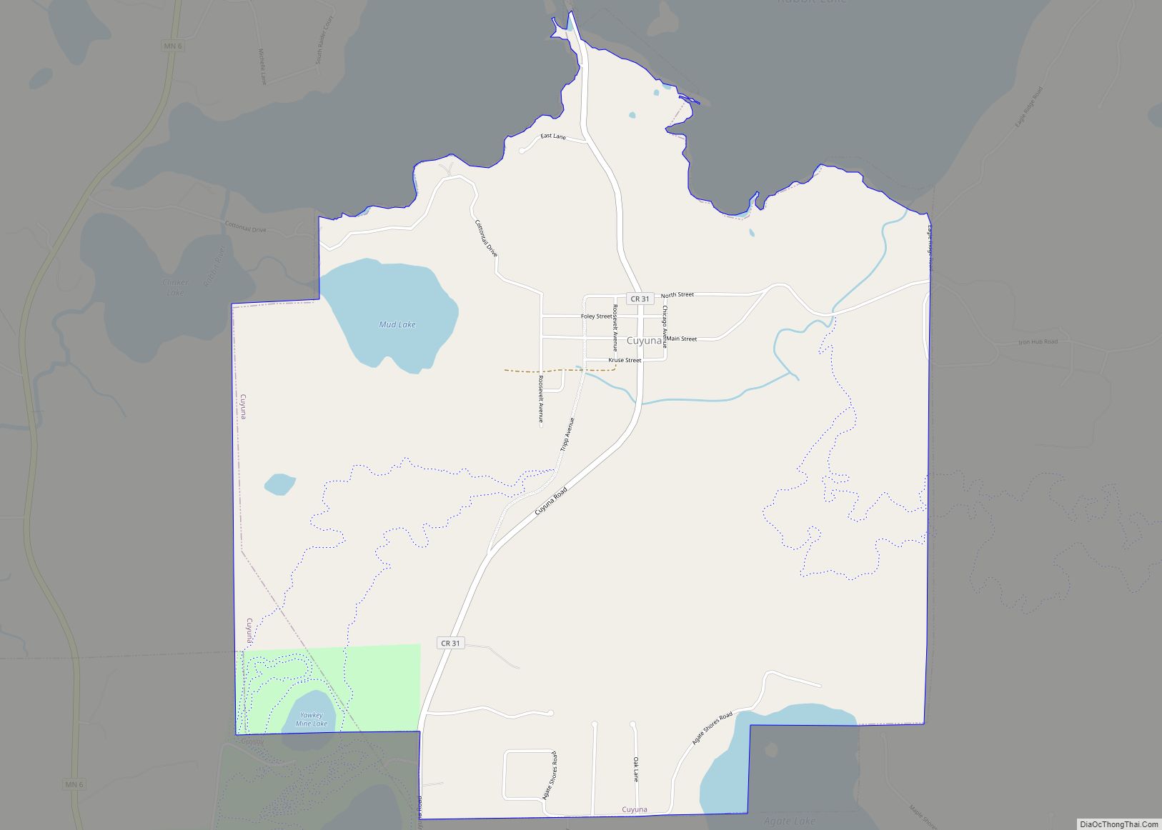
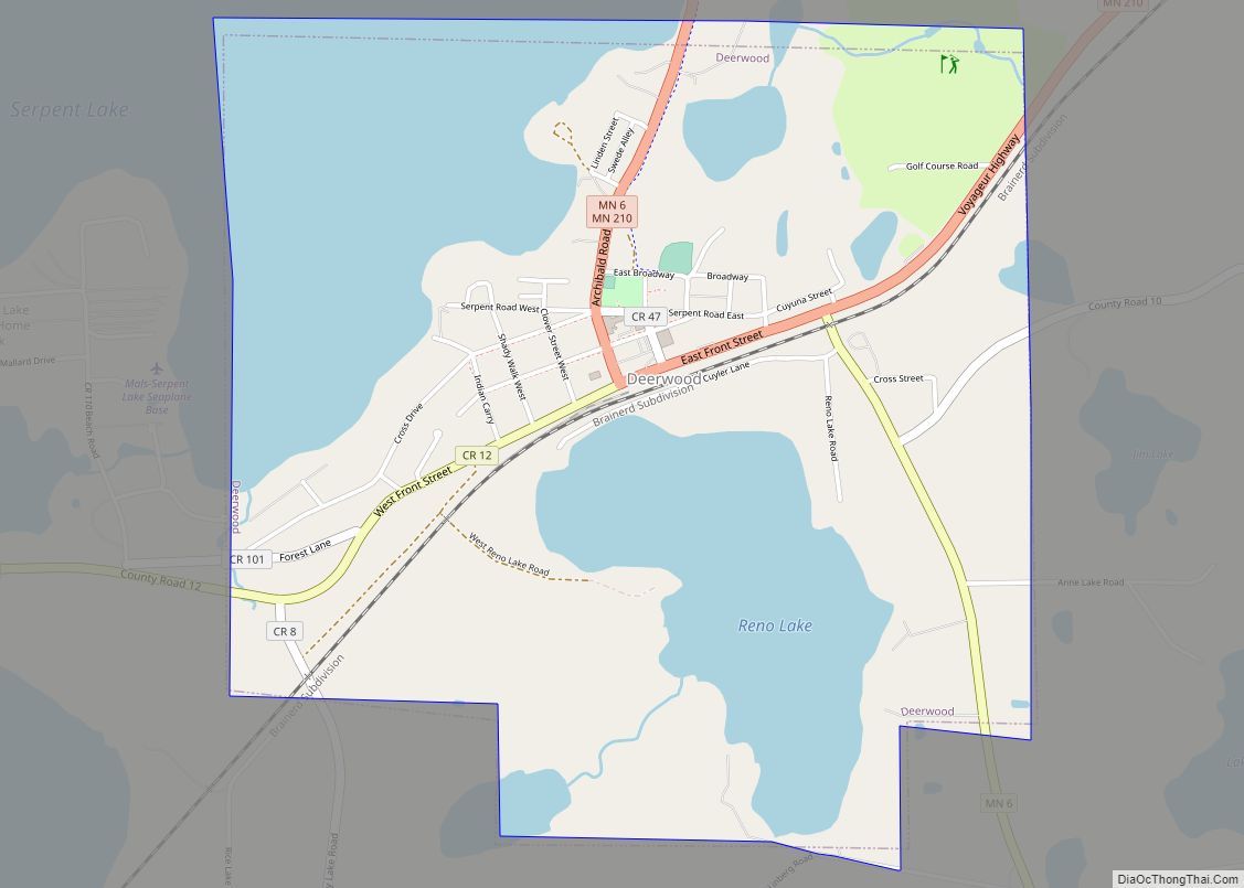
Online Interactive Map
Click on ![]() to view map in "full screen" mode.
to view map in "full screen" mode.
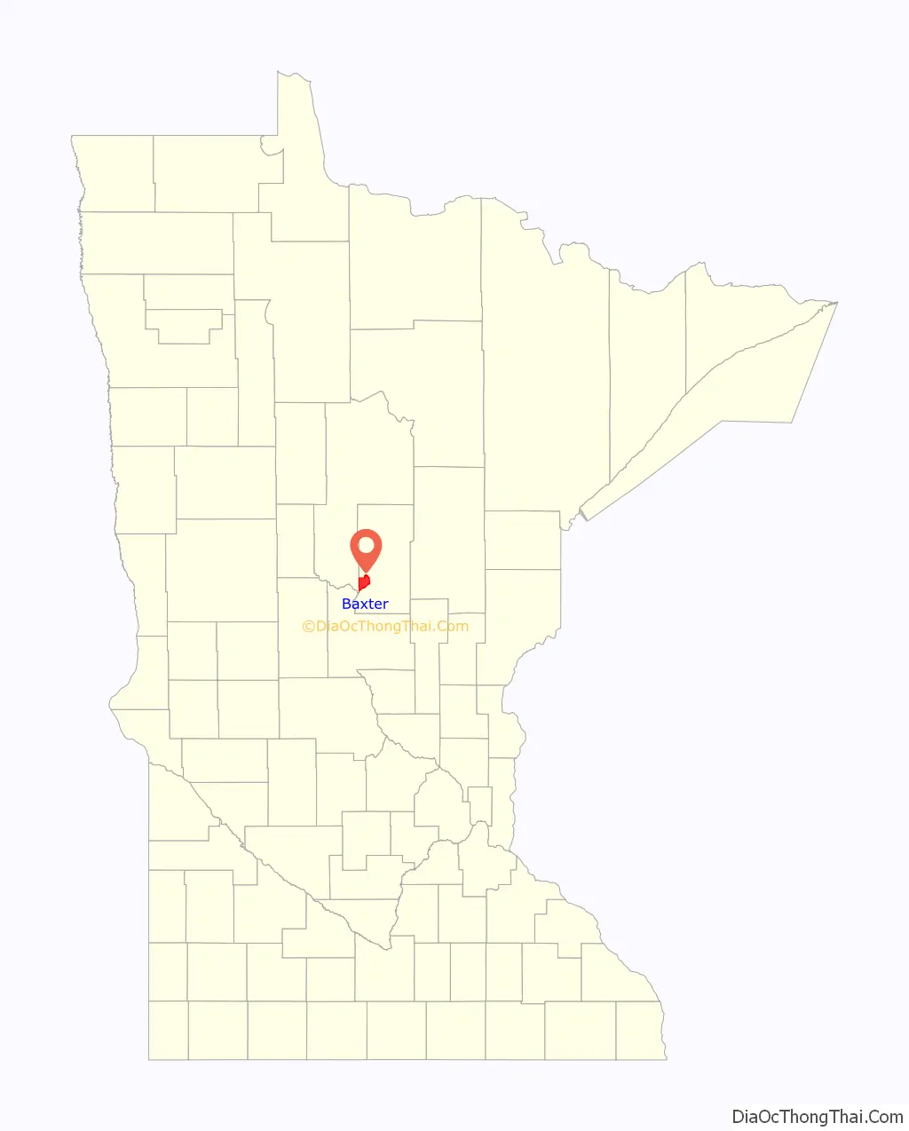
Baxter location map. Where is Baxter city?

History
Baxter owes its existence partly to the 1920s operation of a (since closed) large tie-treating plant, owned by Northern Pacific Railroad. Farming was also an important early industry.
Baxter was incorporated on May 25, 1939. The town is named after Luther Baxter, an attorney for the railroad who served in the Minnesota Legislature and as a colonel in the Civil War.
Tourism and various service industries have become Baxter’s biggest employers, and numerous housing subdivisions have been developed in the wooded area west of Minnesota Highway 371, which passes through the town. Owing to the amount of unused land in the area, commercial development along the highway itself has also increased in recent years, though it has tended to conform to the pattern of urban sprawl.
Baxter Road Map
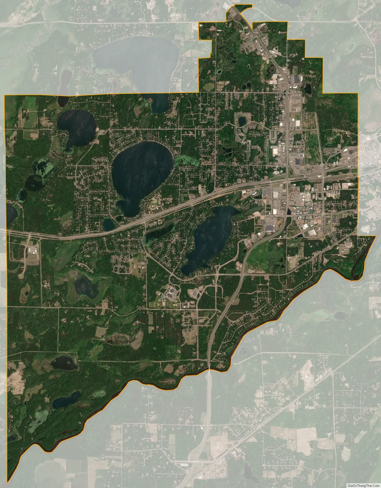
Baxter city Satellite Map
Geography
Baxter is just north of Minnesota’s geographical center, in a terminal moraine area created by the Superior Lobe of the Labradorian ice sheet. The city is home to numerous lakes and ponds.
Baxter is bordered on the west by Cass County and on the east by Brainerd. The Mississippi River marks the southern border but expansion both north and south is possible.
Along with the rest of Crow Wing County and parts of the adjoining counties, Baxter is part of the Brainerd Lakes Area.
According to the United States Census Bureau, the city has a total area of 20.62 square miles (53.41 km), of which 18.39 square miles (47.63 km) is land and 2.23 square miles (5.78 km) is water.
See also
Map of Minnesota State and its subdivision:- Aitkin
- Anoka
- Becker
- Beltrami
- Benton
- Big Stone
- Blue Earth
- Brown
- Carlton
- Carver
- Cass
- Chippewa
- Chisago
- Clay
- Clearwater
- Cook
- Cottonwood
- Crow Wing
- Dakota
- Dodge
- Douglas
- Faribault
- Fillmore
- Freeborn
- Goodhue
- Grant
- Hennepin
- Houston
- Hubbard
- Isanti
- Itasca
- Jackson
- Kanabec
- Kandiyohi
- Kittson
- Koochiching
- Lac qui Parle
- Lake
- Lake of the Woods
- Lake Superior
- Le Sueur
- Lincoln
- Lyon
- Mahnomen
- Marshall
- Martin
- McLeod
- Meeker
- Mille Lacs
- Morrison
- Mower
- Murray
- Nicollet
- Nobles
- Norman
- Olmsted
- Otter Tail
- Pennington
- Pine
- Pipestone
- Polk
- Pope
- Ramsey
- Red Lake
- Redwood
- Renville
- Rice
- Rock
- Roseau
- Saint Louis
- Scott
- Sherburne
- Sibley
- Stearns
- Steele
- Stevens
- Swift
- Todd
- Traverse
- Wabasha
- Wadena
- Waseca
- Washington
- Watonwan
- Wilkin
- Winona
- Wright
- Yellow Medicine
- Alabama
- Alaska
- Arizona
- Arkansas
- California
- Colorado
- Connecticut
- Delaware
- District of Columbia
- Florida
- Georgia
- Hawaii
- Idaho
- Illinois
- Indiana
- Iowa
- Kansas
- Kentucky
- Louisiana
- Maine
- Maryland
- Massachusetts
- Michigan
- Minnesota
- Mississippi
- Missouri
- Montana
- Nebraska
- Nevada
- New Hampshire
- New Jersey
- New Mexico
- New York
- North Carolina
- North Dakota
- Ohio
- Oklahoma
- Oregon
- Pennsylvania
- Rhode Island
- South Carolina
- South Dakota
- Tennessee
- Texas
- Utah
- Vermont
- Virginia
- Washington
- West Virginia
- Wisconsin
- Wyoming